Severe Thunderstorm Watch has been issued for parts of Kentucky and Tennessee until 1 AM CDT. Damaging winds are the primary threat, but some small hail and a couple of tornadoes are possible.
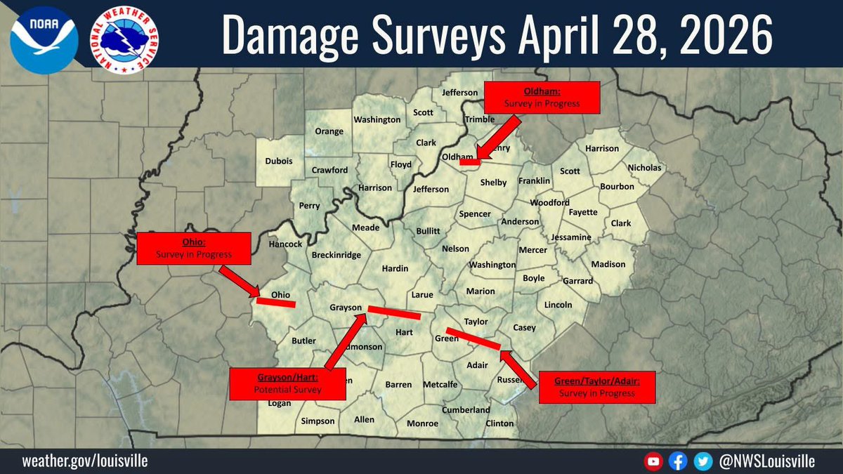
The National Weather Service in Louisville will be checking out several areas in Kentucky after last night’s storms. They do these surveys to look for damage that could have been caused by a tornado and to figure out if one actually touched down and how strong it was.
Reminder: Another round of strong to severe storms is expected later this evening. The best window for storms in central Kentucky looks to be between 8–11 PM EDT. Damaging winds will be the main concern, with the potential for small hail and a low chance of an isolated tornado
8 PM CDT / 9 PM EDT MON UPDATE:
No storms have developed ahead of the main line, and that threat is decreasing.
The main line is still expected between 12–4 AM, with damaging winds as the primary threat and an isolated tornado possible.
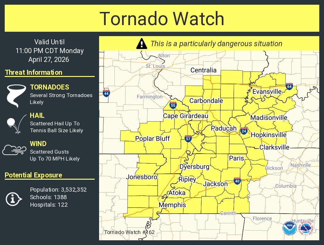
The Storm Prediction Center has issued a PDS Tornado Watch for parts of AR, MO, TN, KY, IL, and IN until 11 PM CDT.
This is a serious situation with the potential for strong tornadoes. Be sure you have a plan, know your safe place, and stay alert for warnings.
Conditions are expected to become increasingly active across western Kentucky, as the Storm Prediction Center indicates a growing threat for supercell development this afternoon into the evening hours. With the potential for tornadoes on the rise, a tornado watch will be issued.
Nadocast estimates the probability of a tornado within 25 miles of a given location. The latest data shows a lower risk—under 5%—east of I-65, but don’t let your guard down; even a low chance means a tornado is still possible. West of I-65, probabilities increase to around 5–10%