Sabitlenmiş Tweet
Andrew Adams
22.7K posts


Andrew Adams
@AAdamsWX
Meteorologist @NEWS9 | Former @ABC7SWFL | FWTX Native | Boomer Sooner | Sometimes I talk about sports | views are my own
Oklahoma City, OK Katılım Eylül 2016
952 Takip Edilen3.7K Takipçiler

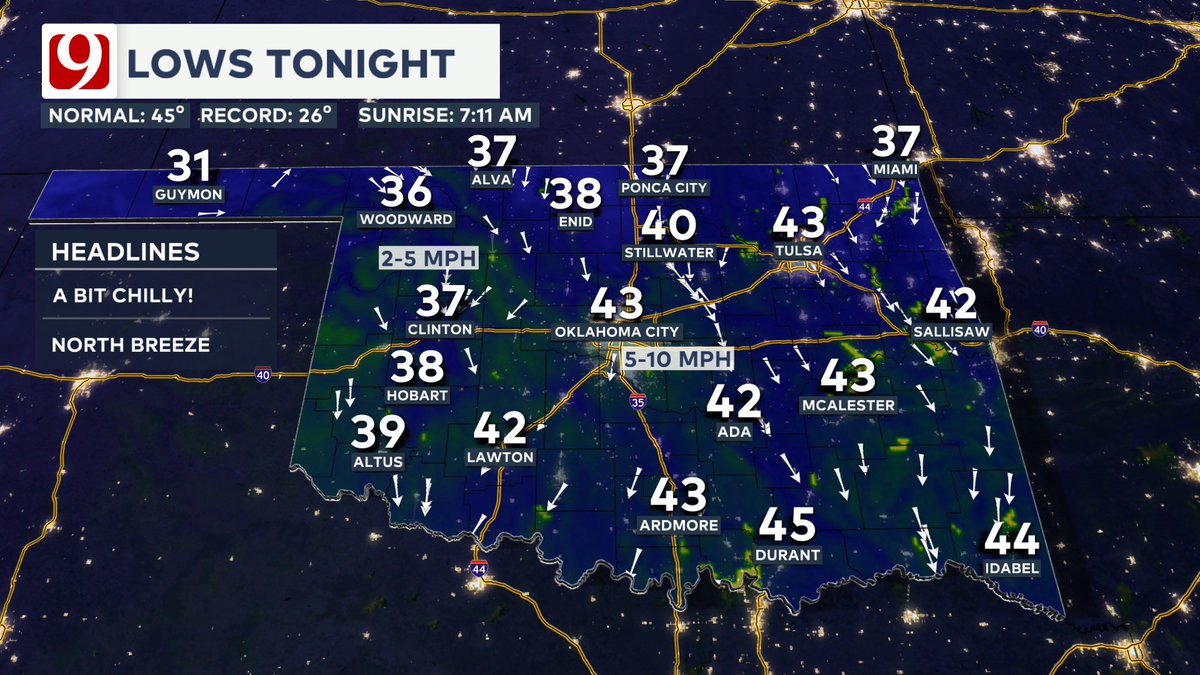
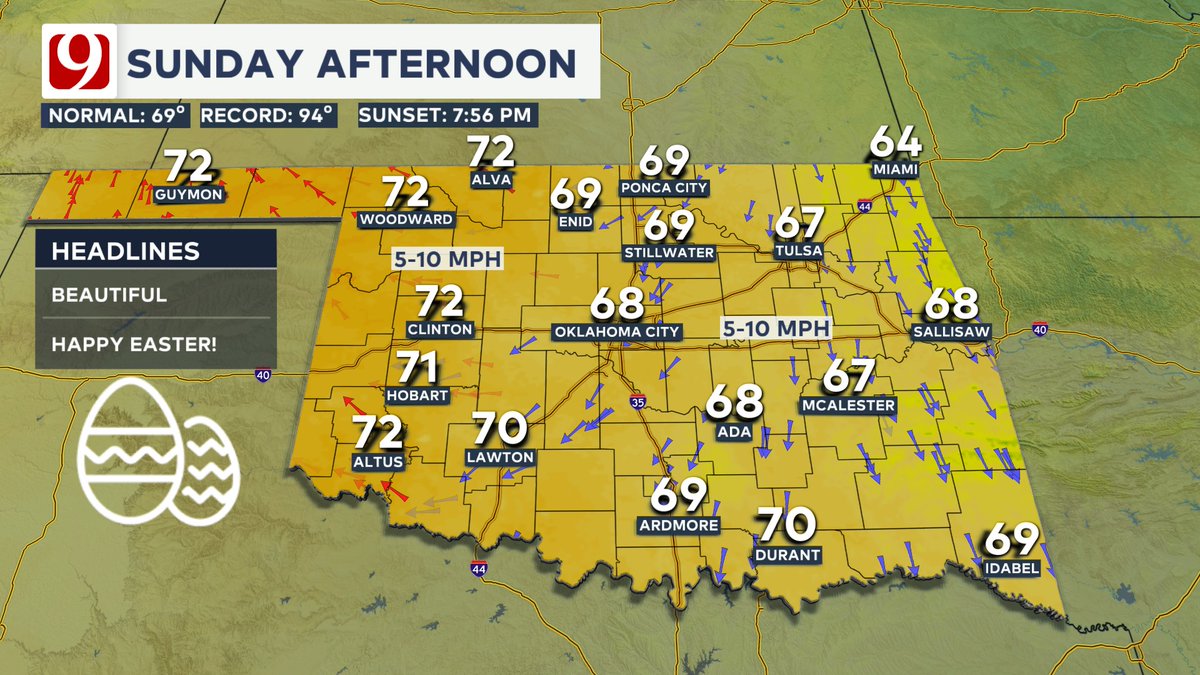
A wonderful Easter Sunday headed our way!
We'll be a bit chilly in the morning, but highs return to the 60s and 70s Easter afternoon with a light northeast breeze.
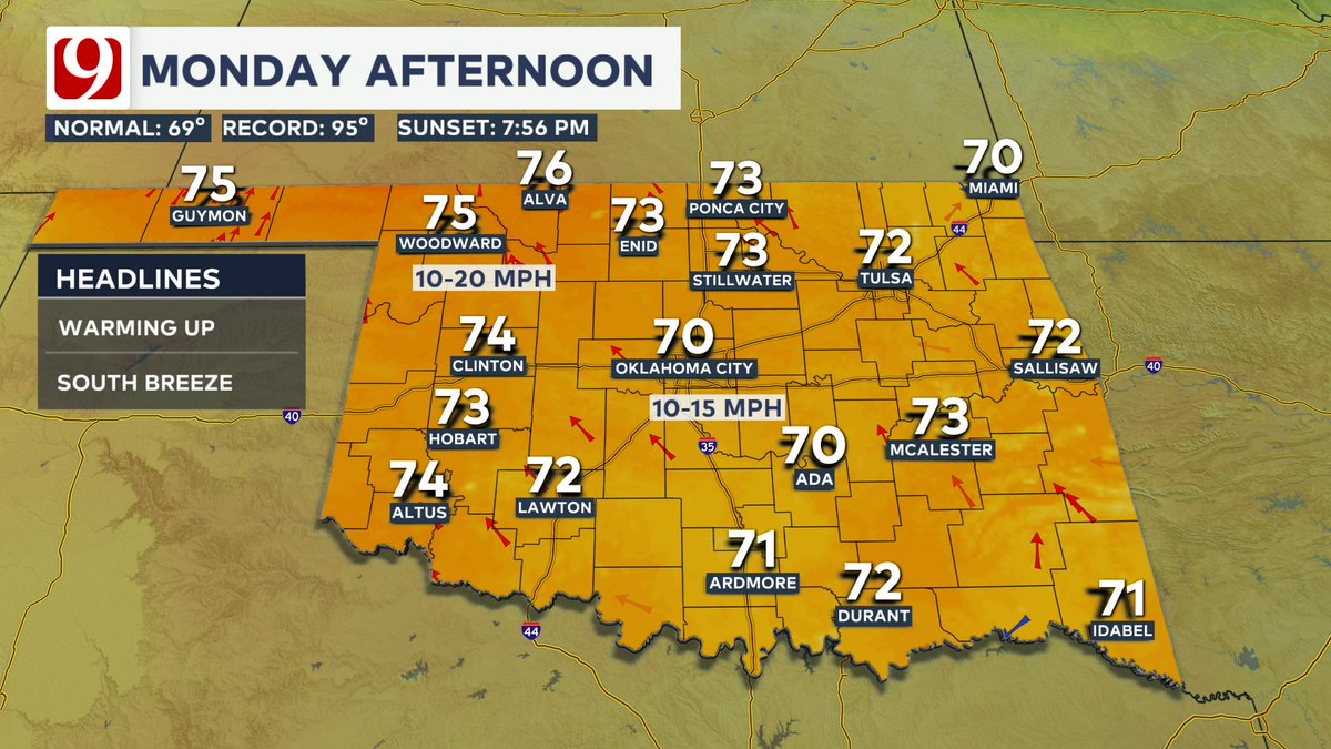
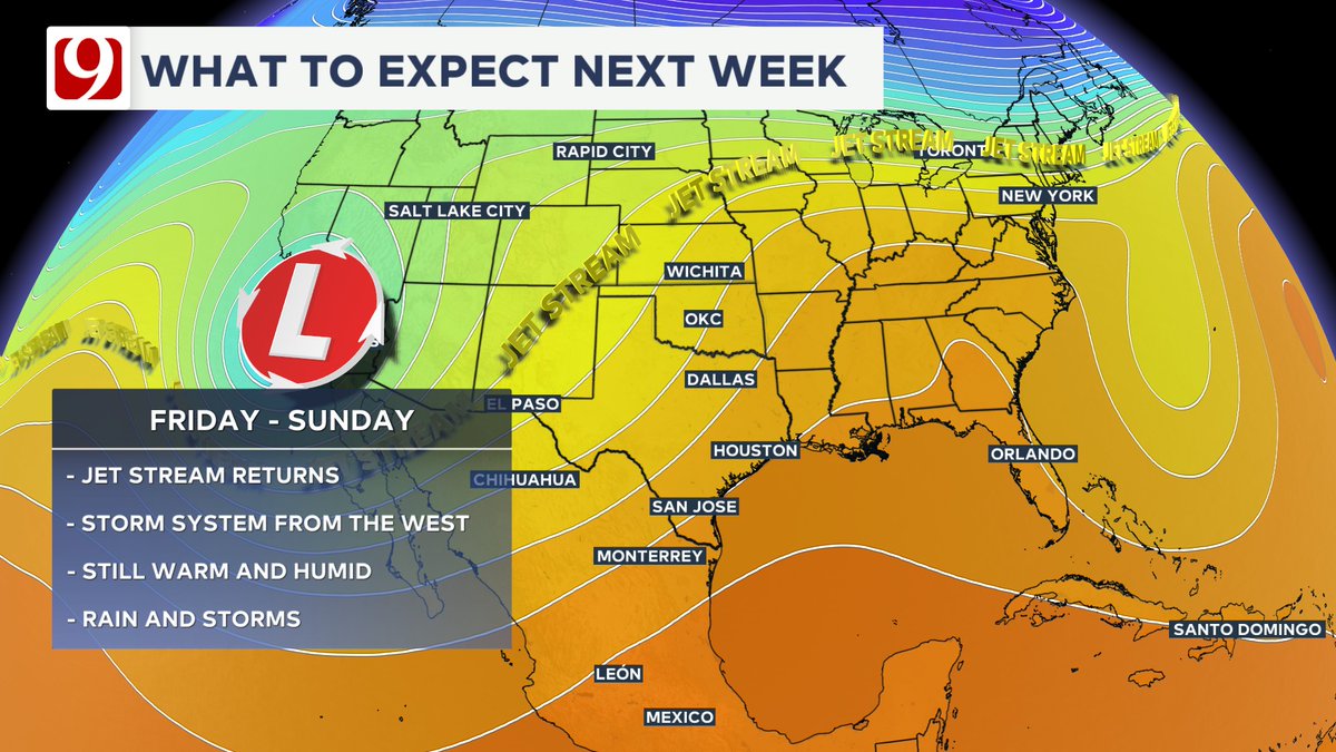
We are keeping an eye on late next week for rain and storm chances to return. #okwx
English
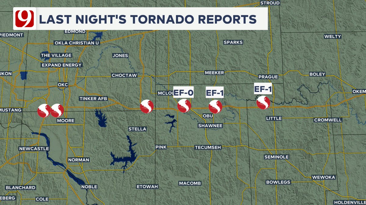
Friday Night Tornado Update!
3 of last nights tornadoes have been surveyed, and so far we have at least:
EF-1 Little
EF-1 Shawnee
EF-0 Dale
Storm damage surveys will continue in the metro into next week to confirm additional tornadoes. #okwx
English
@NathanC37516110 @LaceySwope There will be some additional rain overnight, but the severe threat leaves.
English

@AAdamsWX @LaceySwope Are we safe for the night once storm moves east of us?
English
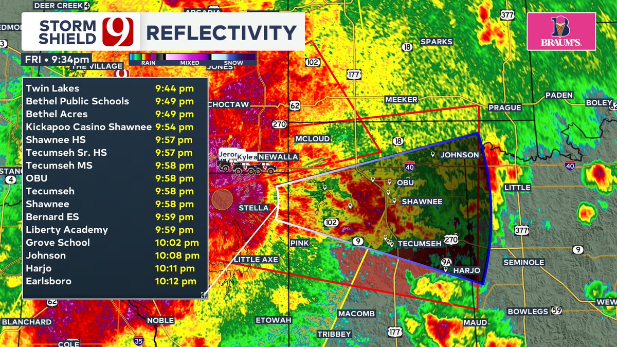
Severe Thunderstorm Warning for the large complex of OKC metro thunderstorms as they move east. 70 mph gusts and brief tornadoes are possible. #okwx

English
Severe Thunderstorm Warning for Kiowa, Comanche, and Tillman counties until 10:45 PM. Quarter size hail and 50 mph gusts possible. #okwx

English
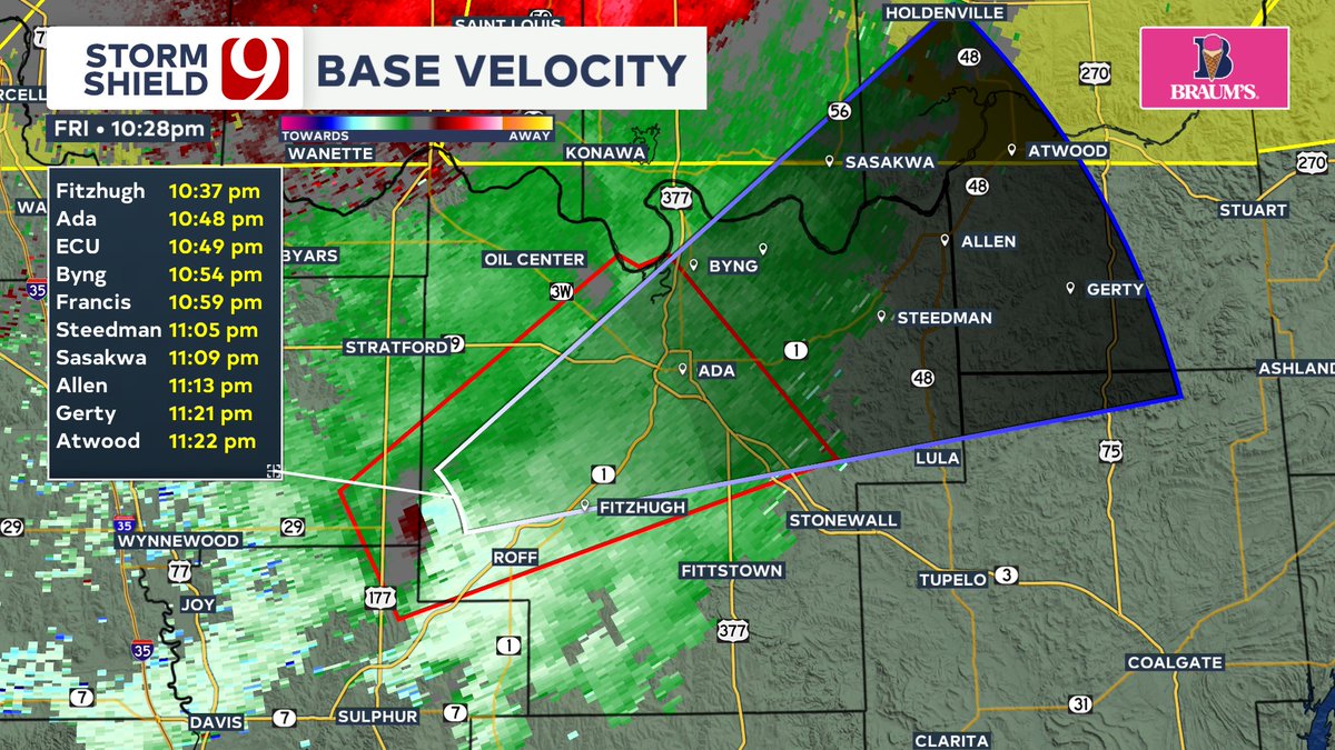
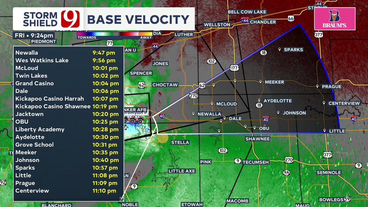
Tornado Warning for Seminole, Pottawatomie, and Lincoln counties. The circulation is moving toward Okfuskee county. #okwx

English
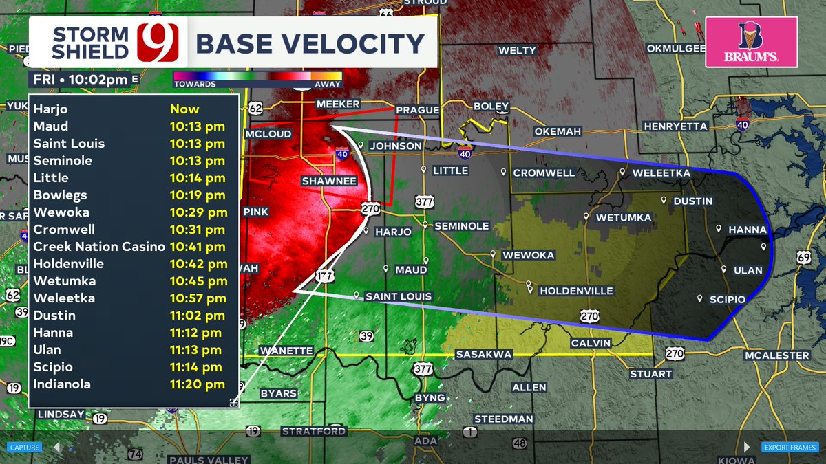
Radar Update 10:02 - Damaging winds 60-80 mph, perhaps up to 90 mph, will continue to pass through Pottawatomie, Seminol, and Hughes counties. #okwx
English

Tornado Warning for Oklahoma, Cleveland, Pottawatomie, Seminole, and Lincoln counties until 10:15 PM. #okwx
English
Tornado Warning for Oklahoma, Cleveland, Lincoln, and Pottawatomie counties until 10 PM. #okwx

English
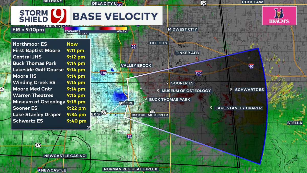
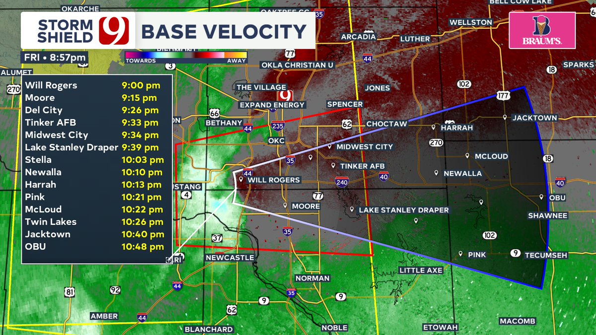
9:10 PM - Straight line winds up to 80 mph possible in and east of Moore as the storm rolls through. Blue color over more is the pocket of high winds. #okwx
English
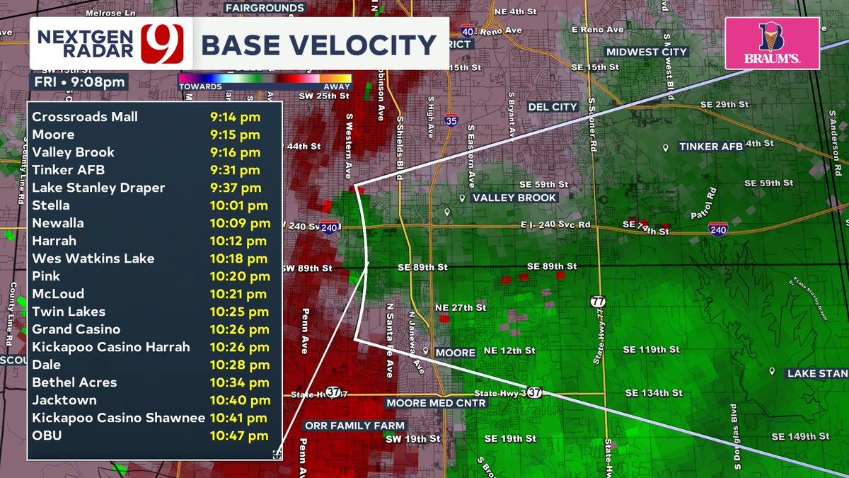
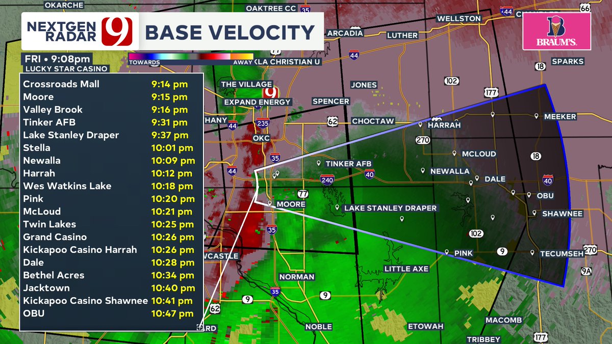
Tornado likely on the ground just south of I-240 approaching Shields Blvd along the Oklahoma Cleveland county line! #okwx
English
Tornado Warning for Oklahoma and Cleveland counties until 9:45 PM. Circulation is right on the Oklahoma-Cleveland county line. #okwx
English
8:52 PM Friday - Multiple Flash Flood Warnings in effect. Do not drive into flooded roadways! #okwx

English
Severe Thunderstorm Warning for Canadian, Oklahoma, Grady, McClain, and Cleveland counties until 9:15 PM. Nickel sized hail and 60 mph gusts possible. #okwx

English
Severe Thunderstorm Warning for Caddo and Grady counties until 9 PM. 60 mph gusts and quarter size hail possible. #okwx

English
8:20 PM - storm moving into the south metro has a big bag of wind in it (circled in blue. 60-70 mph gusts possible in here. #okwx

English