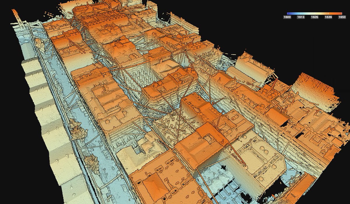
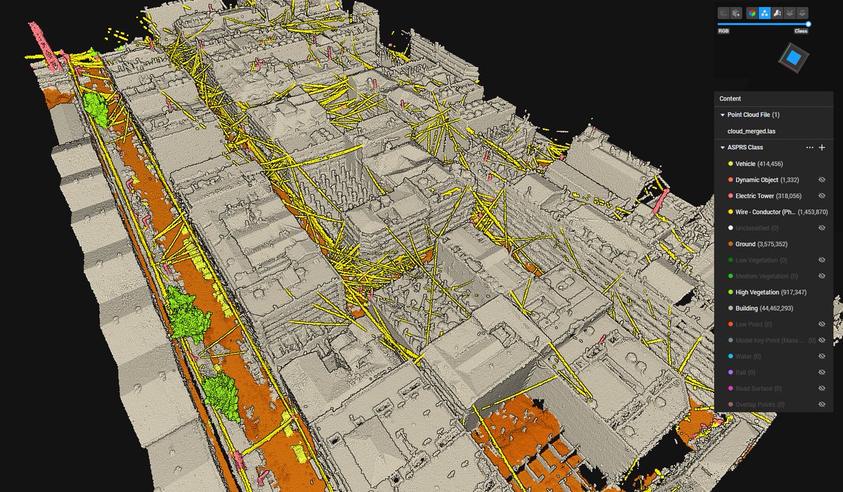
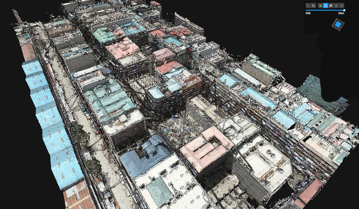
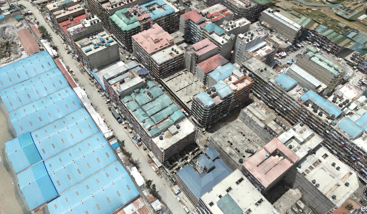
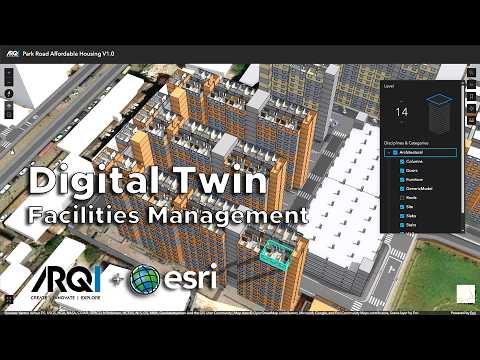
ARQIsolutions

118 posts

ARQIsolutions banner
ARQIsolutions

ARQIsolutions

@ARQIsolutions

Pioneers in construction innovation by seamlessly integrating Drones, BIM and GIS for transformative project workflows.

International Katılım Kasım 2012
922 Takip Edilen447 Takipçiler
ARQIsolutions
ARQIsolutions@ARQIsolutions·
Hosted on @Esri #ArcGIS Online, the digital twin enables facility managers to: ✅ Navigate the development in an interactive 3D environment ✅ Access asset-level information across buildings ✅ Monitor operations through integrated dashboards ✅ Support maintenance planning
English
1
0
1
19
ARQIsolutions
ARQIsolutions@ARQIsolutions·
The future of 𝐅𝐚𝐜𝐢𝐥𝐢𝐭𝐢𝐞𝐬 𝐦𝐚𝐧𝐚𝐠𝐞𝐦𝐞𝐧𝐭 is increasingly data-driven. Digital twins are making this a reality. Video showcases Park Road Housing Digital Twin, a web-based platform that integrates 𝐁𝐈𝐌, 𝐆𝐈𝐒, 𝐚𝐧𝐝 𝐫𝐞𝐚𝐥-𝐭𝐢𝐦𝐞 𝐝𝐚𝐭𝐚. #DigitalTwin
English
1
1
0
30
ARQIsolutions retweetledi
Babu
Babu@daktari_MS·
𝐁𝐢𝐠 5 𝐂𝐨𝐧𝐬𝐭𝐫𝐮𝐜𝐭 𝐊𝐞𝐧𝐲𝐚 2025 | 𝐑𝐞𝐜𝐚𝐩 Grateful to have been part of two insightful panel discussions during this year’s Big 5 Construct Kenya Talks; a gathering that continues to drive important conversations about the future of our built environment.
Babu tweet mediaBabu tweet mediaBabu tweet mediaBabu tweet media
English
1
1
2
147
ARQIsolutions retweetledi
Babu
Babu@daktari_MS·
Some more tests I’ve been conducting with Google’s Nano Banana AI. I uploaded a few photos of All Saints Limuru, Kenya (last 2 photos), a historic church built in the early 1930s. From those images, I prompted the AI to produce elevations and axonometric drawings of the church.
Babu tweet mediaBabu tweet mediaBabu tweet mediaBabu tweet media
English
1
2
1
101
ARQIsolutions retweetledi
Babu
Babu@daktari_MS·
Decided to jump into the Google’s #NanoBanana AI bandwagon to see what the hype is all about. For a farmhouse project I’m currently working on, I uploaded a simple screenshot from ArchiCAD (last image) and gave the AI a few prompts for background, landscaping, and lighting
Babu tweet mediaBabu tweet mediaBabu tweet media
English
2
8
20
2.6K
ARQIsolutions
ARQIsolutions@ARQIsolutions·
Thrilled to be shortlisted for the Outstanding Startup Award at the @BIMAfrica_Org Innovation Awards 2025! Honored to be recognized among innovators shaping the future of Africa’s built environment. Fingers crossed for October in Nairobi 🤞 #BAS2025 #BIMAFRICASUMMIT2025
ARQIsolutions tweet media
English
0
1
3
109
ARQIsolutions
ARQIsolutions@ARQIsolutions·
Our team recently carried out a comprehensive roof Scan to BIM at Sarit Centre Mall in Westlands, Nairobi. The goal – to deliver accurate 2D and 3D layouts of the entire roof structure, enabling engineers to plan and position solar installations with precision.
English
0
0
3
88
ARQIsolutions retweetledi
Babu
Babu@daktari_MS·
Drone-captured 3D mesh + classified point cloud of Nairobi’s Pipeline Estate. We visualized building typologies, street activity, rooftops, power lines & more—turning unplanned density into actionable data. #DigitalTwin #DroneMapping #Geospatial #Nairobi @ARQIsolutions
Babu tweet mediaBabu tweet mediaBabu tweet mediaBabu tweet media
English
1
37
82
5.1K
ARQIsolutions retweetledi
Babu
Babu@daktari_MS·
How do you map a resort seamlessly built into natural coral rock formations, featuring underground kitchens, hidden caves, and dense vegetation? Traditional survey methods don't cut it, so we brought in cutting-edge #LiDAR and #SLAM technology to capture every intricate detail.
Babu tweet mediaBabu tweet mediaBabu tweet mediaBabu tweet media
English
6
13
48
5.4K
ARQIsolutions retweetledi
Babu
Babu@daktari_MS·
We mapped a hidden residential compound in Karen—no site drawings, dense vegetation, and early 2000s structures. The goal: deliver accurate as-built CAD drawings and a full BIM model. Here’s how we did it.👇 #LiDAR #BIM #RealityCapture #DigitalTwin
Babu tweet mediaBabu tweet mediaBabu tweet mediaBabu tweet media
English
26
127
467
29.2K
ARQIsolutions retweetledi
Geo-Cart Surveys & Engineering Solutions Ltd
Geo-Cart, in collaboration with @ARQIsolutions, successfully completed a detailed 3D mapping and survey project at the stunning Diamonds Leisure Beach & Golf Resort in Diani, Kenya.
Geo-Cart Surveys & Engineering Solutions Ltd tweet media
English
2
12
42
2.2K
ARQIsolutions retweetledi
Drone Space Kenya
Drone Space Kenya@DroneSpaceKenya·
Brian Babu's journey shows how drone technology empowers architects to make data-driven decisions and shape the future of our cities. A true inspiration! #AlumniSpotlight #UrbanPlanning #BIM
Drone Space Kenya tweet mediaDrone Space Kenya tweet mediaDrone Space Kenya tweet media
English
0
3
9
610
ARQIsolutions retweetledi
Babu
Babu@daktari_MS·
In today's era of advanced technology, LiDAR data is revolutionizing the way we understand and manage our forests. By utilizing drone-mounted LiDAR systems, we can capture incredibly detailed point cloud data, transforming forestry surveying and ecological research.
English
1
1
1
222
ARQIsolutions
ARQIsolutions@ARQIsolutions·
Are you interested in flying drones in Kenya but unsure about the regulations and requirements? Look no further! We've just published a comprehensive blog post that breaks down everything you need to know about operating drones in Kenya according to KCAA arqisolutions.com/a-guide-to-fly…
English
0
0
2
102
ARQIsolutions retweetledi
Babu
Babu@daktari_MS·
Another drone mapping project over an informal settlement in Nairobi, reveals the power of LiDAR data in understanding infrastructure and living conditions. From detailed spatial analysis to mapping vital power infrastructure, every detail counts towards positive change
English
2
11
38
4.4K
ARQIsolutions retweetledi
Babu
Babu@daktari_MS·
Point cloud data has become the new standard for the architecture, engineering, and construction industries. In this latest example, we were in Shanzu Mombasa capturing the as-built status of a resort under construction. #drones #3DMapping #LiDAR #digitaltwin #architecture
English
1
2
8
699
ARQIsolutions
ARQIsolutions@ARQIsolutions·
In the aftermath of catastrophic events like this, rapid and accurate documentation of the affected area is crucial for effective emergency response and rescue planning. 3D Gaussian Splatting (3DGS) offers powerful visualization and annotation capabilities, providing insights.
English
0
0
0
84
ARQIsolutions
ARQIsolutions@ARQIsolutions·
This 3D model of the scene of where the container ship MV Dali struck Baltimore's Key Bridge was created by from videos released by the U.S. NTSB (National Transportation Safety Board) and reconstructed the scene using Gaussian Splatting.
English
1
0
0
136