Alex Countee retweetledi
Alex Countee
9.3K posts


Alex Countee
@AlexCounteeWX
Weekend AM Meteorologist @fox4kc l @ametsoc CBM #906 I 2x Emmy Nominated l @KansasCity Native l @Mizzou Meteorology Class of 2017
Kansas City, MO Katılım Haziran 2017
1.9K Takip Edilen1.8K Takipçiler




Alex Countee retweetledi

Platte River at St. Joe, MO flirting with that major flood threshold.
English
Alex Countee retweetledi

Alex Countee retweetledi


@AlexCounteeWX @fox4kc Okay, thank you! I imagine it will be more of a squall line once it gets to that location?
English
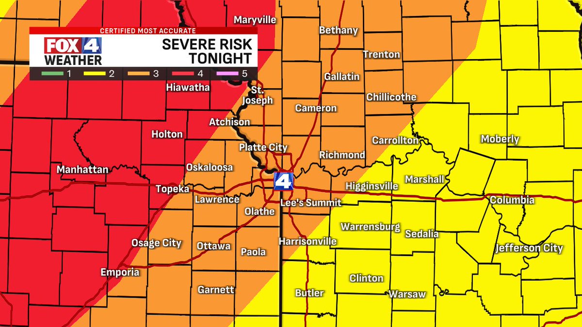
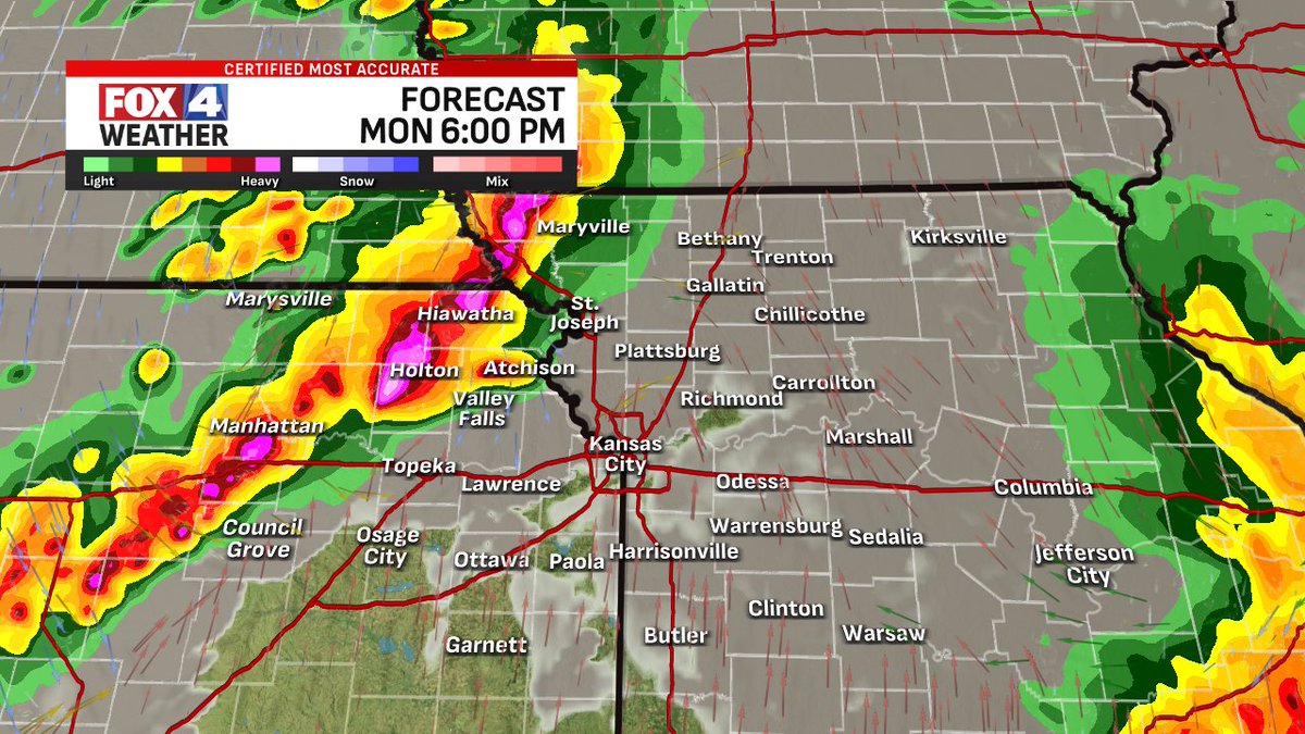
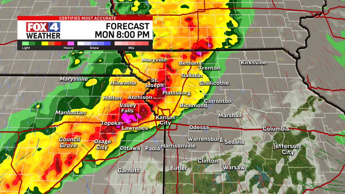
This PM/evening will be loud as the next wave of severe storms forms to our west around 1-3 PM. Large hail & high wind gusts are the top 2 threats with spin-ups possible within as it moves ESE. Into the NW side of the area around and after 6 PM, Metro around & after 8 PM. @fox4kc
English
@adventfear @fox4kc It'll be a lower tornado risk for both of those counties. Not totally zero however.
English
@AlexCounteeWX @fox4kc Any idea regarding tornadoes in Henry or Pettis co. MO tonight?
English
@twinswval @fox4kc It's unlikely. The main event is this evening
English

@AlexCounteeWX @fox4kc Will there still be another overnight round after midnight?
English

@AlexCounteeWX @fox4kc Any estimate on rainfall amounts in the metro?
English
Alex Countee retweetledi

@fox4wx @AlexCounteeWX @JacobLanierWx Various friends shared their pictures of this lenticular(?) cloud south of Hays on the 16th.


English
Alex Countee retweetledi
Incredible tornado just a bit ago near St. Libory, NE. Wow! That was awesome

English
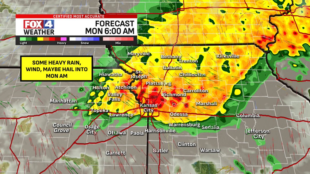
Next severe storm chance is tonight (Sunday night)! Another line of storms should form out west then move into the NW side of the viewing area. Severe wind, hail, and flash flooding are top concerns from KC to the NW. I'd expect a wet/loud start to Monday in the Metro. @fox4kc

English
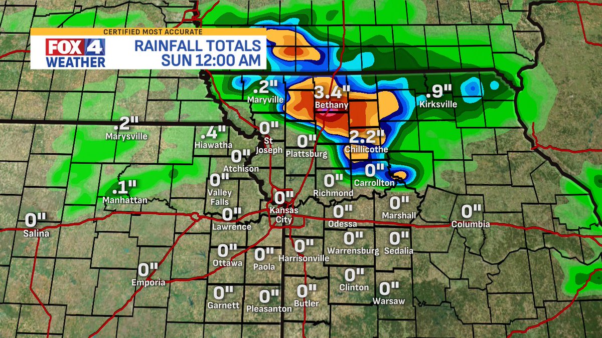
Last night, NW MO really went through it. Big hail of golf ball-baseball size was found around Trenton, MO, along with heavy rain and a couple of tornado warnings (maybe touchdowns?). Then, the flooding happened. This is a look at radar-estimated totals! @fox4kc


English
Alex Countee retweetledi

English
Alex Countee retweetledi



Alex Countee retweetledi

The southward trend of late PM/night storms continues, anchored closer to 36 Hwy & areas N/E. SVR hail & wind are still top threats, but flooding is becoming more of a problem. There is potential for 3"+ of rain & flash flooding tonight into early tomorrow morning. @fox4kc
English
Heads up for folks along/north of 36 Hwy tonight! More storms should develop there around and after 5 PM today & could become severe. 60 mph gusts & quarter-size hail are possible in the most intense storms through 11 PM tonight. This shouldn't be an issue for the Metro. @fox4kc

English