Kyle Brittain
40.2K posts
Kyle Brittain
@BadWeatherKyle
Severe weather specialist
Calgary Katılım Mart 2014
493 Takip Edilen30.7K Takipçiler


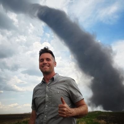
Alberta and northeast chasers would report this as violent
Sarah 📸@swrightCO
tag a chaser who would report this as a tornado
English
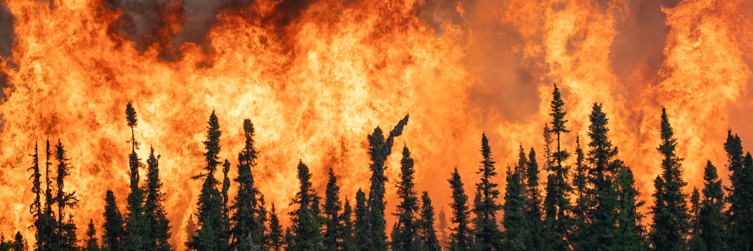
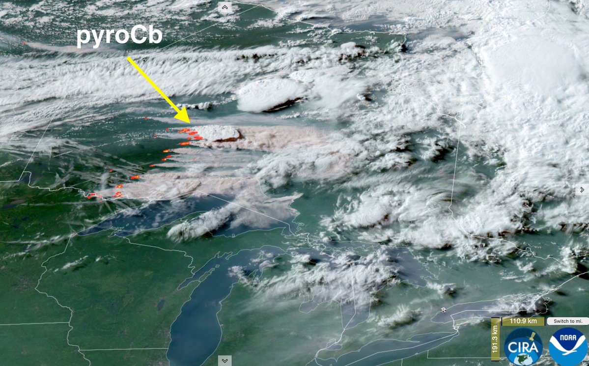
One wildcard could be the wildfire smoke being generated across northern Ontario on Monday evening, which will be blown toward the risk area through Tuesday. This could play at least somewhat of a role in limiting storm severity (and visibility), if timed correctly.
English
A potentially dangerous day of severe weather ahead for portions of eastern Canada on Tuesday.
A set of unusually potent ingredients could yield a regional tornado outbreak spanning from extreme eastern ON to NB, focused over parts of southern Quebec and the Eastern Townships, as well as adjacent areas of northern New England. #qcstorm

English
@scottdkehler Only place I've probably experienced a 27°C dewpoint is in a steam room
English

@ConnorMockettWX Definitely concerning for the St. Lawrence valley...
English
@RyanVoutilainen @JayLesykWX All the moisture was to the northeast!
English

@BadWeatherKyle @JayLesykWX Weird that it was the northeasterly too… And not a southeasterly.
English
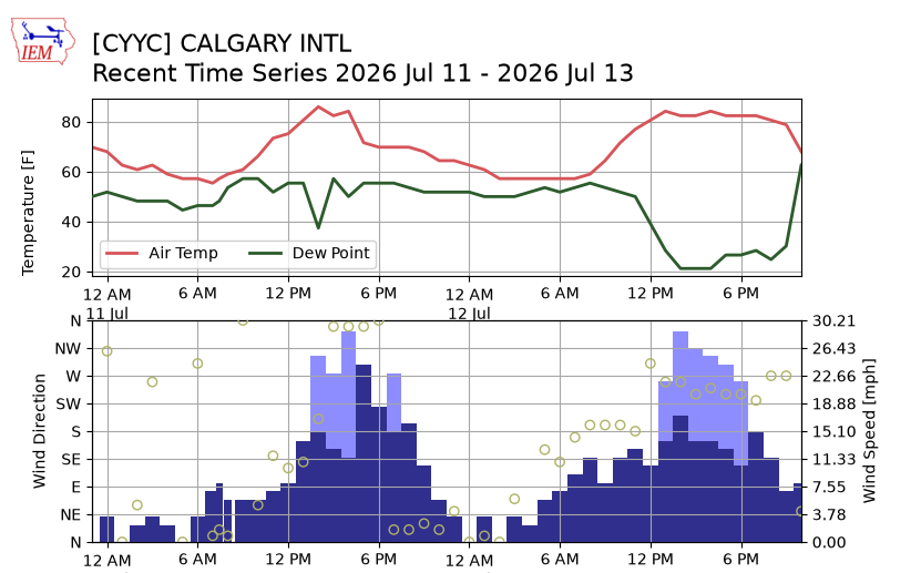
@Brad_In_YYC Dewpoint/moisture is just one ingredient...tomorrow should be pretty chill in southern AB!
English
@BadWeatherKyle I think I remember you thinking there was a good link between dew points and severe thunderstorms. What would this potentially do for tomorrow with the high dew point?
I just arrived in Medicine Hat and it's comfortably warm. But definitely feel a higher humidity than Okotoks.
English
Obscenely high dewpoint temperatures approaching the 27-28°C+ range southern SK and MB this evening.
This could be record-breaking for some locations.
Evening becomes extremely humid as soon as turbulent mixing from solar heating shuts down, but before dew forms.

English


Models are showing the potential for a regional thunderstorm event sometime around Wednesday through Friday as a storm system offshore draws up monsoon moisture from the Desert SW. Still quite a bit of disagreement between models, but this needs to be watched closely, especially for wildfire concerns. Anyone from Arizona to British Columbia and out over to Montana are in the threat zone.

English
Thank extremely wet soils from recent heavy rains, combined with a very strong upper ridge bringing very high temperatures. Evaporation of soils and transpiration of growing crops ("crop sweat") is the pathway #soupy
English
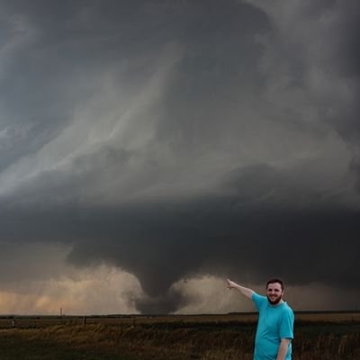
Steak warranted after i witnessed 3 tornadoes in the last 4 days
#abstorm #skstorm
@FORSYTHE_WX @TwistaHunterz

English
@HunterMarkewich 16C dews in Churchill is juiced! Polar bears definitely witnessing subarctic twisters today
English

A profusion of wildflowers in Banff National Park today!
Simply fantastic.


English

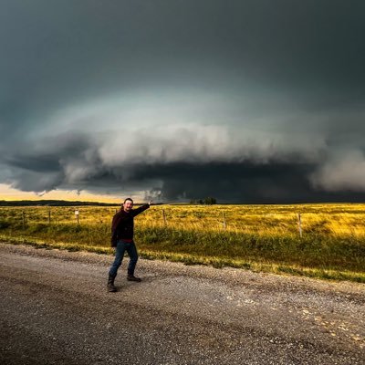
Twin tornadoes south of Glaslyn, Saskatchewan yesterday.
Caught these surprise rope tornadoes as I was approaching the main rainwrapped circulation over town.
#skstorm @teamdomcanada

English
@HunterMarkewich So sick to see the full structure from behind
English

@BadWeatherKyle Thanks! Still happy I got to see it, even if the picture wasn't amazing.
English
This was my only catch of the Tulliby to Onion lake tornado before it reached peak intensity. Unfortunately I hit a road closure and was out of position to get ahead of it. Great job to those who were able to get close, chasing out here is not easy!
#abstorm

English