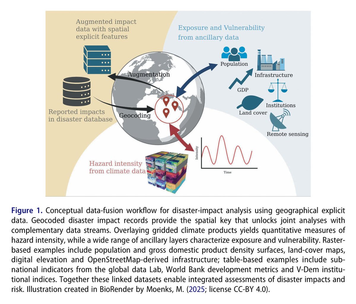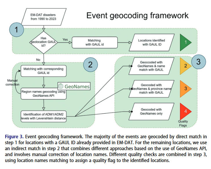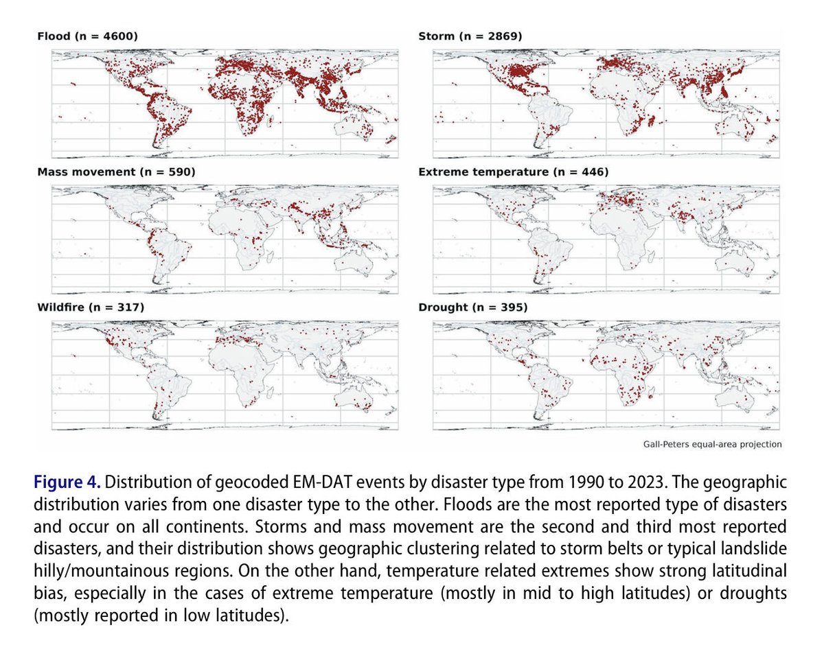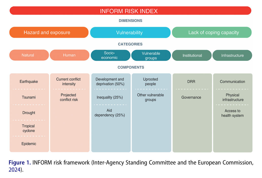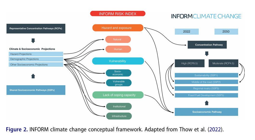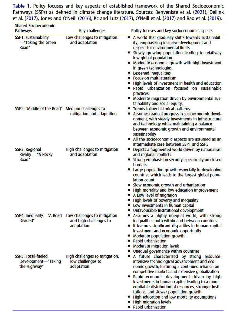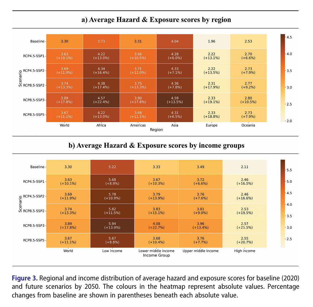
📢 [Data Note] Geo-Disasters: Geocoding climate-related events in the international disaster database EM-DAT by Khalil Teber, Mélanie Weynants, Fabian Gans & Miguel D. Mahecha 👉 doi.org/10.1080/209644… 💌 #Climate #hazards can escalate into humanitarian #disasters. Understanding their trajectories—considering #hazard intensity, human exposure, and societal #vulnerability—is essential for effective anticipatory action. The International Disaster Database (EM-DAT) is the only freely available global resource of humanitarian disaster records. However, it has imprecise geocoded information, which severely constrains its integration with spatial climate and socioeconomic data, limiting its use for climate impact research and policy planning. Here, we present Geo-Disasters (doi.org/10.5281/zenodo…), a database that provides geocoded locations of 9,217 climate-related disasters reported by EM-DAT from 1990 to 2023, along with an open, reproducible framework for updating (doi.org/10.6084/m9.fig…). Our method remains accurate even when only region names are available and includes matching quality flags to assess reliability. The augmented EM-DAT enables integration with other geocoded data, supporting #machinelearning applications and cross-domain analyses of climate risks, vulnerabilities, and adaptation deficits. By making more extreme events available, Geo-Disasters aims to bridge critical data gaps in global climate-hazard #risk assessment and to inform more equitable adaptation planning. #EMDAT #climateextremes #resilience #geocoding #opendata #bigearthdata #digitalearth #geoscience #remotesensing #earthobservation #GIS #dataanalysis #BigData