CLS Group

3.8K posts

CLS Group banner
CLS Group

CLS Group

@CLS_Group

A worldwide company using #data #space to help know better #Oceans and our #Planet. Pioneering on #Earth observations applications, #Argos services provider

France Katılım Temmuz 2014
627 Takip Edilen2K Takipçiler
CLS Group
CLS Group@CLS_Group·
🚚In humanitarian operations, every unnecessary kilometer, fuel loss, or vehicle breakdown directly affects operational performance. That is why optimizing fleet management is not simply about reducing costs, but about maximizing mission efficiency in the field. In the Democratic Republic of Congo, where humanitarian organizations must notably cope with the recent resurgence of Ebola, the ability to effectively coordinate teams and ensure operational continuity is essential. As an example, we supported our client in analyzing the first 12 months of operations of a 70-vehicle fleet, with tangible results: 🛡️ 10% reduction in insurance costs thanks to safer driving behavior ⬇️ 8% reduction in maintenance and tire costs driven by a proactive maintenance strategy 🚚 5% reduction in fleet size with no impact on operational capacity si ⛽12% reduction in fuel consumption through real-time monitoring and fuel control These results demonstrate how HUMANAV helps organizations optimize fleet operations, control costs, enhance safety, and improve coordination between field teams and headquarters through real-time visibility and more reliable decision-maki Smarter fleet management means more efficient missions and greater impact where it matters most. Discover how HUMANAV can optimize your operations 👉mobility.groupcls.com/en/our-activit… #FleetManagement #Humanitarian
English
0
0
0
28
CLS Group
CLS Group@CLS_Group·
❄️ Defence, sovereignty and resilience: polar regions are becoming major strategic areas. As Arctic maritime routes progressively open and geopolitical tensions intensify, the need for maritime surveillance and situational awareness in these extreme environments is accelerating. How can we monitor such vast, remote and hard-to-access areas? Which technologies can today track sea ice, icebergs, vessels and sensitive maritime activities in polar regions? And how can we guarantee the sovereignty and resilience of space capabilities in an increasingly complex geopolitical landscape? Satellite technologies play a key role in addressing these challenges: radar imagery, AIS and satellite data fusion, ice drift modelling, vessel behaviour analysis, AI-powered maritime intelligence… Polar-orbit satellite constellations also provide revisit capabilities particularly well suited to high-latitude monitoring. Yet several challenges remain central: ➡️ improving the responsiveness of satellite tasking and image acquisition, ➡️ strengthening the resilience of space infrastructures, ➡️ ensuring sovereign access to strategic data, ➡️ and maintaining reliable, near real-time maritime awareness. This week, Vincent Kerbaol, Director of CLS Brest and expert in satellite-based maritime surveillance, took part in a roundtable discussion during the forum Brest sur le Pont, dedicated to Defence and Space challenges in polar regions. He shared CLS expertise on: 🧊 sea ice and iceberg monitoring, 🚢 navigation safety in polar waters, 📡 maritime intelligence and vessel behaviour analysis, 🌍 as well as sovereignty and resilience challenges related to space capabilities. Discover more about CLS Maritime Intelligence solutions: maritime-intelligence.cls.fr #defence #arctic #antarctica #maritimesecurity
CLS Group tweet mediaCLS Group tweet mediaCLS Group tweet media
English

0
0
0
37
CLS Group
CLS Group@CLS_Group·
🌱 Farming is changing fast and space technology is becoming a real ally in the field. 🚜 At CLS, we help turn #satellite data into practical tools support farmers, cooperatives, seed producers, land managers, and agricultural stakeholders in their everyday decisions. From monitoring crops and pasture conditions to improving #irrigation and understanding climate impacts, our solutions are designed to make agriculture more efficient, resilient, and sustainable. Here’s how we support smarter farming: 🌾 Crop and field mapping 💧 Irrigation and soil moisture monitoring 🌦️ Weather and agrometeorological insights 📈 Yield estimation and vegetation monitoring 🐄 Pasture and herd monitoring 🛰️ Satellite connectivity for remote farming areas By combining Earth observation, field data, and satellite connectivity, we help bring useful insights directly to the people who need them, even in areas with limited network coverage. 📍 Want to learn more? Meet our experts Steven ROSA , Karim MEHAH and Nathalie RYCKEBUSCH at the 6th Intelligent Farming Summit organized by @Luxatia_intl in Berlin to talk more about the future of smart agriculture. #smartagriculture #agtech #IntelligentFarming2026
CLS Group tweet mediaCLS Group tweet mediaCLS Group tweet media
English
0
0
1
25
CLS Group
CLS Group@CLS_Group·
🌬️ LiDAR Data CFD Correction: improving wind measurement reliability in complex terrain LiDAR technologies are now widely used for wind measurement campaigns. However, in complex terrain environments (hills, valleys, forested areas), airflow becomes non-uniform and can introduce significant bias into wind measurements. At CLS, through , we provide a LiDAR Data CFD Correction service based on high-resolution CFD simulations to correct terrain-induced distortions and improve wind data accuracy. The service enables: ✔️ sector-by-sector and height-by-height correction of LiDAR measurements ✔️ improved correlation with meteorological mast data ✔️ increased reliability for AEP calculations and bankability studies 📊 This scientific approach has been validated on multiple complex terrain sites with significant results: • mean bias reduction up to 7%, resulting in an error of about 1-2% • average performance error improvement up to -0.06% ± 2% and for some sectors, wind speed measurement errors below 1% in 50% of cases CFD-based LiDAR flow curvature correction in complex terrain; Meteodyn, CGN New Energy Holdings Co.,Ltd, Nanjing Movelaser Co., Ltd, 2022). 🌍 As wind projects move toward increasingly complex and high-yield sites, reducing uncertainty in wind resource assessment becomes critical. Even small deviations in wind speed measurements can significantly impact annual energy production estimates, project financing and investment decisions. By combining LiDAR measurements with CFD-based flow modeling, developers and consultants can achieve a more robust understanding of site-specific wind behavior and reduce uncertainty throughout the project lifecycle. ⚙️ Compatible with major LiDAR technologies including ZX Lidars, WindCube® and Vaisala, this solution helps secure wind resource assessment in the most challenging environments. To learn more: meteodyn.com/sectors/onshor… #windenergy #cfd #lidar #windresourceassessment #renewableenergy #windmeasurement
CLS Group tweet mediaCLS Group tweet mediaCLS Group tweet media
English
0
0
0
39
CLS Group
CLS Group@CLS_Group·
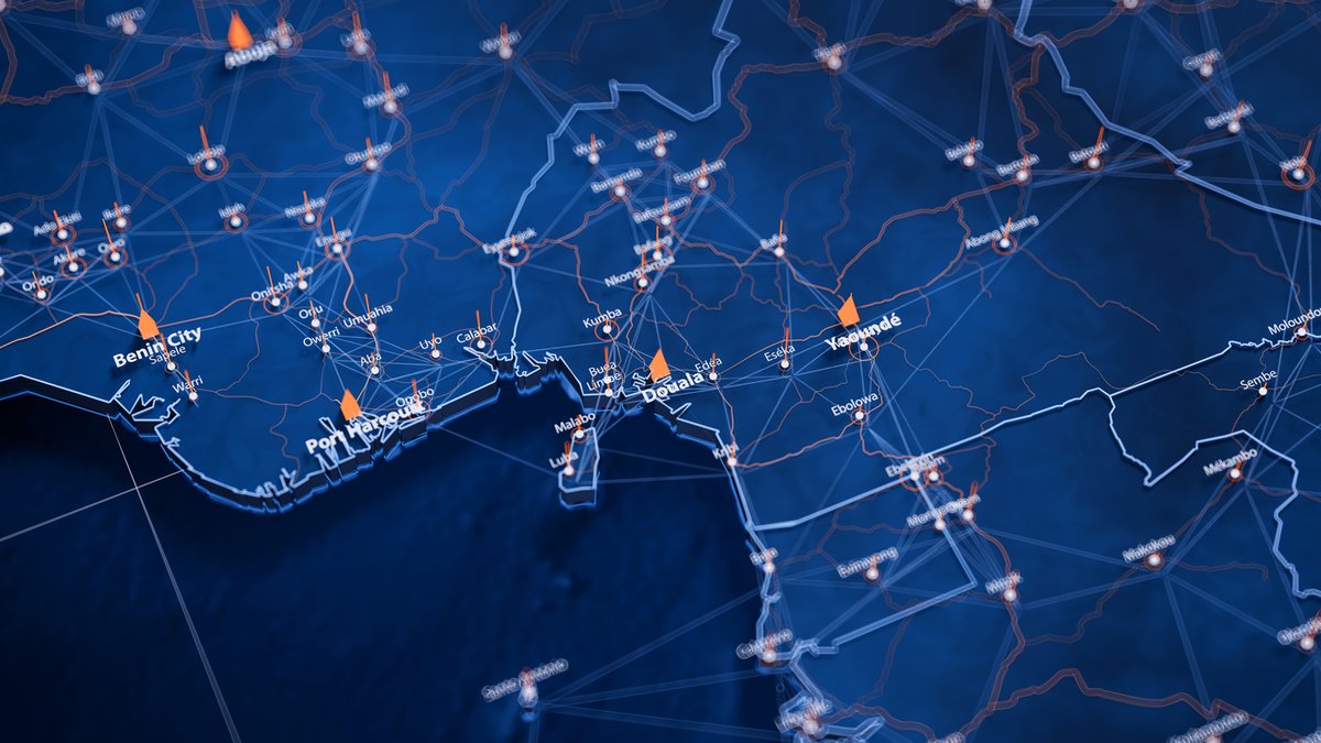
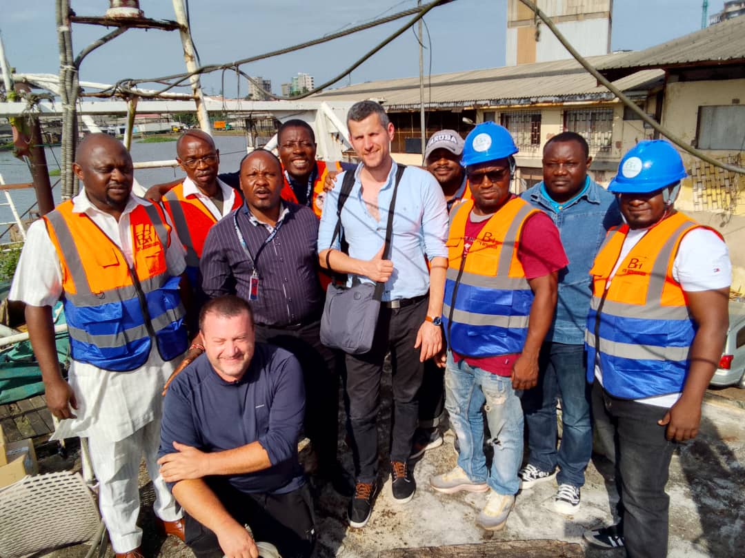
🌊 Nouveau déploiement de NEMO et TRITON en cours au Cameroun 👉 Les équipes CLS ont récemment réalisé l’installation de plusieurs balises #VMS à Douala afin de renforcer les capacités de suivi et de surveillance des activités en mer. 🛰️ Dans le contexte camerounais, où les zones côtières et maritimes disposent parfois d’une couverture réseau limitée, l’utilisation d’équipements de surveillance satellitaire est essentielle pour assurer la continuité du suivi des navires en mer. 🔧 Sur le terrain, une installation réussie repose sur quelques étapes clés : 1. La configuration et activation des balises 2. Les tests de connectivité mobile et satellite 3. La validation des transmissions de données en temps réel 4. L’accompagnement des équipes locales pour une prise en main opérationnelle 🎣 L’objectif commun est de fournir aux autorités des services et technologies contribuant à une gestion durable des pêches, à la sécurité en mer des pêcheurs et à la lutte contre la #pêche illégale. 🤝 Merci à notre partenaire local ETS BETHANIES pour ce déploiement réussi, ainsi qu’à nos équipes CLS. Merci également à la Brigade de Contrôle et de Surveillance des Activités de Pêche (BCSAP) et au Ministère de l’Élevage, des Pêches et des Industries Animales (MINEPIA) pour leur confiance. Pour en savoir plus sur ce déploiement 👉fisheries.groupcls.com/fr/surveillanc… #PêcheDurable #Connectivité
CLS Group tweet mediaCLS Group tweet mediaCLS Group tweet media
Français
0
0
1
58
CLS Group
CLS Group@CLS_Group·
🌬️ How much do you trust your Turbulence Intensity measurements? Turbulence Intensity (TI) directly impacts turbine design, performance, fatigue loads and overall asset service life. But offshore, measuring TI is far from straightforward. Floating LiDAR systems do not measure wind at a single point, they sample the motion of a parcel of air, while the platform itself is moving. The result: Quality of TI estimates can be significantly degraded. And today, there is no universally accepted standard to correct this. At CLS Group, we developed a correction methodology specifically tailored to our DeepCLidar buoy: ✔ Perform a transformation of measurement records into earth (fixed) coordinates ✔ Removal of motion-induced artifacts, including buoy eccentricity effects ✔ Methodology independent of sampling frequency and pattern ✔ Consistent TI correction across varying measurement conditions 📊 Result: up to 10% RMSE reduction in the critical 9–16 m/s wind speed range. Not just better measurements, more reliable solutions across the entire project lifecycle. 📩 Want to improve your TI measurements? Let’s talk. #offshorewind #windenergy #lidar #turbulence
CLS Group tweet mediaCLS Group tweet mediaCLS Group tweet media
English

0
0
1
49
CLS Group
CLS Group@CLS_Group·
🌍 Across Europe, water is changing. 🌊 From rising sea levels to river flooding and shrinking water resources, climate change is already reshaping our environment and impacting communities, ecosystems, and infrastructure. 💡 The European State of the Climate 2025 report, produced by the #Copernicus Climate Change Service (#C3S), @ECMWF and the @WMO brings together key scientific observations to better understand these changes and support climate adaptation. 🛰️ CLS is proud to contribute to this collaborative effort through satellite-based water monitoring expertise. Using satellite altimetry, we help monitor water levels in lakes and rivers worldwide, while supporting the observation of sea level rise and flood dynamics from space. Turning satellite data into actionable climate information is essential to help scientists, decision-makers, and communities anticipate and adapt to a changing climate. 🎥 Discover how satellite observations help us better understand Europe’s changing water systems in our latest video. #ESOTC2025 #climatedata
English

0
0
0
47
CLS Group
CLS Group@CLS_Group·
🌍 #MeetTheTeam at CLS Indonesia Our teams are driven by passionate people combining technology, innovation and international perspectives to build impactful solutions. Today, we are proud to spotlight Meru Radite Harjono, R&D Manager at CLS Indonesia. 🛰️ With a background in Physics from Institut Teknologi Bandung (ITB), Meru has dedicated more than 20 years to developing cutting-edge maritime and satellite-based solutions. 🚢 From Vessel Tracking Systems to Fuel & RPM Monitoring Systems powered by satellite technologies, his work contributes to improving maritime safety, operational efficiency and sustainable ocean management across the region. 💡Throughout his career, Meru has led and contributed to major projects for international clients and institutions, always with the same passion for innovation and teamwork. 🎥 @wttj recently chose to interview Meru to highlight his unique bicultural journey between France and Indonesia, with technology at the heart of his professional path. Discover his inspiring story and what it means to work at CLS in an international and fast-evolving environment. 👇 🚀 Looking for a meaningful career with real impact? Interested in new technologies, space, maritime challenges and international projects? 🌊 Our Careers page is regularly updated with many opportunities worldwide. Join us and help shape the future with data and innovation. #tech4good #innovation #maritimetech #içiçarecrute #joboftheweek
English
0
0
0
49
CLS Group
CLS Group@CLS_Group·
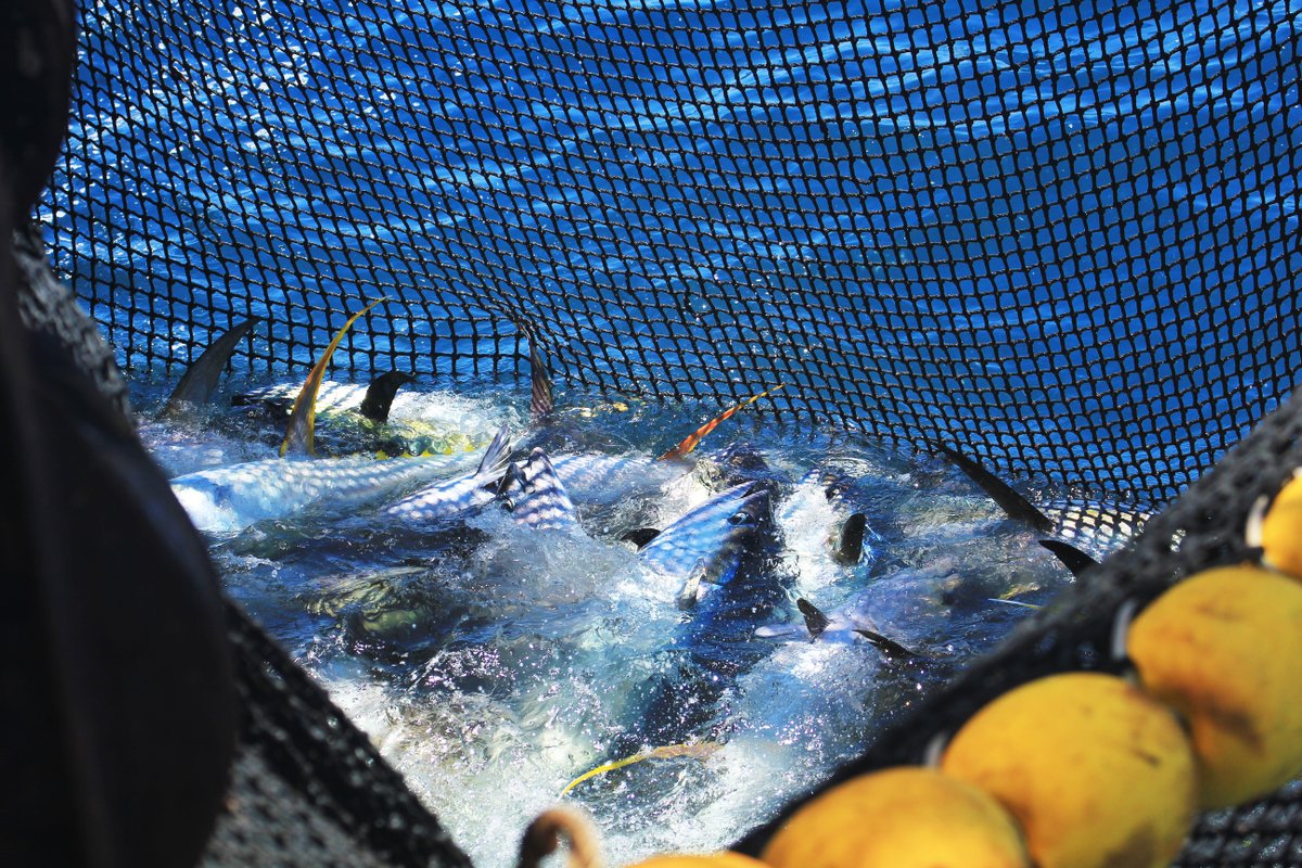
🌍 El Niño is back. What does it mean for fisheries? 🔍 According to the @WMO, there is around a 40% chance that an event will develop between May and July, while @NOAAClimate estimates up to a 90% probability by September. After the 2024 episode, this is a signal worth watching closely. El Niño is driven by a weakening of the trade winds, reducing upwelling off South America, warming eastern Pacific waters, and disrupting marine ecosystems. 🎣For fisheries, the impacts are already well known: - Productivity becomes more variable especially in the eastern Pacific, Peru, Ecuador and Chile making resources less predictable. - Food webs shift, and species respond. - Tuna, in particular, move as ocean conditions and prey availability change. At CLS, we support this transition with ecosystem-based models like SEAPODYM, helping anticipate changes in habitats and better understand stock movements. Learn more about El Niño impacts on fisheries and how CLS helps anticipate change 👉 fisheries.groupcls.com/how-cls-antici… #OceanScience #Fisheries #SEAPODYM
English
0
0
1
59
CLS Group
CLS Group@CLS_Group·
80% of participants experienced GNSS disruption in the past 12 months Not a future risk. A current operational reality. Thanks to everyone who joined our webinar, strong engagement and a clear takeaway: GNSS can no longer be relied on alone in high-risk regions. When positioning fails: 📍Crews lose situational awareness 📍Vessels appear in the wrong waters 📍Decisions are made on false data This is not a positioning issue. This is a control issue. 🛰️That’s exactly why we developed RockFLEET Assured: ✔ Trusted positioning, even when GNSS is compromised ✔ Real-time detection of jamming & spoofing ✔ Continuous operational visibility Because when your GPS lies… you still need the truth. Want to see it in action? 👉 Reach out to our CLS team and Fehmi Sanaa, Sales Representative at CLS, for a demo. #GNSS #jamming #spoofing #maritimesecurity #fleetmanagement #PNT
English
1
0
1
39
CLS Group
CLS Group@CLS_Group·
🗺️ In the field, managing a humanitarian fleet is not just about tracking vehicles. It’s about understanding the environment they operate in. 🏫💧With HUMANAV, new map layers enrich operations with key data: schools, water points, critical infrastructure… Why does it matter? - Prioritizing sensitive or strategic areas - Protecting people: drivers and passengers - Better mission planning by integrating real field conditions - Adding context to decisions, not just data 🚚 Because in humanitarian operations, every point on the map can represent a need or an emergency. Having the right information, in the right place, means acting faster and more effectively. 💻 Humanav is a global web and mobile platform connecting every level of organizations, from your headquarters to the field, designed for humanitarian operations worldwide. Contact our team to learn more about HUMANAV and its new map layer features 👉 pulse.ly/yqpashnwhn
CLS Group tweet mediaCLS Group tweet mediaCLS Group tweet media
English
0
0
0
39
CLS Group
CLS Group@CLS_Group·
🌊 In Belize, the NEMO beacon for sustainable fisheries In Belize, small-scale #fisheries are essential. Across 386 km of coastline, thousands of fishers depend on marine resources for their livelihoods, food security, and cultural identity. 🐟 From spiny lobster and queen conch to Nassau grouper and snapper, these species lie at the heart of a rich but increasingly fragile ecosystem (overfishing, illegal fishing, coral reef degradation). 🌍 Improving the understanding and monitoring of activities at sea is essential to ensure the sustainability of marine resources, particularly within the Belize Barrier Reef, one of the richest ecosystems in the world. 🔍 This is where NEMO makes a difference in Belize. Near real-time tracking improves visibility at sea, supports the fight against illegal fishing, strengthens monitoring for authorities, enhances data-driven resource management, and improves safety for small-scale fishers. NEMO is a beacon combining hybrid connectivity with a robust, energy-autonomous terminal adapted to small vessels. It delivers actionable data through a dedicated platform, while ensuring authorities retain full control over their data. Interested in deploying NEMO? 👉 fisheries.groupcls.com/product/nemo-v…
CLS Group tweet mediaCLS Group tweet mediaCLS Group tweet mediaCLS Group tweet media
English
0
0
1
58
CLS Group
CLS Group@CLS_Group·
From orbit to ocean, faster and smarter oil spill response is becoming a reality 🌍🛰️ At CLS, our Oil Spill Detection & Monitoring solutions combine multi-source satellite data (SAR, optical, thermal), AIS and AI-driven analytics to deliver fast, reliable and actionable insights when it matters most. By leveraging artificial intelligence, we enhance our ability to: ✔️ Automatically detect and classify oil slicks across large maritime areas ✔️ Reduce false positives in complex, high-traffic environments ✔️ Accelerate multi-sensor data fusion and analysis ✔️ Support faster, better-informed decision-making From incident reconstruction to real-time pollution tracking, our technologies support authorities and operators throughout the entire response chain. 🛰️ A recent case study following a tanker collision in the Fujairah area, UAE, demonstrated how satellite-based analysis enabled rapid assessment, distinguishing between chronic pollution and incident-related slicks, and confirming the absence of a major offshore spill while identifying localized leakage. Beyond detection, CLS is also advancing probabilistic oil spill drift modeling, helping response teams better manage uncertainties and define operational response zones with greater confidence. 📍 We’re proud to bring these capabilities to @OTCevents. Our colleague Mauricio Fragoso, Director of Energies and Infrastructure Monitoring at CLS, will speak at the session “From Orbit to Ocean: AI-Driven Satellite and Field Intelligence for Faster, Smarter Spill Response” on May 7, showcasing how AI, satellite data and modeling are transforming environmental response at sea. If you’re attending OTC, let’s connect 🤝! Want to go further? Discover how CLS integrates uncertainty into oil spill trajectory forecasts with probabilistic modeling 👉 …frastructures-monitoring.groupcls.com/probabilistic-… #offshore #oilandgas #maritimesafety #oilspill
English
0
0
1
81
CLS Group
CLS Group@CLS_Group·
🌊 Et si votre alternance ou votre stage contribuait directement à mieux comprendre et protéger notre planète ? Nos équipes placent la science, la data et la technologie au service des grands enjeux environnementaux de la planète. Rejoindre nos équipes en stage ou en alternance, c’est apprendre aux côtés d’experts tout en contribuant à des projets concrets et porteurs de sens. 🎓 Aujourd’hui, nous recrutons plusieurs stagiaires et alternant(e)s sur des sujets passionnants : 👩‍💻👨‍💻 Tech & Data • Alternance - Ingénieur Logiciel • Alternance - Deep Learning pour la reconstruction des courants océaniques de surface • Alternance - Systèmes IT (Stockage & Sauvegarde / Industrialisation Linux) • Alternance - IA dans les métiers de la Qualité 🌍 Sciences & Environnement • Alternance - Modélisation de la distribution des grands poissons pélagiques 📢 Business & Support • Alternance - Assistant Communication • Alternance - Performance Financière Et bien d'autres à consulter sur notre site 👉 cls.fr/carrieres/offr… Pourquoi choisir CLS pour votre stage ou alternance ? • Des projets concrets liés à l’océanographie, à l’environnement et à l’innovation technologique • Un encadrement de proximité pour développer rapidement vos compétences • Un environnement collaboratif où vos idées comptent vraiment • Une expérience professionnalisante au cœur de projets à impact Envie de donner du sens à votre parcours et de relever des défis concrets ? Rejoignez-nous et contribuez, dès aujourd’hui, à construire un avenir durable 👉 cls.fr/carrieres/offr… #recrutement #alternance #stage #tech4good
Français
0
0
0
94
CLS Group
CLS Group@CLS_Group·
🚨 Your GPS might be lying. In the Arabian Gulf, GNSS disruption is no longer occasional, it’s constant. 🌍Jamming. Spoofing. Position errors of several nautical miles. Your vessel could appear in the wrong place. Your AIS track could make no sense. Your crew could be navigating on false data. Position can be spoofed. Control must be assured. So what happens when you can’t trust GNSS anymore? 🎯 Join our webinar and see how to stay in control in GNSS-denied environments with RockFLEET Assured: ✔ Trusted and accurate positioning, independent from GNSS ✔ Real-time jamming & spoofing detection alerts ✔ Clear visibility between “real” vs “fake” position ✔ Continuous fleet control 📅 May 6 | 11:00 AM (Dubai time) ⏱️ 45 min Register now 👉 my.demio.com/ref/NuFLHnKqsM… #maritime #gnss #shipping
English
0
0
0
42
CLS Group
CLS Group@CLS_Group·
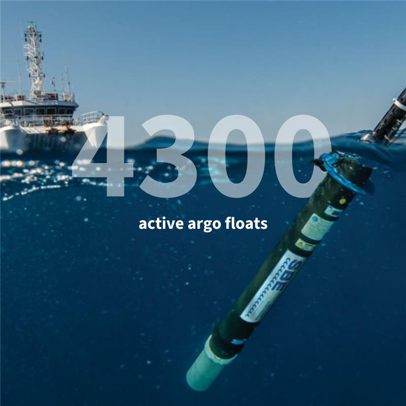
🌊 Right now, nearly 4,400 autonomous floats are currently diving deep beneath the surface of the ocean measuring temperature and salinity. Together, they form the Argo programme, a unique international effort helping us better understand how our oceans work, and how they are changing. 🤔 Why does it matter? Because the ocean plays a key role in regulating our climate. The data collected by Argo helps scientists improve weather forecasts, track climate change, and better protect our planet. At CLS, we are proud to contribute to this global effort. 🛰️ We provide satellite telemetry services (#Argos & Iridium), enabling floats to transmit their data from the most remote oceans. 💻 Our RUDICS data hosting solutions, developed for the #Argo programme, ensure reliable, secure, and efficient data flow from floats to data centers. 🔍 We also help ensure the accuracy of the data. By comparing float measurements with satellite observations, we can detect unusual values or drifts. These insights are then shared with experts, who can verify, correct, or flag the data if needed. 🤝 In this way, we support the quality and continuity of the Argo data stream, a cornerstone of global ocean observation. Because behind every float, there is an ecosystem of technologies and expertise making this global system possible. 📍 And this week, CLS experts Solène Routaboul & Neville Boorman are present at the Argo Steering Committee. Together, we help ensure that ocean data remains accessible, reliable, and impactful for science and society.
CLS Group tweet media
English
0
0
0
57
CLS Group
CLS Group@CLS_Group·
🐟 How CLS supports fishing fleet reporting in Belize with FISHLOG 2.0 In Belize, changing regulatory frameworks across regions are reshaping how fleets handle reporting and compliance. Recent changes include: - Updates to the electronic catch reporting system (ERS) scope for purse seine and longline vessels - Implementation of Fish Aggregating Device (FAD) management plans - A reduced number of authorized FADs per vessel These changes are impacting day-to-day fleet operations. 🎣FISHLOG 2.0 is designed to work in real conditions at sea, improving the quality and reliability of reported data. It gives authorities better visibility on fishing activities, while helping ensure compliance and traceability. For fishers, it makes reporting easier, reduces errors and supports daily operations. 🤝Deployed alongside local teams, CLS teams worked in close collaboration with local authorities to adapt the solution based on real usage and feedback. For more information, feel free to contact us: fisheries.groupcls.com/pecheurs/ers/ #Fisheries #DataReporting
CLS Group tweet mediaCLS Group tweet mediaCLS Group tweet mediaCLS Group tweet media
English
0
0
0
67
CLS Group
CLS Group@CLS_Group·
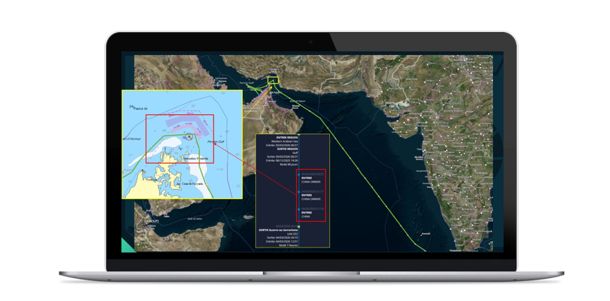
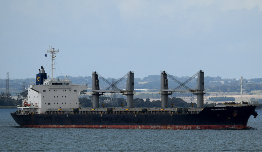
🚨 When AIS positions go dark in the Strait of Hormuz, what are you really seeing? In one of the world’s most sensitive maritime chokepoints, visibility can no longer be taken for granted. In the Strait of Hormuz, vessels are increasingly adapting their behavior to navigate a degraded and high-risk environment. Rather than simply following standard routes and broadcasting consistent AIS signals, some are now actively shaping what they reveal, and when. 🛰️ Recent observations illustrate this shift. A bulk carrier transiting the Strait briefly changed its AIS identity to a “China owner” before exiting the area. Another vessel altered its signal during its passage to better align with the regional context. These are not isolated cases. They reflect a broader evolution where AIS is no longer just a positioning tool, but a strategic layer of communication. At the same time, the challenge goes even further. In such environments, it is not only #AIS that can be manipulated, GNSS itself can be disrupted. This means that both what vessels transmit and what they actually perceive onboard may be compromised. 👉 The result is a growing gap between signal and reality. 🛰️ Rebuilding the maritime picture from space To address this, CLS leverages advanced Geospatial Intelligence (GEOINT) capabilities, combining multi-source data and expert analysis to reconstruct what is really happening at sea. 🖥️ Through MAS, our Maritime Awareness System, and VIGISAT, our data of expertise in maritime surveillance, AIS data has never been taken at face value. It is enriched, cross-checked and interpreted using satellite imagery, RF detection and AI-powered behavioral analytics, turning fragmented signals into actionable intelligence. This approach enables operators to: •detect inconsistencies in vessel identity or behavior •identify non-cooperative or “dark” vessels •understand the intent behind unusual navigation patterns 🧭 Restoring trust at vessel level But understanding the situation from space is only part of the answer. When positioning itself becomes uncertain, crews also need to trust their own navigation data. RockFLEET Assured addresses this challenge by providing a robust alternative to the #GNSS positioning and real-time detection of GNSS interference, ensuring that onboard decisions are based on reliable information to keep control. Want to explore these real-world cases in detail? Discover our full analysis of the Iron Maiden and Bogazici transits 👉 maritime-intelligence.groupcls.com/gnss-spoofing-… #maritimesecurity #shipping #maritimeawareness #straitofhormuz
CLS Group tweet mediaCLS Group tweet mediaCLS Group tweet media
English
0
0
0
59
CLS Group
CLS Group@CLS_Group·
🚀 C’est parti : la Space Game Jam 99 est lancée ! CLS est fier de soutenir la Space Game Jam 99, aux côtés de la Fondation de l'Espace et d’un écosystème engagé pour mettre la créativité au service de la Terre. Pendant 10 jours, plus de 200 étudiants vont relever un défi collectif : imaginer et créer des jeux vidéo mêlant code, design, narration, science et innovation. 🎮 Au programme : • des échanges inspirants et des idées qui fusent • une ambition commune : faire de la créativité un levier d’impact Au total 5 grandes thématiques guideront cette édition dont : 🌱 Bien-être du vivant 🌍 Climat, espace commun 💧 Sous l'eau (thématique autour de l'hydrologie et de la hausse du niveau moyen des mers) Comme nous le faisons au quotidien, la donnée spatiale et les technologies (traitement du signal, IA, big data, etc.) peuvent nourrir ces réflexions et inspirer les nouvelles générations. Nous sommes également heureux de mobiliser nos expertises avec notre expert référent pour le projet : Fabien Lefèvre, Océanographe et Responsable des applications altimétriques chez nous, accompagnera les participants en tant que mentor thématique. 👏 Bravo à tous les futurs participants ! Nous avons hâte de découvrir les projets qui émergeront de cette édition ! #spacegamejam #data4earth
CLS Group tweet mediaCLS Group tweet mediaCLS Group tweet mediaCLS Group tweet media
Français
0
0
1
66
CLS Group
CLS Group@CLS_Group·
🐪 Across the Middle East, Camel populations are growing and bringing new management challenges. As herds expand, the risks are becoming more visible: 🌱 Increasing pressure on fragile desert ecosystems 🚧 Rising road safety concerns linked to stray camels 🌍 Cross-border movements that challenge regulation and control Balancing tradition with modern governance is becoming essential. In our latest article, we explore how policy frameworks and satellite-based monitoring can work together to support safer, more sustainable camel management, at scale. 🛰️ Because today, tracking is no longer limited to small pilots. The #Argos Herd Management solution, combining cost-effective collars and reliable satellite connectivity, makes it now possible to monitor thousands, even millions, of camels across vast and remote desert areas and provides the visibility needed to manage herds at a national or regional level. Discover how data-driven tools are reshaping herd management 👉 argos-system.org/balancing-herd… #smartpastoralism #camelmanagement #livestocktracking
CLS Group tweet mediaCLS Group tweet mediaCLS Group tweet media
English
0
0
0
38