Chicago & Midwest Storm Chasers

8.1K posts
Chicago & Midwest Storm Chasers banner
Chicago & Midwest Storm Chasers

Chicago & Midwest Storm Chasers

@ChicagoMWeather

Extreme Weather Videographer, Storm Chaser, and Photographer. Video stringer for several news companies.

Chicago, IL Katılım Nisan 2020
1.8K Takip Edilen18.5K Takipçiler
Sabitlenmiş Tweet
Chicago & Midwest Storm Chasers
Chicago & Midwest Storm Chasers@ChicagoMWeather·
The Most Impressive Multi-Vortex #TORNADO I have ever seen. The vortices were moving at warp speed. You must watch this! I was very close... I cropped in a bit to show you how intense this tornado was. #OKwx @NWSNorman
English
11
23
157
105.7K
Chicago & Midwest Storm Chasers
I also don't need to prove anything to you or anyone else. I chase for myself, that's all. Why would I need credibility from you? That's funny. You think I chase for you? I don't. You're pathetic, and your anger is even more pathetic compared to every other chaser out there. The awards you give are just part of your ego circle, which you only share with other chasers who are on team Erik, and you hate anyone who does their own thing and opposes team Erik. I don't need credibility from you; I'd rather not. I'm just tired of seeing you cry and complain about everything on social media.
English
1
0
0
509
Erik Fox
Erik Fox@erikfox2000·
@ChicagoMWeather @chaser_summit So, the day you ever have credibility with me is the day I see a pig fly to the moon without a rocket! Go sexually harass someone else and don’t waste my time with your uneducated and uninformed bull shit!
English
3
1
43
1.2K
Chicago & Midwest Storm Chasers
@erikfox2000 @chaser_summit Haha, someone's mad. Hope you learn to do better. Control your anger; you're not the best, and you never will be. There are people better than you out there. You're not the top dog. Stop pretending you are.
English
1
0
0
400
Chicago & Midwest Storm Chasers
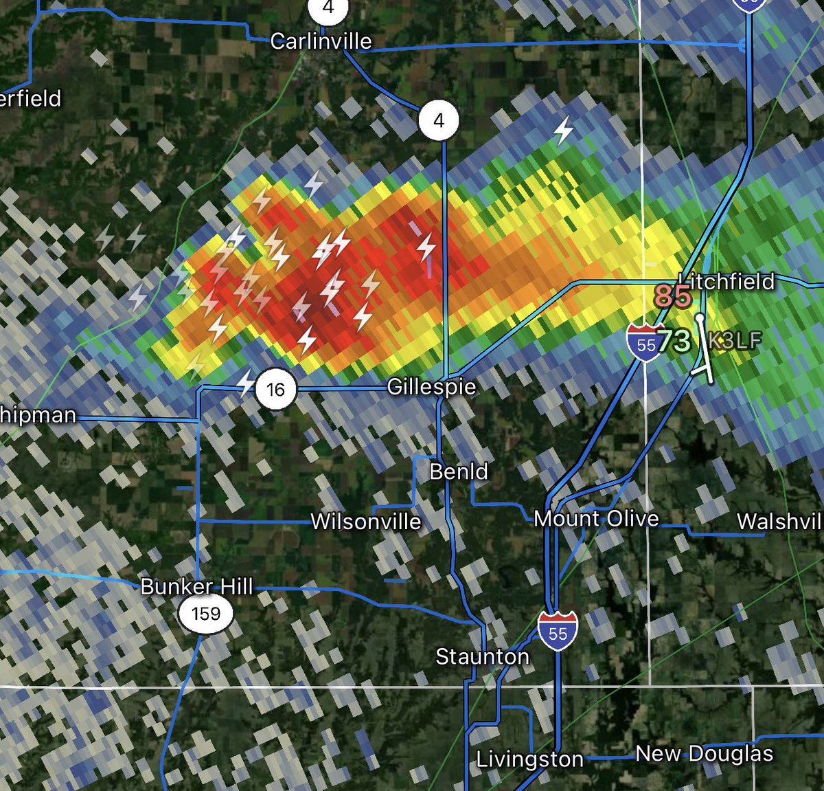
🌩️ Developing Rotating Storm Near Litchfield, IL A thunderstorm near Litchfield, Illinois is showing signs of rotation as it continues to organize into a developing supercell. While no tornado has been confirmed, storms with rotation can strengthen quickly and may become capable of producing damaging winds, large hail, and a brief tornado. If you’re in or near the Litchfield area, stay weather-aware and keep a close eye on radar and any warnings that may be issued. #ILwx #SevereWeather #LitchfieldIL #Supercell #WeatherAlert
Chicago & Midwest Storm Chasers tweet mediaChicago & Midwest Storm Chasers tweet mediaChicago & Midwest Storm Chasers tweet media
English
0
0
4
1K
Chicago & Midwest Storm Chasers
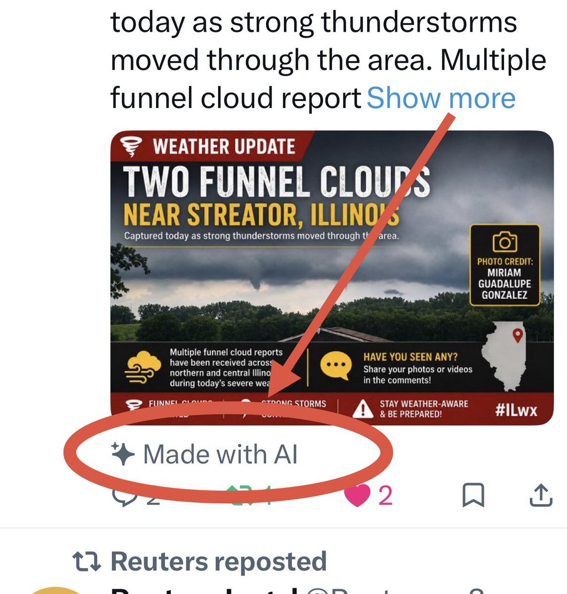
🌪️ Another Funnel Cloud Photo – Near Streator, IL Another impressive photo showing two funnel clouds near Streator, Illinois was captured today as strong thunderstorms moved through the area. Multiple funnel cloud reports have been received across northern and central Illinois during today’s severe weather. 📸 Photo credit: Miriam Guadalupe Gonzalez #ILwx #FunnelCloud #SevereWeather #StormChasing #IllinoisWeather #WeatherPhotography
Chicago & Midwest Storm Chasers tweet media
English
1
2
7
748
Chicago & Midwest Storm Chasers
🌪️ Funnel Cloud Report – Streator, IL A funnel cloud was spotted near Streator, Illinois a short time ago as strong thunderstorms moved through the area. 📸 Photo credit: Erin Wilson. Continue to stay weather-aware, as additional funnel clouds or warnings may develop with these storms.
Chicago & Midwest Storm Chasers tweet media
English
0
1
4
807
Chicago & Midwest Storm Chasers
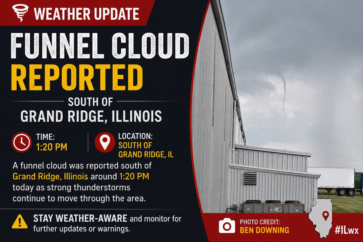
🌪️ Funnel Cloud Report – Grand Ridge, IL A funnel cloud was reported south of Grand Ridge, Illinois, around 1:20 PM today. The report comes as strong thunderstorms continue to move across the region. 📸 Photo credit: Ben Downing. Stay weather-aware and monitor for additional updates or warnings if you’re in the area.
Chicago & Midwest Storm Chasers tweet media
English
0
0
4
693
Chicago & Midwest Storm Chasers
🌪️ Funnel Cloud / Brief Tornado Report – Orion, IL A funnel cloud, or possibly a brief tornado, was reported near Orion, Illinois around 12:45 PM today. Additional confirmation from the National Weather Service is pending. 📸 Photo credit: Allie Hessman. Stay weather-aware if you’re in the area, as storms continue to move through parts of Illinois.
Chicago & Midwest Storm Chasers tweet media
English
0
1
6
755
Chicago & Midwest Storm Chasers
⛈️ Thursday Severe Weather Outlook – Southern Illinois, Southeast Missouri & Nearby Areas Scattered thunderstorms are expected to develop this afternoon and evening across southern Illinois, southeast Missouri, and nearby portions of the Mid-Mississippi Valley. A Slight Risk (Level 2 of 5) for severe weather is in place, with the primary concern being damaging straight-line winds. A low-end tornado threat and isolated large hail are also possible, especially if any storms can remain discrete and develop into sustained supercells before merging into clusters or a line. The tornado risk is considered conditional, meaning it depends on whether storms can stay isolated long enough to rotate. ⏰ Timing 🌤️ Storm development: 2–5 PM ⛈️ Greatest severe threat: 4–9 PM 🌙 Storms gradually weaken or move east later this evening. Main Hazards 💨 Damaging wind gusts of 60–70+ mph 🌪️ Low-end, conditional tornado risk 🧊 Isolated large hail (around quarter size or larger) ⚡ Frequent lightning 🌧️ Localized heavy rainfall and isolated flooding While widespread severe weather is not expected, any storm that becomes a sustained supercell could quickly become severe with all hazards possible. Residents across southern Illinois and southeast Missouri should remain weather-aware through the afternoon and evening in case watches or warnings are issued. #ILwx #MOwx #SevereWeather #StormAlert #TornadoRisk #Hail #DamagingWinds
Chicago & Midwest Storm Chasers tweet mediaChicago & Midwest Storm Chasers tweet media
English
0
1
3
1.2K
Chicago & Midwest Storm Chasers
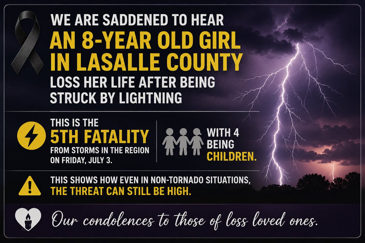
🌩️ Tragic Storm Update We are deeply saddened by the tragic loss of an 8-year-old girl in LaSalle County after she was struck by lightning on Friday, July 3. This marks the 5th storm-related fatality in the region that day, with 4 of the victims being children. This heartbreaking tragedy is a reminder that severe weather can be deadly even without tornadoes. Lightning is one of nature’s most dangerous hazards, and it’s important to seek shelter immediately when thunder is heard. 💙 Our thoughts and heartfelt condolences are with the family, friends, and all those affected by these devastating losses. #ILwx #LightningSafety #WeatherAwareness
Chicago & Midwest Storm Chasers tweet media
English
2
2
12
1.5K
Chicago & Midwest Storm Chasers
Chicago & Midwest Storm Chasers@ChicagoMWeather·
⛈️ Thursday Severe Weather Outlook Attention is turning to Thursday, when a mesoscale convective vortex (MCV) moving into eastern Missouri and central/southern Illinois could set the stage for a conditional all-hazards severe weather threat. The overall risk will depend heavily on how morning thunderstorms evolve, the amount of cloud cover, and the exact track of the surface low. If enough sunshine allows the atmosphere to recover, severe storms capable of damaging winds, large hail, tornadoes, and heavy rainfall could develop. Stay tuned—forecast details and confidence will become clearer over the next couple of days. 🌩️🌪️⚡
Chicago & Midwest Storm Chasers tweet media
English
1
1
7
1.4K
Chicago & Midwest Storm Chasers
Chicago & Midwest Storm Chasers@ChicagoMWeather·
🌪️ Tornado Warning – Livingston & Ford Counties, IL ⚠️ A Tornado Warning is in effect until 4:45 PM CDT for east-central Livingston County and north-central Ford County in central Illinois. At 4:13 PM, a radar-indicated rotating severe thunderstorm was located near Saunemin, about 8 miles northwest of Chatsworth, moving east at 30 mph. The storm is expected to impact Cullom around 4:20 PM. Hazards include: 🌪️ Tornado possible 💨 Damaging winds and flying debris 🌧️ Torrential rainfall with localized flash flooding 🌳 Damage to trees, roofs, windows, vehicles, and mobile homes 🏠 If you’re in the warned area, take cover immediately in a basement or an interior room on the lowest floor of a sturdy building, away from windows. Avoid driving through flooded roads.
Chicago & Midwest Storm Chasers tweet media
English
0
1
12
1.5K
Chicago & Midwest Storm Chasers
Chicago & Midwest Storm Chasers@ChicagoMWeather·
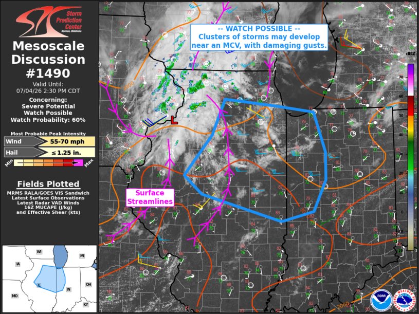
⚠️ Severe Weather Update – Watch Possible ⛈️ The Storm Prediction Center is monitoring central and north-central Illinois for possible strong to severe storm development this afternoon. A watch may be needed, with a 60% chance of issuance. Storms are expected to develop after 1 PM CDT near a low pressure system/MCV moving out of eastern Iowa into northern Illinois. As the atmosphere warms and destabilizes, storms may organize and move east into Indiana later this afternoon and evening. The main threat will be damaging wind gusts, but storms may also produce heavy downpours, frequent lightning, and small to marginally severe hail. Some storm potential could reach near parts of the Chicago metro, depending on how much destabilization occurs. Storm motion will generally be eastward, with some southeast movement possible, which could bring stronger wind potential toward the Indianapolis area by early evening. #ILwx #INwx #SevereWeather #StormChasing #WeatherAlert #SPC #MidwestWeather
Chicago & Midwest Storm Chasers tweet media
English
1
0
16
2.3K
Chicago & Midwest Storm Chasers
Chicago & Midwest Storm Chasers@ChicagoMWeather·
🇺🇸 Happy 4th of July from Chicago & Midwest Storm Chasers! 🎆 Wishing all of our followers a safe, fun, and unforgettable Independence Day! Enjoy the fireworks, spend time with family and friends, and celebrate the holiday weekend. As always, stay weather aware, especially if storms are nearby. If you hear thunder, head indoors and keep an eye on alerts. ⚡⛈️ Have a great 4th, everyone! 🎇 #Happy4th #IndependenceDay #ChicagoAndMidwestStormChasers #ILwx #MidwestWeather #StayWeatherAware
Chicago & Midwest Storm Chasers tweet media
English
2
1
10
873
Chicago & Midwest Storm Chasers
Chicago & Midwest Storm Chasers@ChicagoMWeather·
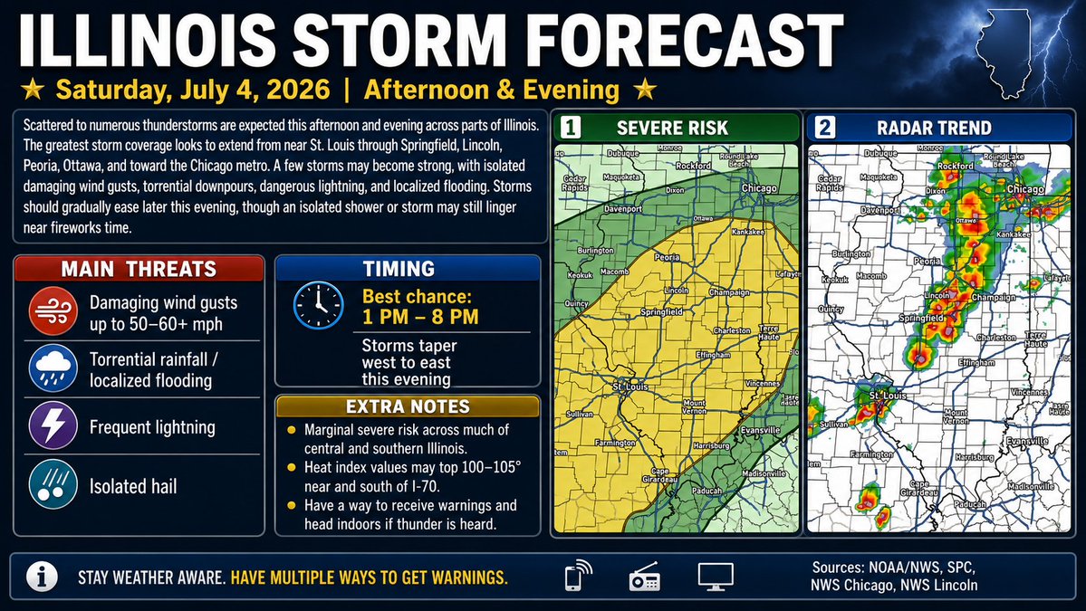
Thought for a couple of seconds⛈️ Illinois Storm Forecast – Saturday, July 4, 2026 🇺🇸 Scattered thunderstorms are expected across Illinois this afternoon and evening, with the main storm corridor running from the St. Louis area northeast through Springfield, Lincoln, Peoria, Ottawa, and toward the Chicago metro. 🌧️⚡The best chance for storms looks to be from about 1 PM to 8 PM, with storms gradually tapering off from west to east later this evening. A few storms could become strong to locally severe, with the main threats being:💨 Damaging wind gusts around 50–60+ mph 🌧️ Torrential rainfall ⚠️ Localized flooding ⚡ Frequent lightning 🧊 Isolated hail Much of central and southern Illinois is under a Marginal severe risk, meaning isolated severe storms are possible. Northern Illinois could also see storms this afternoon and early evening, especially near and south of I-80. Some areas may get a break in time for fireworks, but an isolated storm could still linger. 🎆Also, it will be hot and humid, especially near and south of I-70, where heat index values may reach 100–105°. 🥵 Have multiple ways to receive warnings and head indoors if thunder is heard. #ILwx #IllinoisWeather #SevereWeather #Thunderstorms #ChicagoWeather #CentralIllinois #StLouisWeather #July4thWeather #WeatherAlert #StormForecast #MidwestWeather #FireworksForecast
Chicago & Midwest Storm Chasers tweet media
English
0
2
14
2.6K
Chicago & Midwest Storm Chasers
Chicago & Midwest Storm Chasers@ChicagoMWeather·
⛈️ Illinois Severe Weather Forecast – Saturday, July 4th Strong to severe thunderstorms are expected to develop and move east across Illinois Saturday afternoon through the evening. The greatest severe weather threat is expected across western, central, and northern Illinois, with storms potentially organizing into a line capable of producing widespread damaging winds. Main hazards include: 💨 Damaging wind gusts up to 70+ mph 🧊 Large hail 🌪️ An isolated tornado cannot be ruled out ⚡ Frequent lightning 🌧️ Torrential rainfall and localized flooding The highest risk extends from the Mississippi River east toward Rockford, Peoria, Springfield, and portions of the Chicago metro. Areas farther east, including east-central Illinois, could also see strong to severe storms later in the day if the line maintains its strength. If you have outdoor plans for the Fourth of July, keep a close eye on the forecast and be prepared to move indoors quickly if warnings are issued. Storm timing and intensity may change as new data becomes available.
Chicago & Midwest Storm Chasers tweet media
English
1
2
20
3.7K
Chicago & Midwest Storm Chasers
Chicago & Midwest Storm Chasers@ChicagoMWeather·
⚠️ Severe Thunderstorm Watch – Illinois, Indiana & Iowa ⛈️ A Severe Thunderstorm Watch is in effect until 2:00 AM CDT Saturday for parts of Illinois, Indiana, and Iowa. Thunderstorms capable of producing damaging wind gusts up to 70 mph, ping pong-sized hail, and a couple of tornadoes are possible overnight. If you’re in the watch area, stay weather-aware, have multiple ways to receive warnings, and be prepared to take shelter if a warning is issued. ⛈️ Stay alert and monitor the latest weather updates. #ILwx #INwx #IAwx #SevereThunderstormWatch #SevereWeather #WeatherAlert
Chicago & Midwest Storm Chasers tweet media
English
0
2
8
1.4K
Chicago & Midwest Storm Chasers
Chicago & Midwest Storm Chasers@ChicagoMWeather·
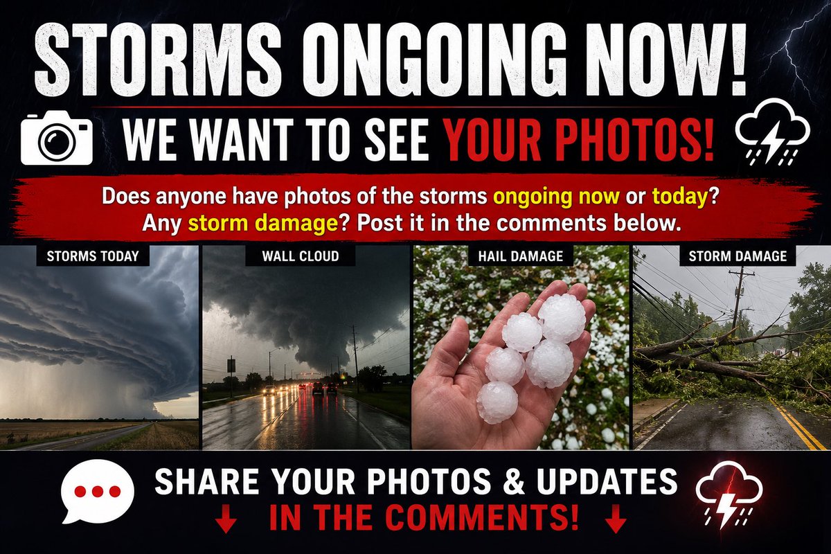
📸⛈️ Storm Photos & Damage Reports Wanted! 🌪️ Are you seeing storms in your area today? We’d love to see your photos and videos! If you’ve experienced hail, damaging winds, flooding, or any storm damage, share your pictures in the comments below. ⚠️ Your reports help others stay informed and show what conditions are like across the region. 📷 Post your storm photos, videos, and damage reports below! #ILwx #INwx #IAwx #StormReports #SevereWeather #WeatherCommunity
Chicago & Midwest Storm Chasers tweet media
English
0
0
0
838
Chicago & Midwest Storm Chasers
Chicago & Midwest Storm Chasers@ChicagoMWeather·
🌩️ Look at this incredible view! A towering 55,000-foot overshooting thunderstorm is rapidly organizing into a supercell near Rochelle this evening. If skies are clear, this massive storm may be visible from many miles away across northern Illinois. Can anyone see it from their house? Drop your location and photos in the comments! 📸⛈️ @WindyCityWxMan
Chicago & Midwest Storm Chasers tweet mediaChicago & Midwest Storm Chasers tweet mediaChicago & Midwest Storm Chasers tweet mediaChicago & Midwest Storm Chasers tweet media
English
9
8
73
6.3K