Chris Jochem retweetledi

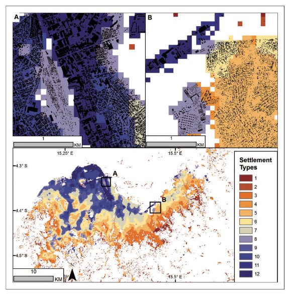
🥳The Breheny Prize for the most innovative @envplanb article published in 2021 has been awarded to @ChrisJochem , Douglas Leasure, Oliver Pannell, @HeatherCh100 , Patricia Jones, @AndyTatem from the @WorldPopProject Congratulations to all👏Find out more: doi.org/10.1177/239980…
English