
@birds_burgh @GamecockWill69 If you don’t mind me asking what kinda issues? Like what should i be looking out for?
English
Dontworryboutit
33 posts


[Epilepsy Warning] ___ Join the colorful, pocket-sized debut of the COLORGEIST on March 19th 2:00 PM PST 👑🎶


Just made a post about this. I’m pretty understanding given how much I love weather science and how active I am on here with wx ppl, but the pushback from the general population is HARD and heavy in NC. Frankly it was a major bust and people, especially those who had to change their schedule for school/childcare, are fuming on X and Facebook.
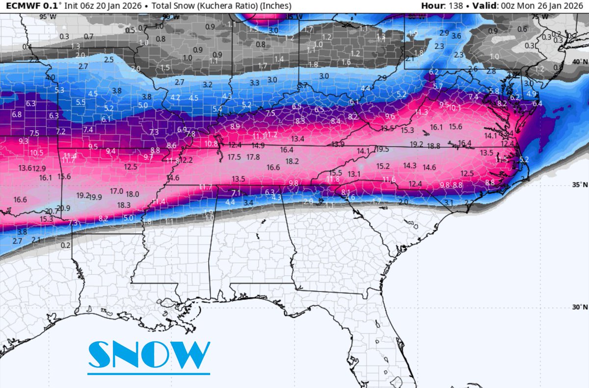
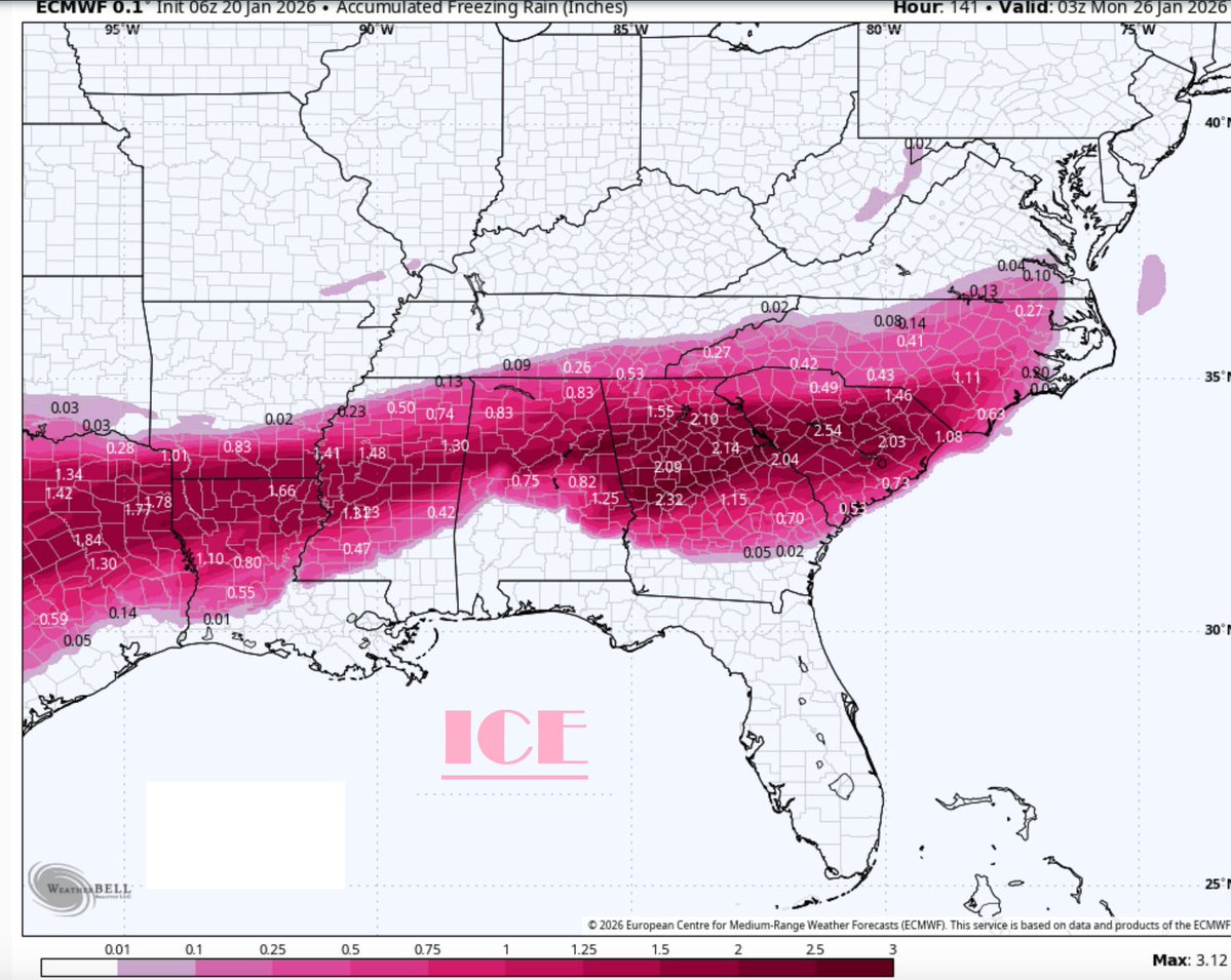
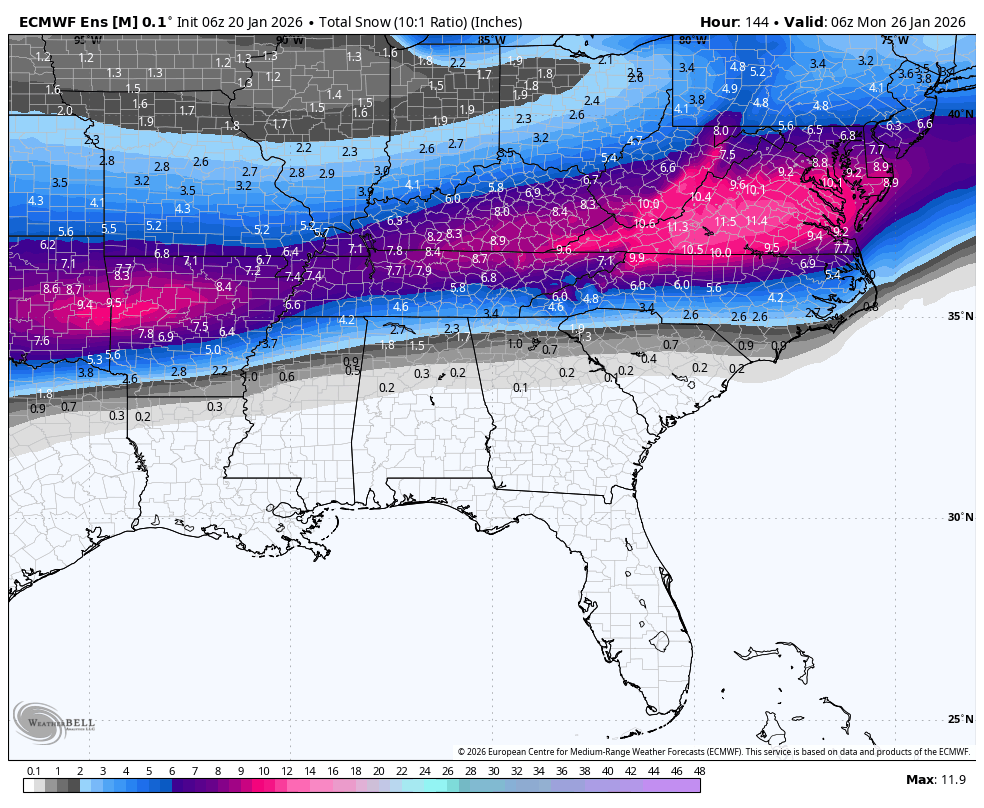
WeatherNext 2.0, the new gold standard for AI modeling, locked into the synoptic evolution of this storm six days ago. At that time, both the Euro and GFS were still showing major snow in the Carolinas. Very, very impressive predictions from AI models across the board.

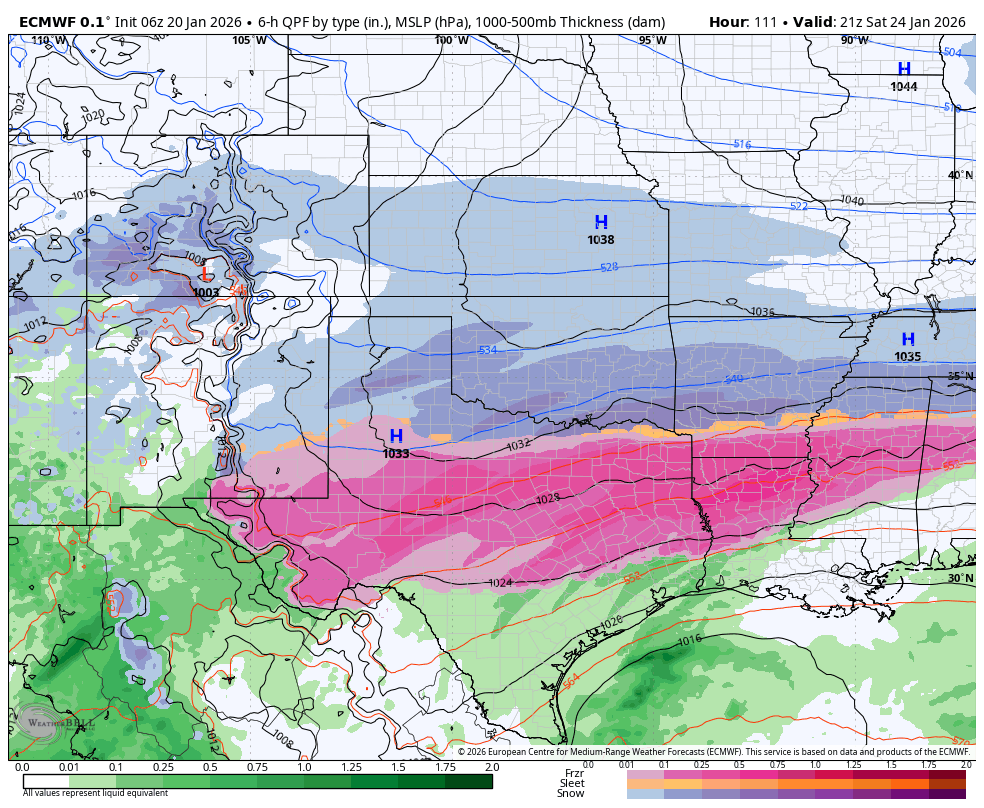
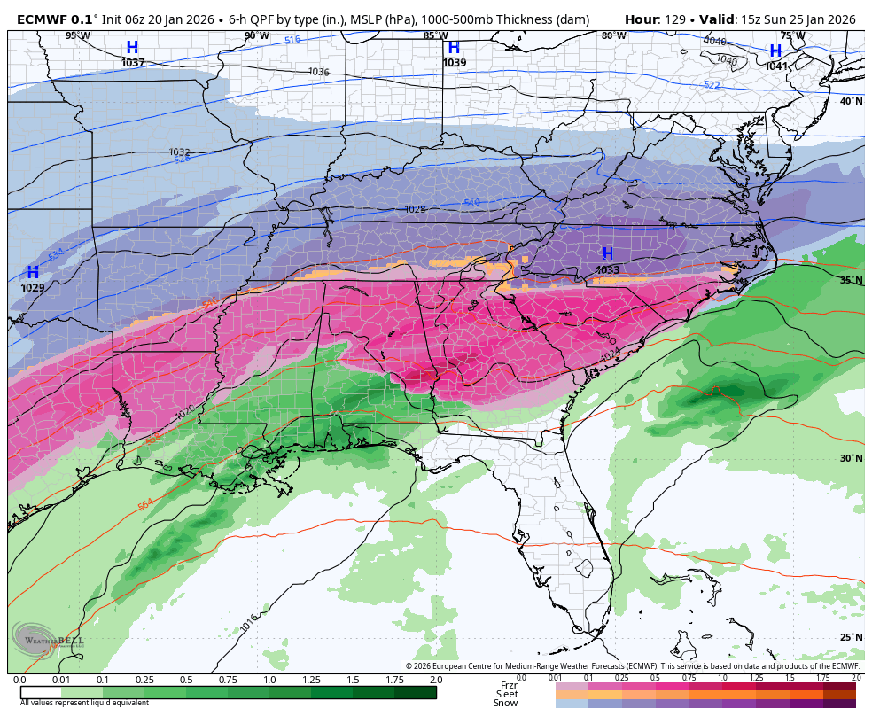
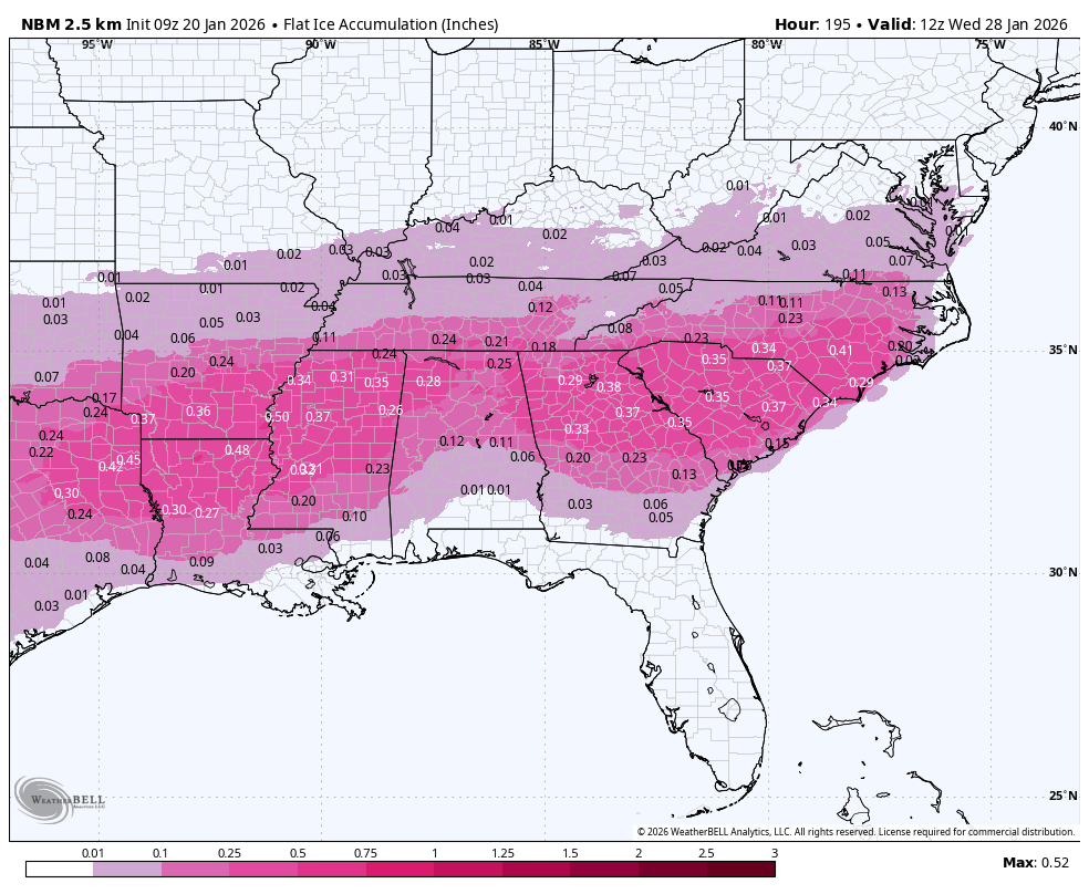
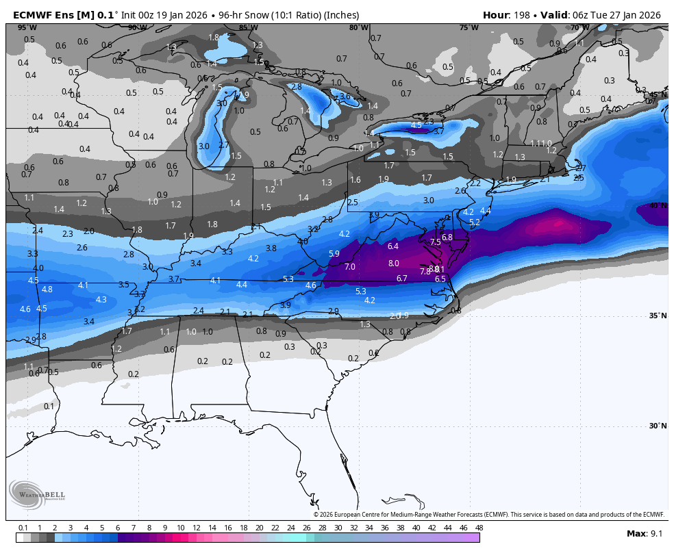
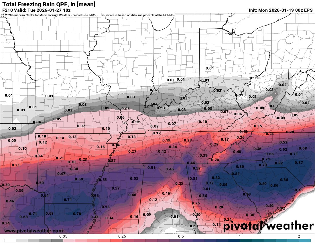
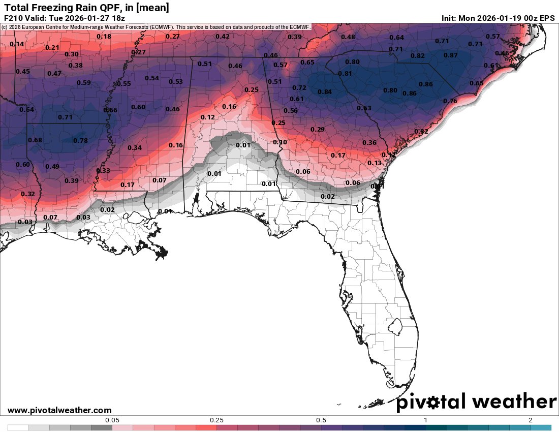
Headline: 🚨 FIRST CALL: Weekend Winter Storm Update (Saturday - Monday) as of 11 AM today (1/22/2026): Here is my First Call for the upcoming winter storm this weekend. As always with winter weather in the Carolinas, the details—specifically that transition line between rain, sleet, and freezing rain—are going to be critical. 🧊 The Ice Threat: This is my biggest concern right now. We are looking at a significant "wedge" of cold air locking in. The guidance is highlighting a corridor of heavy ice potential (0.25" - 0.50") stretching from the foothills through the Triad and potentially clipping the Charlotte metro area. That amounts to enough ice to cause travel issues and likely some power outages if it verifies. The problem is that this area could shift north or south over time, depending on trends. 🌨️ Sleet vs. Snow: For many of us along the I-85 corridor, this is looking like a messy mix. I’ve got a zone of "All Sleet" slicing right through the central Piedmont. If you want pure snow, you’ll likely need to be deeper in the mountains or foothills (Boone/Jefferson area), where the cold air is deep enough to support it. 🥶 The Cold: Look at those Futurecast temps for Saturday evening—22° in Charlotte. That cold air is going to be stubborn and stick around into next week, with single digits possible. Post-storm weather will be brutally cold! ⚠️ IMPORTANT: These maps represent the potential right now. This forecast will likely change a little bit as we get new data and pinpoint exactly where that freezing line sets up. A shift of 20-30 miles north or south changes everything. Stay weather aware and keep checking back for updates. I’ll have the latest data on WCNC tonight! #cltwx #ncwx #scwx #wcnc #wcnc #FirstCall #WinterStorm #IceStorm #WeatherAware


Nyck Harbor on his decision for staying/leaving @GamecockFB: "I haven't even really though about that yet... we just finished the season, I got two more exams to finish up for the year so Ima focus on that." @wachfox

