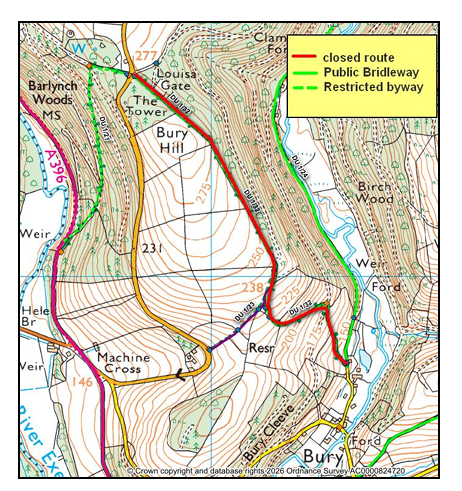
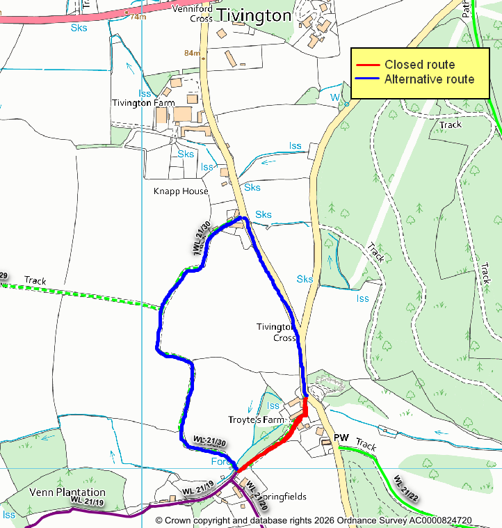
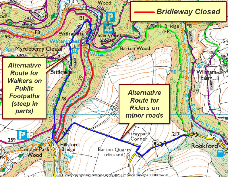
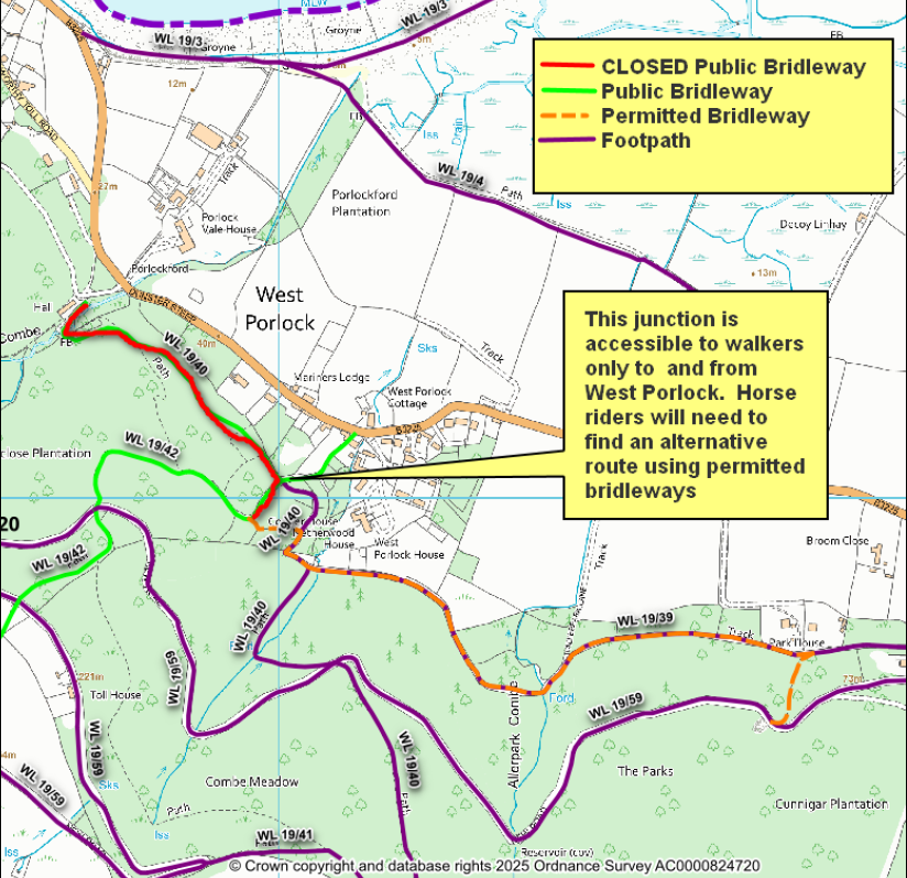
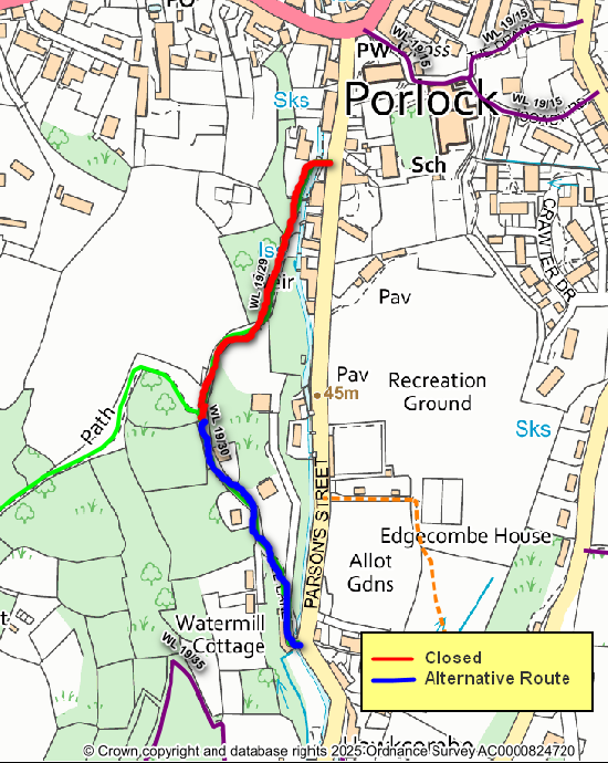
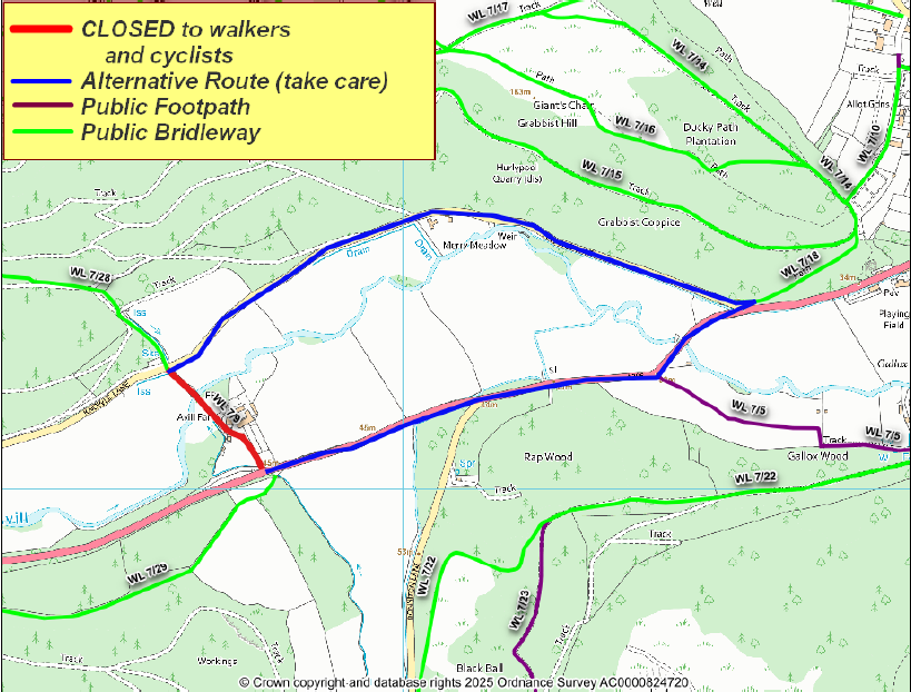
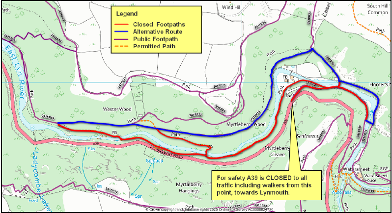
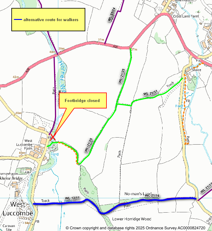
Bridleway at Hillsford Bridge near Lynmouth temporarily closed due to a landslip - route is impassable. Please use alternative routes on plan. @ExmoorNP @ExmoorRangers @NTDevonCornwall
Exmoor Paths
936 posts

@ExmoorPaths
Tweets about the path network in Exmoor National Park. Keeping you up to date with the latest path news!

Bridleway at Hillsford Bridge near Lynmouth temporarily closed due to a landslip - route is impassable. Please use alternative routes on plan. @ExmoorNP @ExmoorRangers @NTDevonCornwall

The footbridge across the Danesbrook near Whiterocks Down was swept away by flood water on Friday 13th June 2025. Bridleway remains open - you can cross via the ford when conditions allow (but you will need to wade through water). Do not cross when river is high. @ExmoorNP


Public Bridleway WL 19/29 has now been cleared and is reopen. @ExmoorRangers @ExmoorNP

Public bridleway at West Porlock closed for 21 days from Monday 15th December for tree and drainage works. Hopefully work will be complete within a week. @ExmoorRangers @ExmoorNP


Footbridge at Avill Farm, Dunster on Public Bridleway WL7/9 has failed an inspection - now closed. The bridleway is closed to WALKERS and CYCLISTS (horseriders may continue to use bridleway via ford). Closure until 29th November - likely to be extended @ExmoorNP @ExmoorRangers


Please be aware that Restricted Byway DU3/7 in Burridge Woods, Dulverton is closed due to a fallen tree. An alternative route for walkers is shown below in blue. The closure will be lifted once tree work is complete to make the path safe. @ExmoorNP @ExmoorRangers

Several paths between the Watersmeet Road and the East Lyn river in the Myrtleberry, Lynton & Lynmouth are closed from 4th– 21st November due to rock works. The A39 road is also partly closed. Alternative route on northern riverbank. @NTDevonCornwall @ExmoorNP @ExmoorRangers


Please be aware the footbridge on bridleway WL21/25 at West Luccombe is CLOSED for public safety. The bridleway remains open using the ford, when conditions allow. Walkers an alternative route is shown below. Cyclists please find your own route via the road network.


