
FOX6 Weather retweetledi

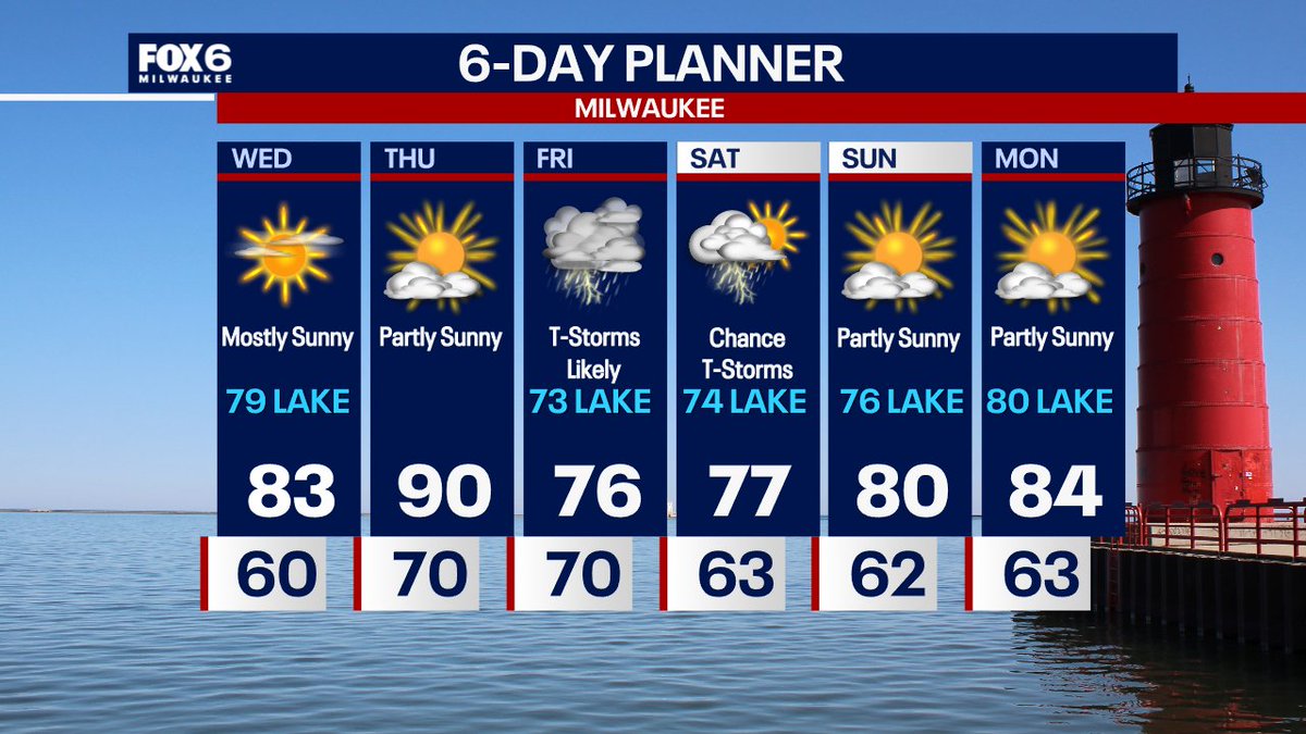
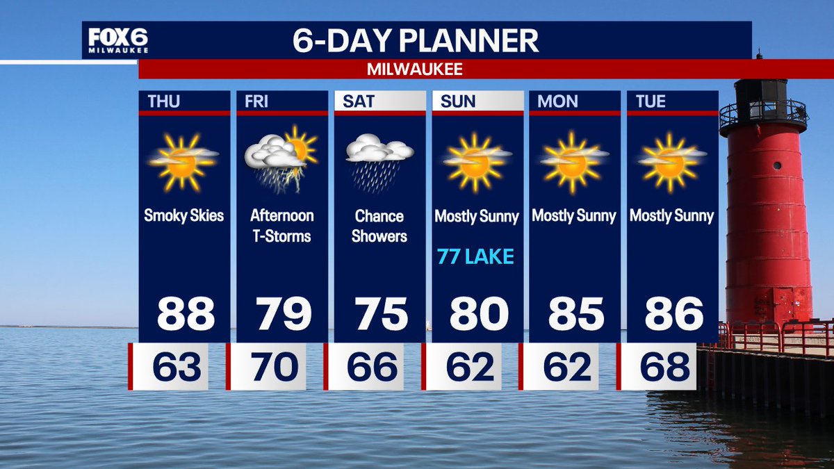
Wed. 7/29 10:23pm: Elevated wildfire smoke on Thursday with highs in the upper 80s and dew points in the low 60s. Rain and non-severe t-storms return after noon on Friday and continue into Saturday. Warming up late in the weekend into early next week. Are you a fan of this forecast?
English