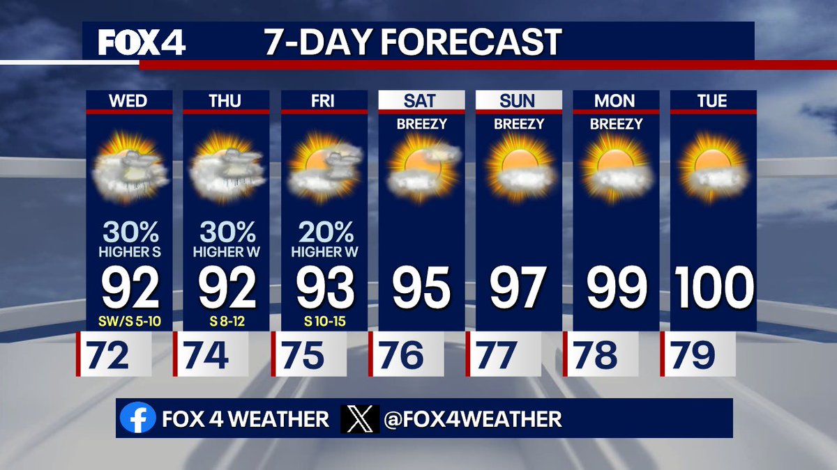
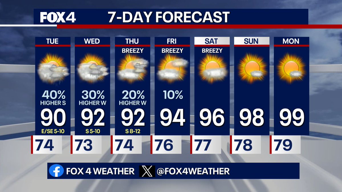
Scattered thunderstorms Wednesday & Thursday. They'll favor areas south tomorrow and west on Thursday and Friday. By the weekend, the upper low fills and the ridge builds back. That will send temps well into the 90s this weekend and close to 100 by Monday.
4:10pm: Widely scattered showers and storms continue to drift westward across N TX. Many of these will be short-lived as they produce brief heavy downpours.
2:30PM- An uptick in shower activity is ongoing across NTX as a boundary south begins to lift north. Lightning and brief, heavy rain will be the main threats through the afternoon.
1:25PM- A few showers have popped up elsewhere across NTX. Coverage will remain highest across far southern and SW areas through the rest of the day, but a few storms closer to DFW will be possible. Heavy rain and lightning will be the main threats.
Today, expect slow-moving scattered showers/storms. Highs in the upper 80s to 90. Wednesday & Thursday are similar, with slightly lower coverage. By the weekend, high pressure returns drying us out. Expect more sunshine and highs in the mid to upper 90s.
Scattered thunderstorms will flare up again as we heat up Tuesday and Wednesday. Localized flooding will be possible with the slow-moving heavy downpours. Rain chances dwindle by the end of the week with typical hot, dry weather on tap for the weekend.
NOT A GOOD SIGHT!! 10pm: Very heavy, slow-moving thunderstorms have prompted Flash Flood Warnings for the Texas Hill County northwest of San Antonio. These were areas hit by deadly flooding on July 4th of last year. More heavy rain is expected through the overnight hours.
8:52pm: A few small clusters of heavy thunderstorms continue to drift west from North Fort Worth to Perrin in southern Jack County. These storms may produce some localized flooding along with frequent lightning strikes.
7:48pm: Storms have developed from just south of Strawn down through Erath County into Hamilton County. These are nearly stationary and will produce some heavy rain along with some lightning strikes.
7:46PM: A couple of outflow boundaries have triggered some new storm development in Arlington north into Denton County and farther west into Runaway Bay. Expect some heavy downpours and a few lightning strikes.
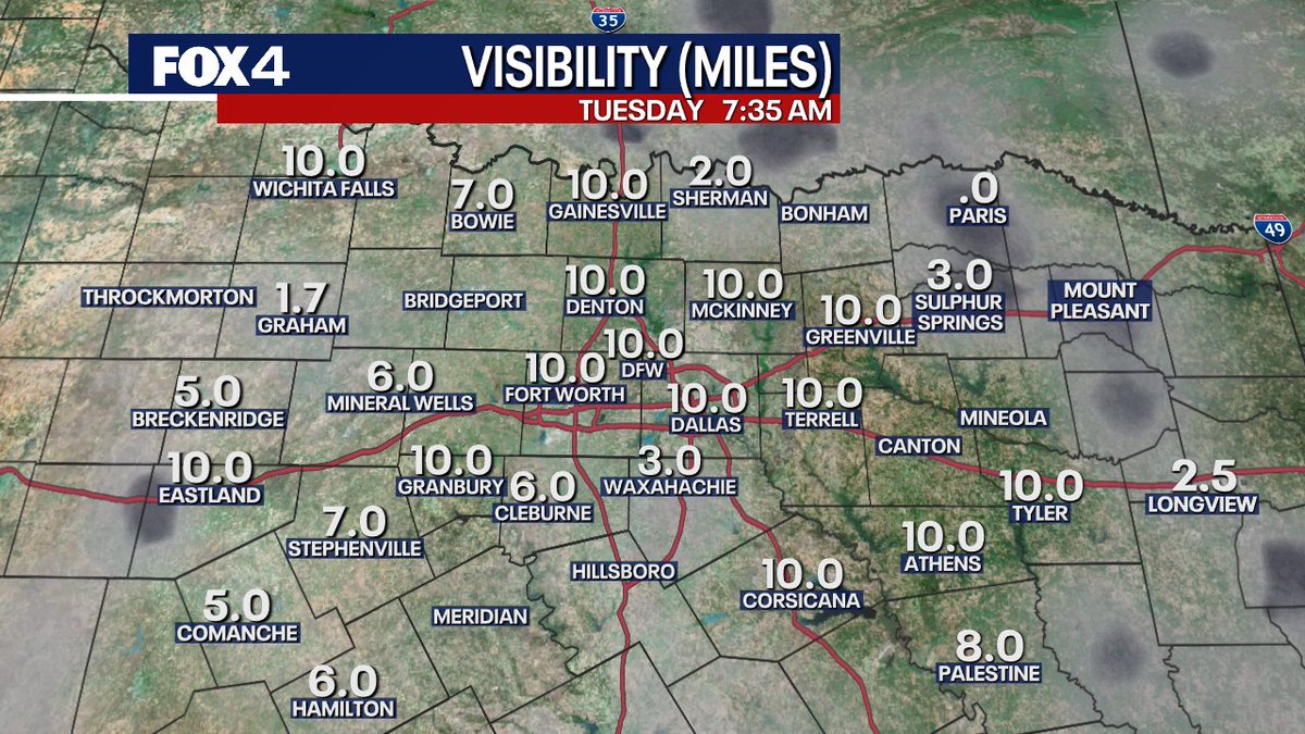
6:27pm: Very spotty showers and storms across N TX at this time. Will keep a slight chance of some activity overnight, and then more scattered storms will fire as we heat up Tuesday.
Some areas picked up WAY more rainfall than others. Amounts literally ranged from Nothing to 7" according to doppler radar estimates. How much did you receive?
3:46pm: While much of N TX is getting a dry break at this time, scattered storms are moving westward along the Red River and into Jack County along a stalled front.