Sabitlenmiş Tweet
Geosun Navigation
637 posts


Geosun Navigation
@GeosunNav
Make the LiDAR/SLAM solution more affordable and applicable.
Wuhan City, China Katılım Temmuz 2020
4.2K Takip Edilen1.2K Takipçiler


Confined. Hazardous. Inaccessible.
Now fully measurable.
GEOSUN brings high-precision 3D mapping to where humans can’t go.
#LiDAR #3DMapping #SLAM #Geospatial #Robotics #QuadrupedRobot #DigitalTwin #Surveying #SmartMapping #Inspection #GeoSpatialIntelligence #PointCloud
English
Just landed in Singapore — and straight to work.
Started our first on-site demo right away, and as always, impressed by how clean and well-organized the city is.
Looking forward to more demos and great conversations ahead.
#GeosunLiDAR #LiDAR #3DMapping #Surveying


English
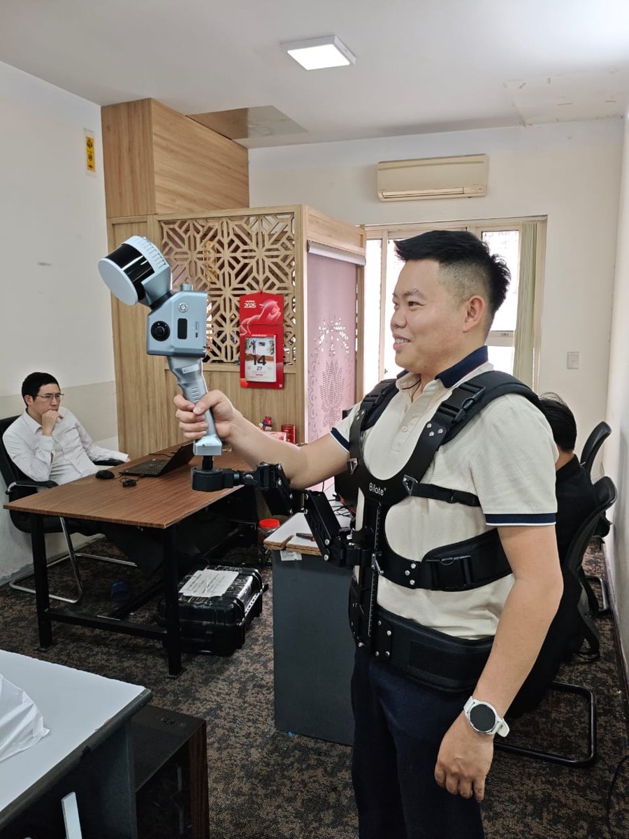
Getting the GS-130G ready for testing 🔧
We helped our client complete the setup on-site, making sure everything is calibrated and ready for real-world data capture.
From assembly to operation — we’re here to support every step.
#GeosunLiDAR #GS130G #LiDAR #3DMapping #Surveying

English
Visiting different client sites and collecting real project data with our LiDAR systems.
Always great to see the technology working directly in the field.
#LiDAR #GeosunLiDAR #3DMapping #Surveying #Vietnam #Hanoi #FieldWork #PointCloud


English
Geosun Navigation retweetledi

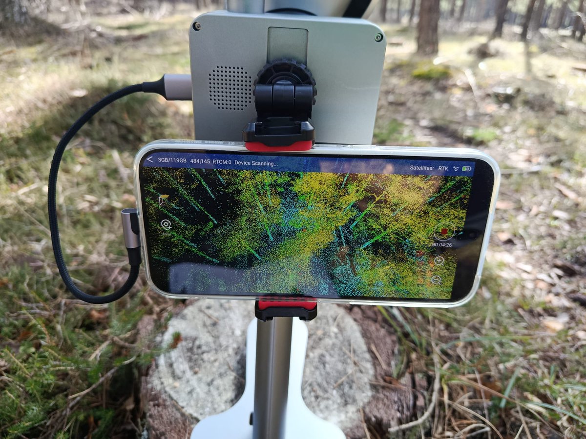
Esta semana hemos estado en #Abejar #Soria , donde estamos probando nuestro nuevo equipo de escaneo LiDAR portátil SLAM de @GeosunNav , financiado por el proyecto @RetechFOR , allí estamos midiendo con @FCesefor parcelas continuas de inventario para confrontar sus datos.

Español
Great to be in Hanoi, Vietnam!
Our team has started the first on-site demo with a local client — thanks for the warm welcome.
If you're in Vietnam and interested in a live LiDAR demo, feel free to reach out!
#LiDAR #GeosunLiDAR #3DMapping #Vietnam #Hanoi

English
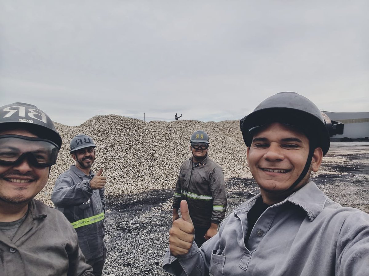
Most LiDAR demos look impressive on buildings.
Try scanning a gravel stockpile.
Brazil project — 200G capturing low-feature terrain with no edits.
Raw point cloud Real conditions.
And the client’s smile?
Worth more than any rendering.
Awaiting final volume validation.
#RealData
English
Impressive details from a 3DGS reconstruction.
Clean geometry, clear edges, and stable structure — even in a complex indoor environment.
#3DGS #3DGaussianSplatting #LiDAR #PointCloud
#RealityCapture #3DReconstruction #SpatialData

English
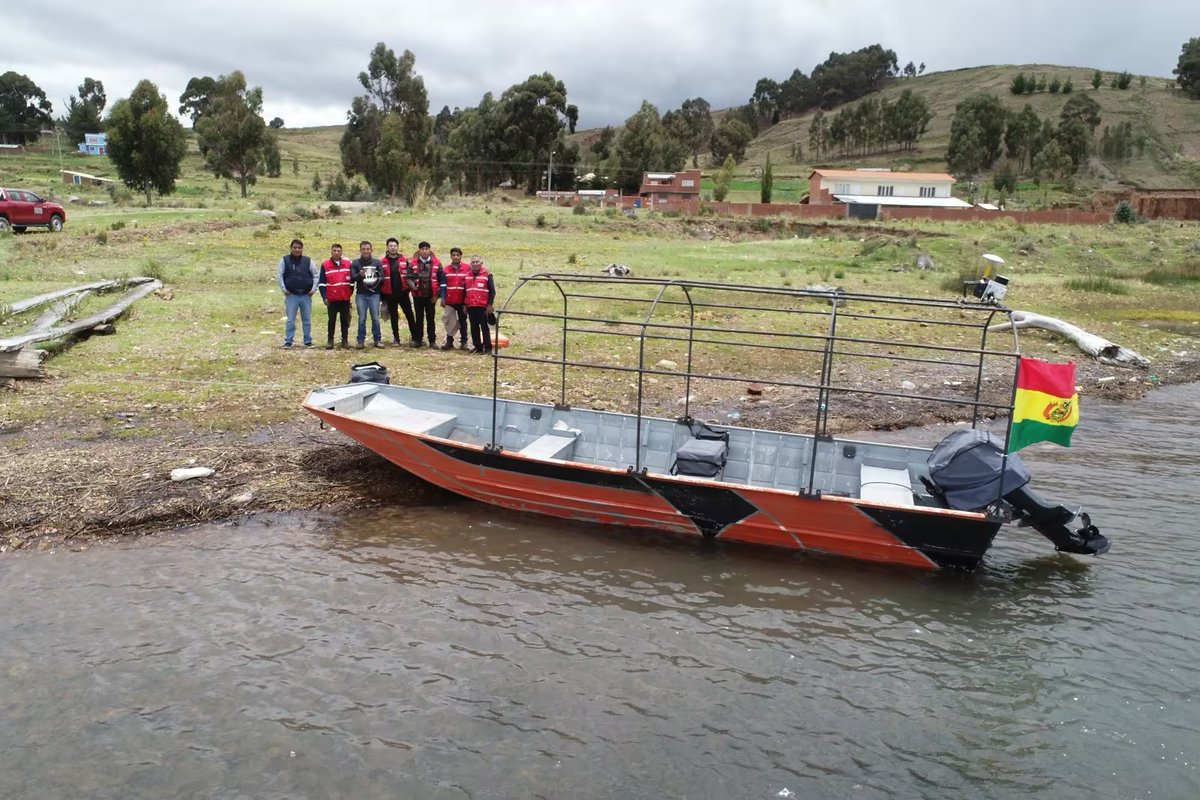
Land. Water. One workflow.
A customer in Bolivia is successfully testing our 260X vehicle & boat-mounted systems and the GS-100G handheld LiDAR — and is now actively promoting the solution after great results.
#LiDAR #HandheldLiDAR
#MobileMapping #3DMapping #Geospatial


English
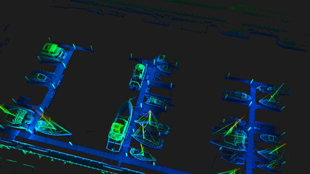
Harbor LiDAR data output.
Clear vessel geometry, dock layout, and spatial relationships — ready for mapping, inspection, and digital port management.
#LiDAR #PortMapping #PointCloud #3DData


English
GEOSUN PPK-When signals disappear, precision remains.
Full workflow in the next episode.
#PPK #LiDAR #SLAM #GeospatialIntelligence #GNSS #3DMapping #GEOSUN
English
Every system is calibrated before delivery.
This 3DGS output was generated from real data collected in our calibration room — validating performance before it reaches the field.Accuracy is tested, not assumed.
#GeosunLiDAR #Calibration #3DGS #LiDAR #Mapping
English
Looking for a professional solution to capture real road and urban environments?
#RoadRealityCapture #MobileMapping #VehicleMountedLiDAR #LiDARSystem #3DDataCapture #Surveying
#Geomatics #GIS #Engineering #RoadSurveying #RailwayMapping #Urban3D #InfrastructureMapping #SmartCity

English
High-density LiDAR capture at a sand quarry in the Netherlands.
Clear elevation changes, clean structure — data you can trust for real decisions.
#GeosunLiDAR #LiDAR #3DMapping #Surveying #PointCloud


English
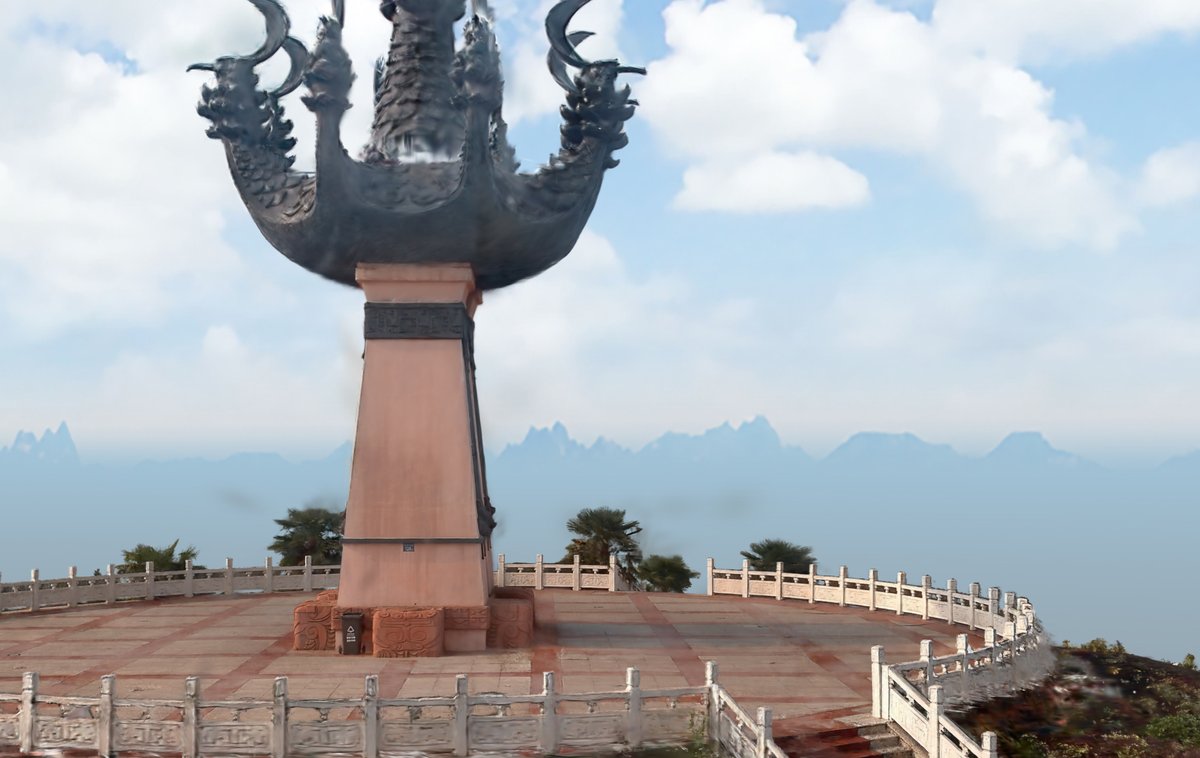
Jiufengtai, captured in 3D.
Through 3DGS modeling, layers of history and structure come into focus — preserving space, detail, and context beyond what the eye can see.
#3DGS #DigitalHeritage #3DReconstruction #GeosunLiDAR


English
Happy New Year 2026 from GEOSUN.
Thank you for your trust and partnership.
We look forward to another year of reliable LiDAR solutions — from sky to ground.
#GEOSUN #HappyNewYear #LiDAR #MappingSolutions
English
Hands-on capture is more than just walking around.
GS-102G vs GS-200G — different capture rhythms, one consistent workflow.
Proper operation delivers reliable 3DGS results.
#LiDAR #3DGS #SLAM #RealityCapture #Geospatial #PointCloud #HandsOnCapture
English
Season’s Greetings from GEOSUN
As the year comes to a close and a new one begins, we thank you for your trust and partnership.
Wishing you a season of peace, clarity, and continued progress — now and into the year ahead.
#GEOSUN #SeasonGreetings #HappyHolidays #NewYearWishes

English
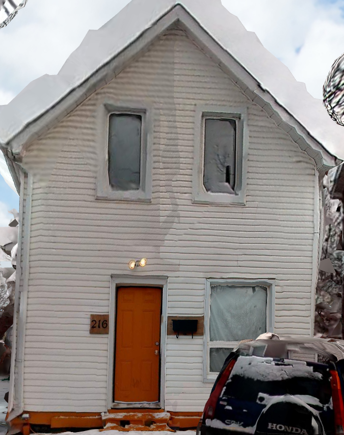
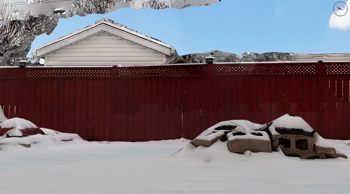
❄️ Snowy streets, Christmas vibes in Canada. Captured with the GS-200G, turning winter beauty into clean 3D data. Wishing everyone a warm and peaceful Christmas 📷 #GeosunLiDAR #GS200G #LiDAR #3DMapping #PointCloud #OSGB #WinterScan #ChristmasVibes #SeasonGreetings

English