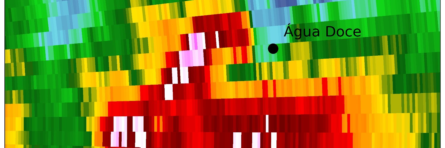
Vitor Goede 🇺🇦
5.3K posts

Vitor Goede 🇺🇦
@GoedeTDS
PhD Student at ARRC-OU. BR - US. Radars, severe storms and lightning. I make jokes so bad they are clearly not supposed to be taken seriously.


Tornado en Córdoba capital, Argentina, el 26/12/2003. Fue seguido por los medios locales, que alertaban a la población mientras avanzaba por el extremo oeste de la segunda ciudad más grande del país (+1,5 M hab.) .Fotos del diario La Voz, edición papel. A este lo vi desde mi casa


> Hello everyone, once again we have new features in the app for you. We now have a Live Mode, where storms can appear in real time based on your geolocation, making it easier for storm chasers and weather observers. …98873450-7cc8f.us-central1.hosted.app


🌪️ What was the first storm you ever chased?


🌪️ What was the first storm you ever chased?


Here is why a tornado outbreak did not materialize yesterday - it’s all related to trough geometry, resulting in a front surging east faster than the storms. Even though it had a negative tilt, notice the weaker, meridional upper winds in central/southern MO in region 1. These NNE movers were quickly grabbed by the surging front, with no time to sample the favorable environment. QLCS tornadoes were the result. Farther south in AR, even though the upper winds were more westerly, they were much weaker and the upper trough was ejecting well north of the region. This led to unfavorable shear and thermodynamics for these southern storms as milk advanced ahead of the slower moving storms.


