accounts like this
get deleted
and stop fear mongering
a dream
夢@earthquake2011_
でかい地震 震源地は分からない たしか東北 震度7 関東で震度5強? すごい揺れ の夢
English
Grace Cohen 🌪️
2.7K posts
@GraceCWeather
Tornado Researcher・ 竜巻研究者 ・東北大/UCD C3 ・ creator of @cohenwxBOT ・bridging the gap between japanese and american weather・all opinions my own ・ she/her
でかい地震 震源地は分からない たしか東北 震度7 関東で震度5強? すごい揺れ の夢
Discord is adding Spatial Audio support for voice channels, so you can hear your friends as if you were talking next to each other!
就寝中の女性が窓から布団を引っ張られる 仙台 newsdig.tbs.co.jp/articles/-/268…
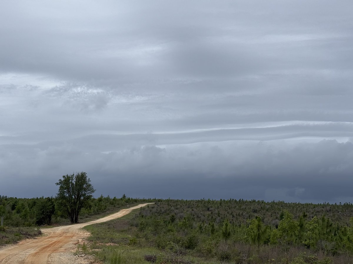
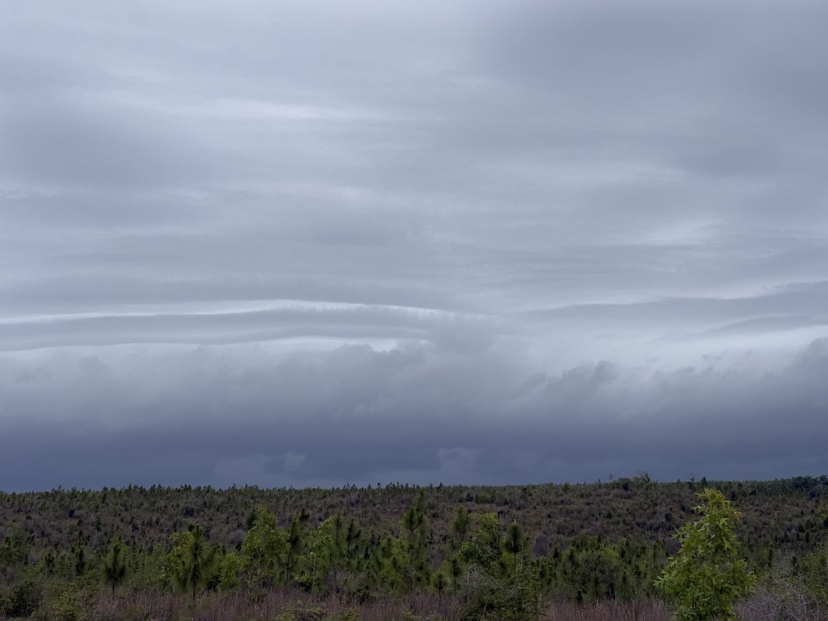
青森県あたりにウィンディー画像で長い雲が発生中‼️ 紫色◯周辺での震源地震に 要警戒‼️ 満月🌕から5日前となります

Massive "heat dome" enveloping United Kingdom and western Europe. A measurement parameter called "geopotential height" is the same over London as Dubai this afternoon: 594 dm This almost "off-the-charts" atmospheric ridge will continue to bake England like a Dutch oven.

People saying June is dead but forget about fire chasing 🥱

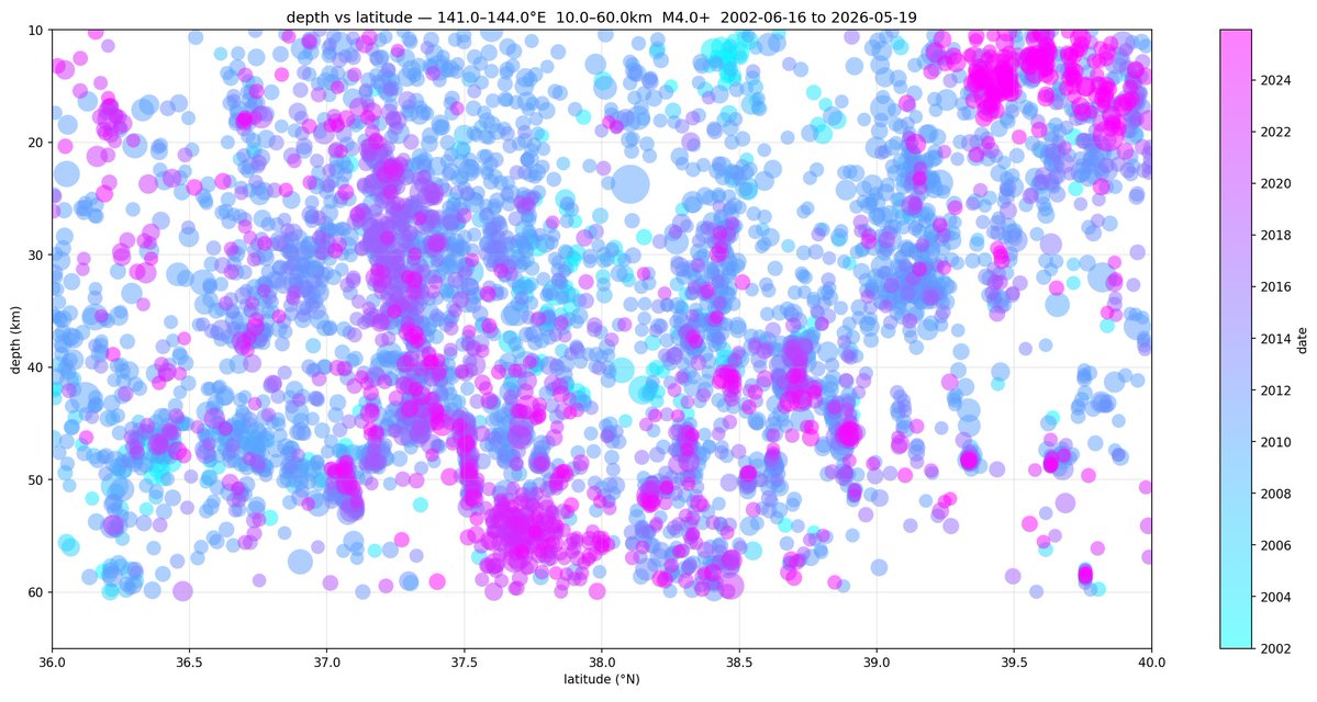

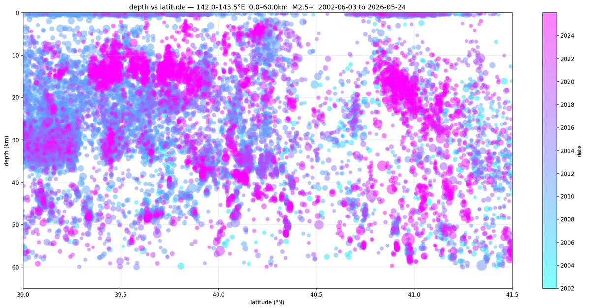
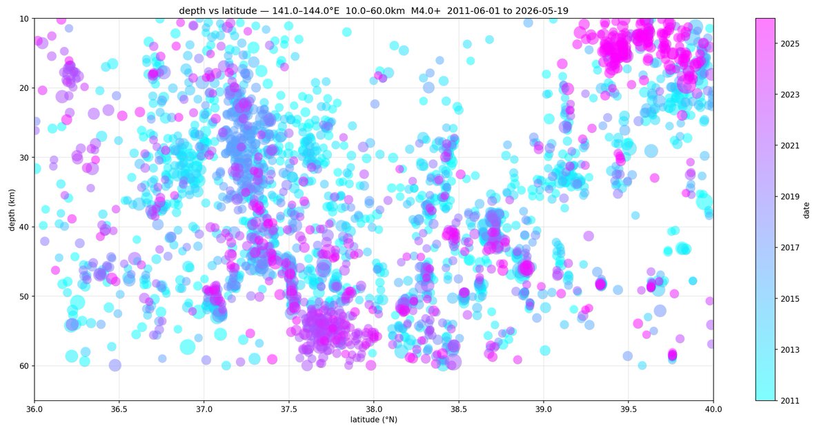
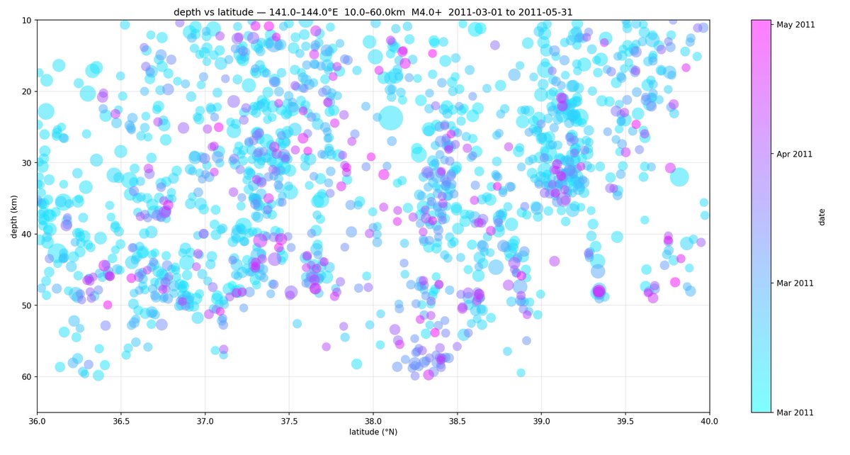
Plotting some Sanriku seismicity 1/? - Depth vs Latitude