
#ONStorm #ONwx ⛈️ Severe Thunderstorm Risk on Tuesday Across Southern Ontario
We’re closely watching the potential for strong to severe thunderstorms during the afternoon and evening on Tuesday across parts of Southern Ontario.
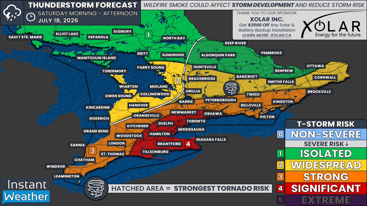
Environment Canada’s latest thunderstorm outlook places a ‘Moderate’ severe weather risk from Deep Southwestern Ontario through the Golden Horseshoe and into areas east of Lake Simcoe. This is roughly the same region that was impacted by Saturday’s severe weather.
This includes Windsor, Chatham, Sarnia, London, Hamilton, Niagara, Kitchener, Guelph, Barrie, Newmarket, Toronto, Oshawa, Peterborough and Kingston.
Environment Canada says the main hazards could include wind gusts of 90 to 110 km/h, hail up to quarter-sized, and torrential downpours. Localized flash flooding may also be a concern, with 30 to 50 mm of rain possible in some areas.
Further north, from Grey-Bruce through cottage country and into the Ottawa Valley, thunderstorms are also possible. However, the current risk remains ‘Minor’, with most storms expected to stay below severe limits.
We’re putting together our own detailed forecast for Tuesday and will have it posted soon, including timing, the areas most at risk, and what hazards to expect. Stay tuned!

English