
Justin🇨🇦
651 posts

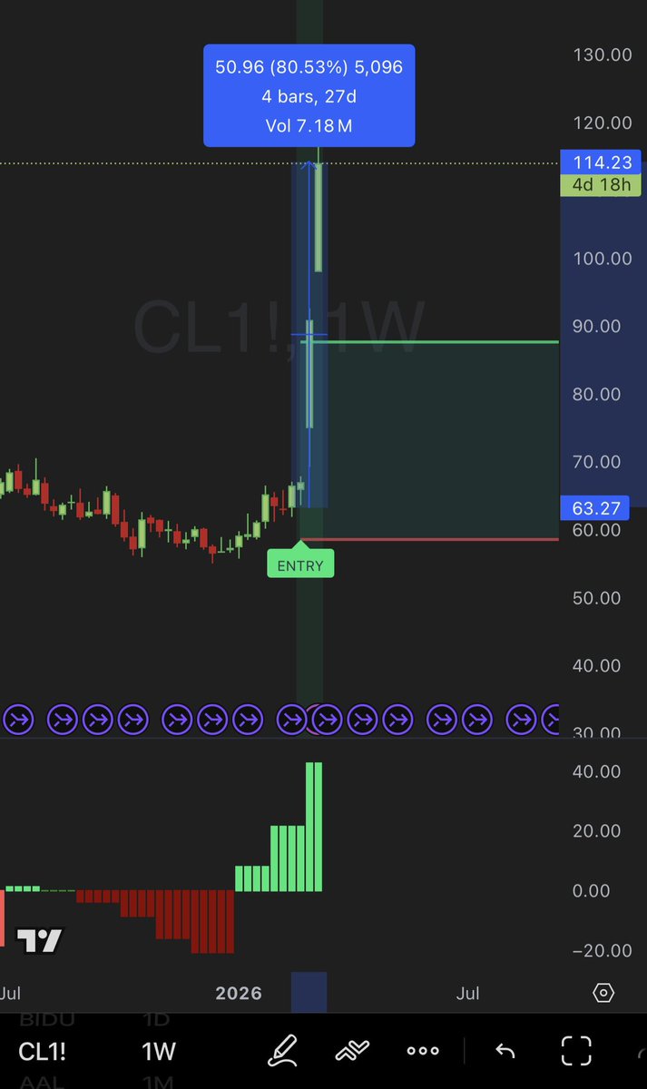
Our Monthly Bx Strategy caught the 80% move on oil
…. Good thing I didn’t see it
Only 80% move in 3 weeks 💀
English

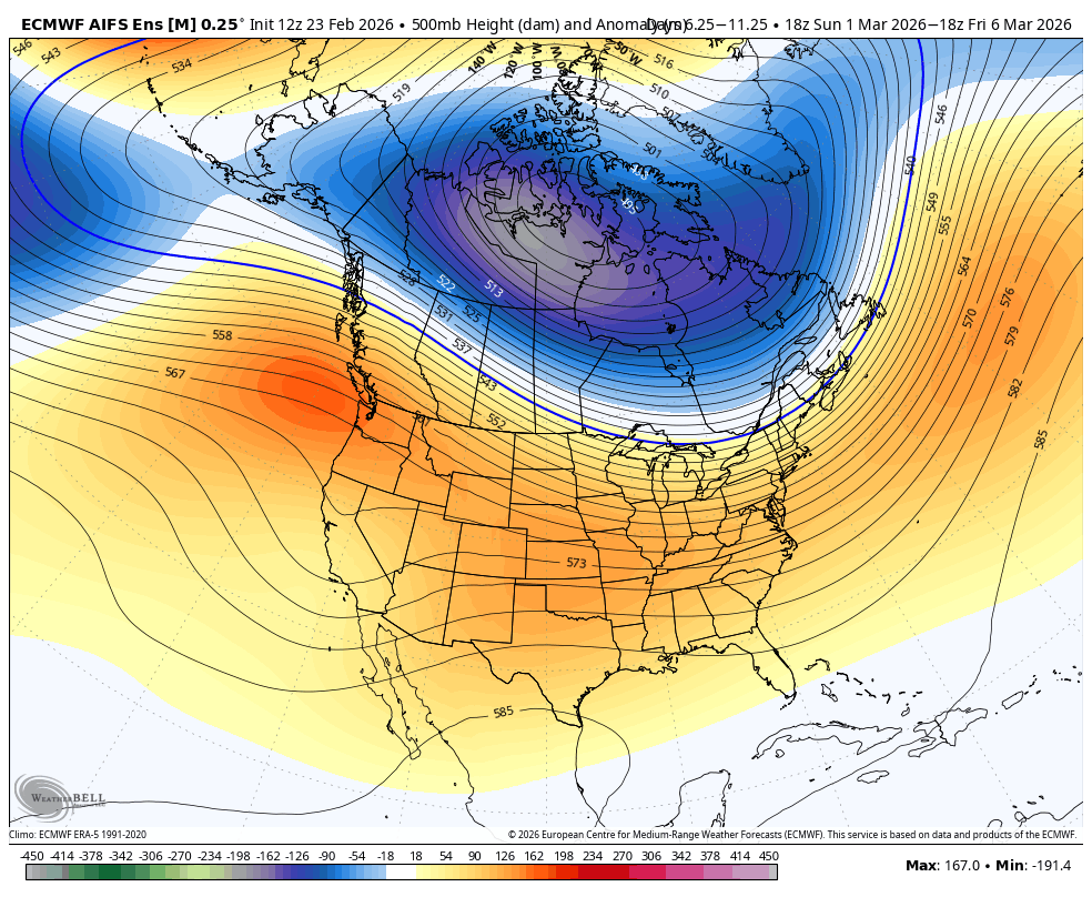
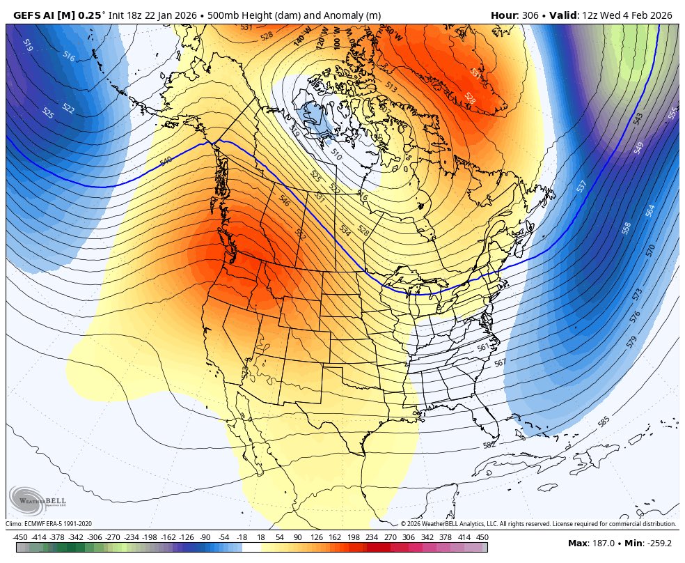
Looking mild and dry out #West heading into March. Spring is around the corner, then again we never had a winter. #BCWx #BCStormWatch #PNW #Spring
English

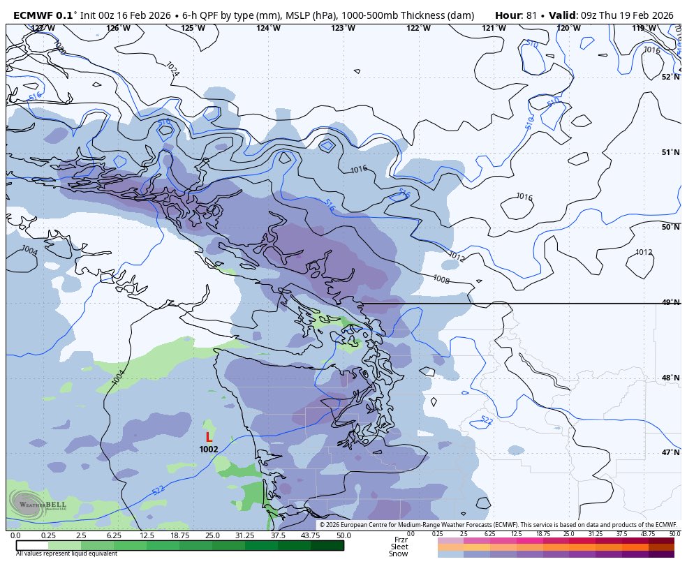
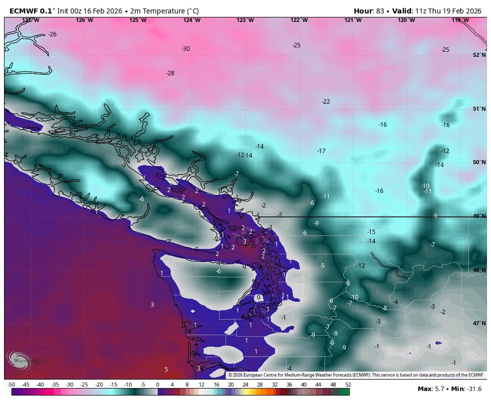
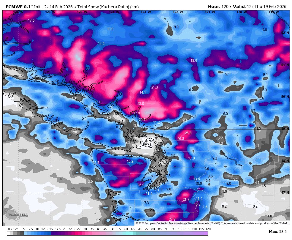
Something like this is worth watching. Latest Euro develops a strong Shortwave, with modified arctic air nearby Wednesday night into Thursday, this would be our only accumulating snow event of the year for lower elevations on metro van. *COME BACK FOR UPDATES. SNOW EVENTS ARE FICKLE AND MAY NOT HAPPEN* #BcStorm #snow #winter #prayforit

English
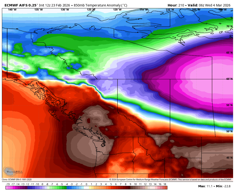
A polar Trough Will make a Pass at the #PNW Next week. There is potential for lower elevation #Snowfall via convective showers that temporarily drag the snow level down. Accumulations could occur at 100 metres asl (300FT) at times. Watching for some weak Arctic Air to get in mid next week with crisp temperatures. Stay tuned for more details if more widespread snow becomes possible.
#BCStorm #wawx #snow #vancouver
GIF

English
English


I will post the link to join today one hour before close.
I only let in 20-25 people each week and it fills up (usually) pretty quick.
I don’t leave it open 24/7 or “link in bio”.
Be ready.
jd227@Judah_227
@colin_gladman Been following for about a week. How do I get in the discord?
English
English

English
English

@bam_weather Brief warm up out west....? All winter has been a literal torch lol
English

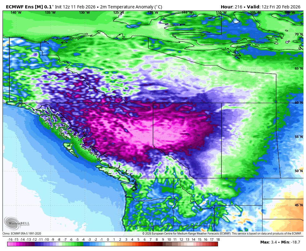
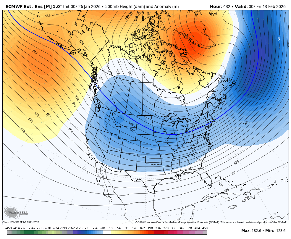
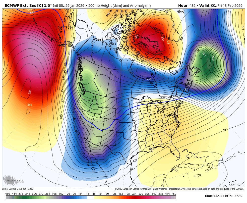
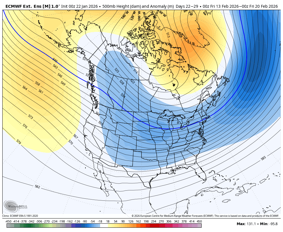
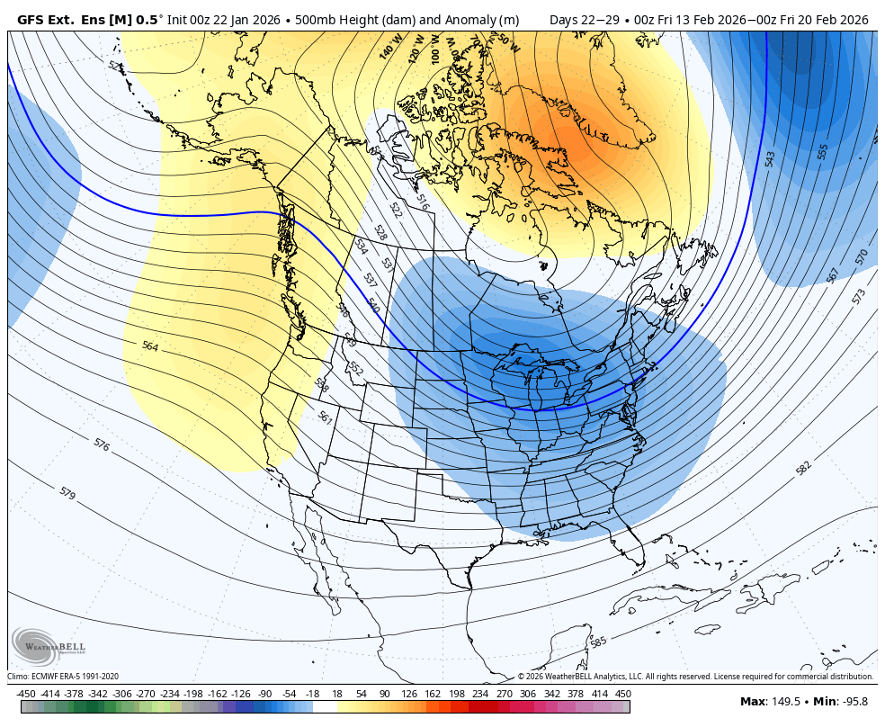
🧵While a brief warm up for the Central and Western US is likely as we head into February (cold lingers on the East Coast), the signals for more blockbuster winter weather are increasing for Mid-February on data.
English
@ElijahBman This has to be one of the worst winters that I can remember,absolutely brutal
English
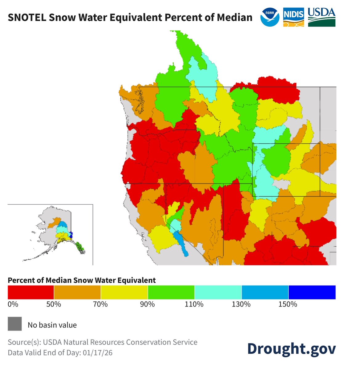
No end in sight to the SW flow, expect ski resorts to shut down, with no significant snowfall below 2000 metres ASL to close Jan. Really hope this changes in February as we are already much below normal for the snowpack. #bcstorm #wawx #orwx #drought #snowdrought


English
@WhidbeyWXGuy Man i hope we get a chance at some lowland snow,this winter has felt more like spring lol
English

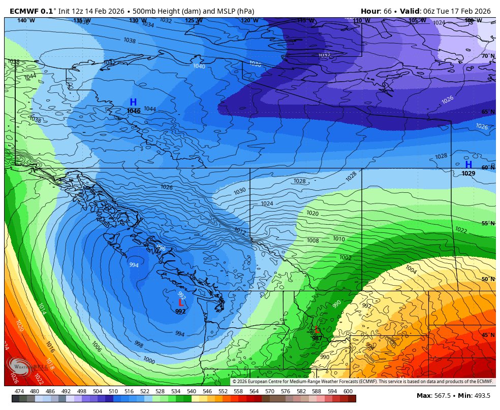
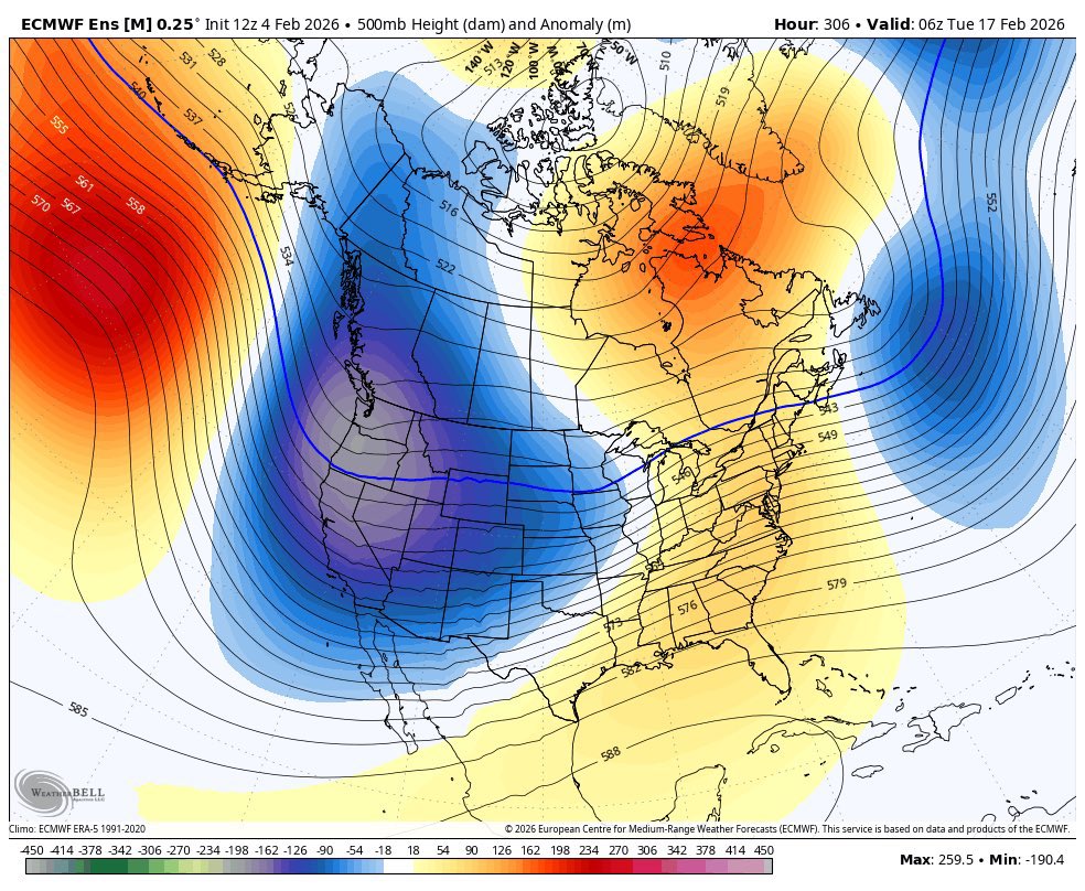
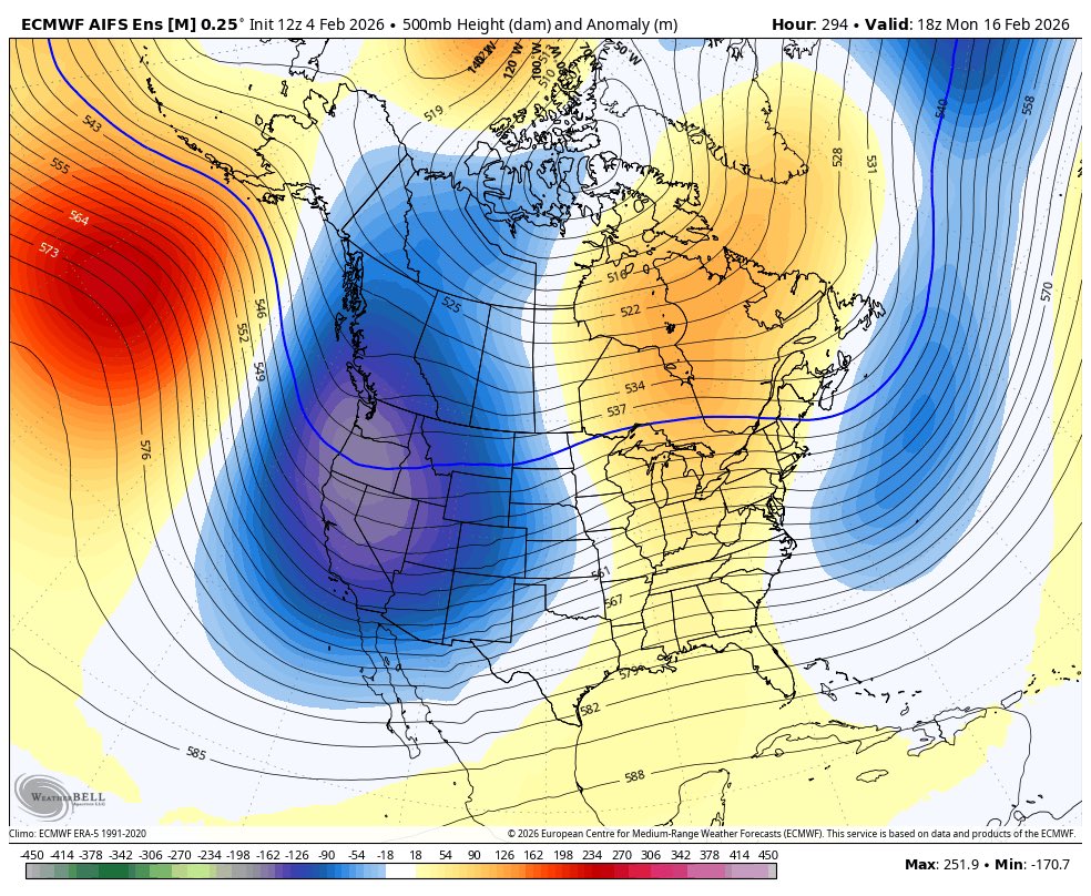
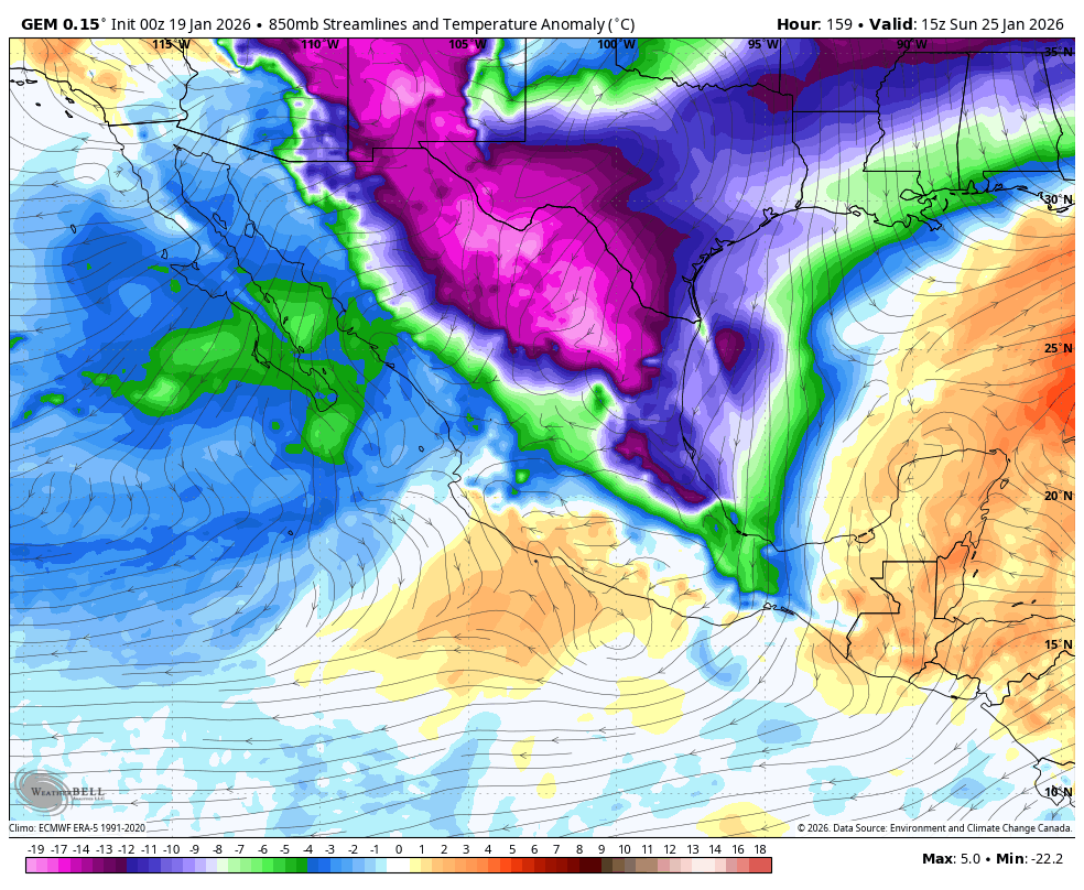
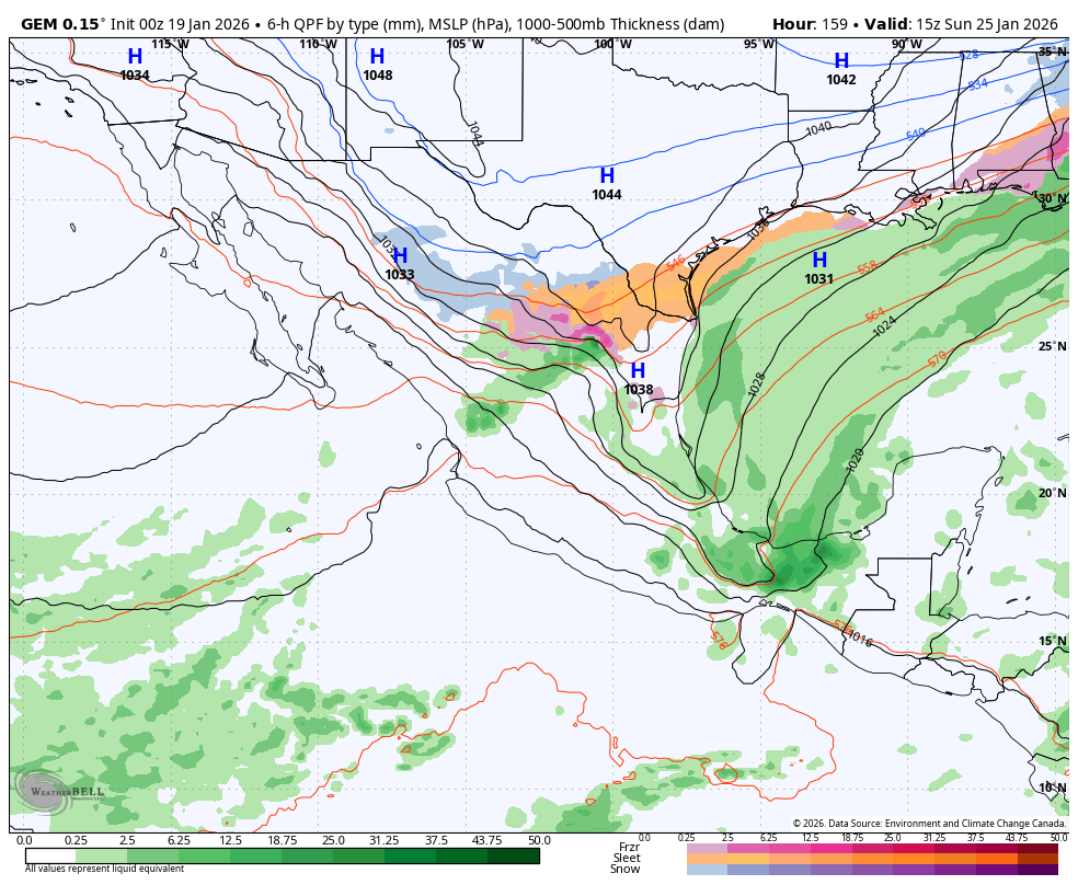
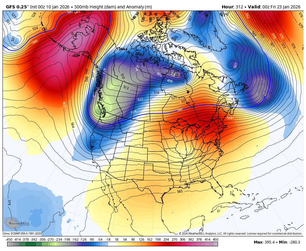
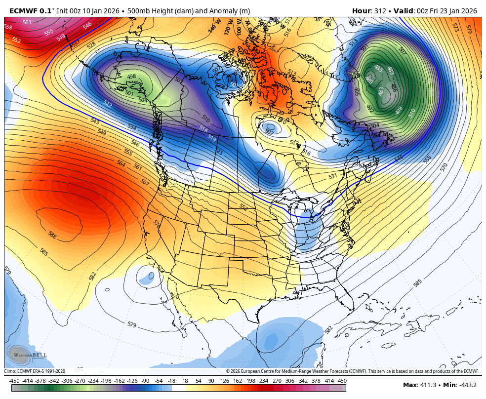
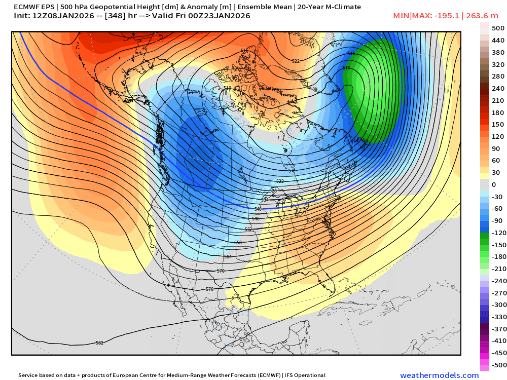
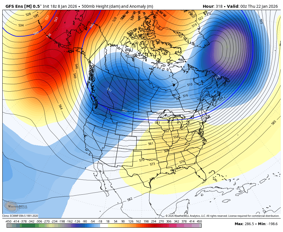
How have the models trended since last night? It looks like next weekend a mass of cold air will move out of the Arctic. What we need to watch is just how close it gets to the PNW. To get a high chance of lowland snow, we want the center of that trough (circled blue/purple) to be very close to or directly over us. At the moment, we look to only get clipped by the Arctic air which would mean a more marginal cold event. However, this is still about 7 days out so plenty of time to watch how things trend! I'll have more updates as we get closer.

Jonathan Pulley@WhidbeyWXGuy
Models have been hinting at some Arctic air moving south over parts of NA sometime around next weekend for the past few days. They have been showing it mostly going way east... until tonight's Euro model run. That would be a near perfect set up for lowland snow, but unfortunately it has a very unlikely chance of happening. I'll let y'all know if chances start to increase as we get closer! I would especially love this after the crappy winter we have gotten so far.
English
English
@vlad_rad @AdamFurey4 Ahhh it's gonna be alot of flip flopping but it's seems like End of Jan is our best shot for some winter weather
English

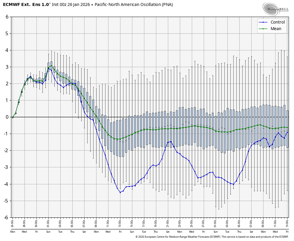
More lies on here. The new EPS is not showing a big +PNA the last week of this month. Not even close. I swear, some people on this app either get off on lying or are flat out delusional and having hallucinations
English
@Snowlover111232 Maybe 400 inches of rain lol it's been a torch over here since Nov
English

@JCiolfitto @AdamFurey4 You know that I’ll be the first to hype about a good cold and snow pattern if I see one.
English