Jessica Hafner retweetledi
Jessica Hafner
22.9K posts

Jessica Hafner
@JessicaABC17
Chief Meteorologist at @ABC17News. @ametsoc CBM. Wife, mom 👶🏻🐶, runner🏃🏻♀️, and proud @NIUlive alum🐺. #CoMO #JCMO #LOTO #mowx #midmowx
Columbia, MO Katılım Haziran 2011
1.5K Takip Edilen5K Takipçiler


NEW: Severe Thunderstorm Warning for Moniteau Co. until 12:00 AM for 60 mph winds. A brief spin up tornado is possible. #midmowx

English

NEW: Severe Thunderstorm Warning for northern Benton Co. until 11:15 PM for 60-70 mph winds and small hail. #midmowx

English

NEW: Severe Thunderstorm Warning until 10:30 for northern Pettis and western Saline counties for 60 mph winds #midmowx

English

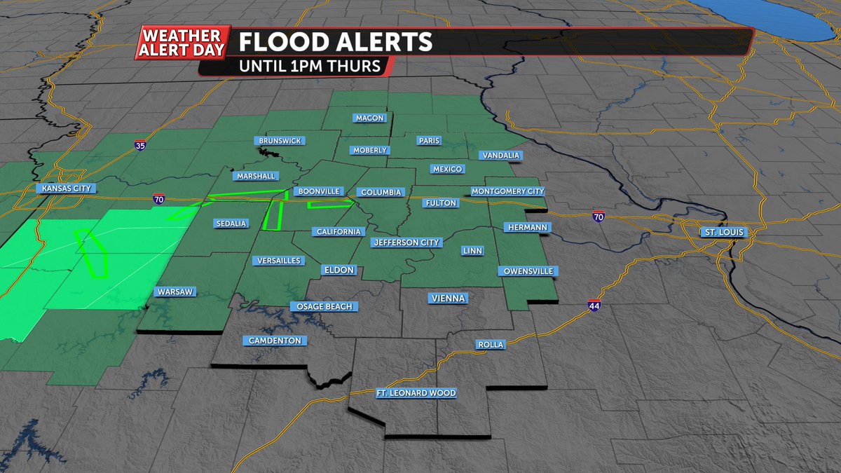
A Flood Watch is in effect for much of Mid-MO tonight as 1-3" of rain could fall over some of the same locations that saw 1-2" of rain in the last 24 hours. Low water crossings will be dangerous into the morning! #midmowx

English

SNOW SQUALL: Snow Squall Warnings are in effect until 5:45PM for Pettis, Saline, Chariton, Howard, and Cooper counties as winds have increased to 35 mph, blowing snow around and dropping visibility under 1/4 mile. Try to stay home if you can! #midmowx
English

NEW: Severe Thunderstorm Warning for far eastern Pulaski and southern Phelps Co. for 60 mph winds #midmowx

English

A Severe Thunderstorm Warning continues for central Miller and western Maries counties until 2:45PM for the potential of up to 60 mph winds. #midmowx

English
Jessica Hafner retweetledi

NEW: Severe Thunderstorm Warning for northern Chariton and southern Macon counties until 11:15 PM for 60 mph winds and 1" hail #midmowx

English

NEW: Severe Thunderstorm Warning until 9:30 PM for Chariton Co. for 60 mph winds and ping pong ball size hail #midmowx

English

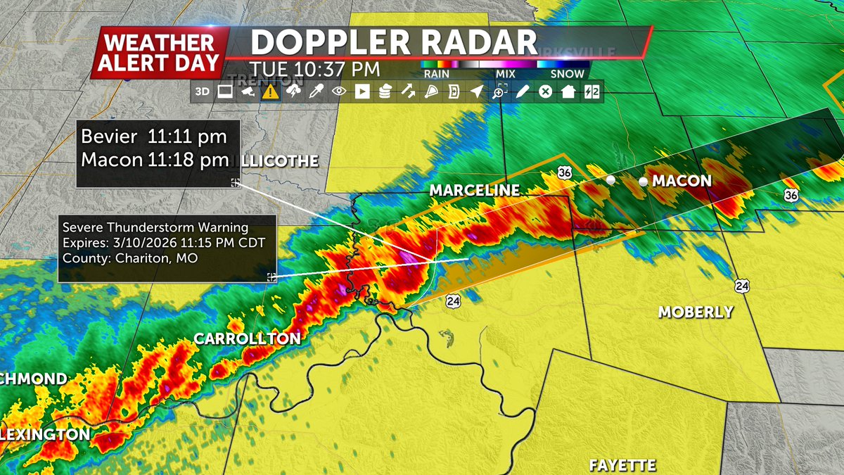
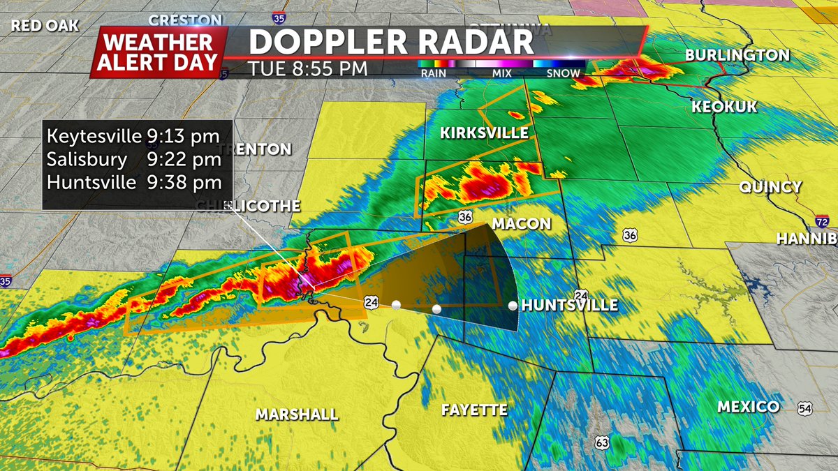
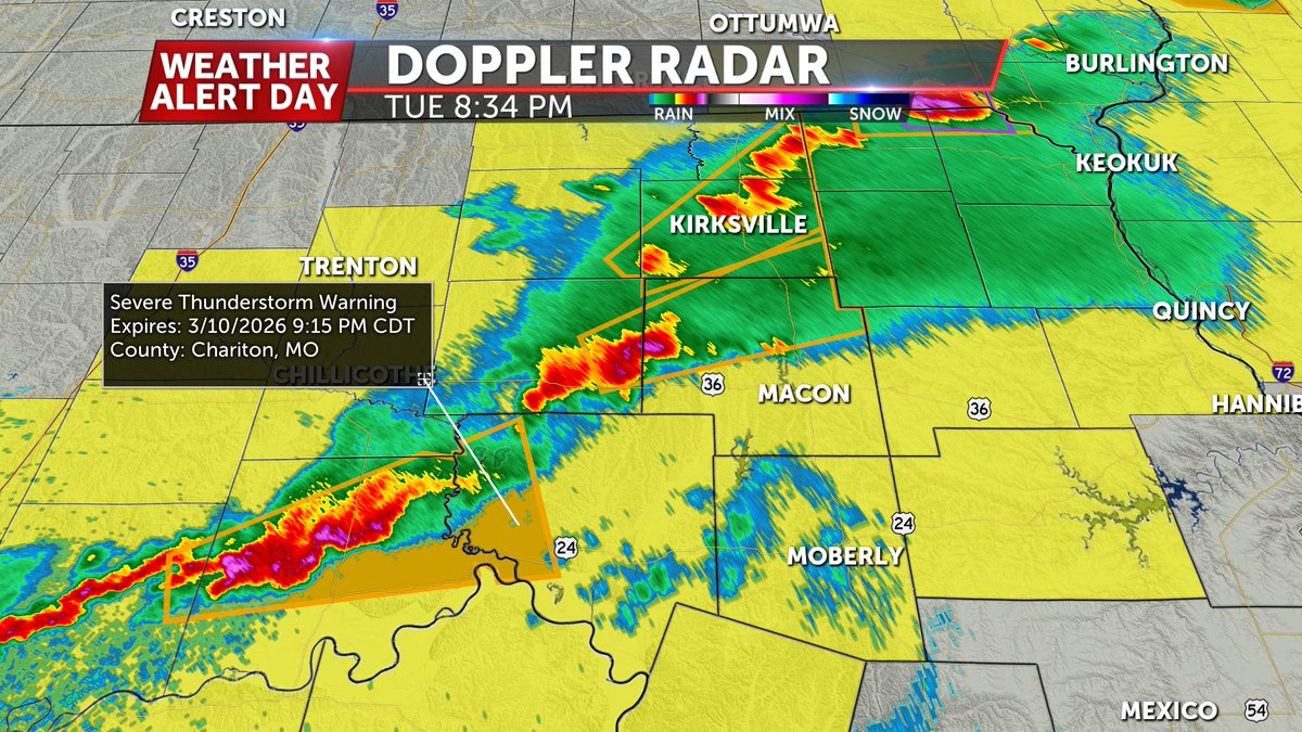
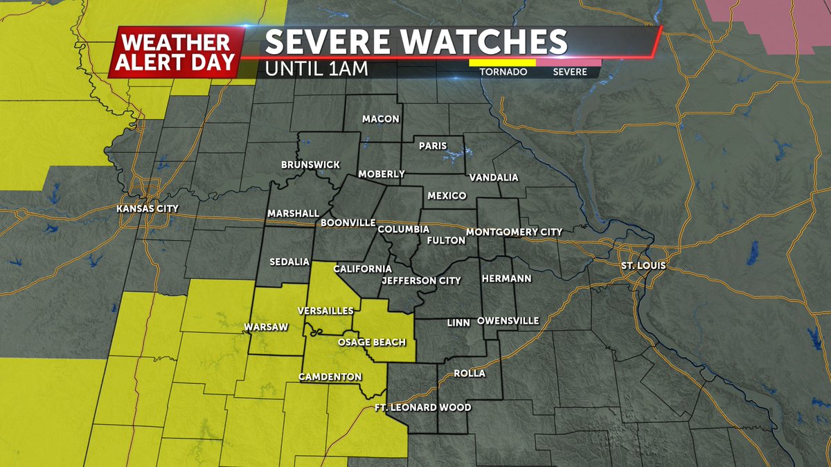
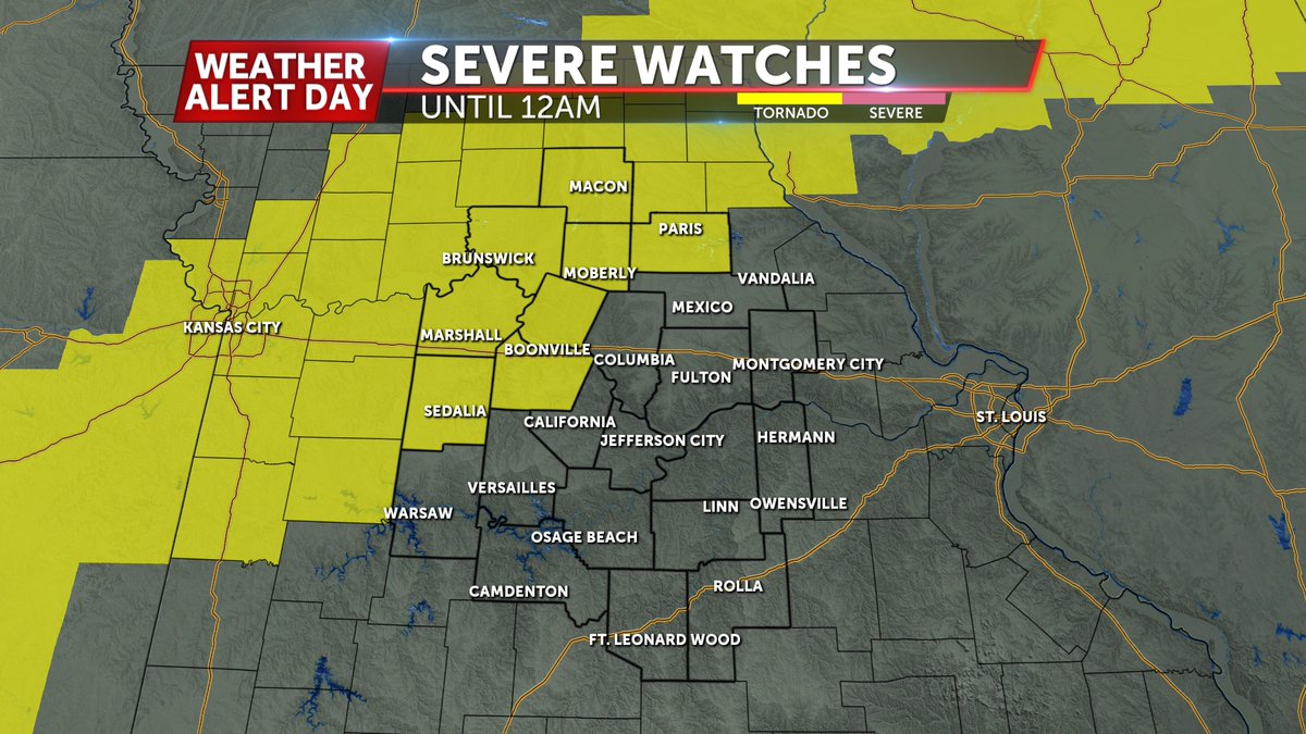
Severe Thunderstorm Warnings are in effect for Macon and Chariton counties for quarter to ping pong ball size hail and 60 mph winds until 9:15 PM #midmowx

English


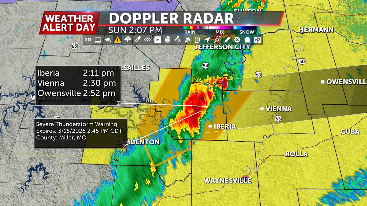
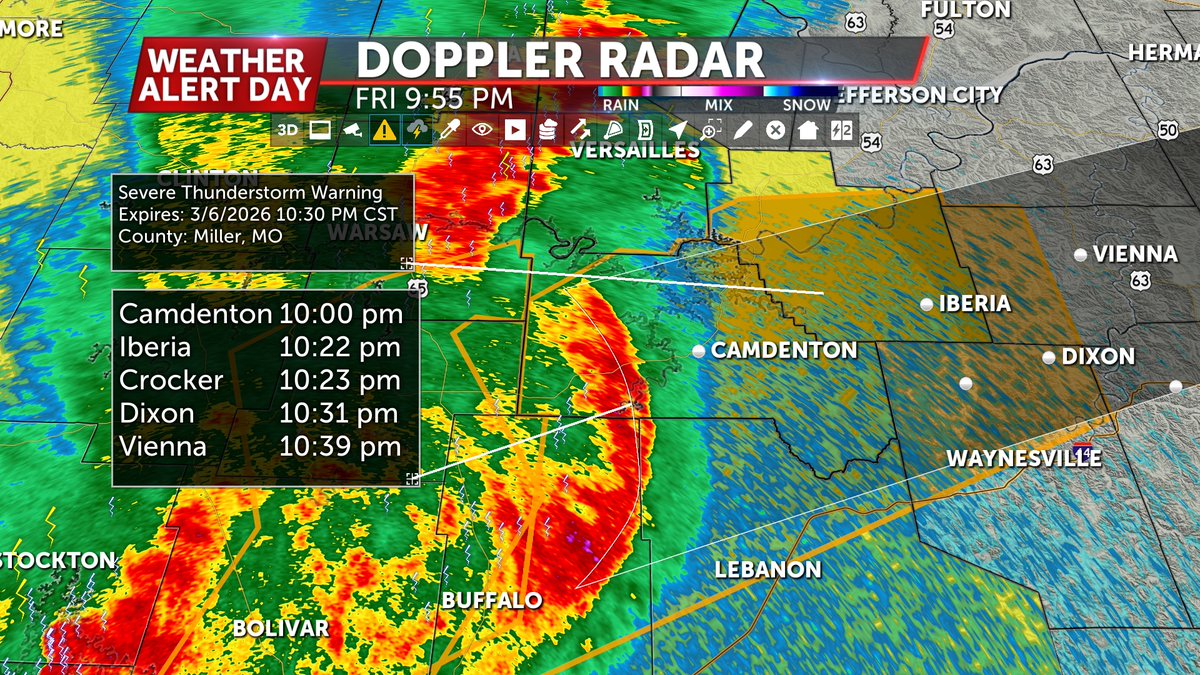
A Flash Flood Warning is in effect for far southern Camden Co. where more than 2" of rain has fallen in just a few hours. Turn around don't drown! #midmowx

English

NEW: Severe Thunderstorm Warning until 11:15PM for Boone and far northern Cole Co. for 60 mph winds. This includes Columbia #midmowx

English

NEW: Severe Thunderstorm Watch until 6AM for counties in pink primarily for 60+ mph winds #midmowx

English

NEW: Severe Thunderstorm Warning until 10:30 PM for Camden, Miller, western Maries, and northern Pulaski counties for 60 mph winds #midmowx

English

NEW: Severe T-Storm Warning for Howard, Cooper, Saline, and northern Pettis Co. until 9:30, southern Benton Co. until 10PM for 60 mph winds #midmowx


English

TORNADO WATCH: In effect until 1:00 AM for Benton, Camden, Morgan, and Miller counties #midmowx

English


