Sabitlenmiş Tweet

Hello Everyone.
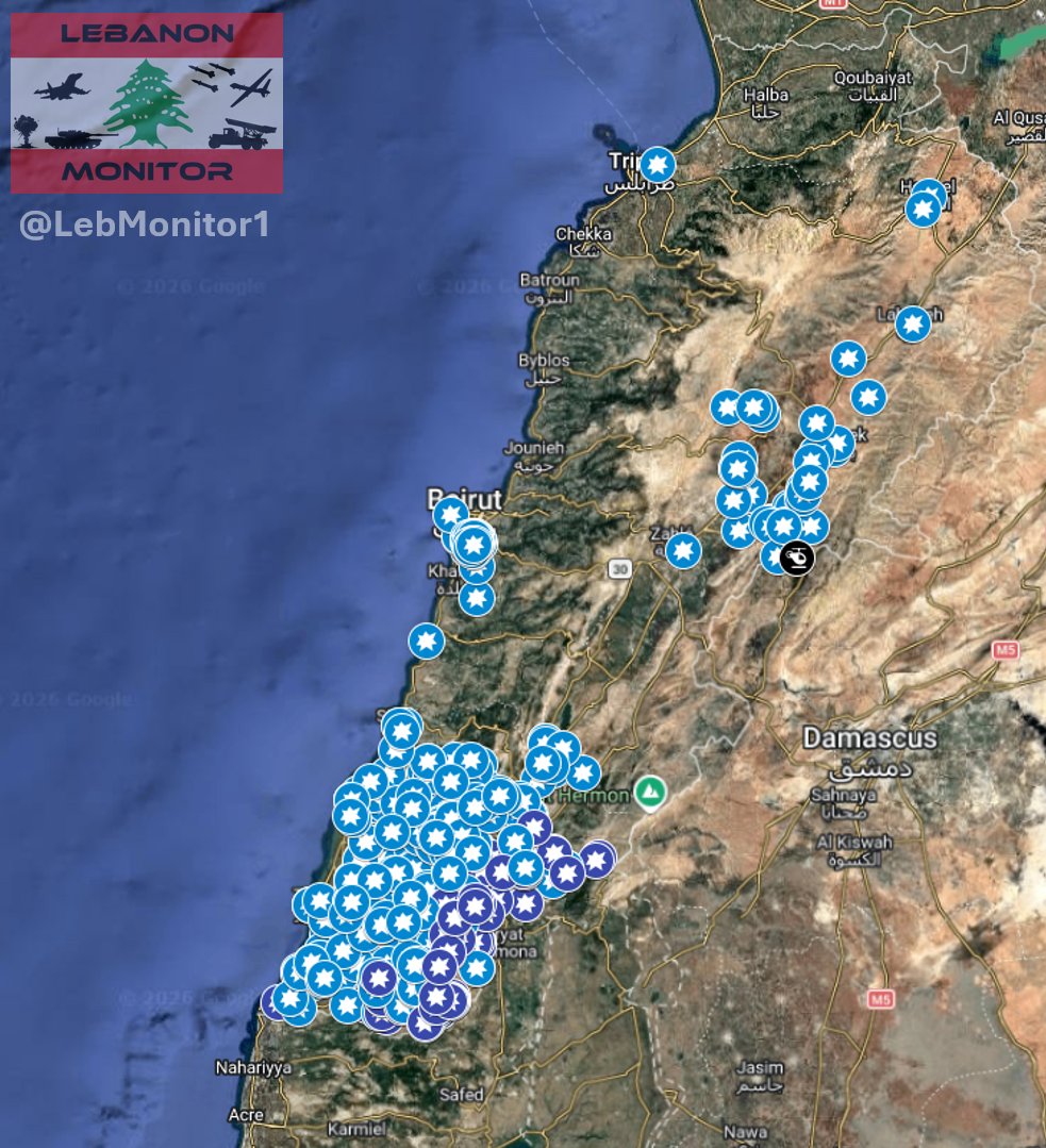
In light of the current situation, I have decided to return (at least temporarily) to reporting about Lebanon.
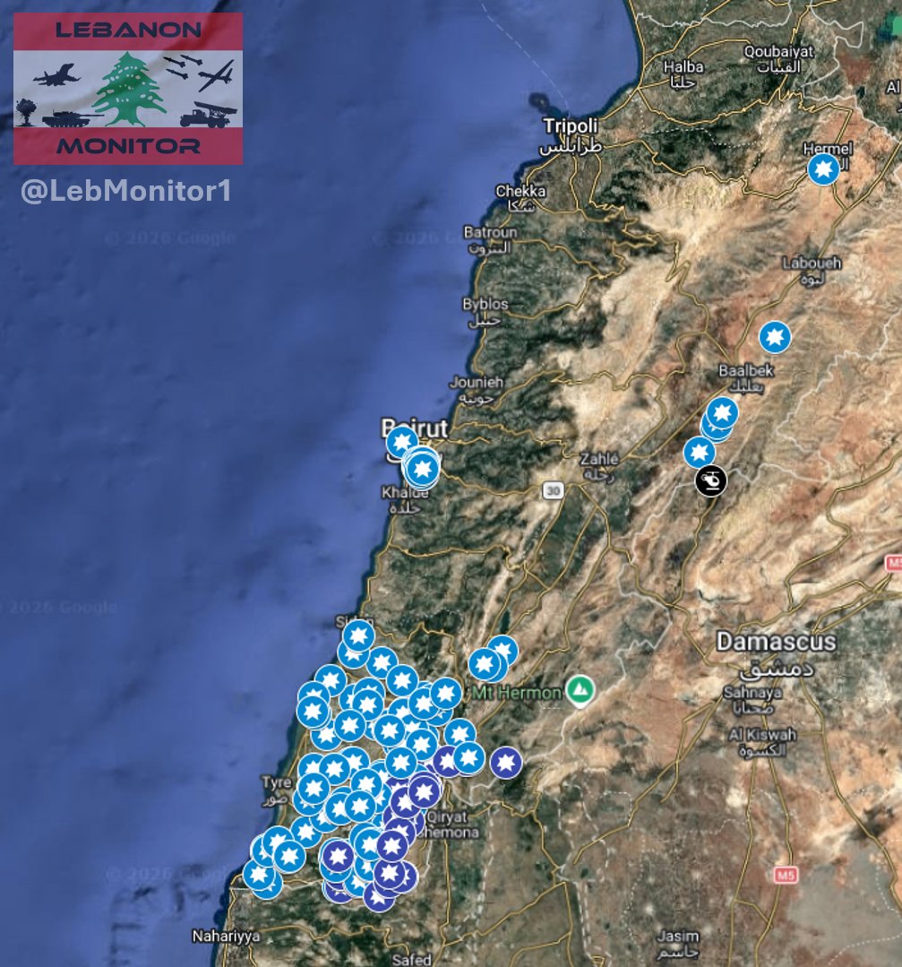
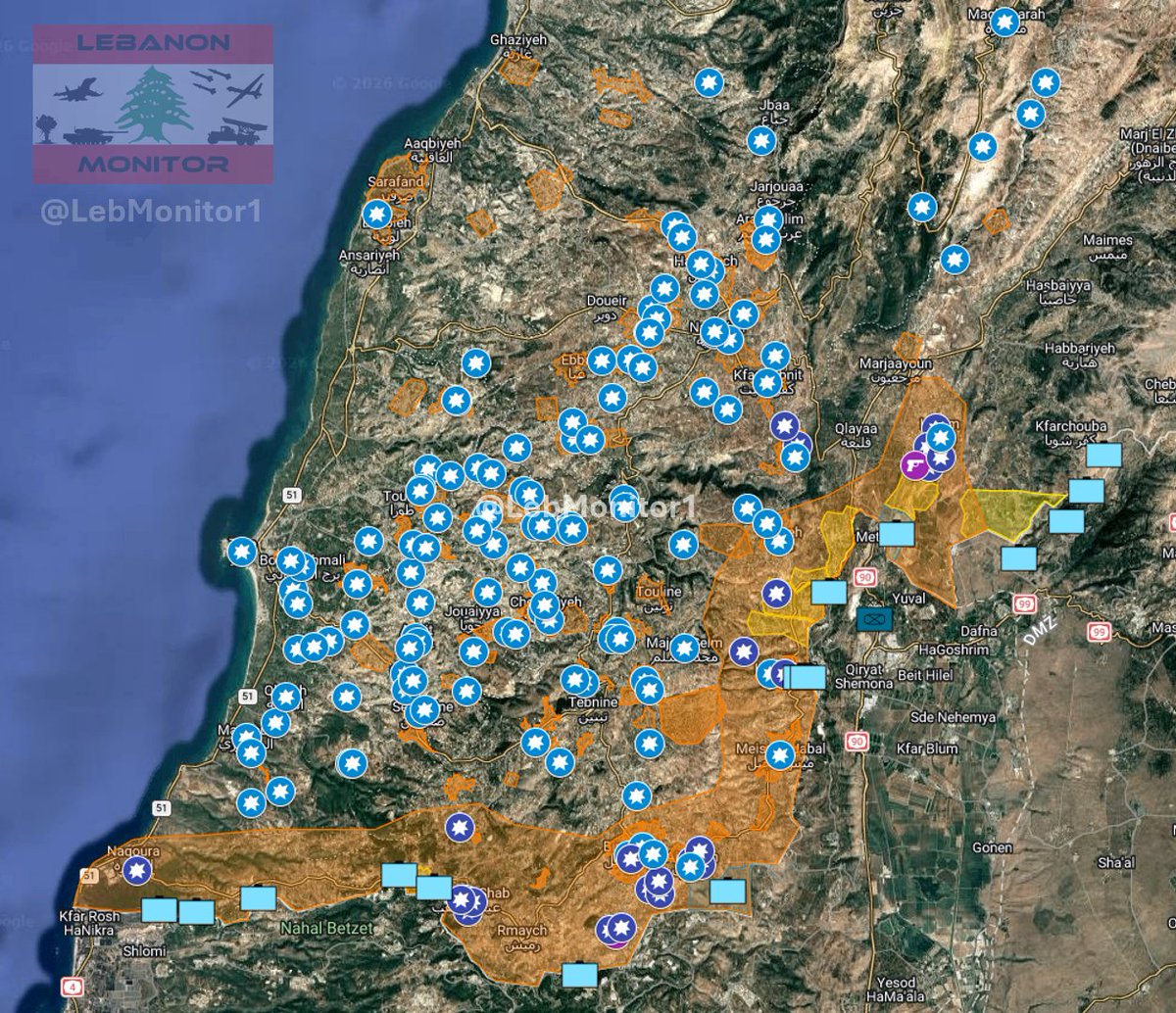
As some of you may know, I mapped out the war in 2024 (Under the name "Cheetah Intel - Project Cheetah").
Since the conflict between Israel and Hezbollah escalated yesterday, I have been working intensely to map out everything amidst the chaos.
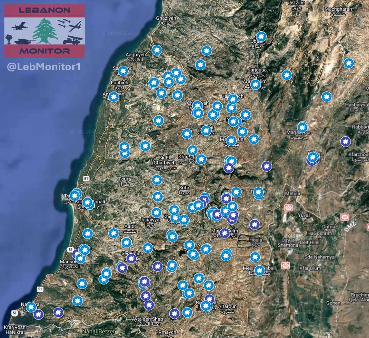
Now I am excited to announce Project Cheetah V2!
Currently, I am actively mapping out:
- Air strikes
- Artillery shelling
- Evacuation warnings
- Ground incursions
And more!
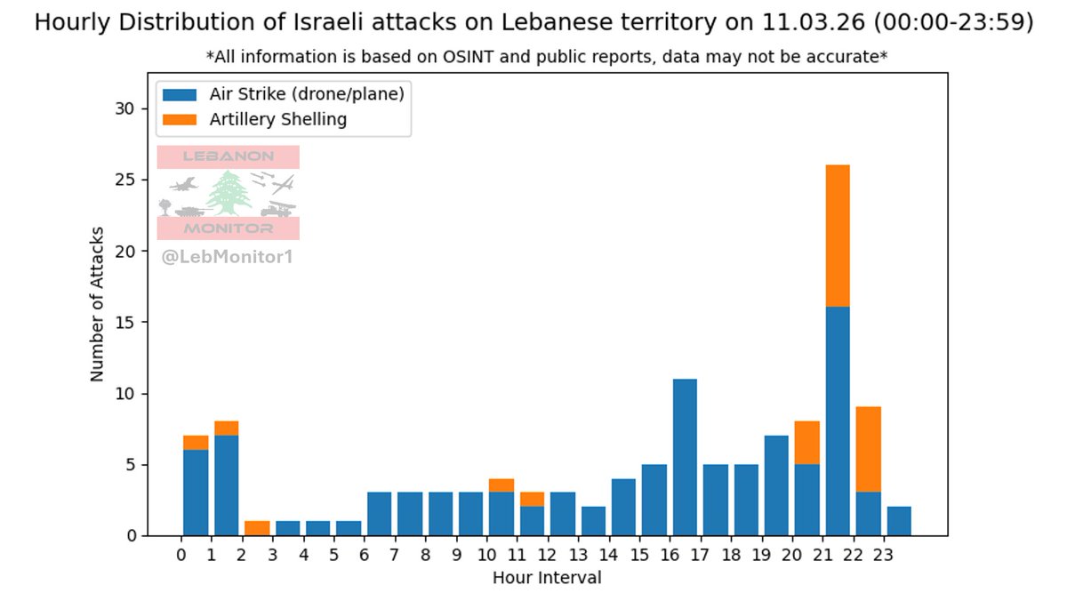
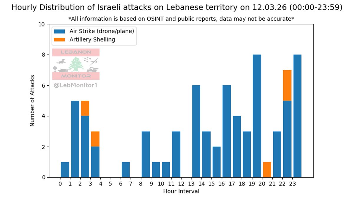
I am putting in as much work as I can, but I am also just a human. While I am giving my absolute best at staying transparent and reliable, I can also make mistakes and map data may be inaccurate, false or baseless.
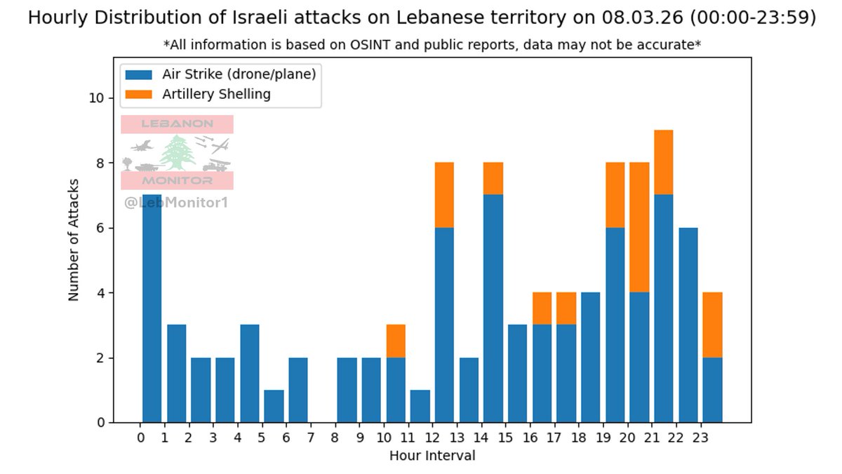
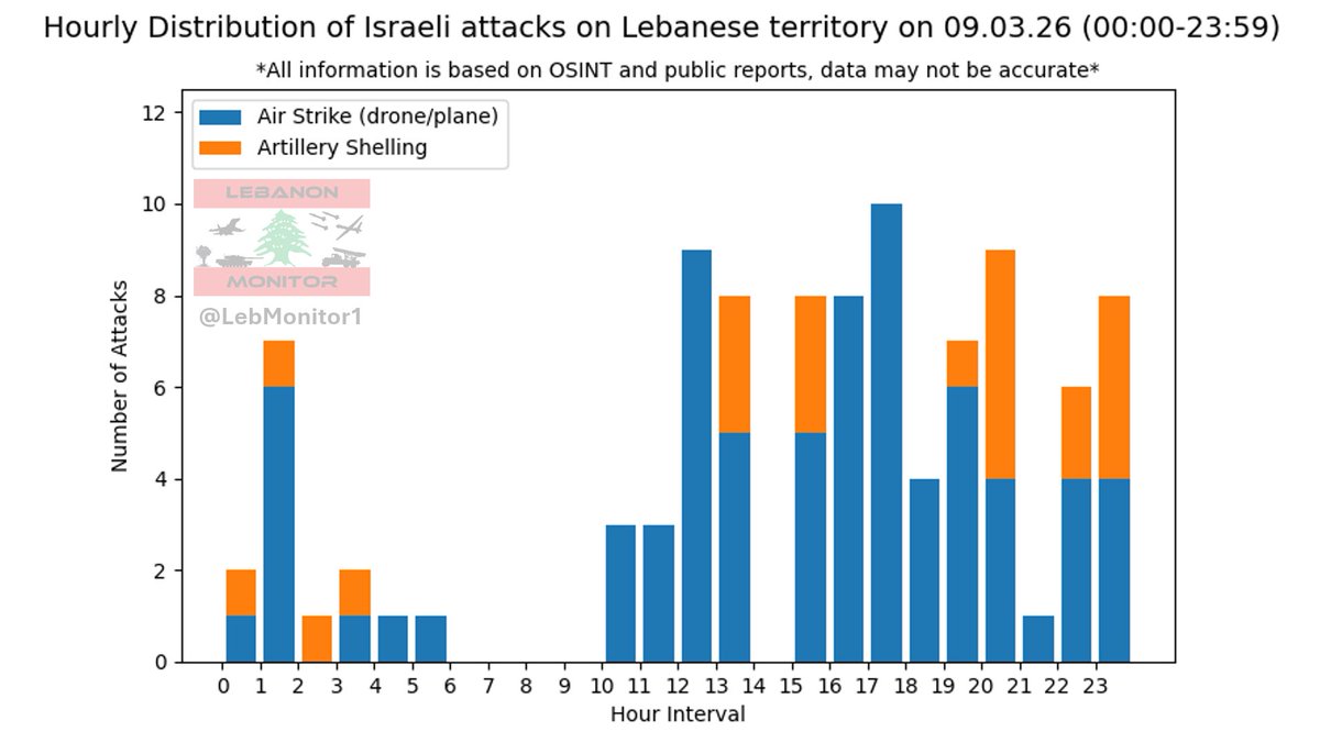
Especially for air strikes and shelling, data may be inaccurate (as it is an ENORMOUS effort to verify every single strike).
Any dates / times mentioned on the map are in local time.
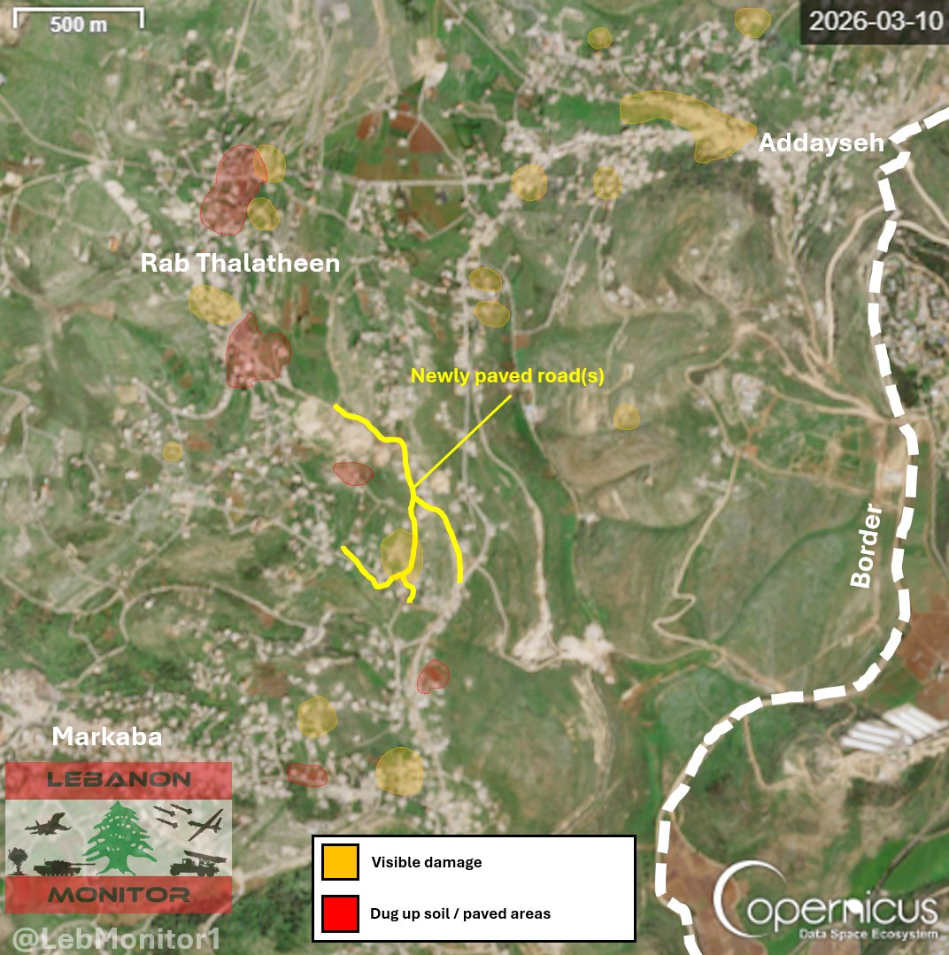
Please note that work is still in progress and some things are still to be added. Everything is based on OSINT (Publicly available information).
And lastly, if you have any suggestions, just let me know! I am happy to adapt the map to what's best for you to view.
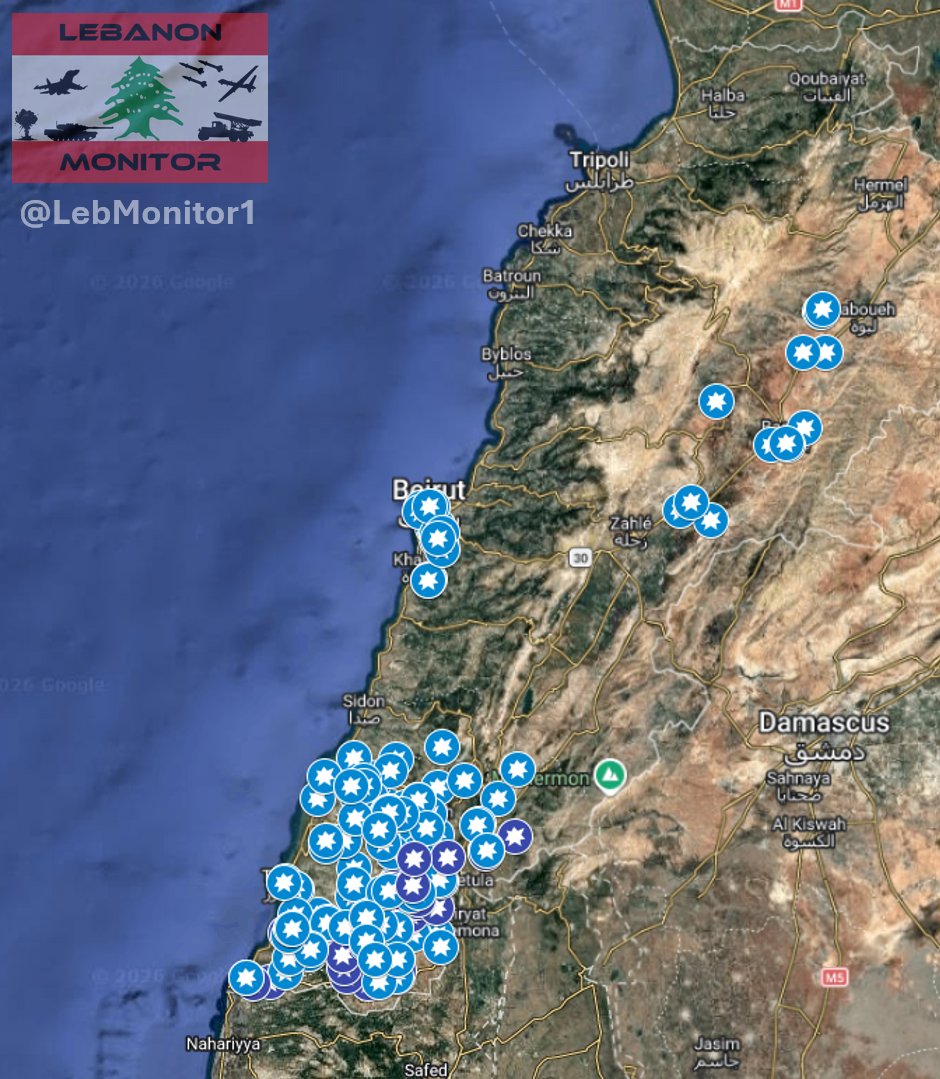
View the map here:
google.com/maps/d/viewer?…
English