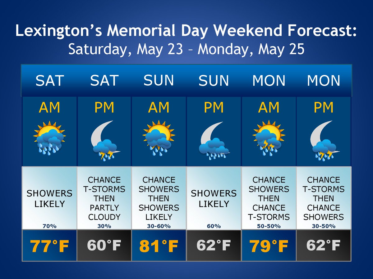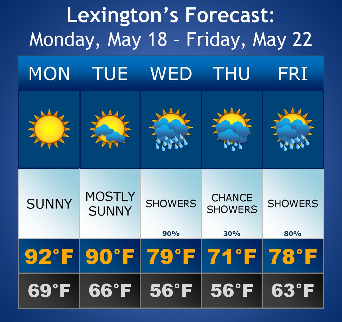

LexingtonKY EM retweetledi

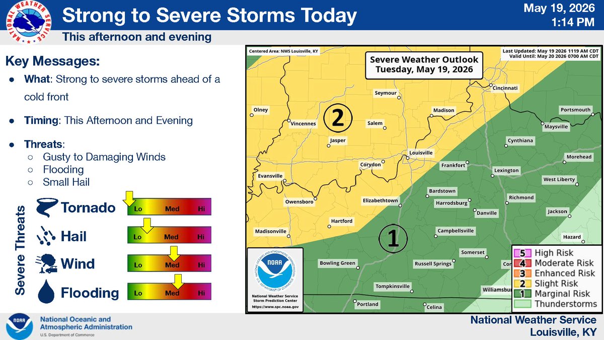
Chances for showers and thunderstorms will decrease throughout the day today as a cold front slowly moves east. Rainfall totals will be less than yesterday and last night, with accumulations up to 0.50" forecast. Isolated downpours could cause locally higher amounts.

English