
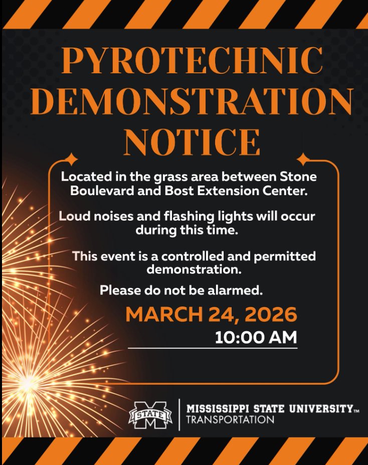
Stop by the PrepareAthon to learn important preparedness and response skills! Displays and booths are set up in front of and beside the YMCA, as well as inside the Union.

English
MSU Maroon Alert
1.2K posts

@maroonalert
Mississippi State University's official feed for emergency and advisory information. Twitter messages are not monitored or replied to.


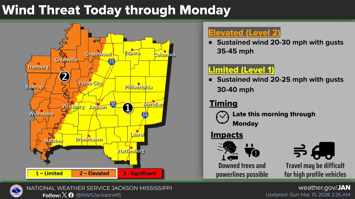
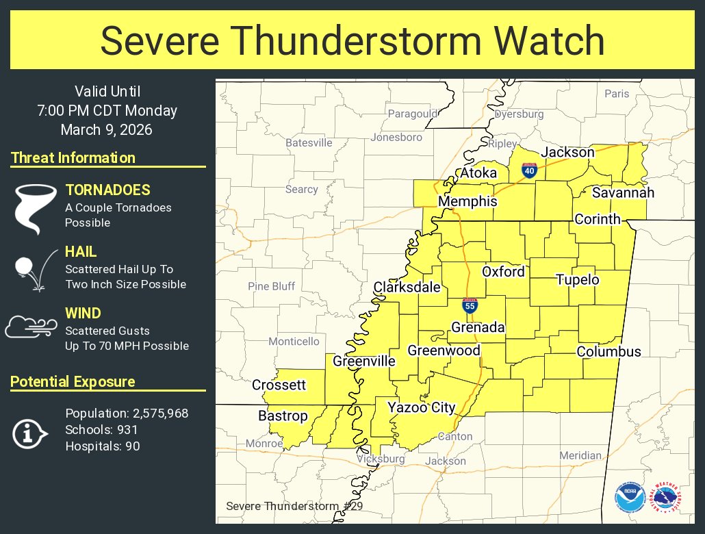
We're in for some big swings in the weather in the coming days! First, a cold front will bring a very gusty line of showers and storms Sunday night. Damaging winds will be the main concern, and tornadoes will be possible. Winds will be very gusty ahead of and following the line.


Severe Thunderstorm Warning including Columbus MS, West Point MS and New Hope MS until 8:30 PM CDT
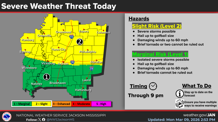
Good morning! A slow moving cold front will bring storms and a marginal risk for severe weather as we go through Saturday and into Saturday evening. The storm threat will generally shift from northwest to southeast, and damaging winds will be the primary concern.
Dangerous cold is expected this weekend as wind chills fall to near zero. Frostbite can occur quickly & hypothermia is likely with prolonged exposure. Damage to exposed pipes & water main breaks are likely. Ongoing power outages will continue to make the cold more dangerous.