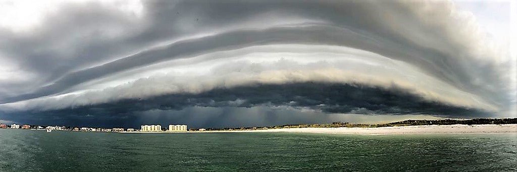
The biggest way to improve weather forecasts now isn’t new math. It’s better data. More weather balloons. More radar coverage. More satellites. More observations feeding the models.
Brian McClure
17.8K posts

@mcclureWX
Evening meteorologist @BN9weather. Tropical analyst. Hype-free forecasts. Weather, photography, and travel. @NCState Alum

The biggest way to improve weather forecasts now isn’t new math. It’s better data. More weather balloons. More radar coverage. More satellites. More observations feeding the models.


Say it with me - "THE NAM IS MY JAM" Chatting model changes with @blamarre

Me every time I read about how terrible/unusual for there to be fire in the Everglades in May. "The River of Grass is perpetuated by fire. For thousands of years, lightning strikes and humans have ignited fires in the sawgrass prairies. Sawgrass fires actually improve the passage of water through the slough or shallow river basin, by reducing grass that would otherwise impede the vital flow of water through the Everglades. Fire not only improves habitat for wildlife by creating a mosaic pattern of vegetation, but also helps reduce large accumulations of flammable fuels near hammocks or tree islands, which harbor a wide variety of subtropical plants that are less tolerant of fire." nps.gov/ever/learn/man…


The ECMWF weeklies and long-range GEFS now extend out through the start of the hurricane season. They show a pretty nice preview of what we can expect for most of this season, with a stronger-than-usual TUTT thanks to El Niño and westerly wind shear that's above normal. The shear in the subtropics looks lower, so any activity we see this year will probably be focused there. The Gulf does look potentially open for something in early June, but we'll see if we get any source disturbances with the Caribbean hostile.


