
Caleb Chevalier
9.4K posts

Caleb Chevalier
@MetCalebC
Afternoon meteorologist with KSHB. BWG ➡️ FWA ➡️ ACT ➡️ MCI. Western Kentucky University class of 2015.
Katılım Ocak 2015
133 Takip Edilen755 Takipçiler

Noon temperatures observed in the low-70s. That spells low-80s for some metro areas this afternoon.
English
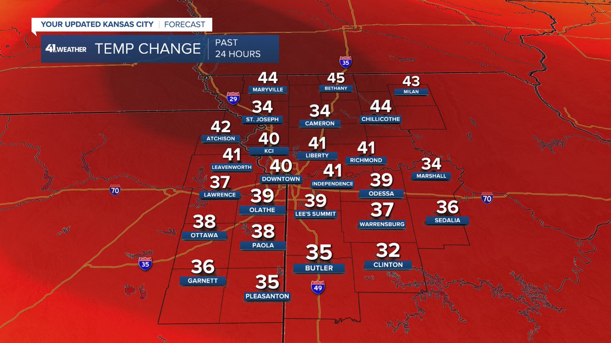
Running out of colors to display how much warmer this afternoon is versus yesterday.
English
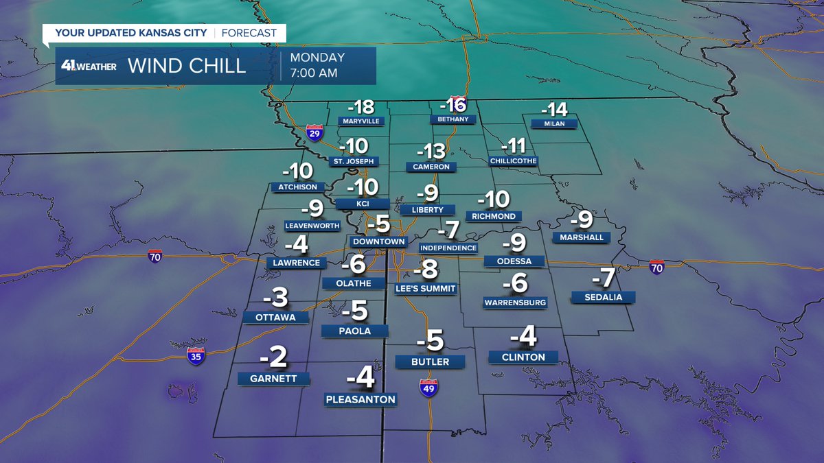
Winds on Monday morning will still be around 20 mph, and with temperatures in the teens at that point, the wind chill will drop several degrees below zero.
English
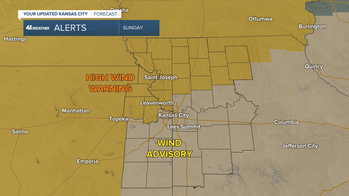
Just how windy tomorrow? Well, zones in the High Wind Warning could reach gusts of 60 mph in the evening. 50 mph gusts possible in the Wind Advisory.
English
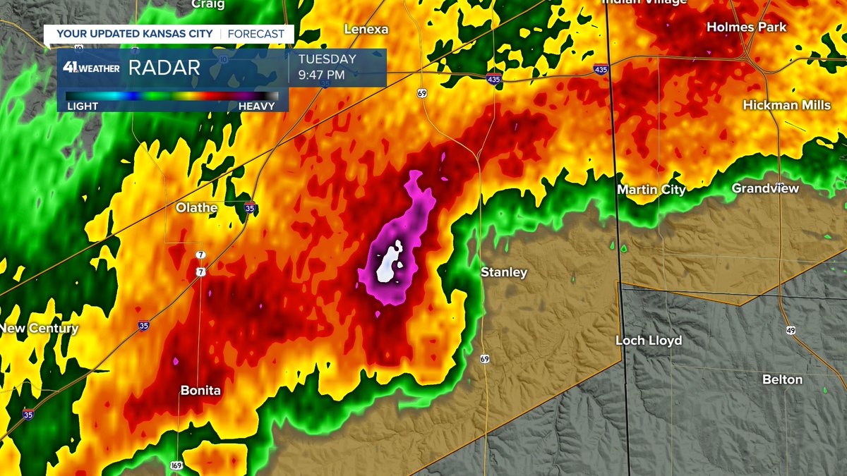
No surprise that a Flash Flood Warning has now been issued for the south side of KC and further down I-35.
English
@Johnsie10 That's a lot. Thankfully it looks like the larger stuff just missed you.
English

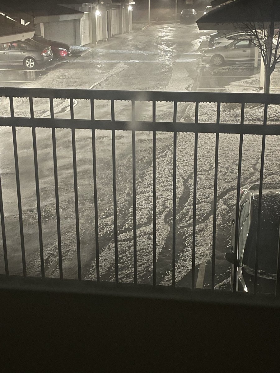
@MetCalebC I’m just north of Stanley. This came down pretty quickly. Looks like maybe marble size.
English

@MetCalebC What time are storms rolling in tomorrow? Am I good to try and fly back by 330pm?
English
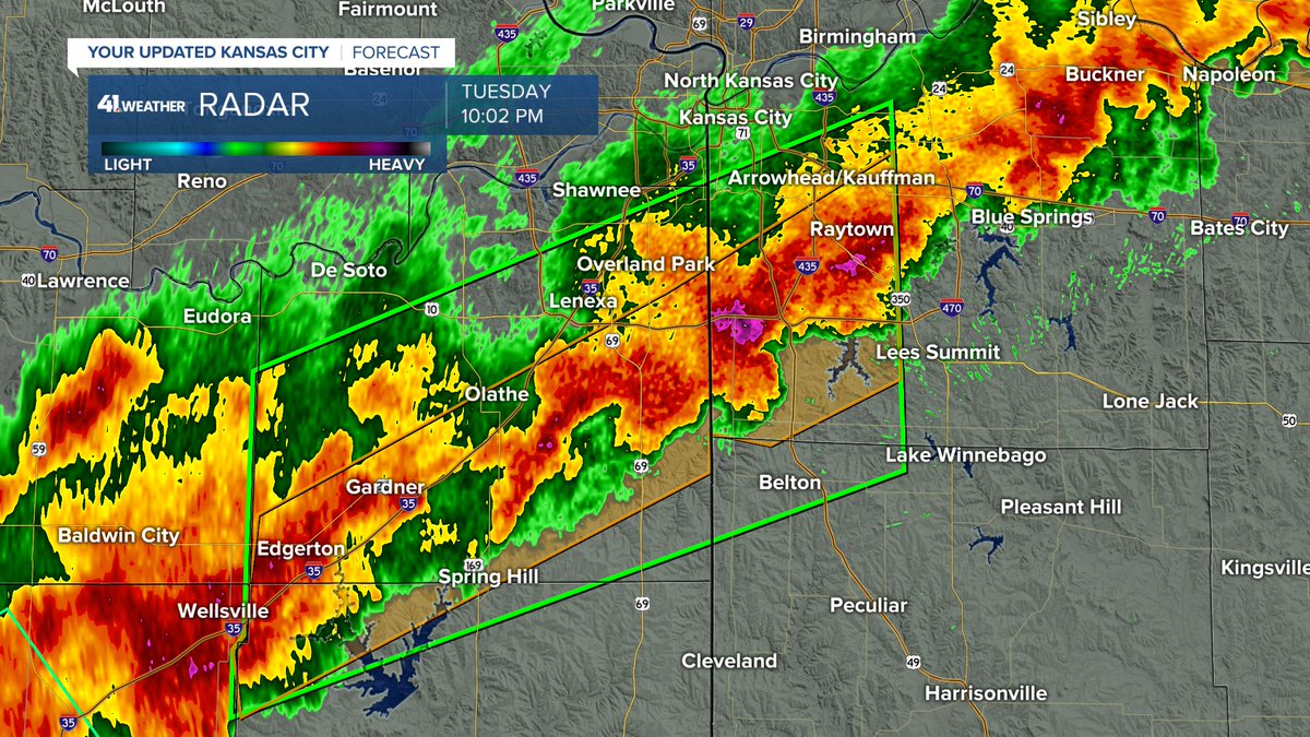
The good news so far is that there are no severe thunderstorms currently associated with the line to our west.

English
This is what 7:10 PM looks like now. How are we liking the change?

English
@Kcredjayhawk I would say last night helped make a case against it.
English

@MetCalebC Based on this map you can never convince me the Tonganoxie split is not real.
English
Some rain will linger for a little bit longer in Henry County and Pettis County, but that's all. Everyone can sleep peacefully.
English
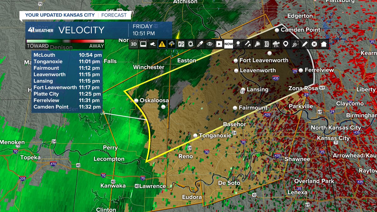
@RussKnight_Ag @KSHB41 Yup, actual rotation but thankfully no word of anything being produced.
English

@MetCalebC @KSHB41 In Western Shawnee, that was intense. was her actual rotation captured on radar?
English
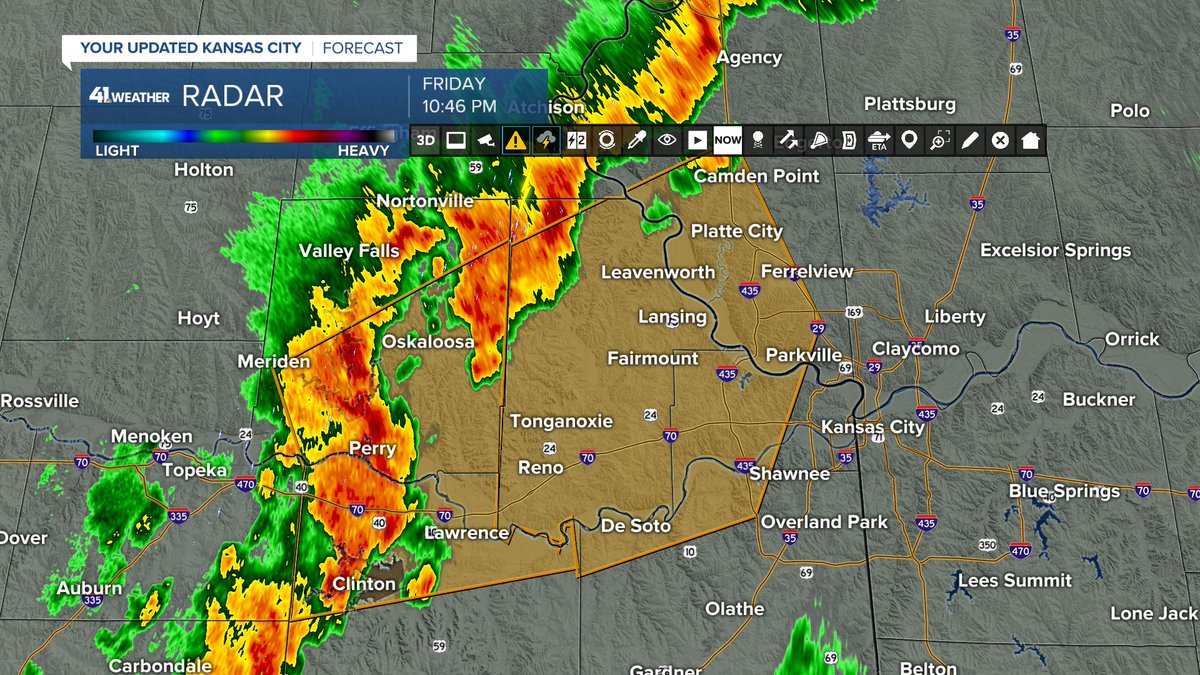
Severe Thunderstorm Warning until 12 AM for the following counties: Clay, Jackson, Johnson (KS), Leavenworth, Platte and Wyandotte.
English

@MetCalebC has been absolutely locked in tonight. What a thrill it has been to follow that rotating signature with him for the last hour. Cheers, sir, you’re crushing it.
English
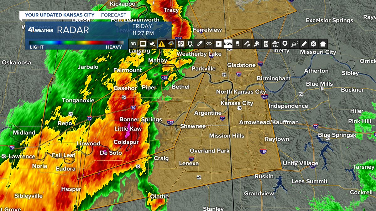
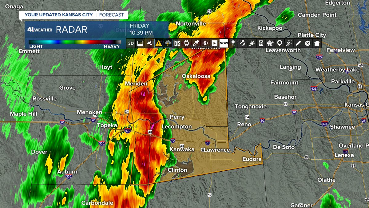
Severe Thunderstorm Warning for parts of Buchanan, Clay, Clinton and Platte Counties until 12 AM.

English
The National Weather Service has extended the Severe Thunderstorm Warning all the way to Platte County in anticipation of 50-60 mph winds.
English
@jm_gotti Stormy but hopefully just normal stuff by the looks of things.
English
@MetCalebC Looks like 12-2am is gonna be interesting for northeast Johnson county… ?
English
Severe Thunderstorm Warning for Douglas and Jefferson Counties until 11:15 PM for 60 mph winds.
English