David Paul

12.8K posts

David Paul banner
David Paul

David Paul

@MetDavidPaul

Chief Meteorologist at WTVY-TV in Dothan, AL, continuing my life-long passion for weather. B.S. Degree in Meteorology from Northern Illinois University.

Dothan, AL Katılım Nisan 2013
353 Takip Edilen1.6K Takipçiler
David Paul
David Paul@MetDavidPaul·
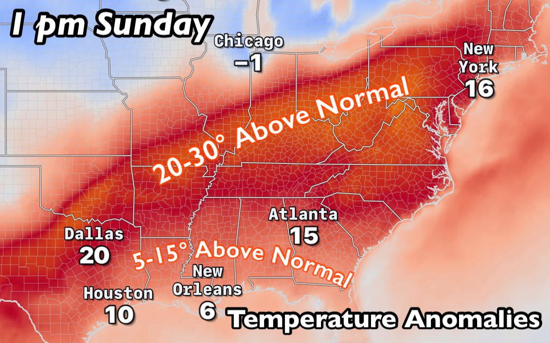
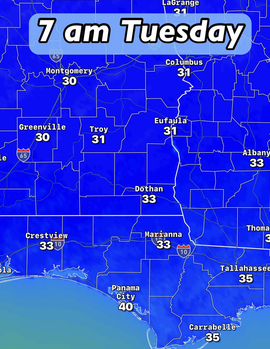
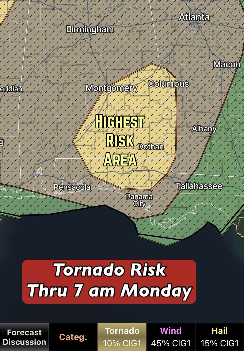
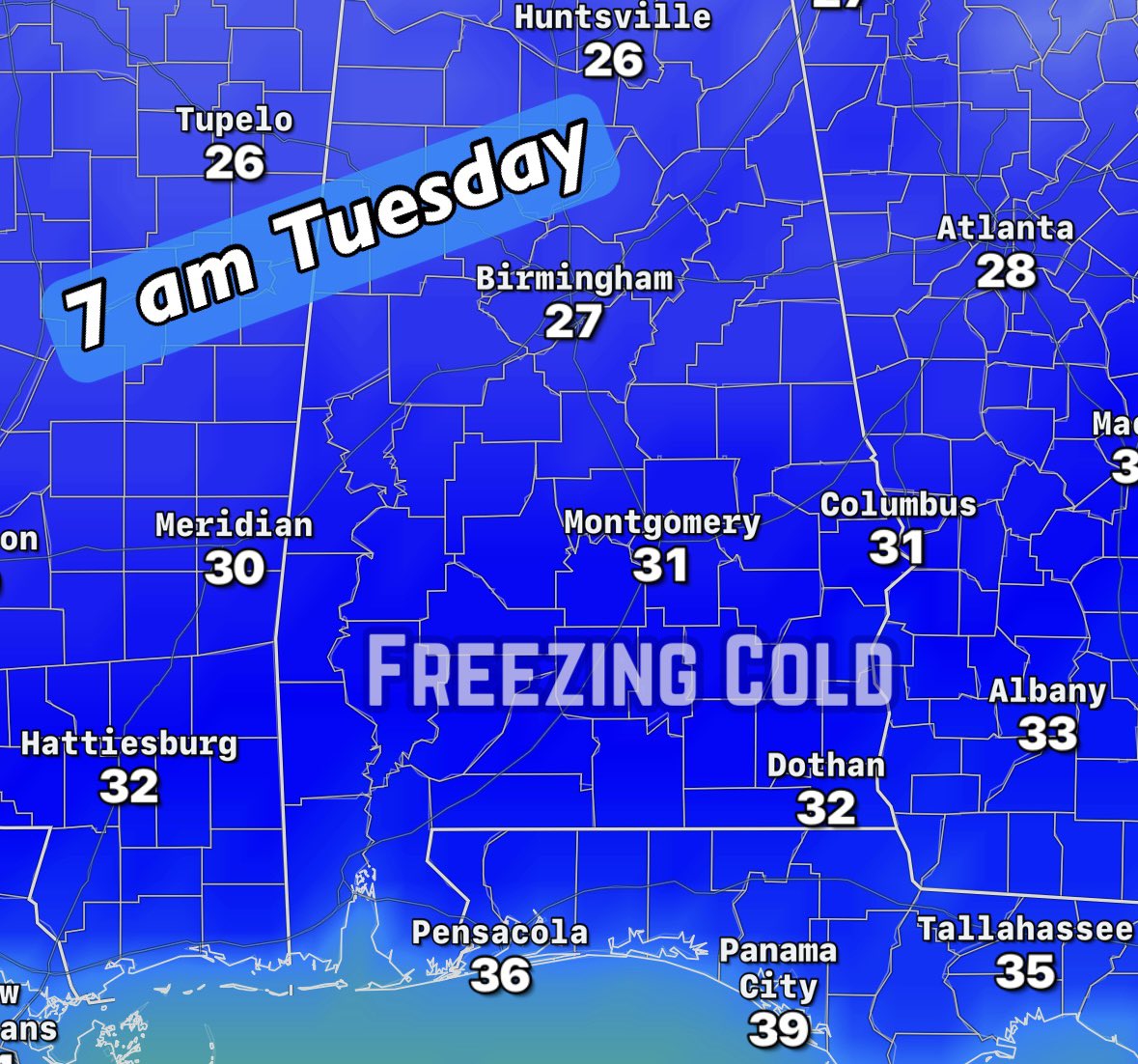
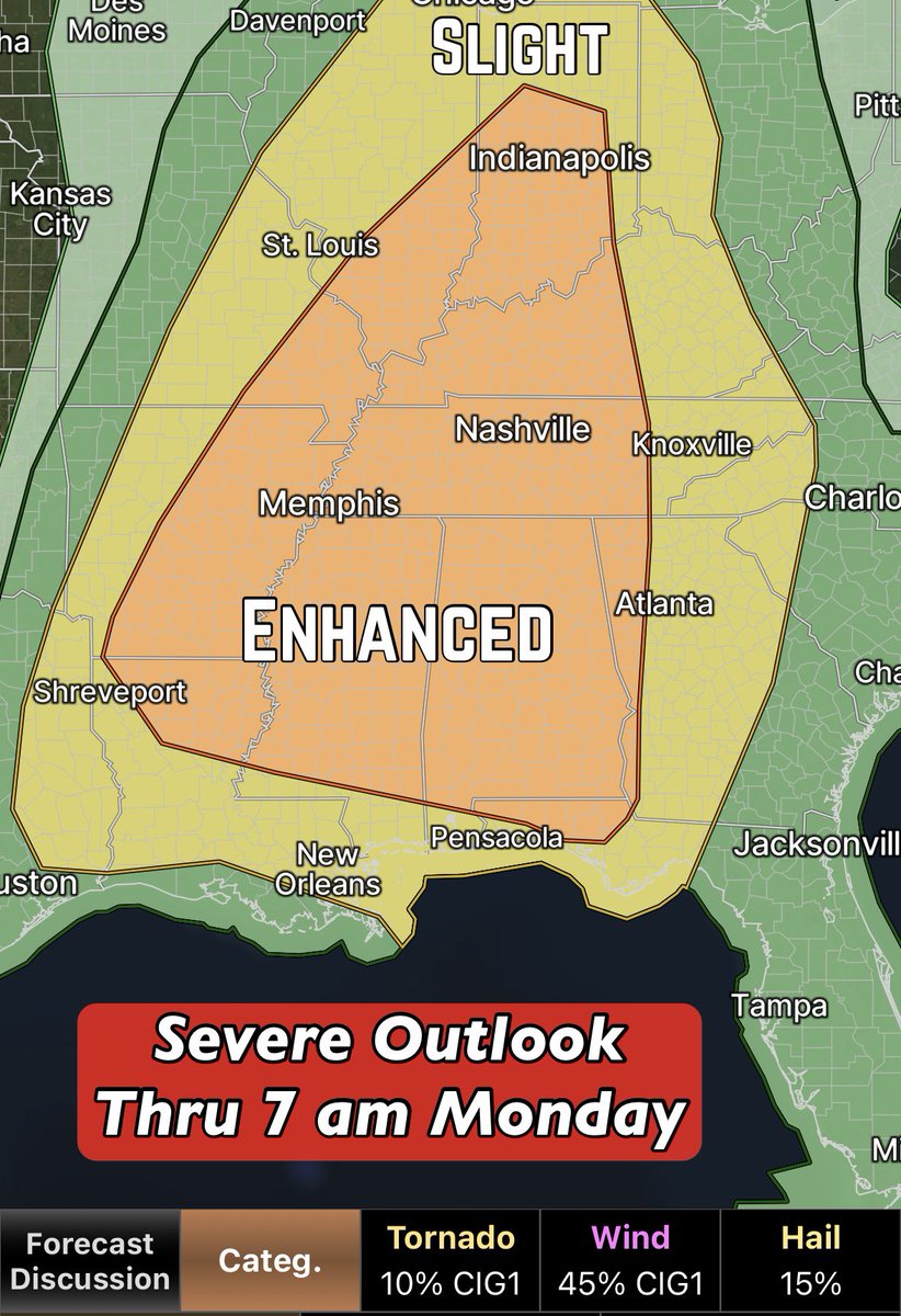
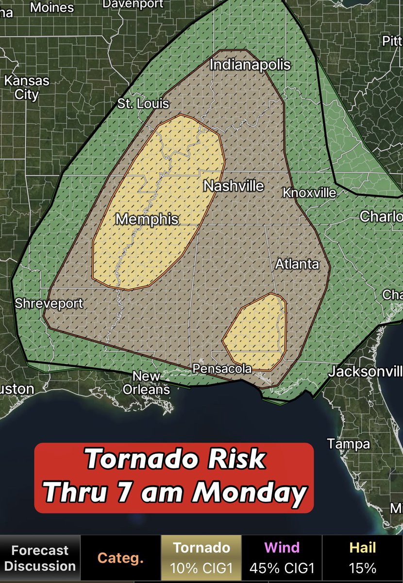
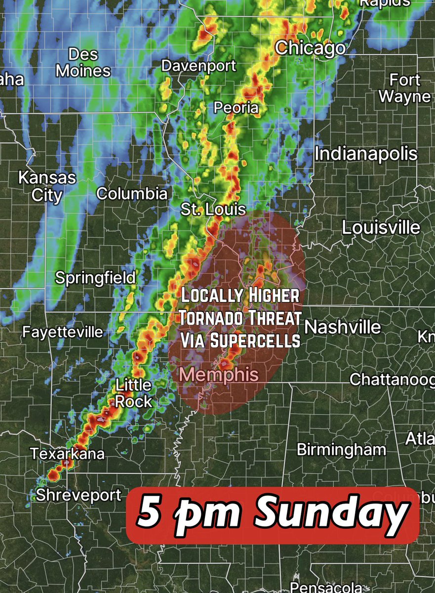
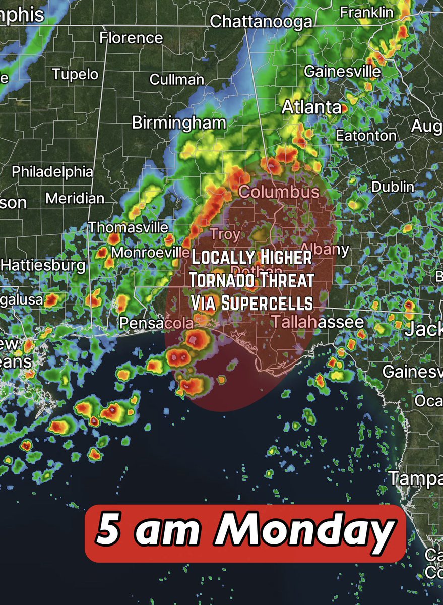
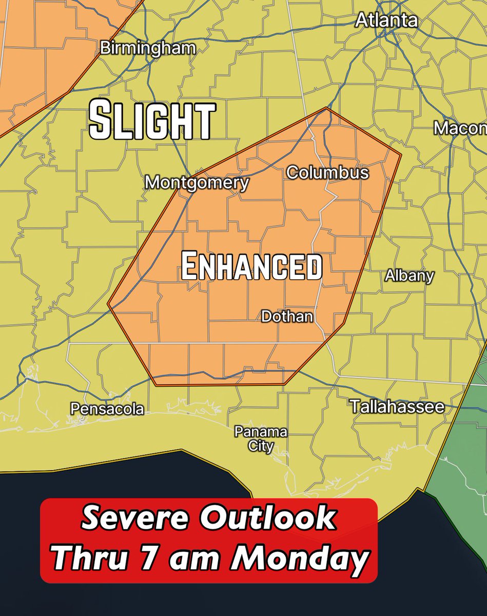
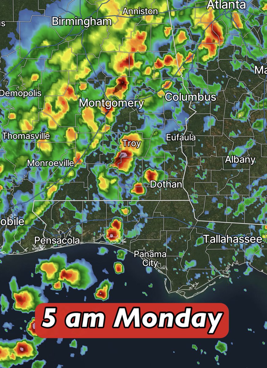
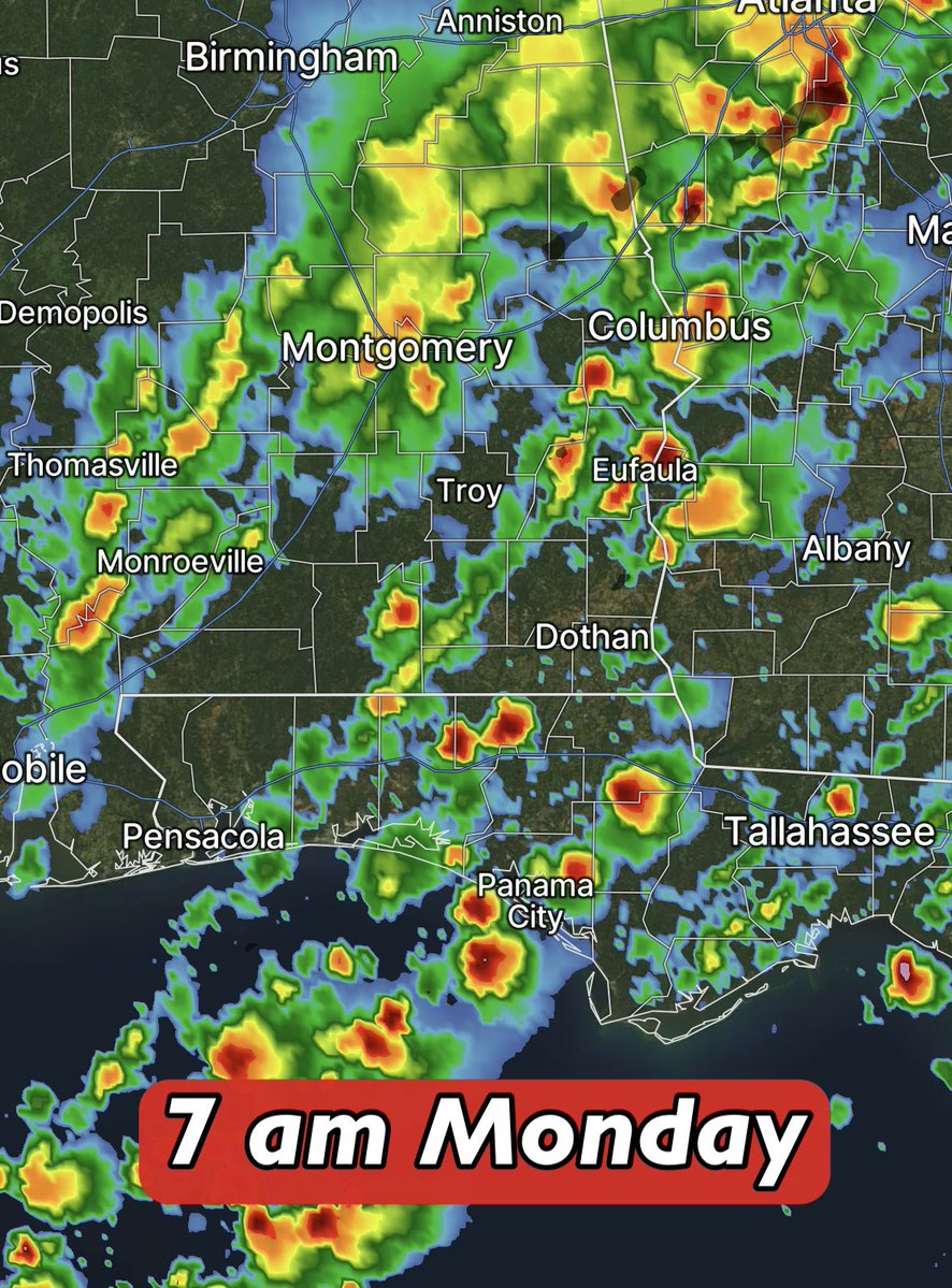
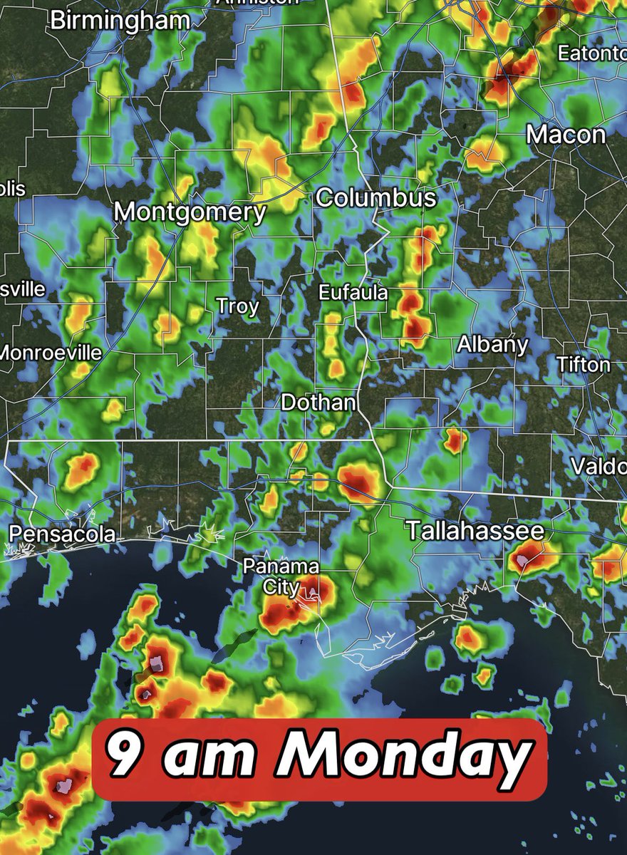
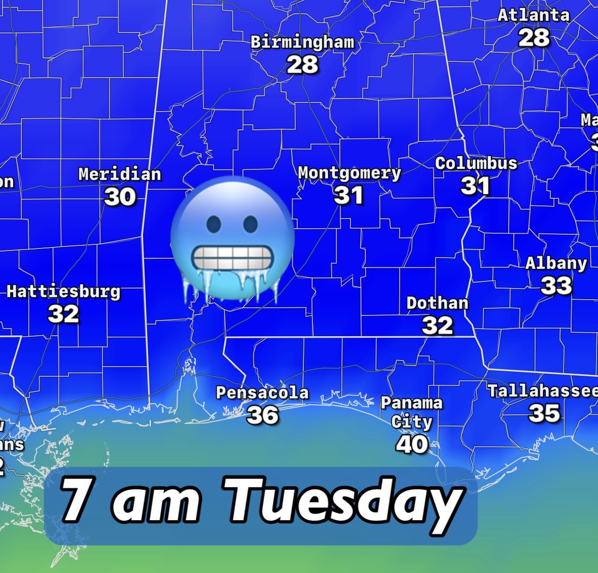
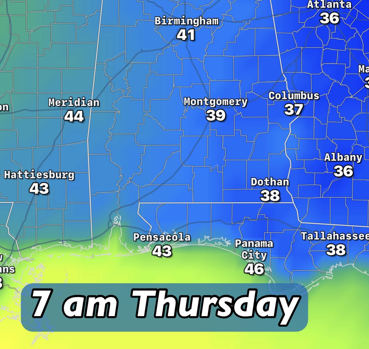
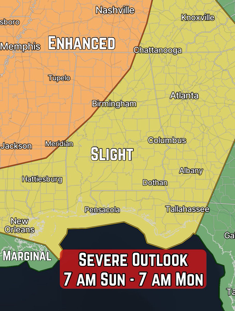
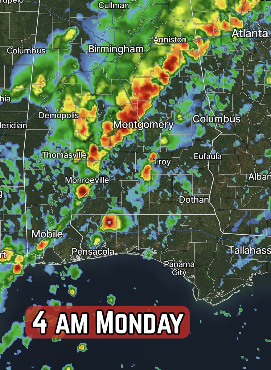
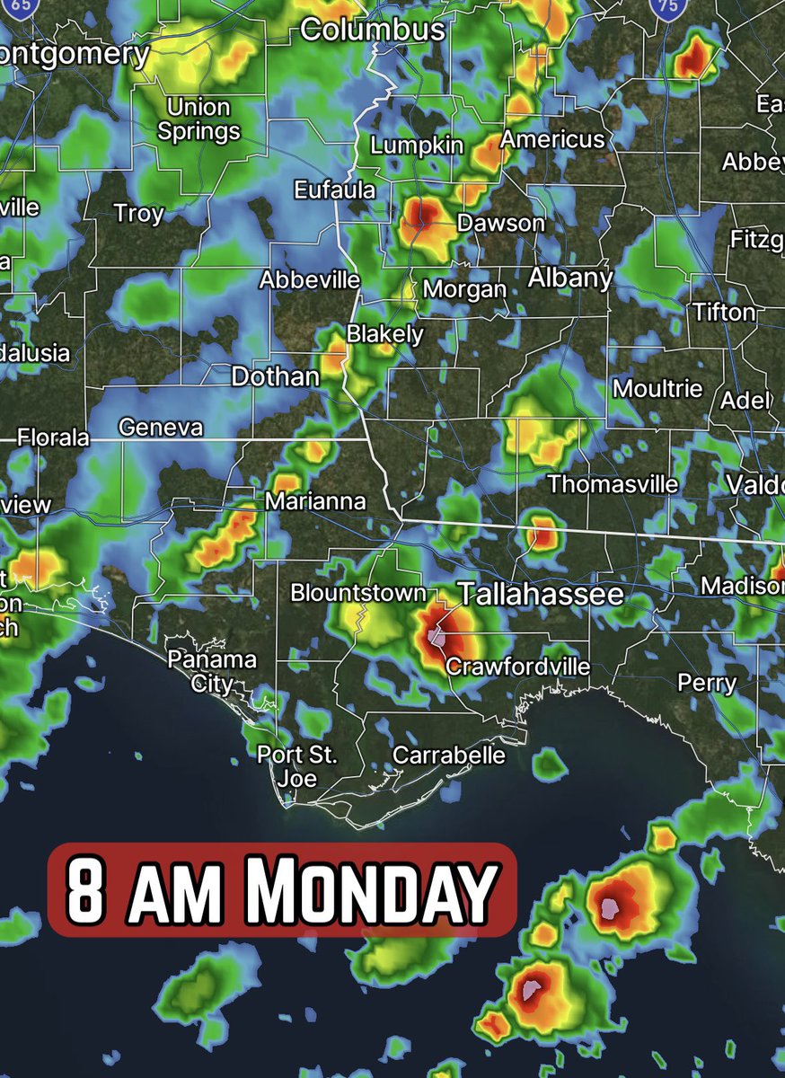
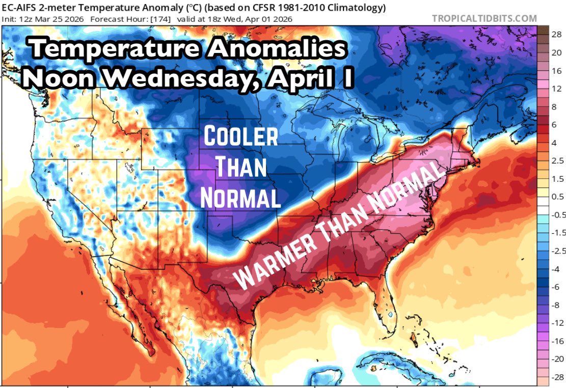
🎢 Rollercoaster weather alert! Temperatures across the Southeast are going to warm Thursday and Friday, drop over the weekend, then rebound next week. These temperature anomalies for the middle of next week show a much warmer than normal set-up from Texas to New England. This sets the battle zone for showers and thunderstorms for the first week of April for the Plains to Midwest and Great Lakes.
David Paul tweet media
English
0
2
4
186
David Paul
David Paul@MetDavidPaul·
Our pollen situation is out of control! 🤧 The mid-week Pollen-Ometer is running on the high side, driven by Oak, Juniper and Birch trees. If your car is getting that tell-tale yellow dusting or your eyes and nose are complaining, you're not alone - spring tree pollen season is in full swing across the Wiregrass. Keep windows closed, wash your face after being outside and have those meds handy. It’s only going to ramp up more in the coming days. We should see some improvement next week as some of these tree varieties begin to leaf-out. As far as rain 🌧️ to cleanse the atmosphere…not going to happen for a while.
David Paul tweet media
English
0
0
0
53
David Paul
David Paul@MetDavidPaul·
🌵 The latest 10-day rainfall outlook from the AI-ECMWF model is in… and it’s looking pretty thirsty out there, y’all! From now through 7 am April 3, most of the Wiregrass will be lucky to pick up any sort of rain, perhaps just a sprinkle or stray shower. Much of the Southeast looks to be in the “basically nothing” club. If you’re maintaining a garden, lawn, or new sod, it’s time to keep the sprinklers handy. The fire risk is creeping up too, so use caution with any open burning.🔥 ⛈️ The upside? No severe weather chances! ❤️
David Paul tweet media
English
0
0
1
102
David Paul
David Paul@MetDavidPaul·
Spring fever will sweep across most of the country this weekend! Maybe it's better to say "summer fever" for parts of the Plains and Southwest, with highs in the 90s to even 100s. The temperature anomalies are pretty impressive, with readings running well above normal. For the Wiregrass, we're looking at highs in the lower to middle 80s.
David Paul tweet media
English
0
0
2
129
David Paul
David Paul@MetDavidPaul·
The latest U.S. Drought Monitor, released Thursday, shows Florida and much of the Southeast gripped by serious dryness. Large areas of the state are in extreme drought (D3) and even exceptional drought (D4) near the Georgia line. Classic La Niña patterns have kept rainfall well below normal for months, dropping soil moisture levels and streamflows. Stay vigilant on the fire risk - little to no rain is expected over the next week to two weeks over the driest areas.
David Paul tweet media
English
0
1
4
245
David Paul
David Paul@MetDavidPaul·
We’ve been unseasonably cold across the Eastern US in recent days, but the pattern will flip for the second half of the week and into the weekend. These are temperatures anomalies for midday Sunday. Temps that are 10-20° or more below normal Wednesday morning will be 10-20° or more above normal this weekend! What a ride…🎢
David Paul tweet media
English
0
1
3
100
David Paul
David Paul@MetDavidPaul·
We have a tranquil pattern ahead which is pretty nice this time of year. Severe weather is always a concern and chances, according to climatology, continue trending upward over the next month. Here's a comparison of the probability of any type of severe weather on March 17 versus April 17.
David Paul tweet mediaDavid Paul tweet media
English
0
0
1
87
David Paul
David Paul@MetDavidPaul·
Brrr! 🥶 Freeze Warnings for Monday night/Tuesday morning are posted as far south as the Florida Panhandle. This cold blast isn’t messing around! Implement your cold weather preparations for the next couple nights.
David Paul tweet mediaDavid Paul tweet media
English
0
1
2
131
David Paul
David Paul@MetDavidPaul·
Weather Alert...A Tornado Watch has been issued for parts of the Wiregrass. Severe weather is possible.
David Paul tweet media
English
0
0
2
108
David Paul
David Paul@MetDavidPaul·
*WEATHER ALERT* A Tornado Warning has been issued for Dale County. The red polygon outlines the risk area.
David Paul tweet media
English
0
0
1
95
David Paul
David Paul@MetDavidPaul·
*WEATHER ALERT* A Tornado Warning has been issued for Henry County. The red polygon outlines the risk area.
David Paul tweet media
English
0
0
1
83
David Paul
David Paul@MetDavidPaul·
Weather Alert...A Tornado Watch has been issued for parts of the Wiregrass. Severe weather is possible.
David Paul tweet media
English
0
0
0
70
David Paul
David Paul@MetDavidPaul·
Weather Alert...A Tornado Watch has been issued for parts of the Wiregrass. Severe weather is possible.
David Paul tweet media
English
0
0
0
75
David Paul
David Paul@MetDavidPaul·
Weather Alert...A Tornado Watch has been issued for parts of the Wiregrass. Severe weather is possible.
David Paul tweet media
English
0
0
0
62
David Paul
David Paul@MetDavidPaul·
🚨 First Alert Weather Day 🚨 for Monday AM! ⛈️ The forecast is locked in. An Enhanced Risk of severe weather, level 3/5, with a bullseye of higher tornado threat across Southeast Alabama into surrounding areas of Georgia and Florida. 🕰️ Main threat window is around 3-8 am CT. 📉 A cold front will be approaching. The line of storms along the front should weaken a little, but supercell thunderstorms ahead of the front should develop at the same time. The result will be powerful storms capable of producing gusty winds, tornadoes and hail. 🌪️ A Tornado Watch is likely. Tornado Warnings are likely. Have multiple ways to get weather warnings to wake you up. 🗣️ Tell your family and friends about the threat. You’d be surprised how many people have no idea there’s a severe threat Monday morning. 📺 Live coverage will be on the WTVY News 4 platforms. Download our apps, watch on Roku, the Facebook page, etc. Dish customers, you can still watch us. 🛌 Get to bed early, prepare for an early wake-up call Monday. Stay weather-aware!
David Paul tweet mediaDavid Paul tweet mediaDavid Paul tweet mediaDavid Paul tweet media
English
3
0
5
472
David Paul
David Paul@MetDavidPaul·
Beyond the severe threat Monday morning, we’ll have to deal with a freeze/frost threat, especially for Tuesday and Wednesday mornings. If you have any tender plants outdoors, prepare to protect them. Same goes for pets and exposed pipes. Don’t forget to layer-up yourself, too, the mornings will be winter-like! 🥶
David Paul tweet mediaDavid Paul tweet media
English
0
0
3
191
David Paul
David Paul@MetDavidPaul·
Midday Sunday Update: 🚨 First Alert Weather Day 🚨 for early Monday. ⛈️ A large Enhanced Risk from the SPC covers the US thru 7 am CT Monday. Including the Wiregrass. Damaging winds and tornadoes are the primary threats, along with hail, potentially large. 🌪️ What I’m seeing: Locally higher tornado threats look to develop in two areas. One centered around/north of Memphis later Sunday, with the other around Dothan early Monday. A favorable wind profile fueled by the low-level jet will enhance wind shear and rotation potential in these areas, combined with atmospheric energy. ⏰ For Southeast Alabama into the Florida Panhandle and Southwest Georgia. The primary impact window looks to be from around 3-9 am CT. Be weather-aware and have a way to get warnings. Live coverage will be provided on WTVY News 4 platforms. You’re informed…please let those you care about know the risk, too.
David Paul tweet mediaDavid Paul tweet mediaDavid Paul tweet mediaDavid Paul tweet media
English
0
0
3
210
David Paul
David Paul@MetDavidPaul·
🚨 First Alert Weather Day 🚨 declared for Monday. Scattered showers and thunderstorms are possible between around 3 am and 9 am CT. The main concern is the development of supercells ahead of the cold front, which could produce damaging winds, tornadoes and hail. One limiting factor could be energy levels in the atmosphere, but the wind shear will be high. The SPC as of Sunday morning has much of the Wiregrass in an Enhanced Risk, level 3/5. There could be an adjustment back to Slight, depending on how the new data comes in throughout the day. Regardless, be weather-aware early Monday. Have a way to get warnings. Live coverage will be provided as-needed on WTVY News 4 platforms.
David Paul tweet mediaDavid Paul tweet mediaDavid Paul tweet mediaDavid Paul tweet media
English
0
0
1
149
David Paul
David Paul@MetDavidPaul·
Did you put those frost sheets away? Time to dig them out! Frost and light freeze conditions are on the way this week. 🥶 Tuesday and Wednesday mornings look to be the coldest, but Thursday morning will be chilly, too. Winter isn’t done quite yet!
David Paul tweet mediaDavid Paul tweet mediaDavid Paul tweet media
English
0
0
4
168
David Paul
David Paul@MetDavidPaul·
We’re tracking a couple big weather stories this weekend. First, showers and thunderstorms Monday morning, then cold air for the following mornings. Let’s focus on Monday with this post. The Storm Prediction Center has our area outlined under a Slight Risk for severe weather thru 7 am Monday. The primary threat window for the Wiregrass is roughly 3-9 am Monday, with gusty winds and perhaps an isolated tornado as the main threats. Any supercells ahead of the cold front could also produce hail. Be weather-aware Monday morning. Live coverage will be provided on WTVY News 4 as-needed.
David Paul tweet mediaDavid Paul tweet mediaDavid Paul tweet mediaDavid Paul tweet media
English
0
0
2
112