NWS Aberdeen
26.2K posts
NWS Aberdeen
@NWSAberdeen
Official X account for the National Weather Service Aberdeen, South Dakota. Details: https://t.co/jSNAmYevWB
Aberdeen, SD Katılım Haziran 2012
203 Takip Edilen12.7K Takipçiler


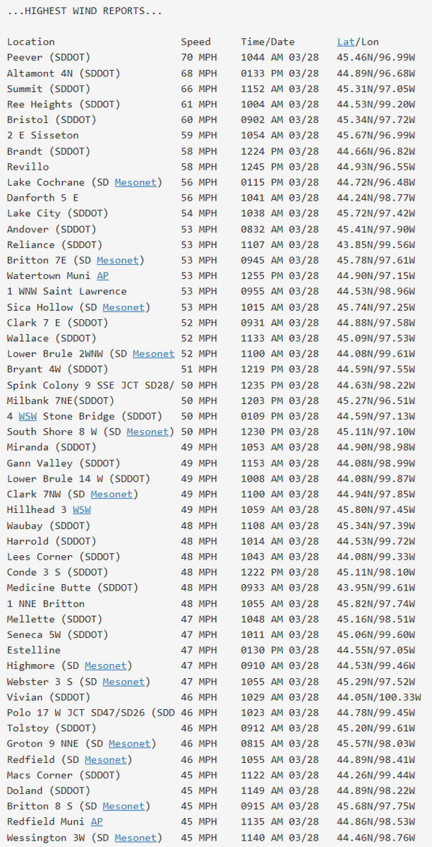
Here is a listing of highest peak winds from across the region today. Most of the usual suspects are points along and east of the Sisseton Hills.
English
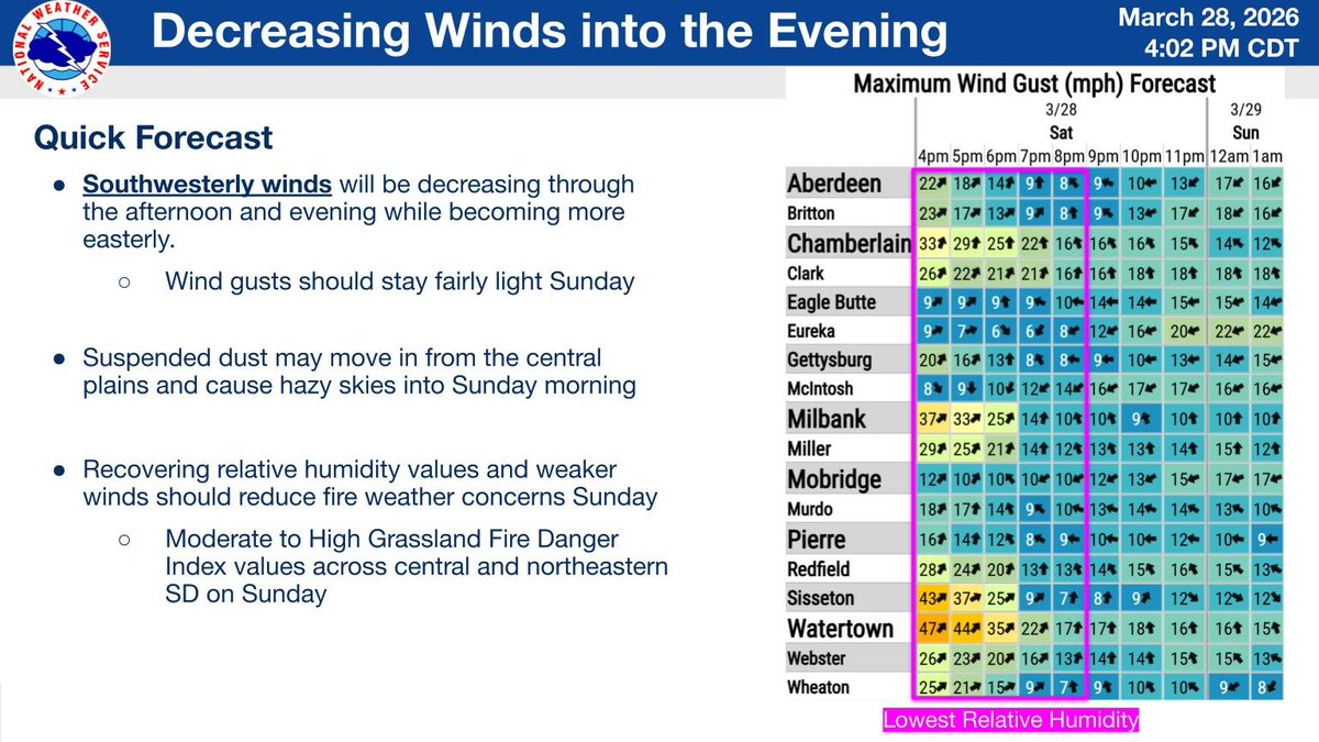
Southwesterly winds will be decreasing into the evening. While the winds weaken, there could be some suspended dust that causes some hazy skies through Sunday morning. Recovering RH values over night and weaker winds should reduce fire weather concerns on Sunday #SDwx
English
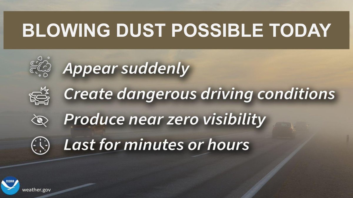
Strong winds have continued to pick up, especially along the Sisseton Hills and along/south of HWY 14, which have been gusting 50-70 mph. Blowing dust is developing with the strong winds near open fields, which could create hazy skies to a decrease in visibility at times #SDwx

English


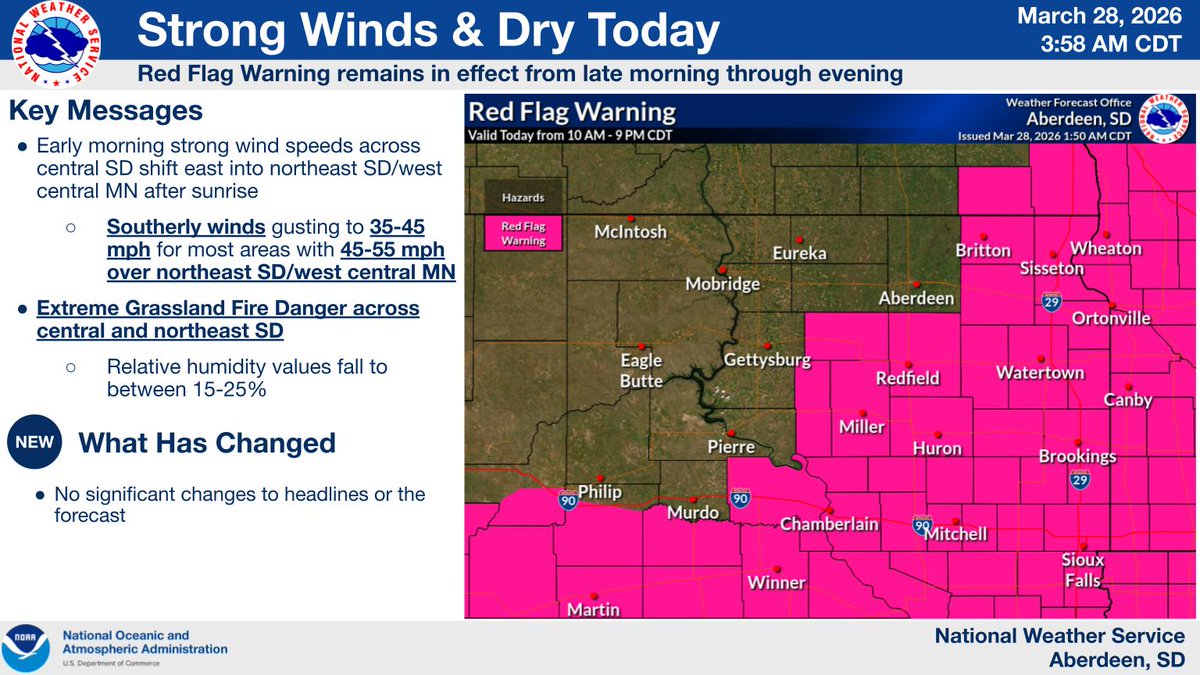
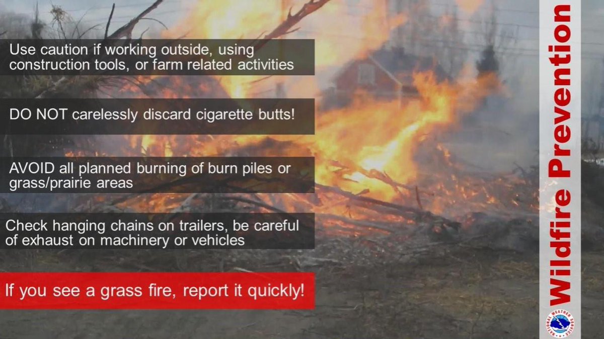
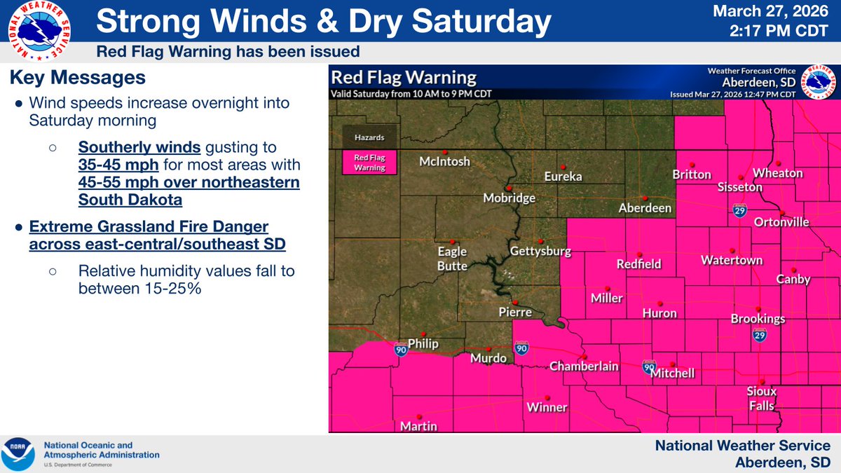
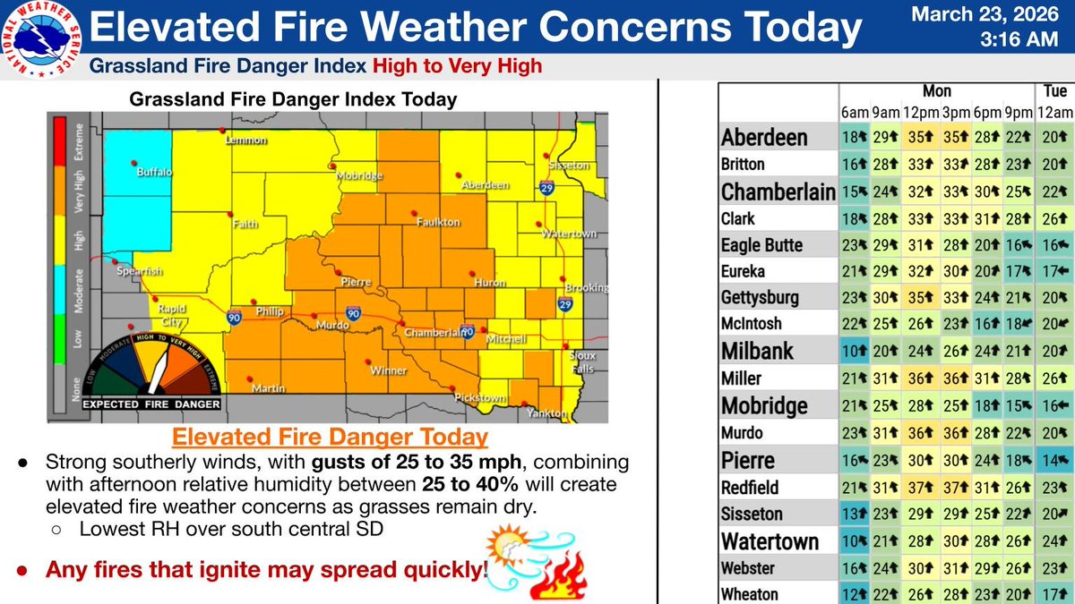
A Red Flag Warning remains in effect today for northeast SD and parts of central SD due to strong southerly winds as well as dry conditions. Take caution as any fires that ignites will spread rapidly and become difficult to control or suppress #sdwx
English
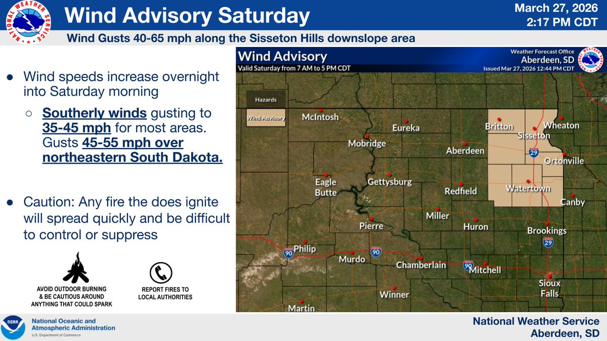
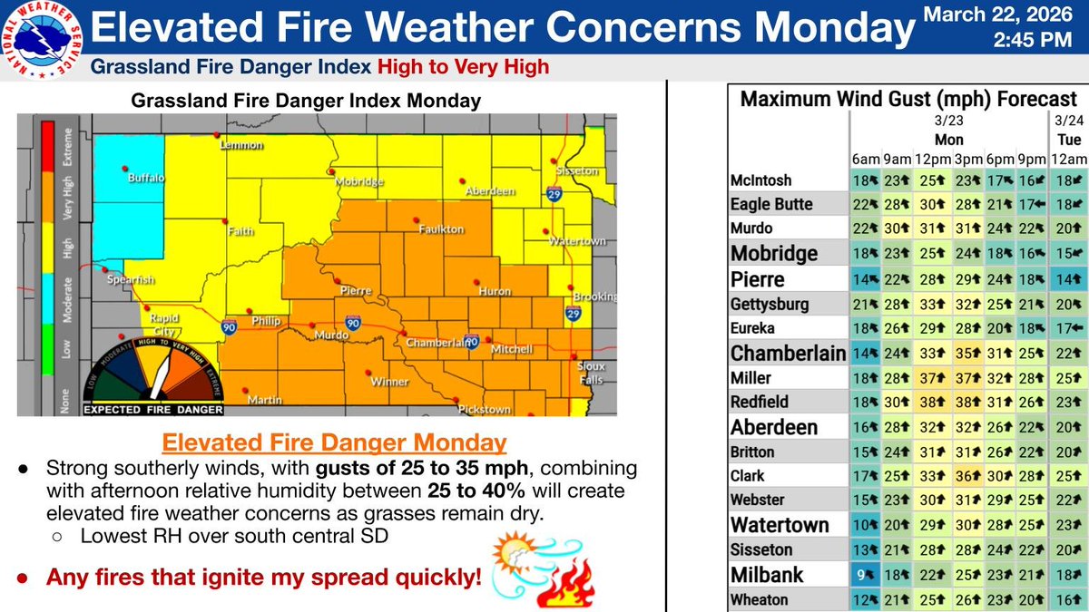
Winds will increase Saturday, with the strongest winds occurring in the morning. The southerly winds will gust 35-45mph over most of the area, though gusts could get up to 45-55mph over northeastern SD. These winds will help create dangerous fire weather conditions #SDwx
(2/2)

English
A Red Flag Warning has been issued for Saturday over northeastern SD and parts of central SD due to strong southerly winds as well as dry conditions. Take caution as any fires that ignites will spread rapidly and become difficult to control or suppress #SDwx
(1/2)

English
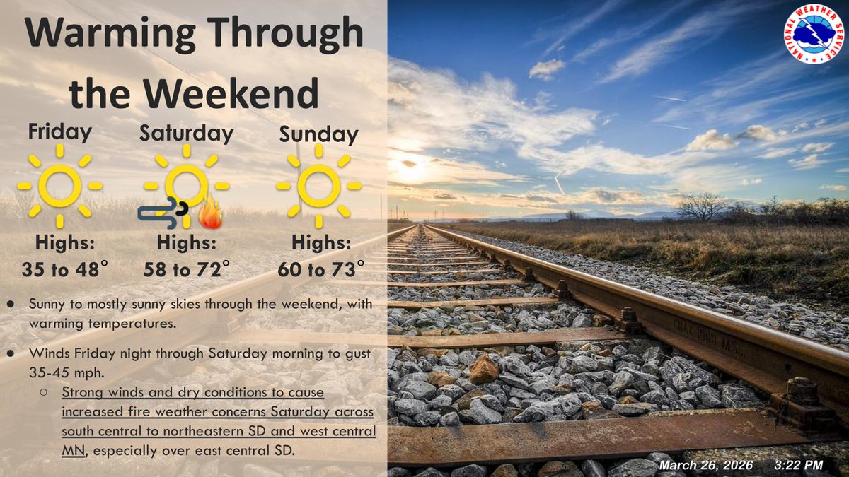
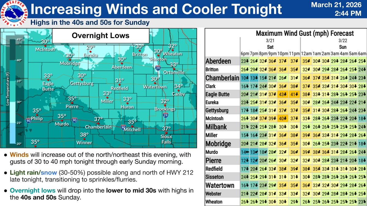
Warmer temps return this weekend. Southerly winds increase late tonight into Saturday morning with gusts of 35-45 mph in most areas with the Sisseton Hills downslope areas expected to see 45-65 mph. These winds with the dry conditions will lead to increasing fire danger. #sdwx


English
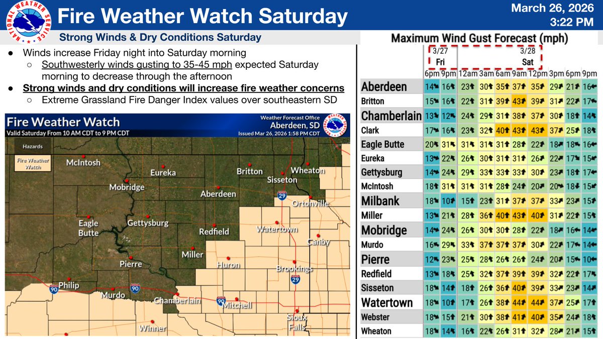
Sunny skies and warm temps will be around through the weekend. The winds Friday night will increase into Saturday morning, with gusts up to 35-45mph. The strong wind and the dry conditions will increase fire weather concerns Saturday across south central and northeastern SD #SDwx
English
A cold front will sink southward across the area later tonight through Thursday. The front will bring a 30 to 50 percent chance of light rain, along with increasing northerly winds. Gusts of 30 to 40 mph can be expected at times.

English
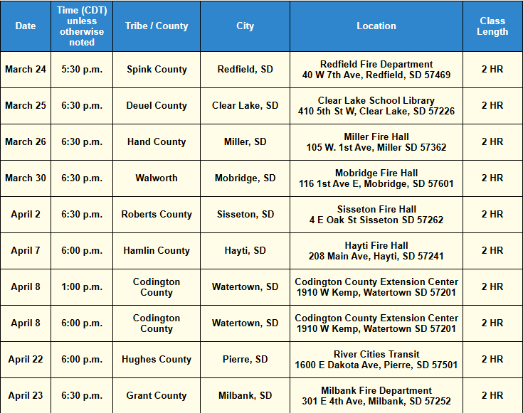
⚡️🌩️It is that time of year once again! Storm spotter classes are being offered through April! Anyone with an interest in weather or weather safety is encouraged to attend!
For more information please visit: weather.gov/abr/spottercal… #sdwx
English
Enjoy the warmth outside for the next few hours as a change is coming! A cold front tracking southward through the region this evening will bring in "cooler" air tonight and Sunday. Sunday's highs will be normal to slightly above normal but chilly compared to today! #sdwx
English
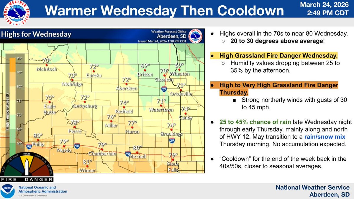
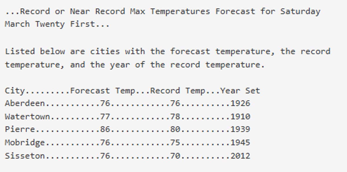
Record high temperatures for a 3rd day in a row will be broken, or be close to being broken today...
English
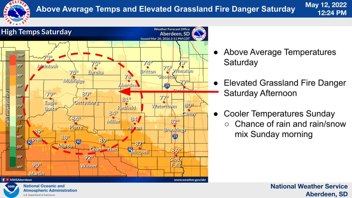
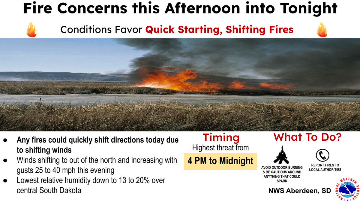
🔥 High to Very High Grassland Fire Danger mainly west of the James River Valley this afternoon through this evening.
Expect winds out of the north with gusts 25-40 mph this evening. Caution: Any fire will experience shifting winds, which may change the direction of the fire.

English
Expect mainly light winds through early this afternoon, out of variable wind directions. Winds will shift out of the north behind a cold front shifting in from North Dakota, and increase with gusts of 25 to 40 mph this evening, before slowly decreasing overnight.

English
🌡️Temperatures will rise into the 70s and 80s today, with several record high temperatures expected to be broken.

English