NWS Cleveland
28K posts
NWS Cleveland
@NWSCLE
Official X Account for National Weather Service Cleveland, Ohio. Details: https://t.co/OiJC4biDxx
Cleveland, OH Katılım Haziran 2012
535 Takip Edilen51.9K Takipçiler

A Heat Advisory has been issued for portions of northern Ohio on Tuesday as high temperatures will climb into the mid to upper 90s with heat index values of 100-104° expected. Make sure to stay hydrated and check on vulnerable persons and pets! #ohwx

English

Sunny skies Monday. Winds Northerly to NE 3 to 8 mph. Highs temperatures in the mid to upper 80s. Lake Erie marine conditions very nice!

English
Hazardous swimming conditions are expected along portions of the Lake Erie shoreline 2 - 9 PM today as waves build to 3-5 feet. A high swim risk is expected for Erie, Lorain, and Cuyahoga counties, with a moderate swim risk in Lake County. Stay out of the water.

English
A special weather statement has been issued for Akron OH, Canton OH and Massillon OH until 3:30 PM EDT

English
[2:38 PM] Scattered thunderstorms will continue to slowly drift south across the region this afternoon. Locally heavy rainfall remains the primary concern with any training thunderstorm. #ohwx
GIF
English
Scattered showers and thunderstorms are likely this afternoon, mainly near and south of US-30. Locally heavy rain is possible with thunderstorms, especially in the circled area.

English
Areas of fog expected this morning. If you encounter fog, slow down, use your low beam headlights, and leave plenty of distance ahead of you.
IEMBot CLE@iembot_cle
Areas of fog reducing visibility for Ashtabula Inland, Holmes, Mahoning, Portage, Stark, Summit, Trumbull, Wayne [OH] and Crawford [PA] till 8:00 AM EDT mesonet.agron.iastate.edu/p.php?pid=2026…
English
Dangerous swimming conditions are expected along Lake Erie after 1 PM today and Sunday. Waves of 3 to 4 feet will create a moderate swim risk, and swimming is discouraged. Stay dry when waves are high and avoid piers, breakwalls, and river outlets.

English
A special weather statement has been issued for Gibsonburg OH, Pemberville OH and Bradner OH until 9:45 PM EDT

English
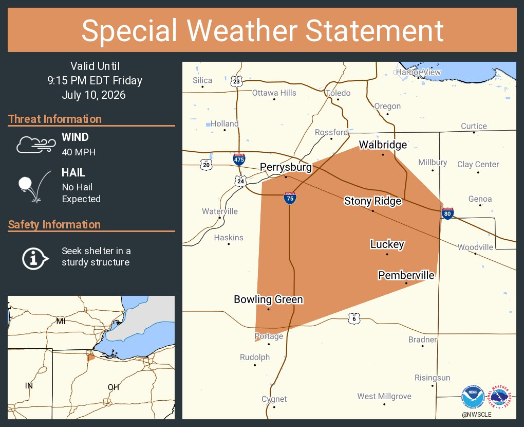
A special weather statement has been issued for Bowling Green OH, Perrysburg OH and Walbridge OH until 9:15 PM EDT
English
A special weather statement has been issued for Mount Vernon OH, Apple Valley OH and Gambier OH until 6:45 PM EDT

English
Severe Thunderstorm Warning including Centerburg OH, Marengo OH and Fulton OH until 5:45 PM EDT

English
Flash Flood Warning including Akron OH, Cuyahoga Falls OH and Stow OH until 8:00 PM EDT

English
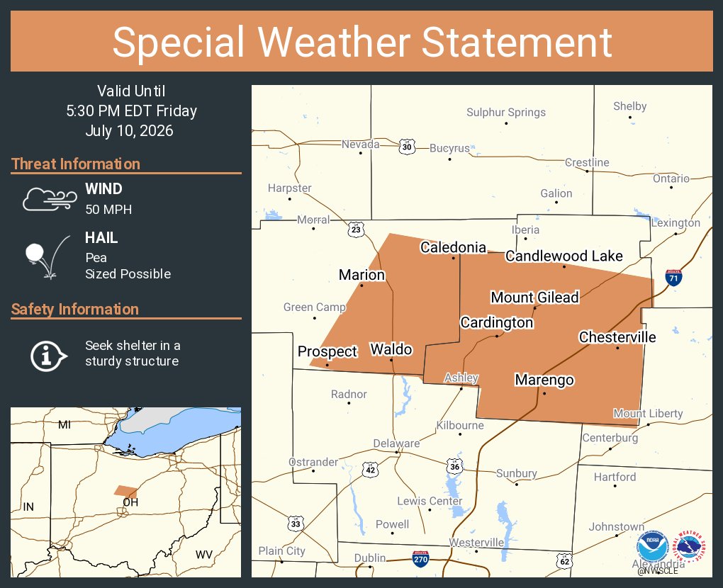
A special weather statement has been issued for Marion OH, Mount Gilead OH and Cardington OH until 5:30 PM EDT
English
A special weather statement has been issued for Walnut Creek OH, Winesburg OH and Charm OH until 4:30 PM EDT

English
A special weather statement has been issued for Norwalk OH, Bellevue OH and Willard OH until 3:00 PM EDT

English
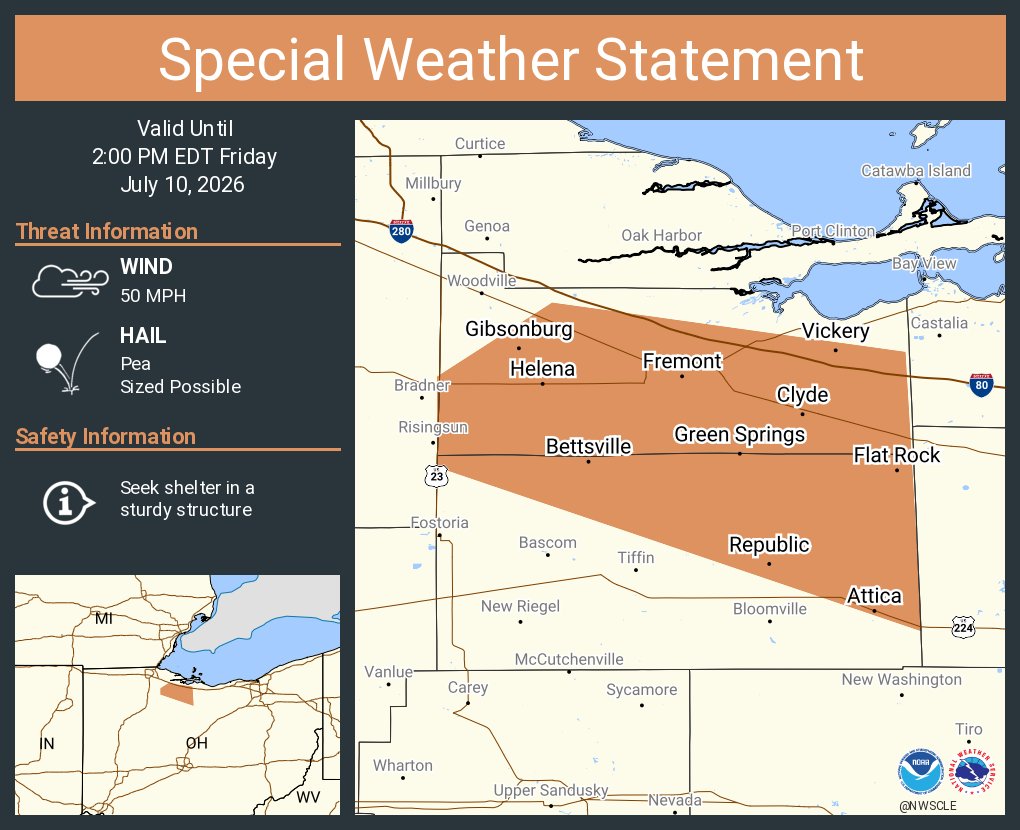
A special weather statement has been issued for Fremont OH, Clyde OH and Ballville OH until 2:00 PM EDT
English
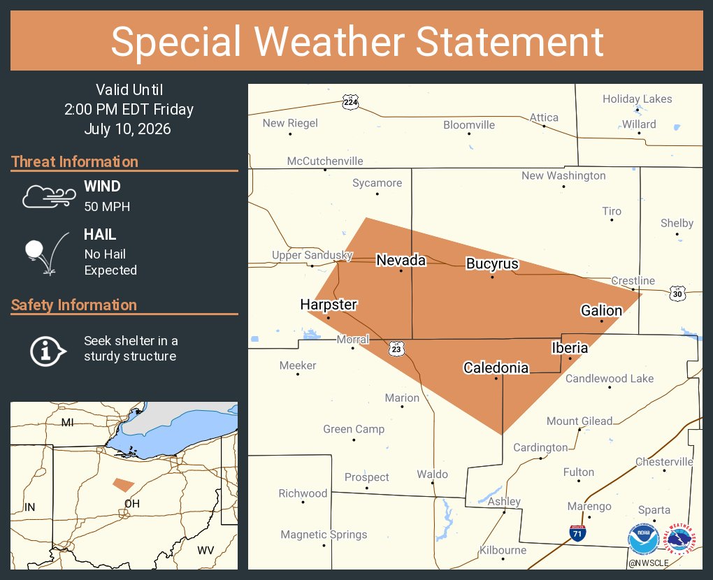
A special weather statement has been issued for Bucyrus OH, Galion OH and Nevada OH until 2:00 PM EDT
English