
Carolina Storm Chasers
458 posts

Carolina Storm Chasers
@NcScStrmChasers
a group of wx geeks across the piedmont of NC that like to monitor, chase, and forecast the weather.
North Carolina, USA Katılım Ağustos 2023
231 Takip Edilen2.2K Takipçiler
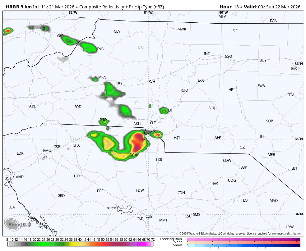
sneaky northwest flow event tomorrow evening in the carolina’s. these events are notorious for big hailers around here. golf ball and hen eggs are the maximum sizes imo, but if we get CAPE to increase we could see a higher ceiling. mainly watching cola to clt points northwest.

English
had it not been for the FROPA yesterday would’ve been a total bust. now the significant wind risk didn’t verify, but this still verified as a decent 45% no hatch wind day. say whatever you want about the tornado risk though, that busted HARD. only tornado was in the 10 CIG1 area.


English
gotta be thankful this happened. on paper this looked like a significant event since friday.
Dan@Djrobinson_wx
A reasonable failure mode here for tomorrow would be if the QLCS from tonight remains organized past the mountains. This would clear most of the warm sector and lead to messy convection and overall severe probabilities would be dropped quite notably.#ncwx
English
a scenario that we’ll need to watch to see if it plays out; shredding the QLCS once it crosses the mountains. this would increase the tornado potential a-lot. wind would stay the same.

English
@greer93_greer @wx_sammy skeptical towards that area but definitely possible, im thinking this area
English

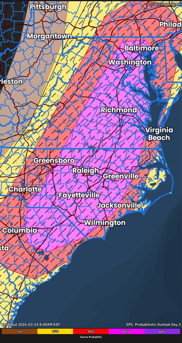
what a change in 18z/00z model guidance. likely models came to the conclusion that they were way to progressive. this would increase the tornado and wind risk for everybody with a later front. i honestly wouldn’t be surprised to see the SPC paint many areas in a mdt risk soon.
GIF
GIF
GIF
English
insane to see this over the mid atlantic/carolina’s. monday shaping up to be a dangerous day!
English
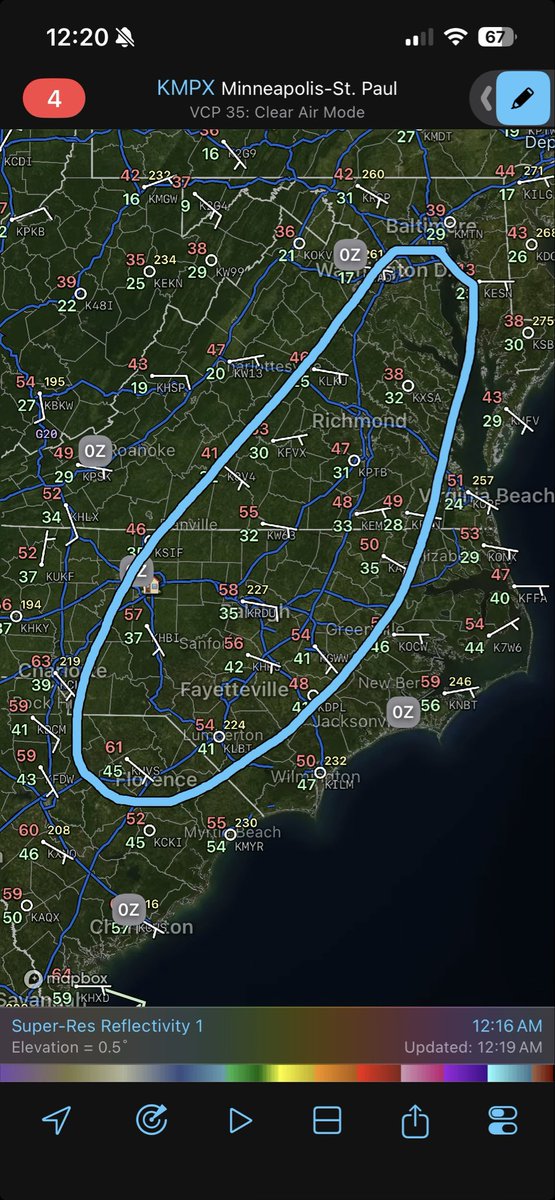
with a warm front lifting north out of SC tomorrow i’m quite concerned that a few storms could rotate and get tornadic sunday pm into the am hours of monday. lots of directional shear and low level instability out there. will probably have some decent structure on these also.


English
you’d want the progressive GFS to be right (which i doubt it will be) for Monday or otherwise we could be dealing with a very dangerous severe weather day in the Carolina’s. several tornadoes and widespread significant damaging winds are becoming increasingly possible.
GIF
English
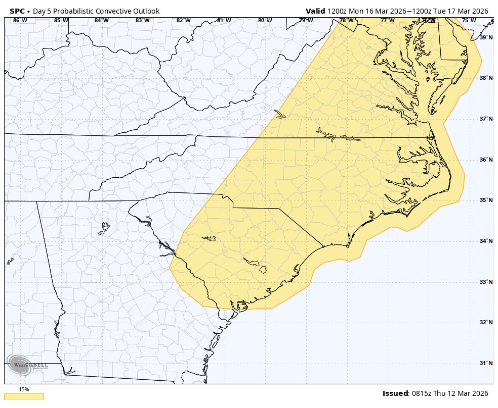
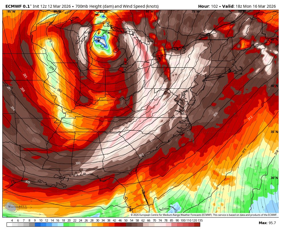
will have to watch Monday for the possibility of a significant severe weather event in the Carolina’s. deep layer shear, ripping LLJ, decent CAPE, and looping curved hodos with elevated EHI levels and strong forcing from 700 mb. widespread dmg wind and tornado event on the table.


English

@greer93_greer I saw that, inland warnings are now being posted
English


@chazzzwx “Second time it’s happen” second time you’ve shit talked
English

second time it has happened now
Tornado Love☈ ChazzzWX 🌩️@chazzzwx
Leaking a GC over a model run is CRAZY WORK NC ☠️
English

@chazzzwx Leaking a gc, ts is not a secret government chat
English
@chazzzwx @NWS_BaltWash Yeaaaaah, ur not. 30-45mph ? Maybe. 60mph ? No lmfao
English