Very Heavy - Extremely heavy Rainfall Alert for East & Northeast India.....
As System reach west bengal & likely to move further over Northwest direction + Monsoon Trough passing from these regions & Wind at lower trophosphere directly hitting Northeastern states..
This will lead Moderate to heavy showers over Gangetic west Bengal Bihar Jharkhand & Eastern Uttarpradesh and odisha for next 48 hrs.
Further system will weak and stationary over purvanchal region will lead heavy to very Heavy Showers over East UP bihar Gopalganj siwan champaran,Buxar kaimur mahrajganj khushinagar Deoria Chandauli azamgarh Ghazipur Basti Sidharthnagar Mau etc can get 150-200 during sunday-tuesday.
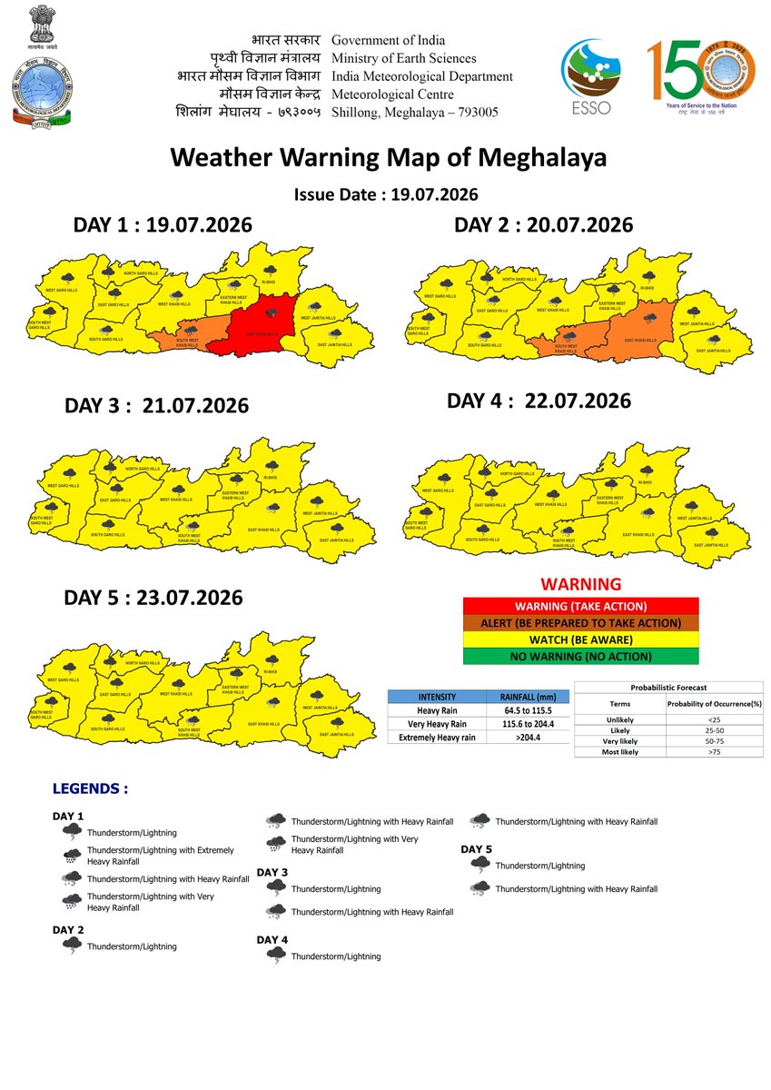
Further parts of Sub himlayan west bengal West Assam Meghalaya will hit heavy-very heavy Showers from today - 21st of july.
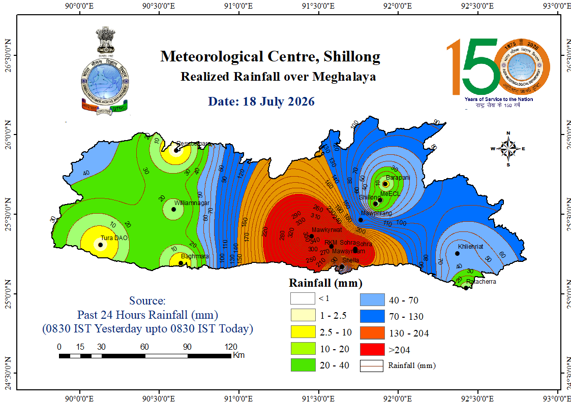
With peak in intensity during 19-20 Siliguri Alipurduar Darjeeling jalpaiguri Kokrajhar Nalbari Barpeta Baksa , Khasi & Jaintia gaints can get intense showers with extreme precipitation over Mawkyrwat Cherrapunji - Mawsynram Belt.
Mawkyrwat a gaint in Southwest Khasi hills of Meghalaya become the 1st official obs to cross 4k annually with 3K seasonal rainfall in country (after Mawsynram ).
Since 1 january - 12 july #Mawkyrwat got total 4241 mm rainfall
#Monsoon2026#SouthwestMonsoon#Mawsynram#Cherrapunji#Elnino