Sabitlenmiş Tweet

🌀 Understanding the MJO: Why it Appears "Stuck"!
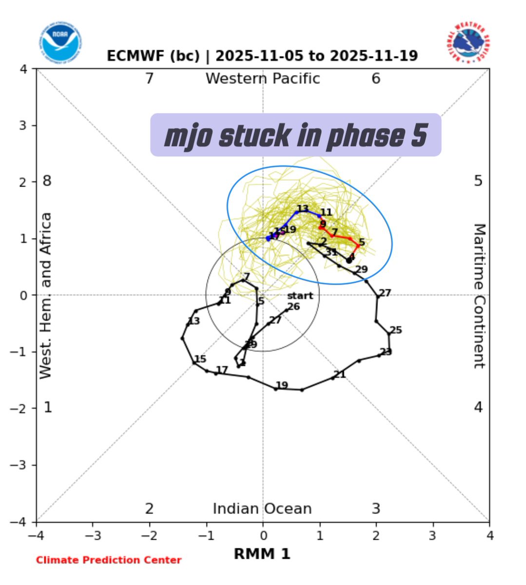
The Madden-Julian Oscillation (MJO) is a naturally occurring, eastward-propagating weather system that cycles through eight distinct phases over a typical period of 30 to 60 days. It does not permanently "get stuck" in any single phase; any apparent lingering, particularly in phases 5-8, is a temporary part of its naturally irregular cycle, influenced by several complex atmospheric and oceanic factors.
⏳ Key Reasons for MJO Slowdown or Lingering: The appearance of the MJO "stuck" in phases 5, 6, 7, or 8 (the Western Pacific to Western Hemisphere) is generally due to the following reasons:
Interaction with the Maritime Continent (Phases 4 & 5):
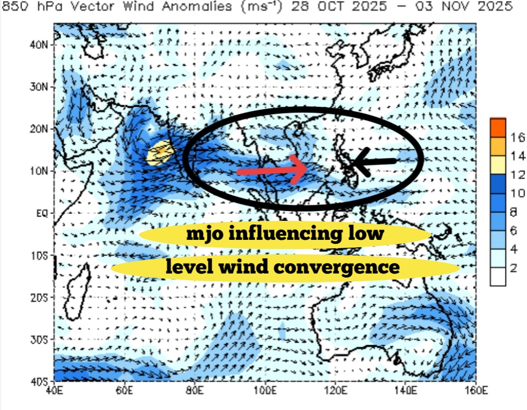
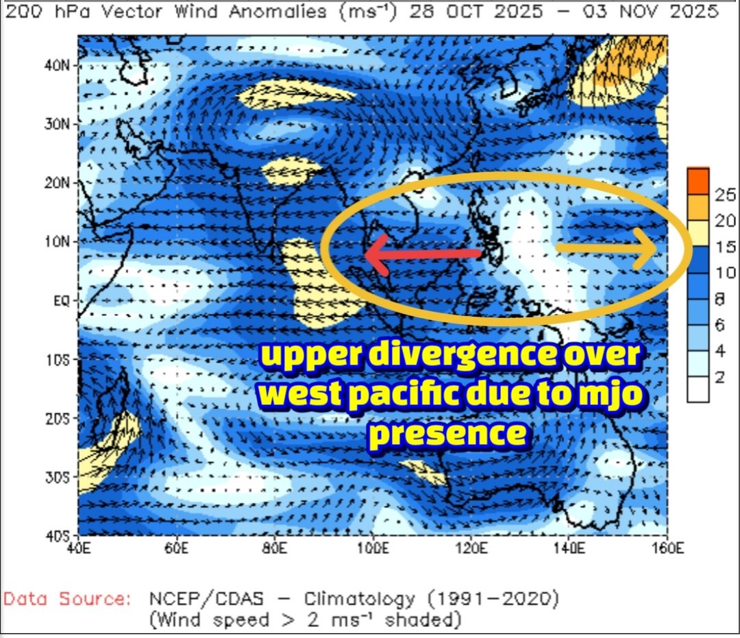
Phases 4 and 5 occur over the Maritime Continent (Indonesia and the West Pacific). The numerous islands and mountains in this region disrupt the MJO's large-scale convection, slowing its eastward progression and making it notoriously difficult for weather models to predict accurately. Tracking its progress often relies on methods like Outgoing Longwave Radiation (OLR) measurements.
Interference from Major Climate Drivers:
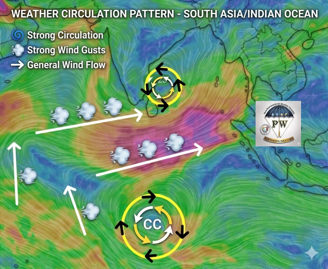
The MJO's signal can be temporarily masked or slowed down by interactions with other large-scale climate patterns. A developing La Niña phase, for example, can suppress the MJO's propagation, effectively "killing the spirit" of its movement. This interference is often visible when Equatorial Rossby Waves (ERW) emerge to the west of the MJO location.
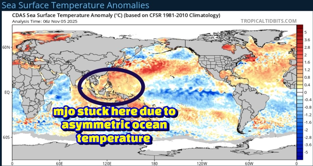
Asymmetric Ocean Warming and LaNiña:
Changes in regional sea surface temperatures, exacerbated by asymmetric ocean warming, have altered the MJO's speed. Slower propagation, particularly over the Western Pacific, can be linked to the developing or "immature" phase of a La Niña event.
Natural Variability:
The MJO's propagation is rarely smooth. Its cycle length naturally varies, sometimes extending up to 90 days. It can also become dormant for periods, contributing to the perception of it being stalled.
Model Limitations:
Current global climate models often struggle to simulate the MJO with perfect accuracy, especially over the complex geography of the Maritime Continent. This can lead to forecast runs that incorrectly show the MJO lingering in a specific phase longer than it does in reality.
🌧️ Northeast Monsoon 2025 Forecast Implications:
The MJO's current behavior holds significant implications for the Northeast Monsoon (NEM) 2025, which affects regions like Chennai.
Scenario 1: MJO Lingers (Negative Impact): If the MJO remains strong in the West Pacific (Phases 6-8) or continues to linger there until the end of November, it is likely to disrupt the monsoon flow over Southern India, potentially leading to a deficit in the Northeast Monsoon.
Scenario 2: MJO Weakens (Positive Impact): If the MJO weakens in the West Pacific or progresses quickly through its phases, it increases the likelihood of a normal NEM performance.
Note: The exact forecast track for the MJO is crucial and typically requires waiting for updates around the 10th of November for a clearer picture.
English