Parker Weather Service

239 posts

Parker Weather Service banner
Parker Weather Service

Parker Weather Service

@PWXService

Katılım Mart 2026
4 Takip Edilen14 Takipçiler
Parker Weather Service
Parker Weather Service@PWXService·
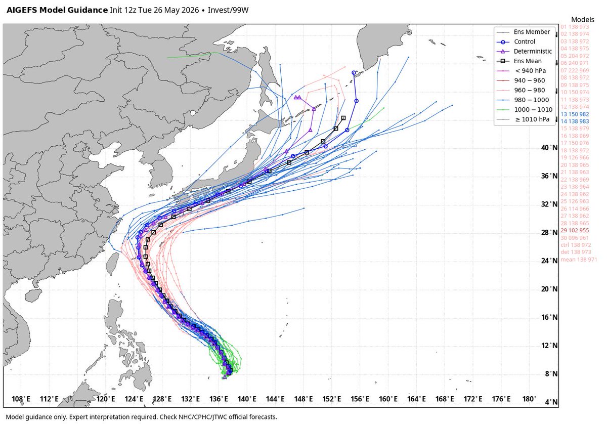
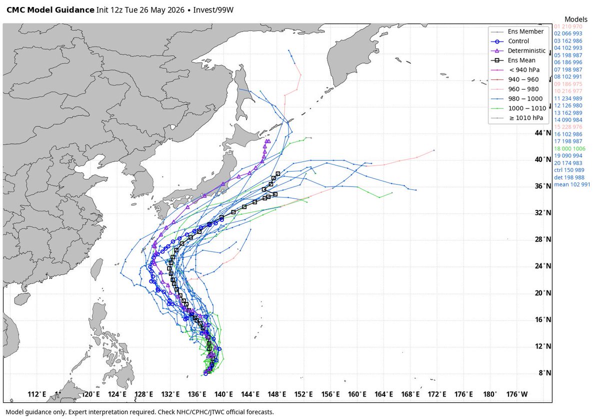
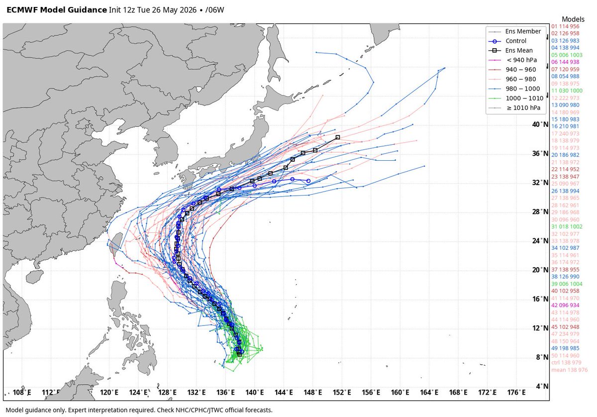
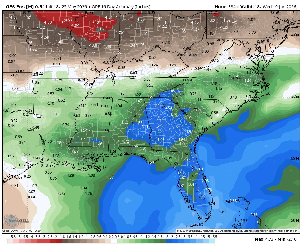
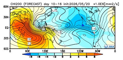
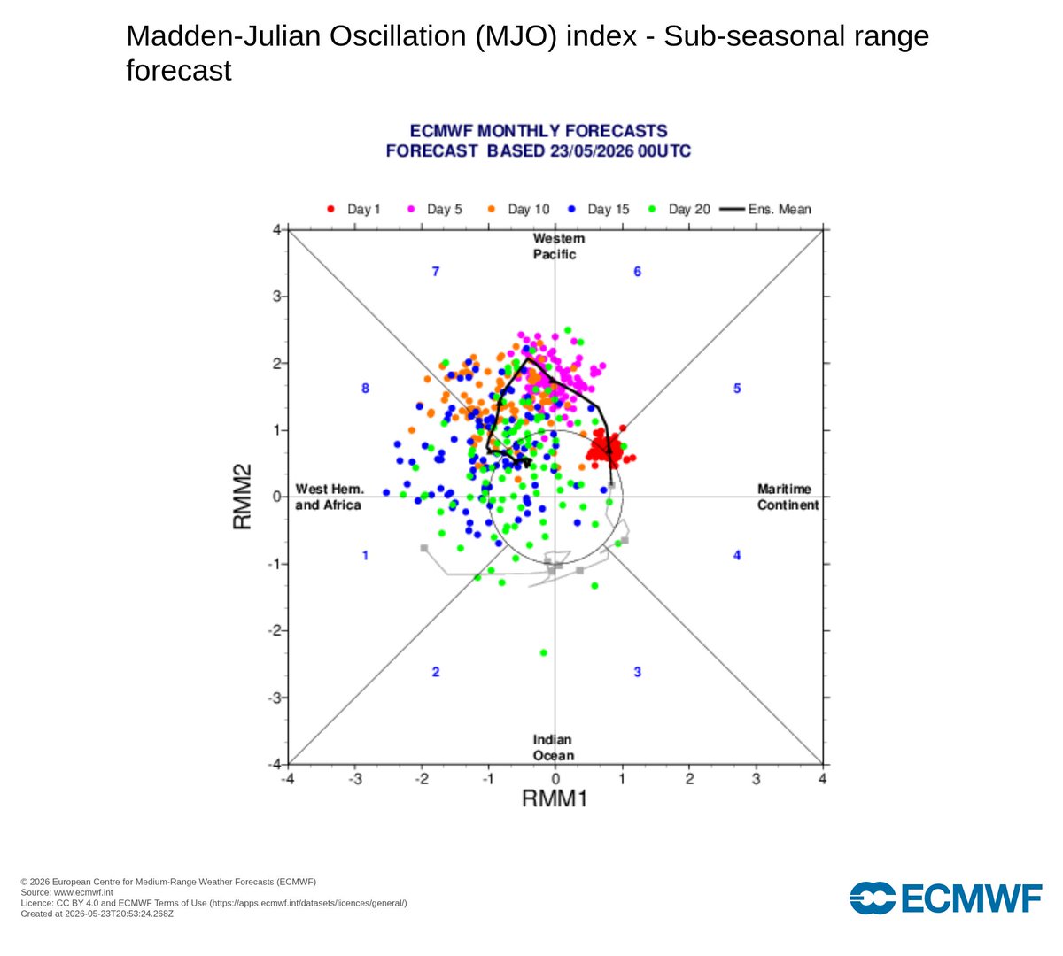
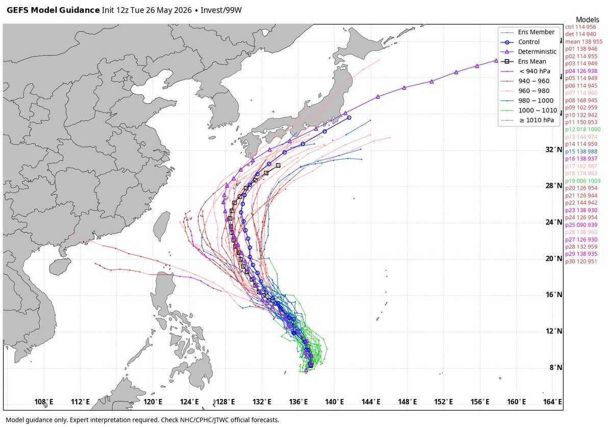
Our next tropical system is expected soon in the Western Pacific. This will likely become the next typhoon and super typhoon. If this does reach super typhoon intensity, it would be the first season since 2015 to have a super typhoon in both April and May.
Parker Weather Service tweet mediaParker Weather Service tweet mediaParker Weather Service tweet mediaParker Weather Service tweet media
English
0
0
0
6
Parker Weather Service
Parker Weather Service@PWXService·
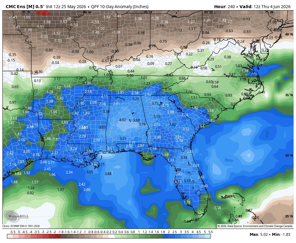
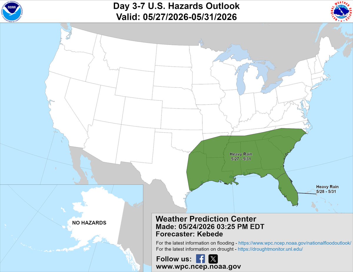
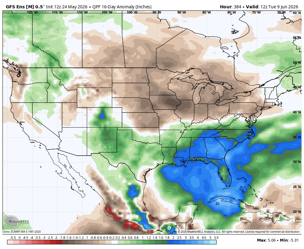
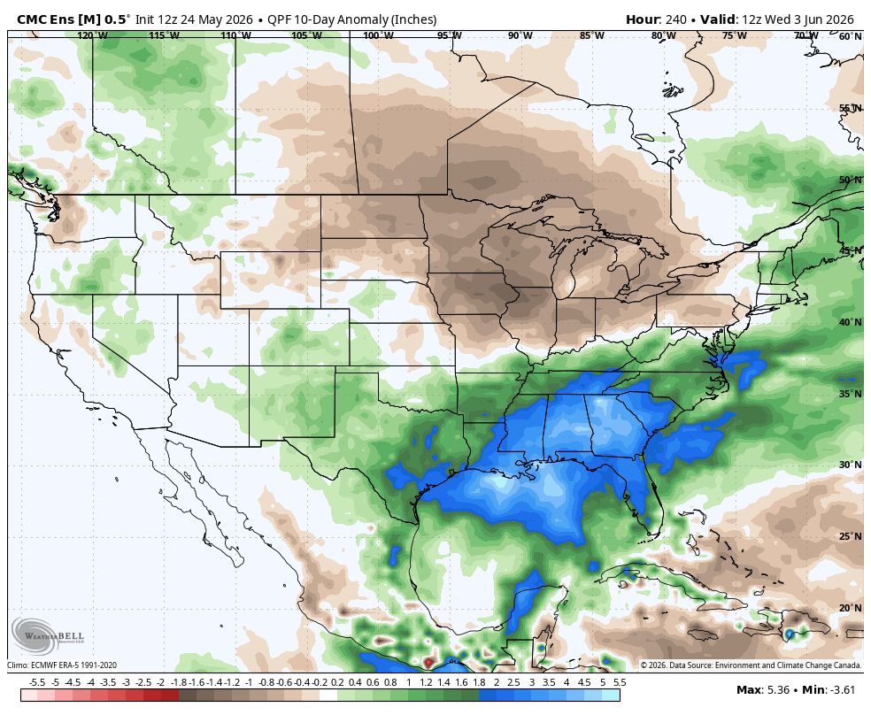
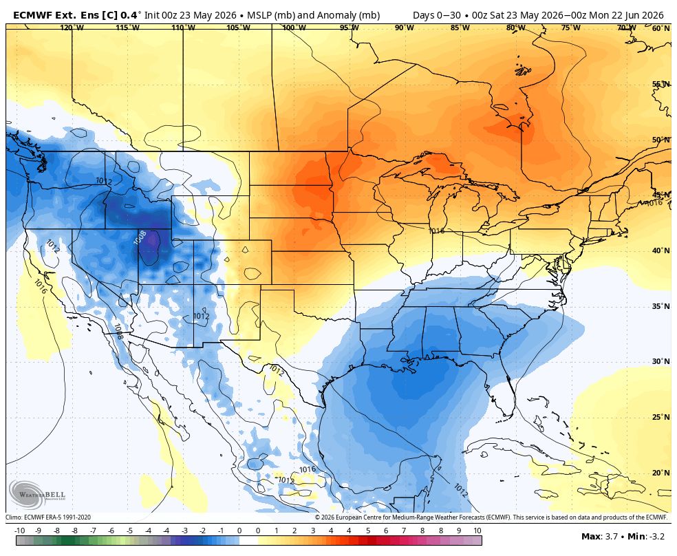
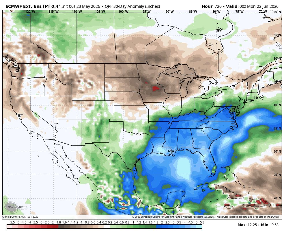
More rain expected tomorrow thru end of the week. Looking at latest ensemble guidance next 10 thru 16 days, this wet pattern looks to hang around into first part of June. Good news is current drought will likely be near or gone by July.
Parker Weather Service tweet mediaParker Weather Service tweet mediaParker Weather Service tweet media
English
0
0
0
9
Parker Weather Service
Parker Weather Service@PWXService·
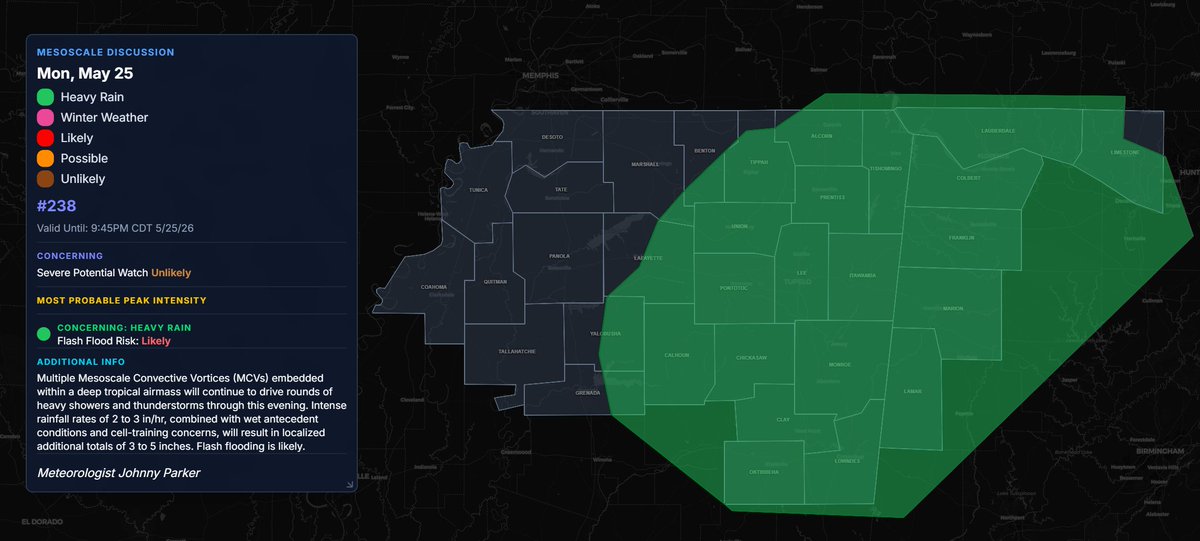
MPD #238: Flash Flooding Likely thru 9:45pm. Rainfall Rates: 2-3 inches per hour. Localized additional 3-5 inches expected.
Parker Weather Service tweet media
English
0
0
0
25
Parker Weather Service
Parker Weather Service@PWXService·
MPD #234: Flash Flooding Likely With Rainfall Rates (2-3 inch per hour) leading to 3-5+ inch rainfall totals thru 4pm
Parker Weather Service tweet media
English
0
0
0
17
Parker Weather Service
Parker Weather Service@PWXService·
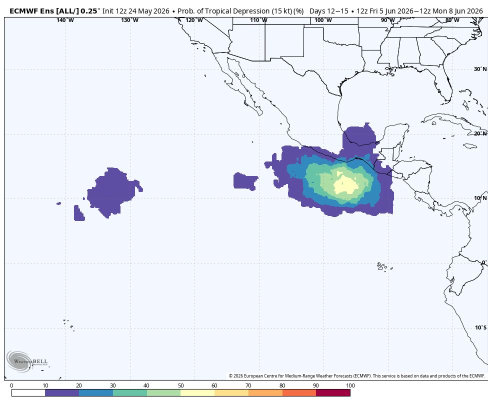
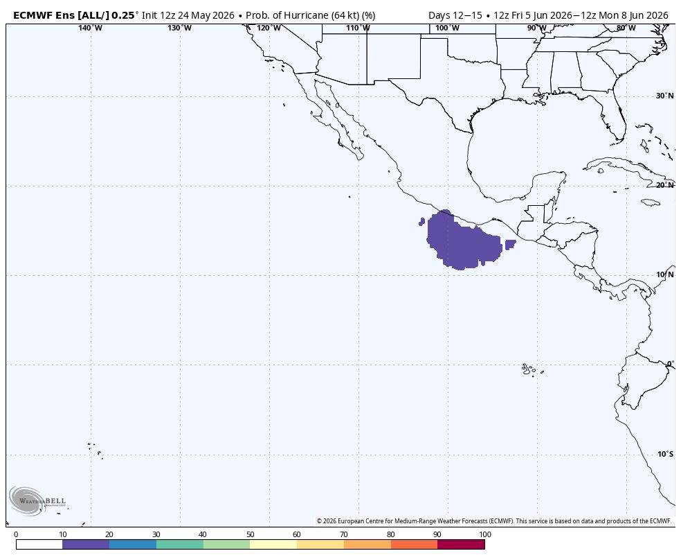
The Euro is showing 60% probability for tropical depression, 30% tropical storm, 20% hurricane formation during June 5th-8th in Eastern Pacific. This goes in line with the JMA in previous post as well as MJO headed into favorable phases. The Atlantic should follow suit thereafter
Parker Weather Service tweet mediaParker Weather Service tweet mediaParker Weather Service tweet media
English
0
0
0
29
Parker Weather Service
Parker Weather Service@PWXService·
The JMA is showing a favorable pattern for tropical systems across both the Eastern Pacific into the Atlantic between Day 10-30 (June 3rd-23rd). Orange/Reddish colors signal sinking air (unfavorable for development) while Blue indicates rising air (very favorable for development)
Parker Weather Service tweet mediaParker Weather Service tweet media
English
0
0
0
20
Parker Weather Service
Parker Weather Service@PWXService·
Another wet and stormy week is expected across the Deep South. While this will not be a severe weather setup, a few severe storms can't be ruled out each afternoon/evening. Additional rainfall of 1-3 inches (locally higher amounts) can be expected.
Parker Weather Service tweet mediaParker Weather Service tweet mediaParker Weather Service tweet mediaParker Weather Service tweet media
English
0
0
0
5
Parker Weather Service
Parker Weather Service@PWXService·
Increased risk for a tropical system first two weeks of June (maybe beyond that). Two areas to monitor for this potential development: 1. Off Southeast Coast and 2. Gulf/Northwest Caribbean. See FB link for more in depth details: buff.ly/XU0JM5h
Parker Weather Service tweet mediaParker Weather Service tweet mediaParker Weather Service tweet mediaParker Weather Service tweet media
English
0
0
0
22
Parker Weather Service
Parker Weather Service@PWXService·
Northeast MS into Northern Alabama is in a Level 1 out of 5 (Marginal Risk) for severe storms. Primary Threat: damaging winds to 60mph. Tornado Possible. Low end flash flood risk today thru Tuesday. Storms will be capable of producing rainfall rates of 2-3 inch per hour.
Parker Weather Service tweet mediaParker Weather Service tweet mediaParker Weather Service tweet media
English
0
0
0
72
Parker Weather Service
Parker Weather Service@PWXService·
Friday thru Next Week: Heavy rain and flash flooding will be main story. 7-Day Total Rainfall: 2-4 inches (locally 4+) 10-Day Total Rainfall: 5-8 inches (locally 8+)
Parker Weather Service tweet mediaParker Weather Service tweet mediaParker Weather Service tweet mediaParker Weather Service tweet media
English
0
0
0
17
Parker Weather Service
Parker Weather Service@PWXService·
Friday: there is a Level 1 out of 5 (Marginal Risk) for severe storms over Northeast MS. Timing: 12pm-7pm. Primary Threat: damaging winds to 60mph. Tornado Possible. Tornado Risk: Very Low, 2%
Parker Weather Service tweet mediaParker Weather Service tweet media
English
0
0
0
30
Parker Weather Service
Parker Weather Service@PWXService·
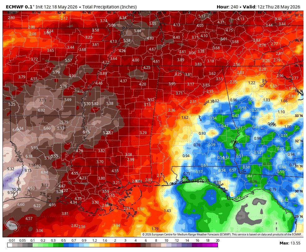
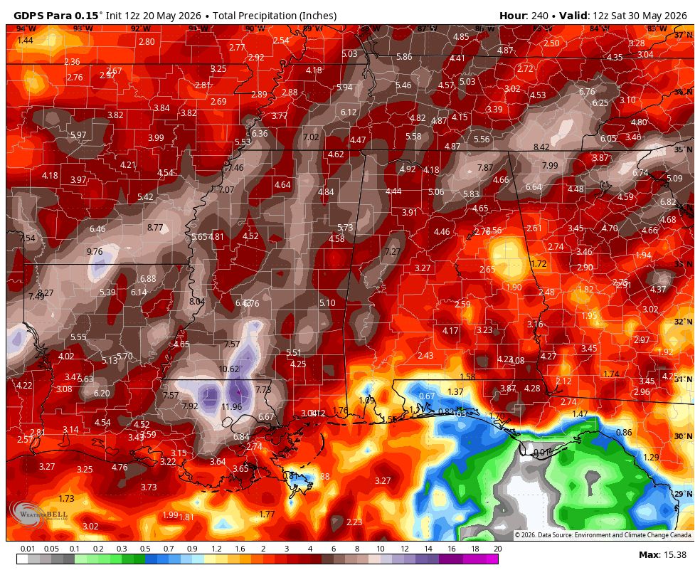
Latest global forecast models (GFS, Canadian, Canadian Parallel, Euro) continue to be bullish on total rainfall thru next 10 days exceeding 5 inches.
Parker Weather Service tweet mediaParker Weather Service tweet mediaParker Weather Service tweet mediaParker Weather Service tweet media
English
0
0
0
15
Parker Weather Service
Parker Weather Service@PWXService·
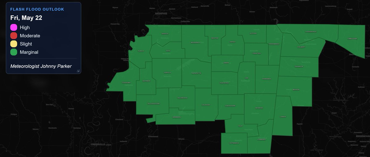
Total Rainfall (thru next 7 days): 2-4 inches (locally 4+) Flash Flood Risk (Thurs. Thru Sunday): Level 1 out of 4 (Marginal Risk) Storms will be capable of producing rainfall rates of 2-3 inches per hour Locally significant flash flooding possible
Parker Weather Service tweet mediaParker Weather Service tweet mediaParker Weather Service tweet mediaParker Weather Service tweet media
English
0
0
0
12
Parker Weather Service
Parker Weather Service@PWXService·
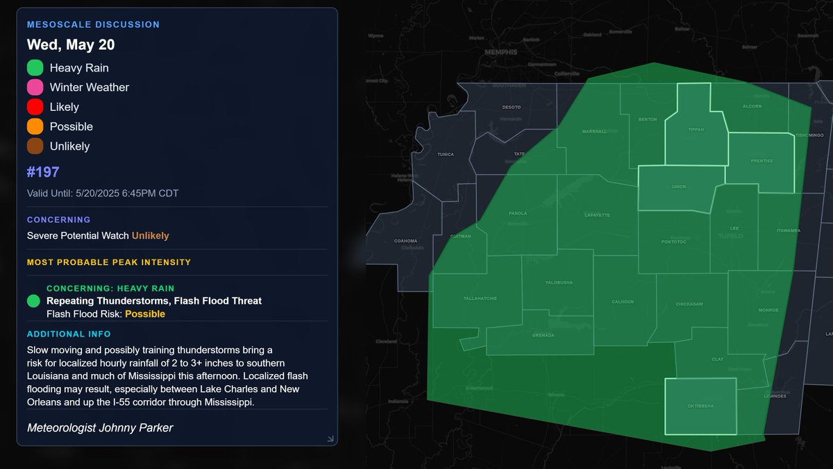
MPD #197: Slow moving and possibly training thunderstorms bring a risk for localized hourly rainfall of 2 to 3+ inches to southern Louisiana and much of Mississippi this afternoon.
Parker Weather Service tweet media
English
0
0
0
12
Parker Weather Service
Parker Weather Service@PWXService·
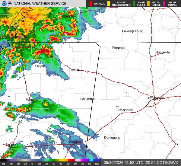
As of 9:01pm, thunderstorms are affecting Northwest MS. These storms will continue to spread eastward. These should mostly remain below severe limits. Additional thunderstorms tomorrow thru rest of week across North MS. #mswx
Parker Weather Service tweet media
English
0
0
0
32
Parker Weather Service
Parker Weather Service@PWXService·
Tuesday thru Friday: Flash Flood Risk: Level 1 out of 4 (Marginal Risk) Total Rainfall: 2-4 inches (locally 4+)
Parker Weather Service tweet mediaParker Weather Service tweet mediaParker Weather Service tweet mediaParker Weather Service tweet media
English
0
0
0
8
Parker Weather Service
Parker Weather Service@PWXService·
A low-end severe weather threat is expected tomorrow across North MS. Latest RRFS valid at 6pm Tuesday evening. Storm Timing: 2pm-11pm Peak Timing: 3pm-10pm Primary Threats: damaging winds to 60mph and quarter size hail. Tornado Possible.
Parker Weather Service tweet mediaParker Weather Service tweet media
English
0
0
0
51
Parker Weather Service
Parker Weather Service@PWXService·
Bulk of latest global forecast runs (GFS, Canadian, Canadian Parallel, Euro) all show total rainfall amounts at or exceeding 3 inches thru next 10 days.
Parker Weather Service tweet mediaParker Weather Service tweet mediaParker Weather Service tweet mediaParker Weather Service tweet media
English
0
0
0
8
Parker Weather Service
Parker Weather Service@PWXService·
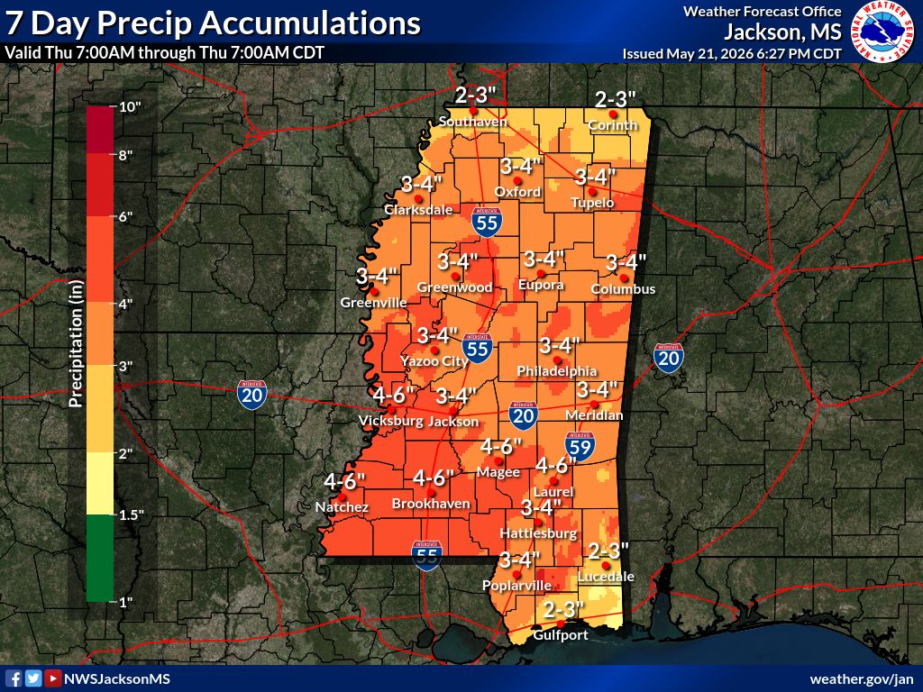
Heavy rainfall and flash flood risk coming up for portions of the Deep South/Mid-South Region May 21st thru end of month. Could be some severe weather risk as well.
Parker Weather Service tweet mediaParker Weather Service tweet mediaParker Weather Service tweet media
English
0
0
0
8