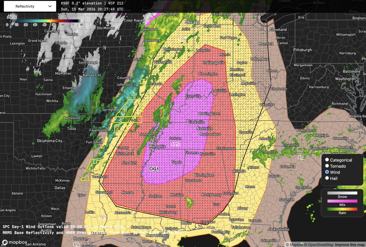
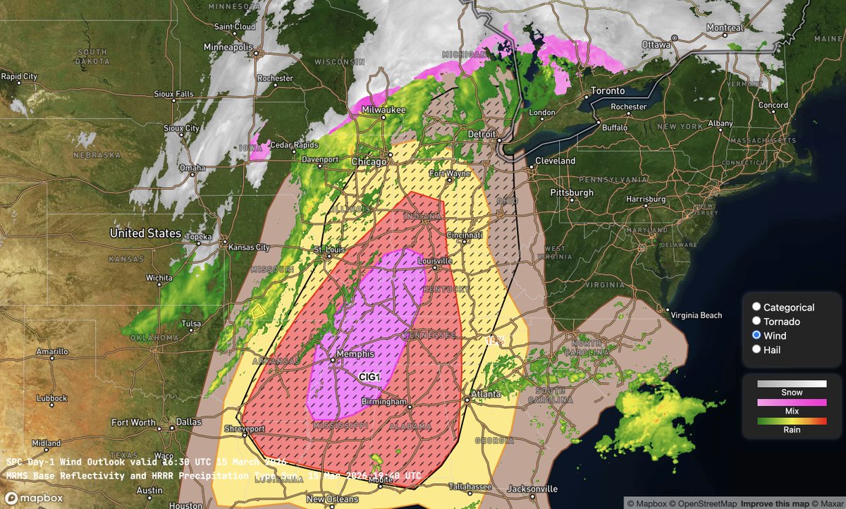
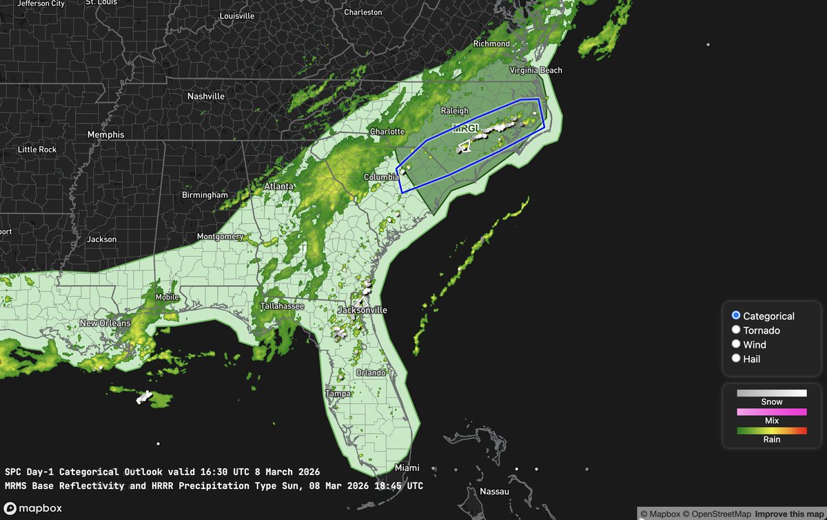
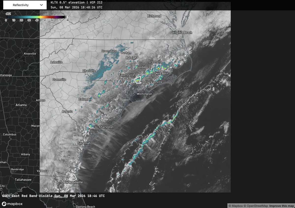
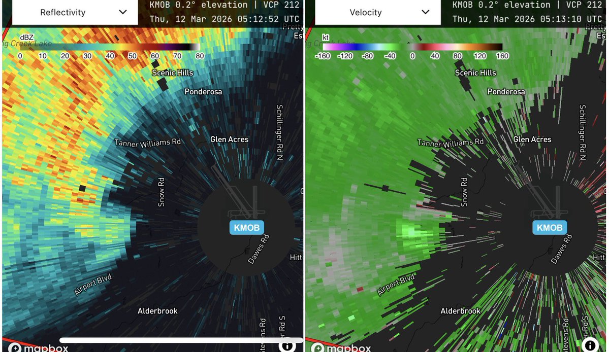
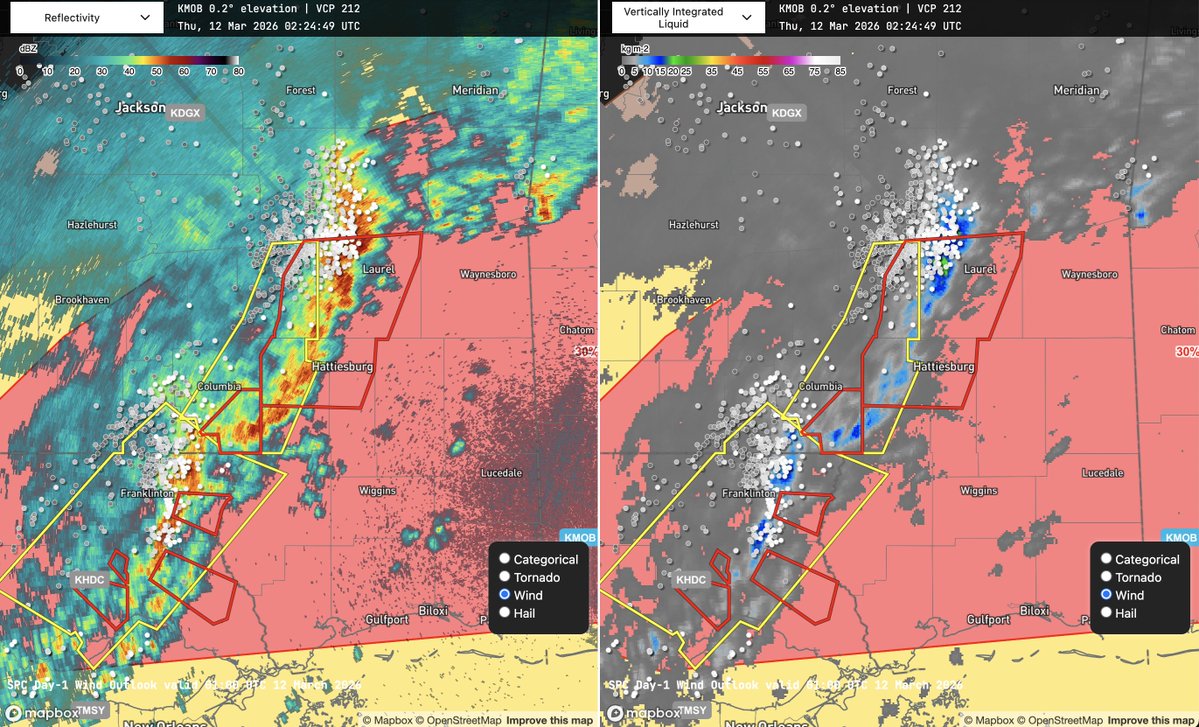
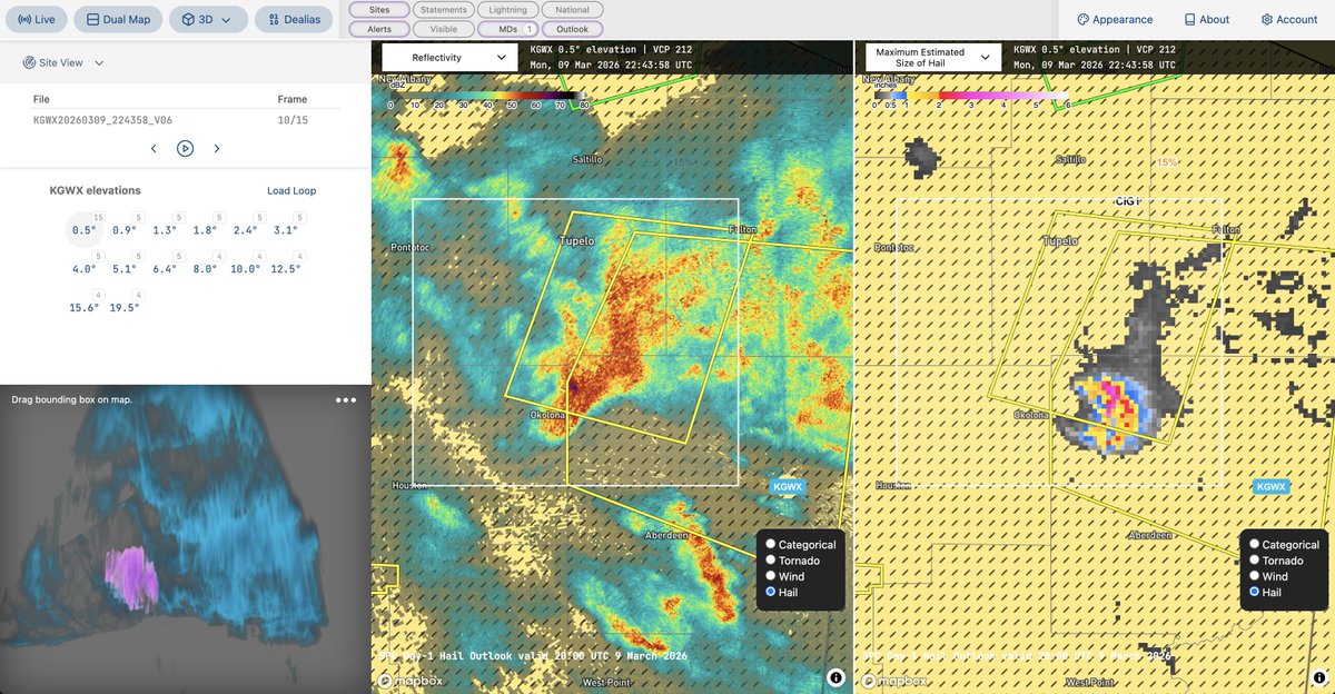
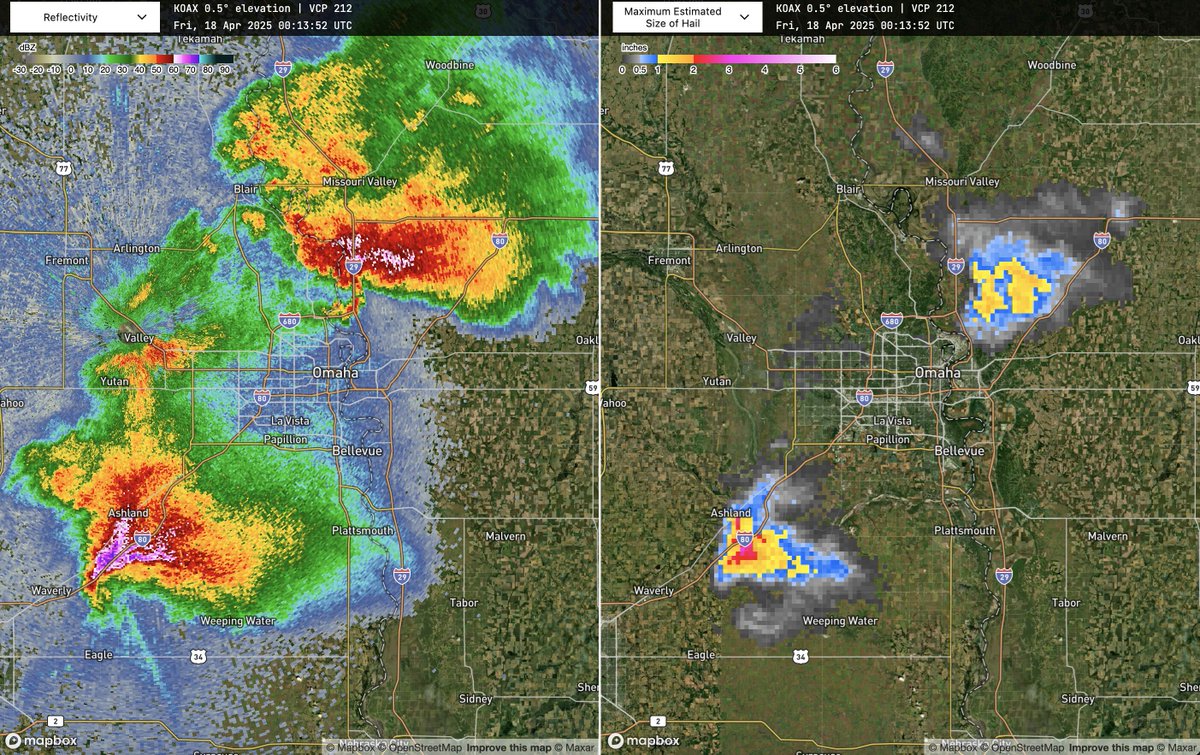
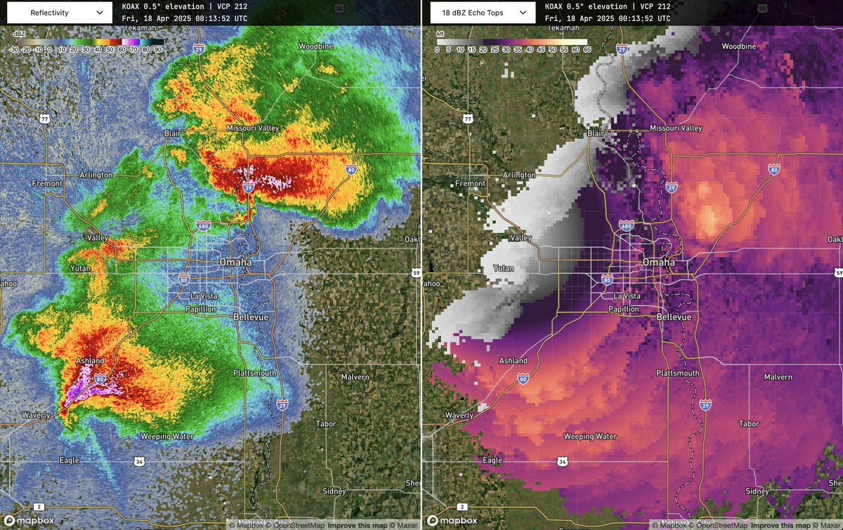
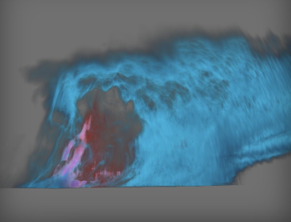
Sabitlenmiş Tweet
QuadWeather
709 posts

QuadWeather
@QuadWeather
Pushing the boundaries of weather visualization on the web
Katılım Ağustos 2019
123 Takip Edilen755 Takipçiler

A lot of people (including myself!) tend to scoff at the notion that these Mediterranean storms can be something other than (sub)tropical. However, from time to time, the atmosphere reminds us that classifying convective lows is hard! Take a look at this polar low near Alaska:
GIF
Deelan Jariwala@WxTca
Interesting disturbance in the Mediterranean Sea drifting towards Libya's Gulf of Sidra. It doesn't look particularly frontal, and there's some persistent convection near the center, although not particularly deep. It probably isn't too far off from being a subtropical storm.
English

FYI you can make radar.quadweather.com look however you want by making a classic Mapbox style and reflectivity color table.
Cool look at severe storms moving through St. Louis.
GIF
English


Satellite imagery of the front opening the south flank of these fires:
Neil Lareau@nplareau
Fires, plumes, and wind shifts. Stay clear of the south flank of these fires, which will open up as the front surges through.
English

Lightning minimum coincident with the VIL minimum.
Strong storms moving through the SPC 30 percent wind probabilities in #mswx.

English

@AtlanticWx @NWS_BaltWash @capitalweather Radar at the time with storm cut in half in the 3D render. The top of the storm is also cut off because it was tall and close to the KLWX radar.

English


Afternoon thunderstorms in eastern #ncwx.
Overview with Convective Outlook and MRMS reflectivity and Level II overlaid on GOES visible.


English


