Daniel Scherer retweetledi
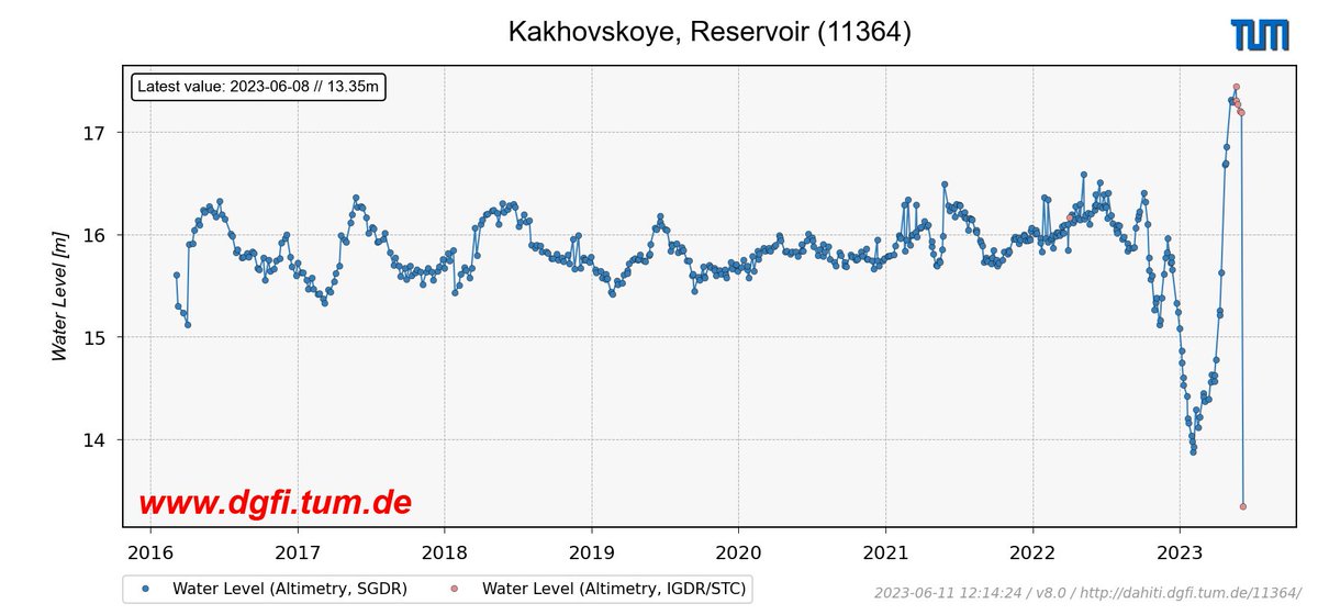
#Sentinel3 satellite #altimetry data show the result of #Kakhovka dam destruction: between June 6 and 8, the water level dropped by >4 meters. Current satellite-based water levels of reservoir & #Dnieper are freely available in @DgfiTum's DAHITI database (dahiti.dgfi.tum.de)
English