On this chilly Tuesday, at least we have seen a lot of sunshine across the DMV. Looking ahead to the evening commute home for some, here is your hour-by-hour forecast. @ScottSumnerWx
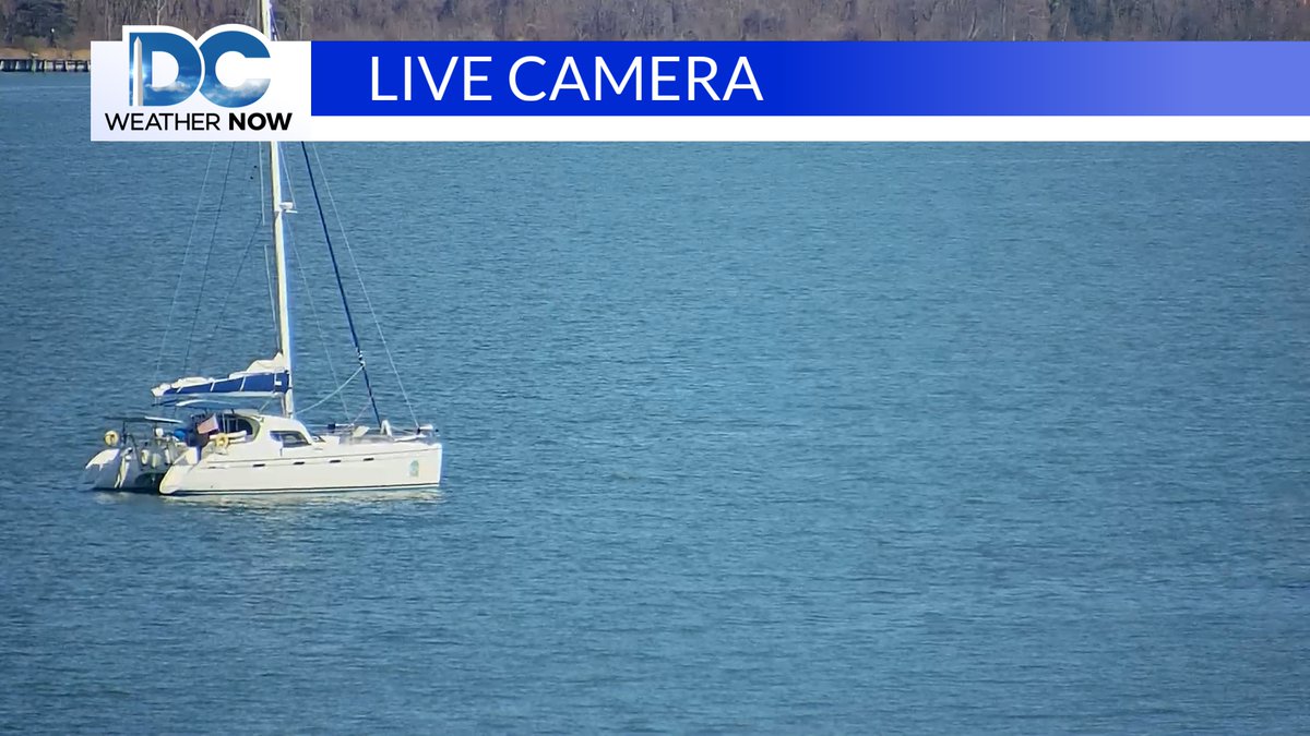
It may be a bit cool to think about summer, but this beautiful shot of a Catamaran in the Chesapeake Bay is where your mind might wander. Enjoy the mostly sunny day on the Bay!@ScottSumnerWx
Looking forward to to seeing warmer temperatures in spring , and of course the summer season? Well, here is a countdown to some of the holidays as we move forward in time. @ScottSumnerWx
Here is your updated 7-day. Not much change, as more rain is forecast to arrive Friday, then we head into next weekend on a sunny, seasonable note.@ScottSumnerWx
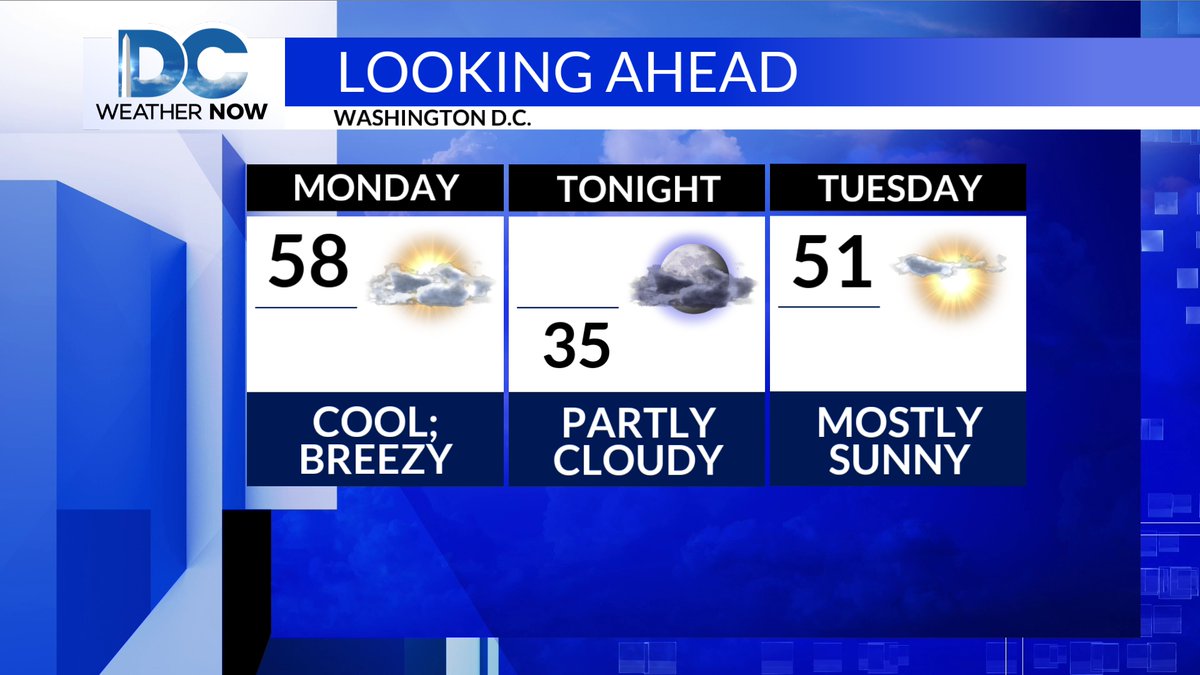
Now that last night's cold front is off our coast, cooler and windier weather will be with us this afternoon and into this evening. The forecast is for a dry couple of days, before another front brings showers back to the DMV.@ScottSumnerWx
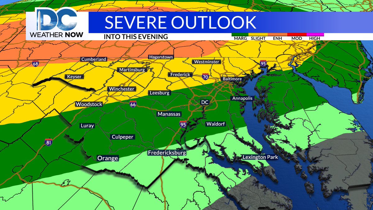
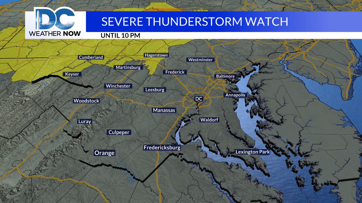
The NWS has extended the earlier Severe T-Storm Watch from 10 pm to midnight, as more storms to the west approach West Virginia and Western Maryland. The greatest threat overnight is moderate hail and then damaging wind gusts.@ScottSumnerWx
If severe weather occurs, the best chance is north of D.C. , as noted by the yellow (Slight Risk 2 out of 5) and orange (Enhanced Risk 3 out of 5) colors covering the DMV. Stay weather alert, even in areas under a marginal risk (Dk. Green color) over the District.@ScottSumnerWx
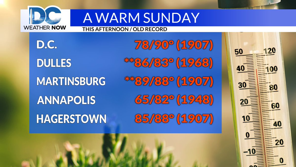
It was a beautiful, warm day, with a couple of records broken in the DMV. Dulles and Martinsburg were those places that broke those past records. Enjoy the rest of the afternoon. @ScottSumnerWx
Your latest 7-day is not much different from what I told you yesterday. A couple of rain chances but mainly a dry week ahead, with temperatures on a rollercoaster ride.@ScottSumnerWx
A Severe T-Storm Watch is in effect for parts of Western Maryland until 10 pm. Large Hail and damaging wind gusts will most likely be the biggest threats this evening in parts of the DMV.
Here is a look at the progression of a line of storms out ahead of a cold front with our Baron's 3K model. The storms should look to weaken overnight, but everything from dangerous lightning to large hail and damaging winds is on the table this evening.@ScottSumnerWx
Big Boomers tonight? Maybe. Look for a line of strong storms to develop in Central PA late this afternoon, then drift towards MD this evening. Most of the modeling has these storms weakening by the time they reach the Baltimore Metro tonight. The best chance for severe weather will be in Northern MD and Southern PA. Stay tuned...
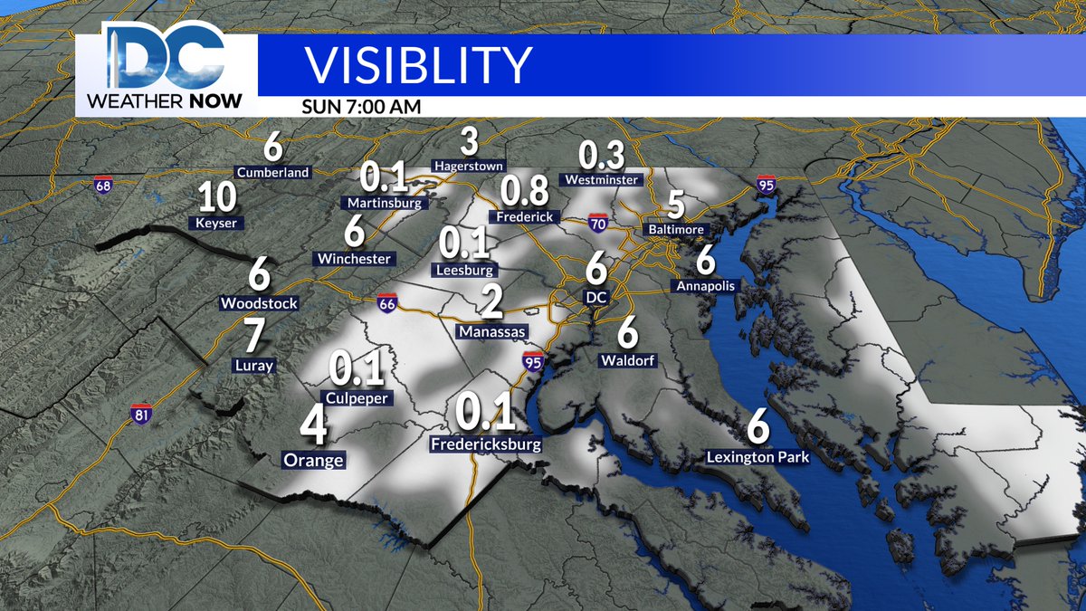
Visibilities maybe low if you are heading out to a early morning service. Please use caution when driving through fog. by mid to late morning driving will impro ve as the low clouds erode away. @ScottSumnerWx
Sunday will be warmer than today, but it might be a little hard to tie or brerak a record tomorrow, especially in D.C. Here are some record for Mrach 22nd in the DMV. @ScottSumnerWx
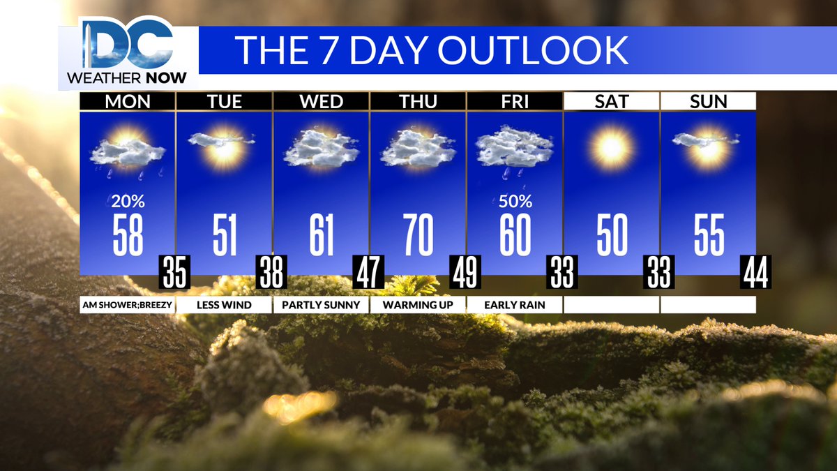
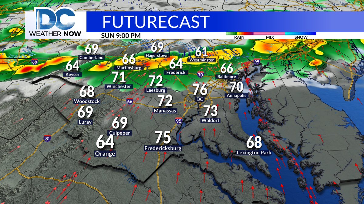
Here is your latest 7-day forecast. Much of the wet weather looks to fall during the nighttime, so that is why there is only one day with showers attached to it. Enjoy Sunday's possible record warmth! @ScottSumnerWx
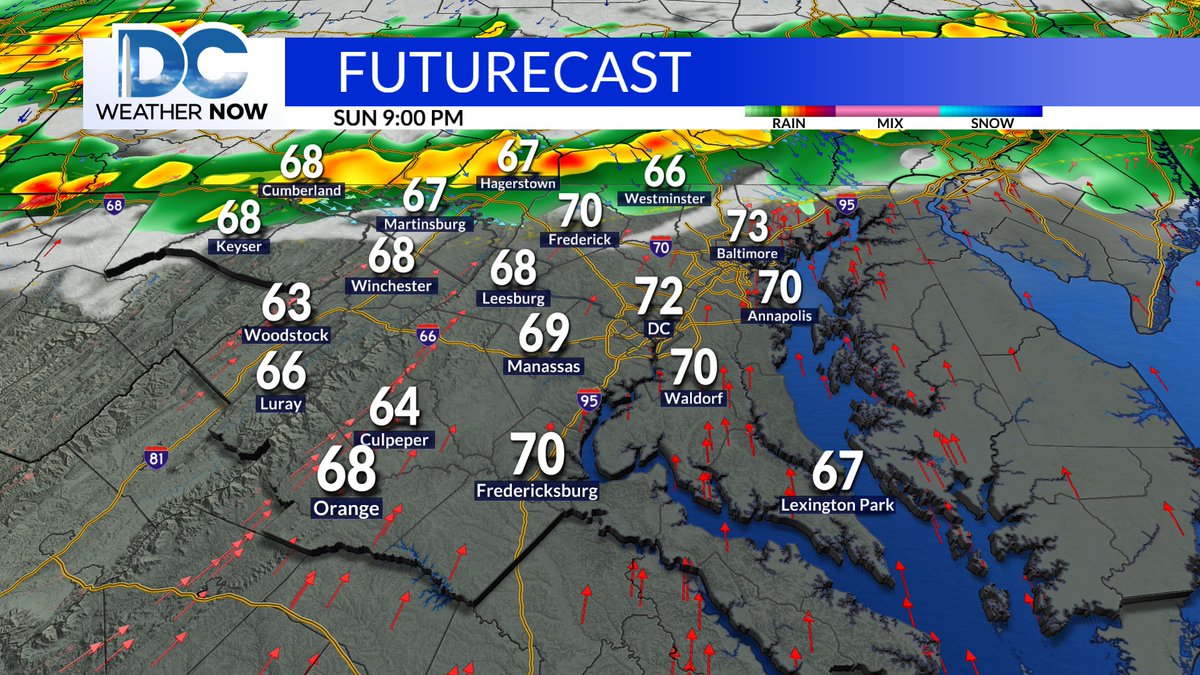
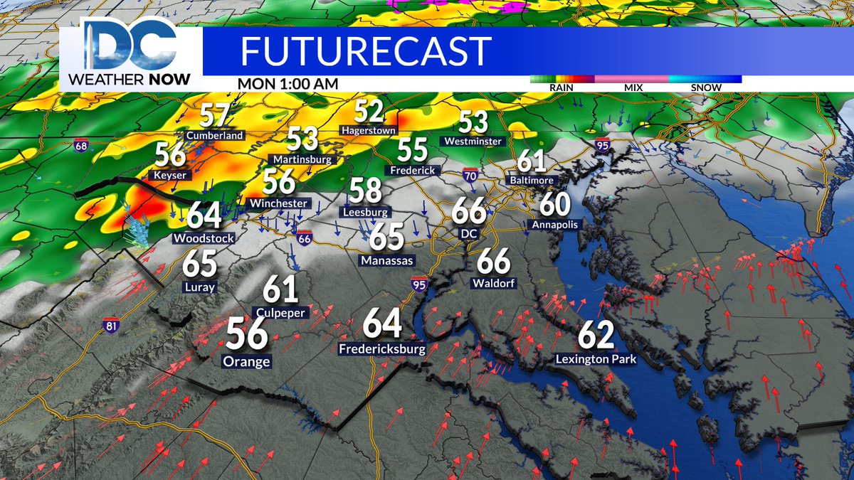
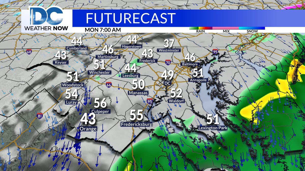
Looking ahead to Sunday night, a powerful cold front will arrive, bringing some storms to the region during the early evening and into early Monday morning (as shown here). You may need to dodge some rain in Southern Maryland early Monday.@ScottSumnerWx