
Steve Caparotta, Ph.D.
48.9K posts

Steve Caparotta, Ph.D.
@SteveWAFB
Chief Meteorologist at @WAFB in Baton Rouge. CBM, CCM, & CDM holder from @ametsoc. Husband. Girl Dad. @UofSouthAlabama & @LSU alum. Instructor at LSU.
Baton Rouge, LA Katılım Kasım 2008
2.8K Takip Edilen17.3K Takipçiler
Sabitlenmiş Tweet

Here's a look at the latest advisory for Tropical Depression #2. More at wafb.com/hurricane?utm_… #lawx #mswx

English

Tropical storm force wind probabilities are still listed at <20% for most of south Louisiana, but these numbers will climb as the storm gets closer.
The overlay is the "most likely arrival time" of tropical storm force winds. Note that it stretches from Wednesday morning for extreme SE Louisiana to Thursday morning for SW Louisiana.
That Wednesday morning timing should be enough to trigger some watches for portions of Louisiana by tomorrow morning. #TD2 #Bertha

Old Jefferson, LA 🇺🇸 English

No major changes in the 4 PM update from NHC. The track was nudged slightly southward, but given that we're still in the developmental stage of this system, additional adjustments are likely.
NHC continues to note lower-than-normal confidence with regards to the intensity forecast. If it remains offshore later in the week, that may increase its potential to intensify.
Steve Caparotta, Ph.D.@SteveWAFB
Here's the latest advisory for Tropical Depression #2. More at wafb.com/hurricane?utm_… #lawx #mswx
Old Jefferson, LA 🇺🇸 English

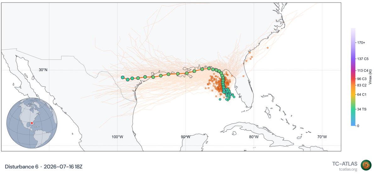
Here's the GRAF model's take on #TD2 as of Sunday afternoon. It shows a system that appears to battle northerly wind shear and periodic intrusions of dry air over the next couple of days.
It hints at a slightly more favorable environment as the storm passes near or south of Louisiana by Wednesday. But notice that it's a lopsided system for the next few days, with most activity near and south of the center. For those in Louisiana, a track like this would keep most of the significant impacts closer to the coast. But tracks paralleling the coast are tricky and small changes in heading can mean a big difference in impacts.
As many have pointed out, a track farther offshore may allow for more intensification. Those in Texas should also continue to monitor trends closely.
Old Jefferson, LA 🇺🇸 English
Steve Caparotta, Ph.D. retweetledi

AF Reserve Hurricane Hunters launch first flight into Tropical Depression Two to gather vital weather data, which is sent to the @NHC_Atlantic to assist in forecast models. Stay #WeatherReady and pay attention to local weather.


English

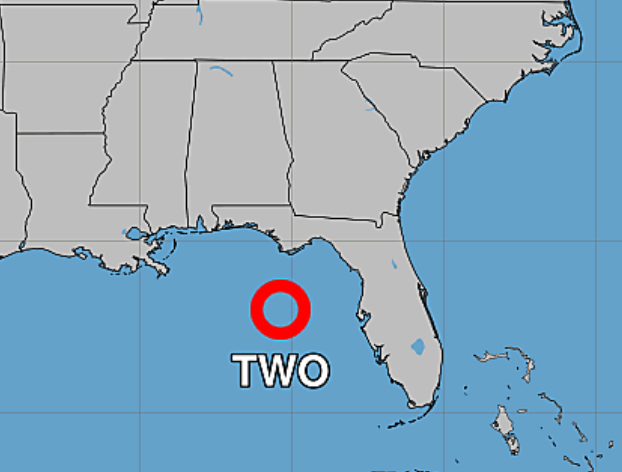
TROPICAL DEPRESSION #2 FORMS
Here's the first advisory and forecast track for newly-formed Tropical Depression #2. It is forecast to become Tropical Storm Bertha by Monday, and a Tropical Storm Watch has been issued for parts of the Florida Panhandle. Additional watches/warnings are likely to be issued in the days ahead.
Obviously, you'll note the forecast brings it either close to or over south Louisiana later this week. However, NHC notes that there is considerable uncertainty with regards to intensity. For the next few days, at least, some dry air and wind shear are expected to be in play. Beyond that, intensity will also be impacted by whether it tracks near the coast or farther offshore.
Be ready for portions of the Louisiana coastline to go under watches and warnings during the early part of the week.

English

A potential limiting factor with regards to intensification of #91L will be the introduction of increasing northerly shear in a day or two. Notice how the GRAF model depicts a sheared system near the mouth of the MS River early Wednesday, with most convection south of the center.
GFS-based SHIPS guidance also shows a significant increase in shear in the days ahead.


Old Jefferson, LA 🇺🇸 English

⚠️ TROPICAL DEPRESSION LIKELY TO FORM
As of the 7 AM Sunday outlook, the National Hurricane Center now says that a tropical depression is likely to form in the northern Gulf today or Monday. The Hurricane Hunters are scheduled to investigate the disturbance this afternoon.
Given the proximity to land, I wouldn't be surprised to see it designated a Potential Tropical Cyclone soon, allowing for the insurance of advisories. That also allows watches and warnings to be issued which will likely be needed soon for parts of the northern Gulf Coast.
More to come through the day ..

English

As we keep a close eye on Invest #91L over the next several days, a reminder that you can view the spaghetti plots on the Hurricane Center page at wafb.com/?utm_medium=so…

English

DEVELOPMENT ODDS 📈
The National Hurricane Center bumped development odds up to 40% with Invest #91L in the 1 PM update. NHC notes that a broad area of low pressure appears to be developing, but the system is still poorly organized.
The Hurricane Hunters are tentatively scheduled to investigate on Sunday. Movement is expected to be slow, so we still have time to monitor trends.

English

Will it develop? That's the question just about everyone is asking about a broad area of low pressure currently in the eastern Gulf. And the answer remains somewhat elusive.
While the satellite view as of Saturday morning looks relatively impressive, we still don't see any clear signs of low pressure developing at the surface. That would be Step #1 in any potential tropical development.
The National Hurricane Center maintains development odds at 30% as of Saturday morning. The latest run of Google's WeatherNext A-I model produces similar odds. Some guidance shows the system moving northward into Florida before significant development can occur. Others, like the hyper-aggressive GRAF model, show significant development with a system meandering in the northern Gulf for the next several days.
For now, we continue to watch. The good news is that if anything does ever develop and move westward, there are several days before that would occur.

English

NHC bumped development odds up slightly -- to 30% -- with the 1 PM update. You'll also note that the hatched area is now mostly in the Gulf and not on the east side of Florida. That's a nod to the trend toward a more westward track.
All that said, it still looks like the chances of anything significant coming of this are pretty low. We'll continue to monitor and keep you updated.

English

We're seeing an impressive flare up of convection (storms) in the eastern Gulf this morning. This is the area we'll be watching for potential development into the weekend. While the flare up may grab your attention, NHC maintains development odds at only 20%.
We continue to see a trend toward a more westward track becoming the more likely scenario. That's sure to get the attention of those along the northern Gulf Coast, but the good news is that most signs point toward limited development. The disturbance will also likely meander in the NE Gulf for a good chunk of the weekend. The most likely impact at this point is heavy rain for parts of the FL Peninsula.
So, for now, we continue to keep an eye on it, but our level of concern remains low.
Thanks to @Weathernerds for the satellite image.

Old Jefferson, LA 🇺🇸 English

EYE ON THE GULF...
We continue to keep an eye on the northeastern Gulf for potential low pressure development this weekend. The environment is marginal and there is still considerable uncertainty on a future track IF something does develop.
NHC continues to message a track across FL and near the southeast U.S. coastline, while AI/ML models (Euro AI, Google) have shown a decided lean toward a westward track in recent runs.
Even if something did develop, significant intensification looks unlikely. Our level of concern remains low, but we'll monitor trends into the weekend.


English


@sambrandt99 😂 Thank you for this. So much unnecessary gatekeeping in the weather community.
English