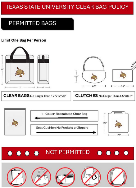
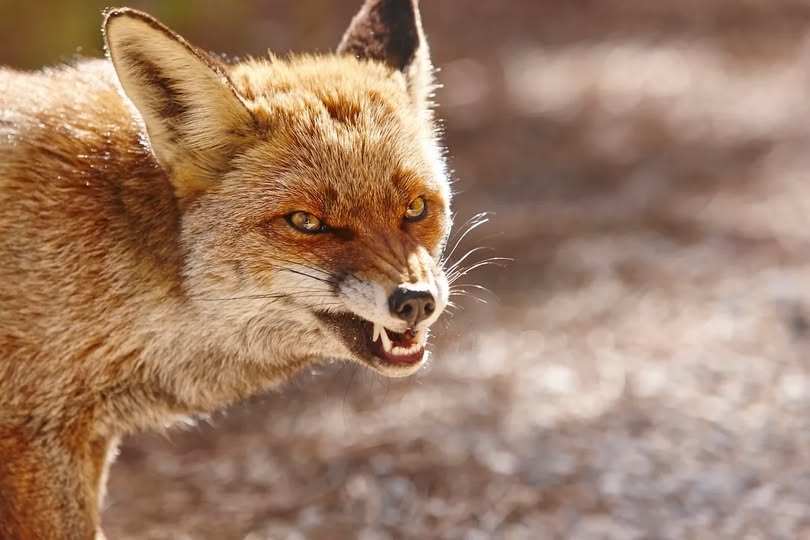
TXST Office of Emergency Management
1.1K posts

TXST Office of Emergency Management
@TXStateOoEM
The official Twitter account for the #TXST Office of Emergency Management. Follow us for important safety updates and more.


With a Flood Watch in effect for the eastern half of the area through Thursday morning, it's time to remind folks about the dangers of flooding. Never drive around a barricade and remember, flooding can escalate quickly. Be sure to have an alt plan in the event of flooded roads.

Today will be mostly cloudy and warm with isolated to scattered storms possible. If any storms do develop some storms could be strong. Otherwise, highs will be in the 80s to middle 90s with the warmer values near the Rio Grande. Rain chances remain in the forecast next week.


Warm conditions will continue on Thursday with another chance for some isolated thunderstorms across northern and western areas, which could be strong to severe. Better chances for showers and storms arrive late Friday and especially Saturday with a cold front. #txwx


There is a chance for strong to severe thunderstorms mainly this evening into early Tuesday morning. Large hail and damaging wind gusts are the main hazards. In addition, a tornado can't be ruled out. As always, stay weather aware and have a way to receive warning information.


