Managing land in the West? Improvements to weekly maps of invasive grasses make it easier!
Aggressive invasive grasses can crowd out native plants, damage habitats, and increase the risk of wildfire. Monitoring tools are important for treatment timing, fire management, grazing decisions, and habitat management.
USGS scientists produce weekly maps that show the amount of invasive grasses like cheatgrass and medusahead growing across the western half of the United States. Improvements to the maps include extending their production through early September to capture more of the growing season.
Learn more about the Exotic Annual Grass (EAG) mapping improvements and access the data: ow.ly/T3Gw50Z1Pi1
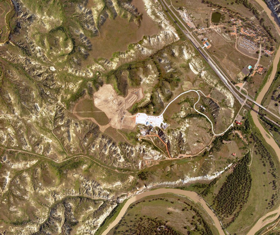
📷1: This area near Rock Springs, Wyoming, within the sagebrush ecosystem, was invaded by cheatgrass after a fire. Cheatgrass has an early, short growing season, leaving behind abundant dry material that can serve as fuel for more fires. Photo credit: Toby Maxwell, USGS
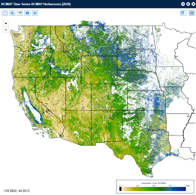
📷2: This Rangeland Condition Monitoring Assessment and Projection (RCMAP) EAG map shows levels of cheatgrass growth during a recent week in the northwestern United States. Additional weekly maps depict medusahead, field brome and Japanese brome, all exotic annual grasses, and total herbaceous ground cover (grasses and forbes).


English