Melon
1.2K posts

Melon
@UncannyObserver
(1989- ) Obsessed w/ Weather, Math, and Physics.
Katılım Aralık 2011
420 Takip Edilen126 Takipçiler
Melon retweetledi

Melon retweetledi

Melon retweetledi

Melon retweetledi
Tornado Warning including Truman MN, Lewisville MN and Northrop MN until 7:45 PM CDT

English
Melon retweetledi

Melon retweetledi

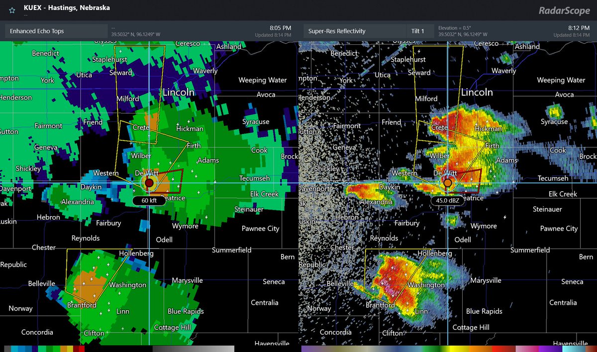
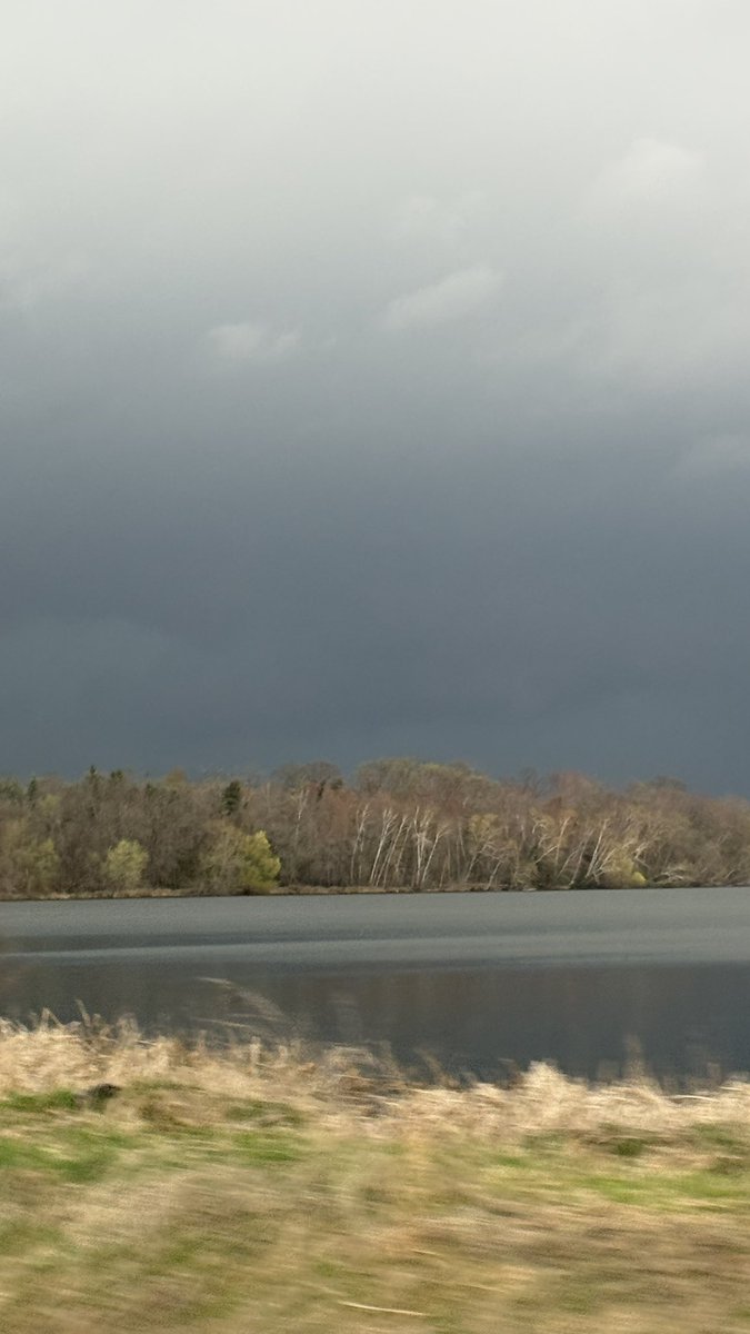
Just intercepted an absolute MONSTER at close range north of St. Libory east of Hwy 281. Homes destroyed. Checking on folks now
English
@CurryIsMyGOATT We are on the norther end of the QLCS and a few bookend vortices are still a major threat for tornadoes, especially for the SW and S metro. The warming was much more robust than expected due to afternoon clearing! Watch for the notches!

English

@UncannyObserver Booo. I’d rather have discrete cells — not because of the greater tornado risk, but the lesser likelihood of the metro actually being hit by storms
English
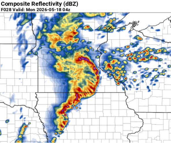
The 00z HRRR just printed a potent QLCS nailing the Twin Cities at around 11pm. The timing is still uncertain but the likelihood of widespread damaging winds (70+mph), large hail, and a few tornadoes, especially SW of the Metro. Likely will be upgraded to enhanced risk. #mnwx
English
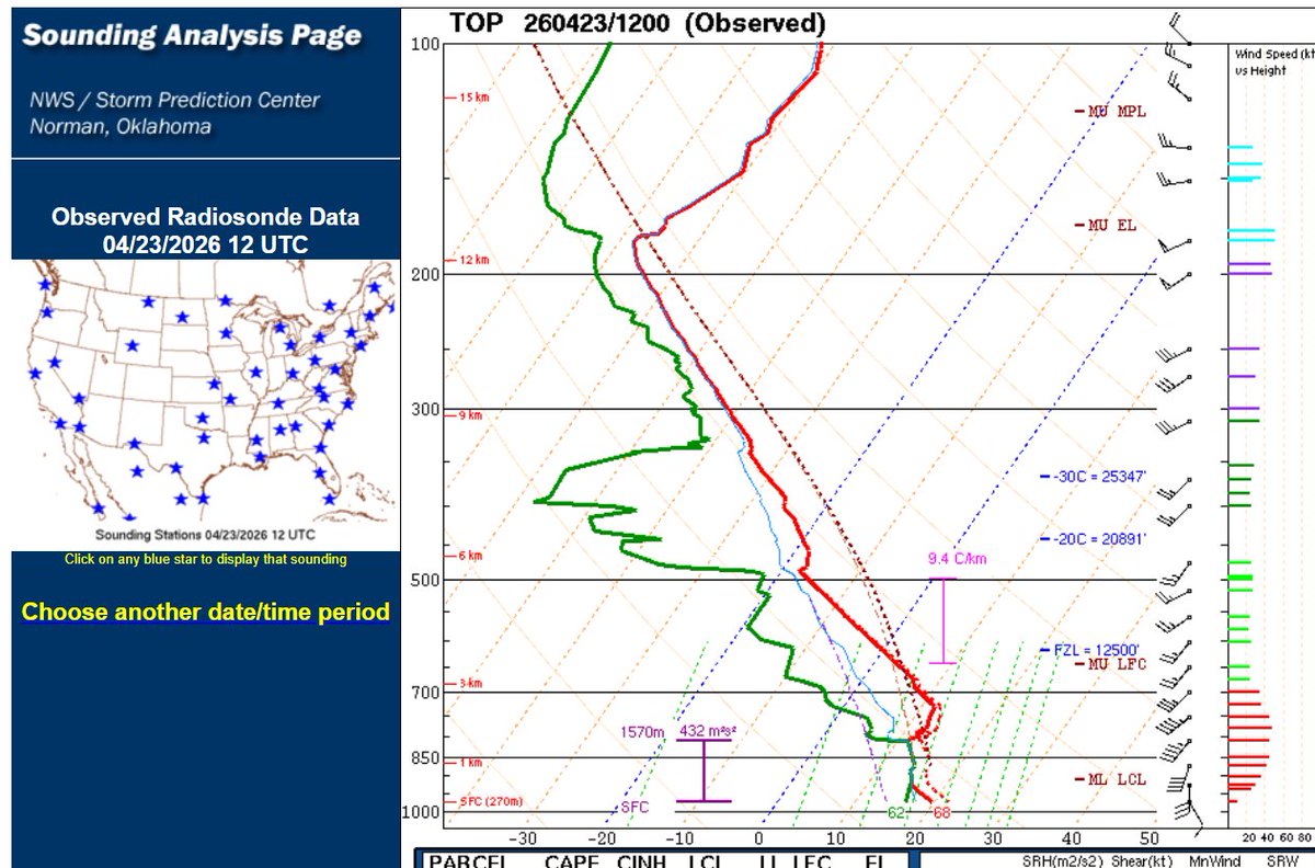
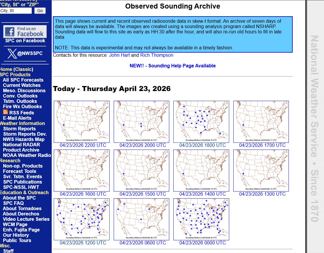
@paulhuttnerwx The lack of soundings is absolutely an issue but I think the post was made before all the stations had reported. This is what I am seeing on the SPC sounding page.
English

Sure would be helpful to have weather balloon data feeding into forecast models on a severe weather day. Little to balloon launch data immediately upstream. Ridiculous. #mnwx
Greg McLaughlin@GregMcwx
Ugh!!!!!! Ugh Ugh Ugh Why???!!!!!!
English
Melon retweetledi

Modest instability and lapse rates meets vigorous initiation and ample lower level SRH. Expect widespread low end severe weather, with isolated intense updrafts that could spawn a tornado. A storm blossoming over Le Sueur, MN is starting a wave heading towards TC metro. #mnwx
GIF
English