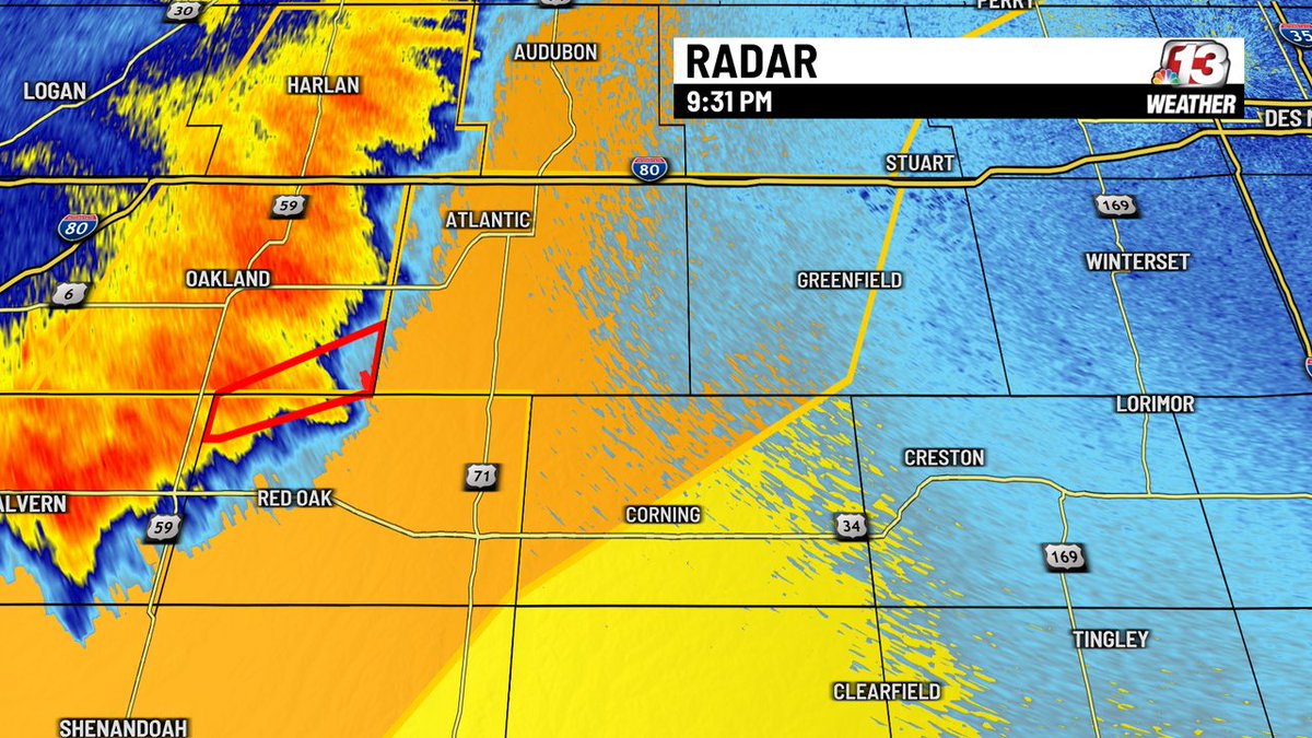
A Severe Thunderstorm Warning has been issued for parts of Cass, Adair, Adams county until May 17 10:30PM. Seek shelter until this storm has passed. #IAwx
A Tornado Warning has been issued for parts of Emmet, Kossuth, Winnebago, Palo Alto county until May 17 10:15PM. Seek shelter in the most interior room on the lowest level of a sturdy structure now! #IAwx
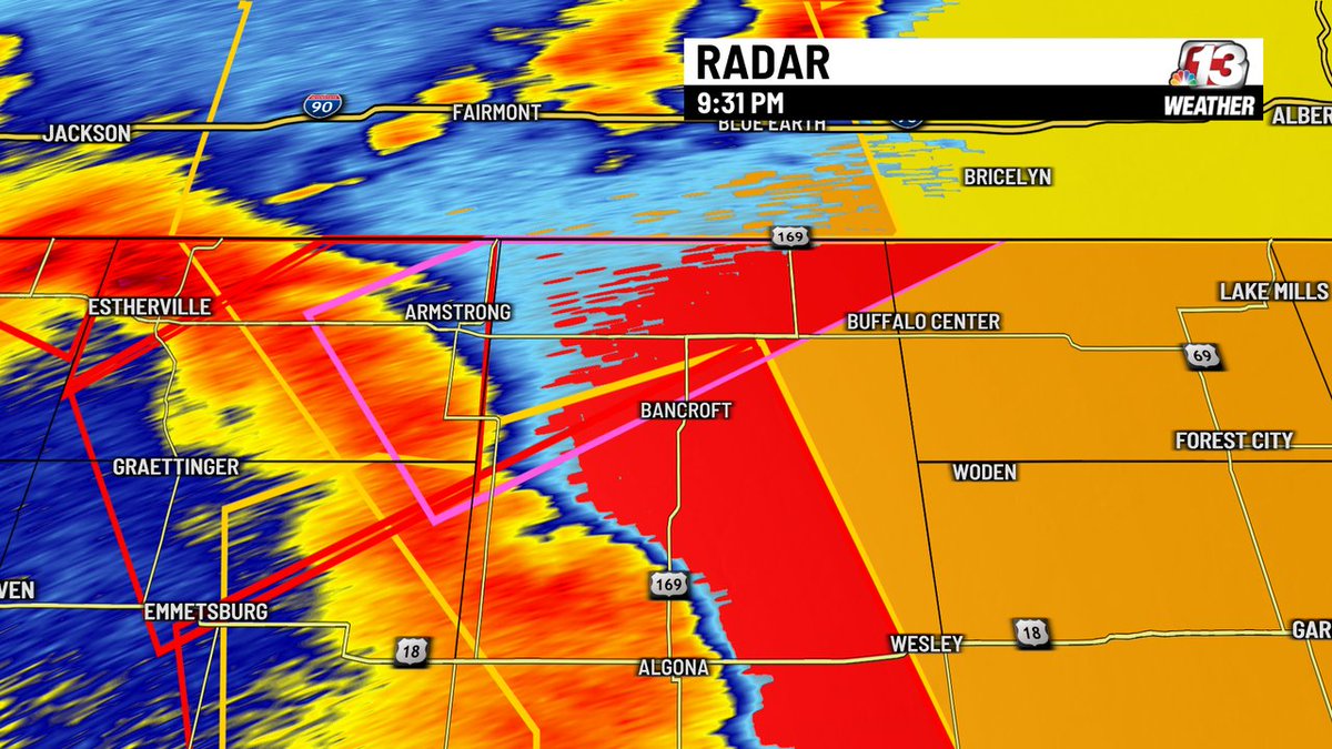
A Severe Thunderstorm Warning has been issued for parts of Kossuth, Cerro Gordo, Winnebago, Hancock, Wright, Worth, Emmet, Humboldt, Franklin, Palo Alto county until May 17 10:30PM. Seek shelter until this storm has passed. #IAwx
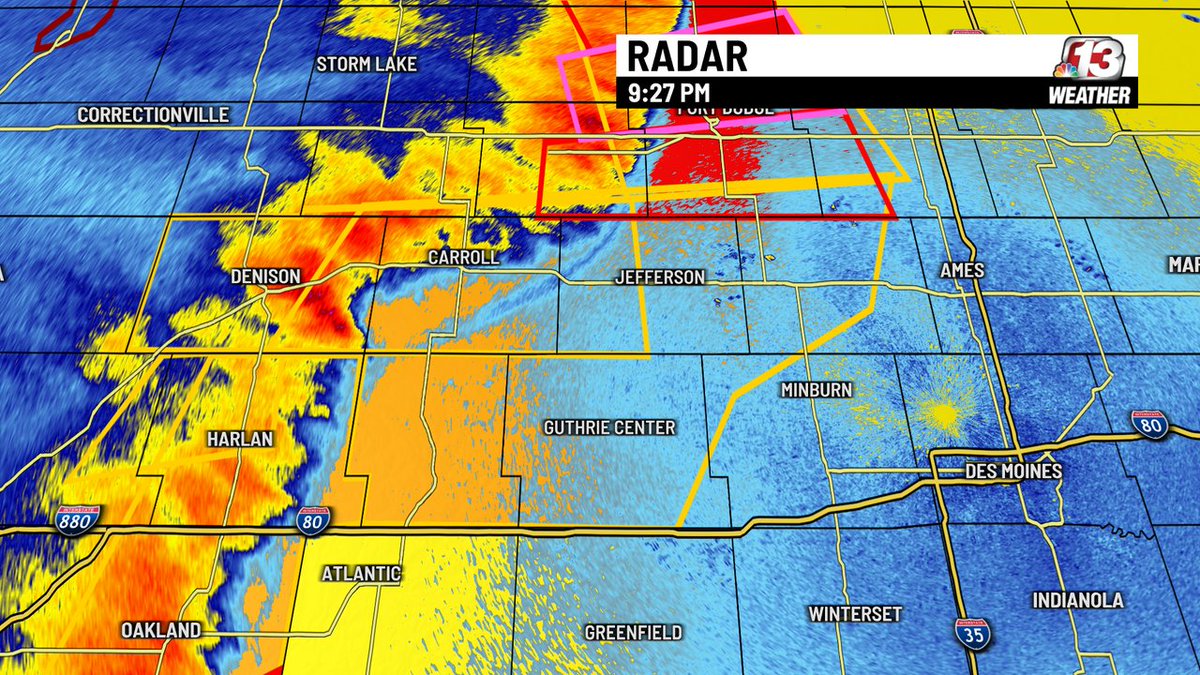
A Severe Thunderstorm Warning has been issued for parts of Carroll, Boone, Dallas, Greene, Audubon, Guthrie, Webster, Crawford, Hamilton, Calhoun, Sac county until May 17 10:45PM. Seek shelter until this storm has passed. #IAwx
A Tornado Warning has been issued for parts of Hamilton, Webster, Calhoun county until May 17 10:00PM. Seek shelter in the most interior room on the lowest level of a sturdy structure now! #IAwx
A Tornado Warning has been issued for parts of Kossuth, Palo Alto, Humboldt, Pocahontas county until May 17 10:00PM. Seek shelter in the most interior room on the lowest level of a sturdy structure now! #IAwx
A Tornado Warning has been issued for parts of Webster, Humboldt, Wright, Calhoun, Pocahontas, Hamilton county until May 17 9:45PM. Seek shelter in the most interior room on the lowest level of a sturdy structure now! #IAwx
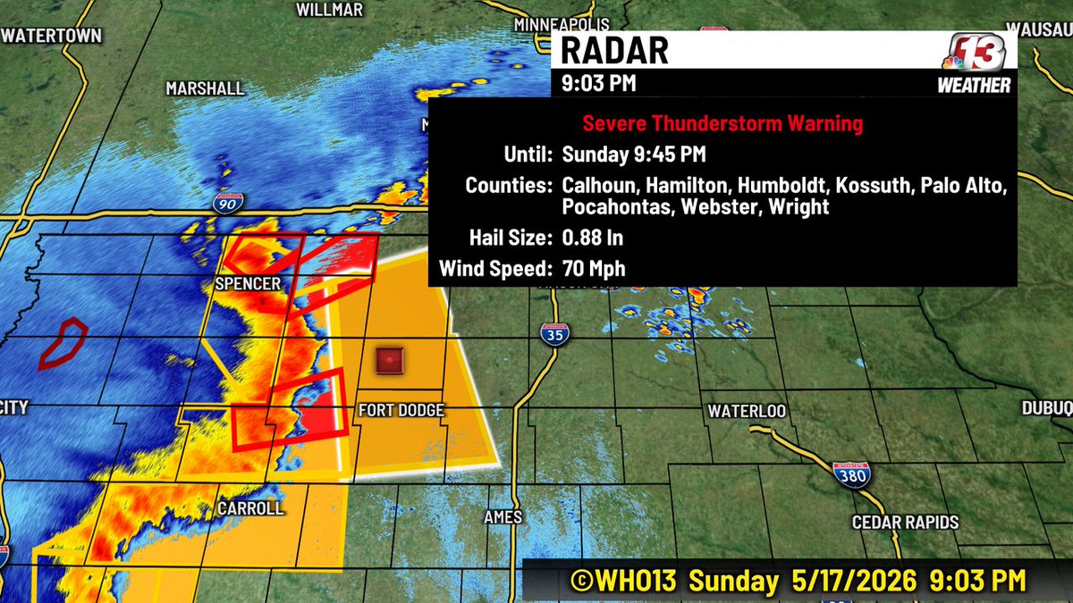
A Severe Thunderstorm Warning is in effect until 9:45 PM for Calhoun, Hamilton, Humboldt, Kossuth, Palo Alto, Pocahontas, Webster, and Wright Counties. 70 MPH wind is possible.
A Severe Thunderstorm Warning has been issued for parts of Webster, Kossuth, Hamilton, Humboldt, Wright, Pocahontas, Palo Alto, Calhoun county until May 17 9:45PM. Seek shelter until this storm has passed. #IAwx
Here is the latest update on the severe thunderstorm warning for Calhoun, Palo Alto , Pocahontas and Sac Counties until 9:15 PM. These storms are moving east at 65 MPH.
This is the Radar loop over the last 3 hours. Severe Thunderstorm Warnings are outlined in yellow...Tornado Warnings are outlined in red. The line of storms in moving east at 40-50 MPH. If you live I this area of NW Iowa...be ready to seek shelter.
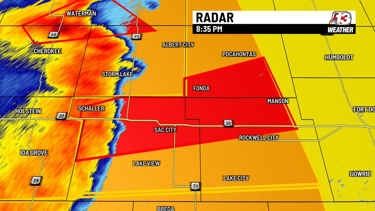
A Tornado Warning has been issued for parts of Calhoun, Sac, Pocahontas county until May 17 9:15PM. Seek shelter in the most interior room on the lowest level of a sturdy structure now! #IAwx
A Severe Thunderstorm Warning has been issued for parts of Carroll, Crawford, Greene, Calhoun, Sac county until May 17 9:30PM. Seek shelter until this storm has passed. #IAwx
A Severe Thunderstorm Warning has been issued for parts of Calhoun, Sac, Palo Alto, Pocahontas county until May 17 9:15PM. Seek shelter until this storm has passed. #IAwx
A Tornado Watch has been issued for parts of central Iowa until 5/18 3:00AM. Stay weather aware--severe storms could be capable of producing tornadoes over the next few hours. #IAwx
A Tornado Watch has been issued for parts of central Iowa until 5/18 1:00AM. Stay weather aware--severe storms could be capable of producing tornadoes over the next few hours. #IAwx