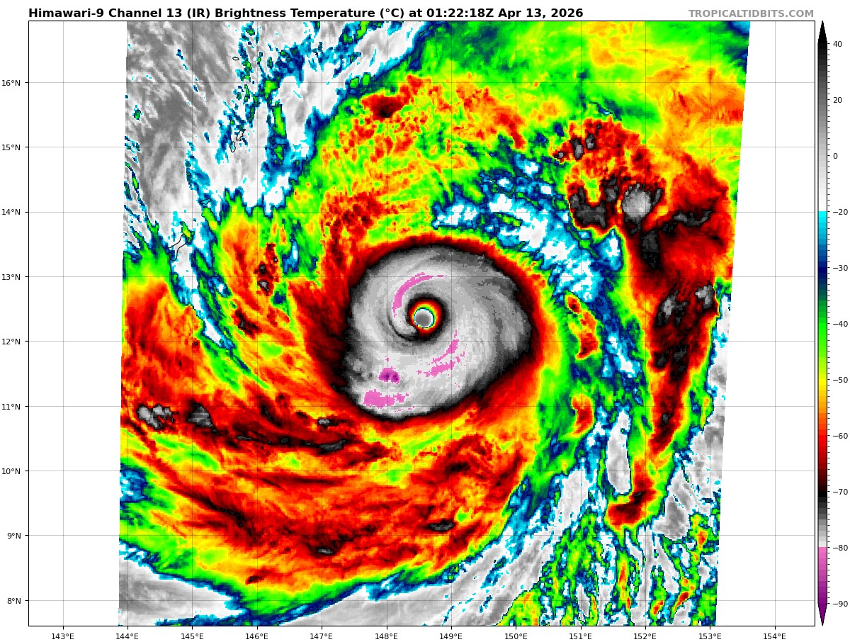
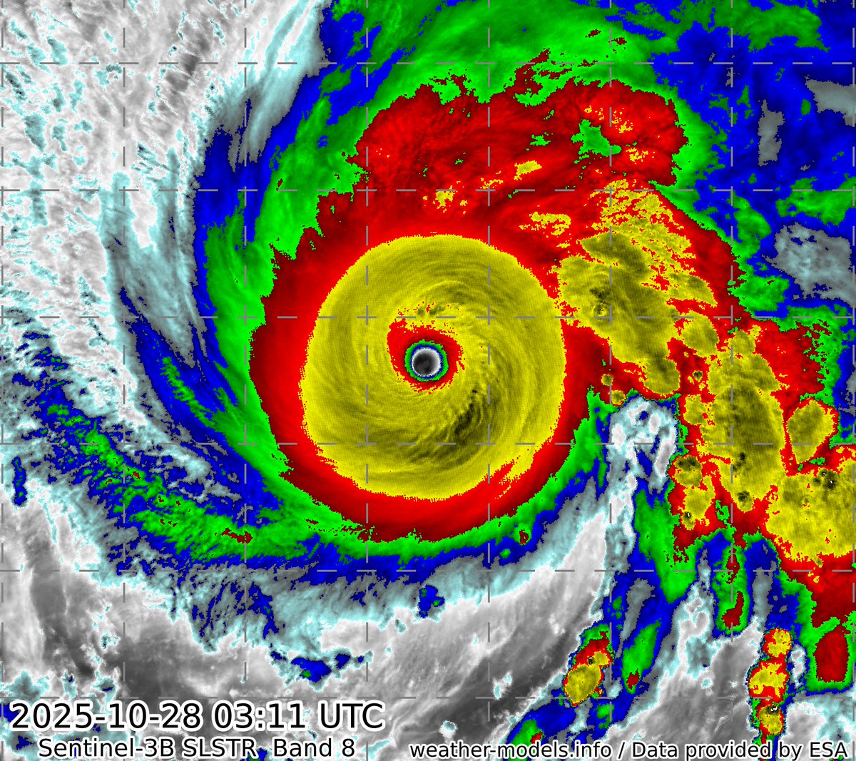
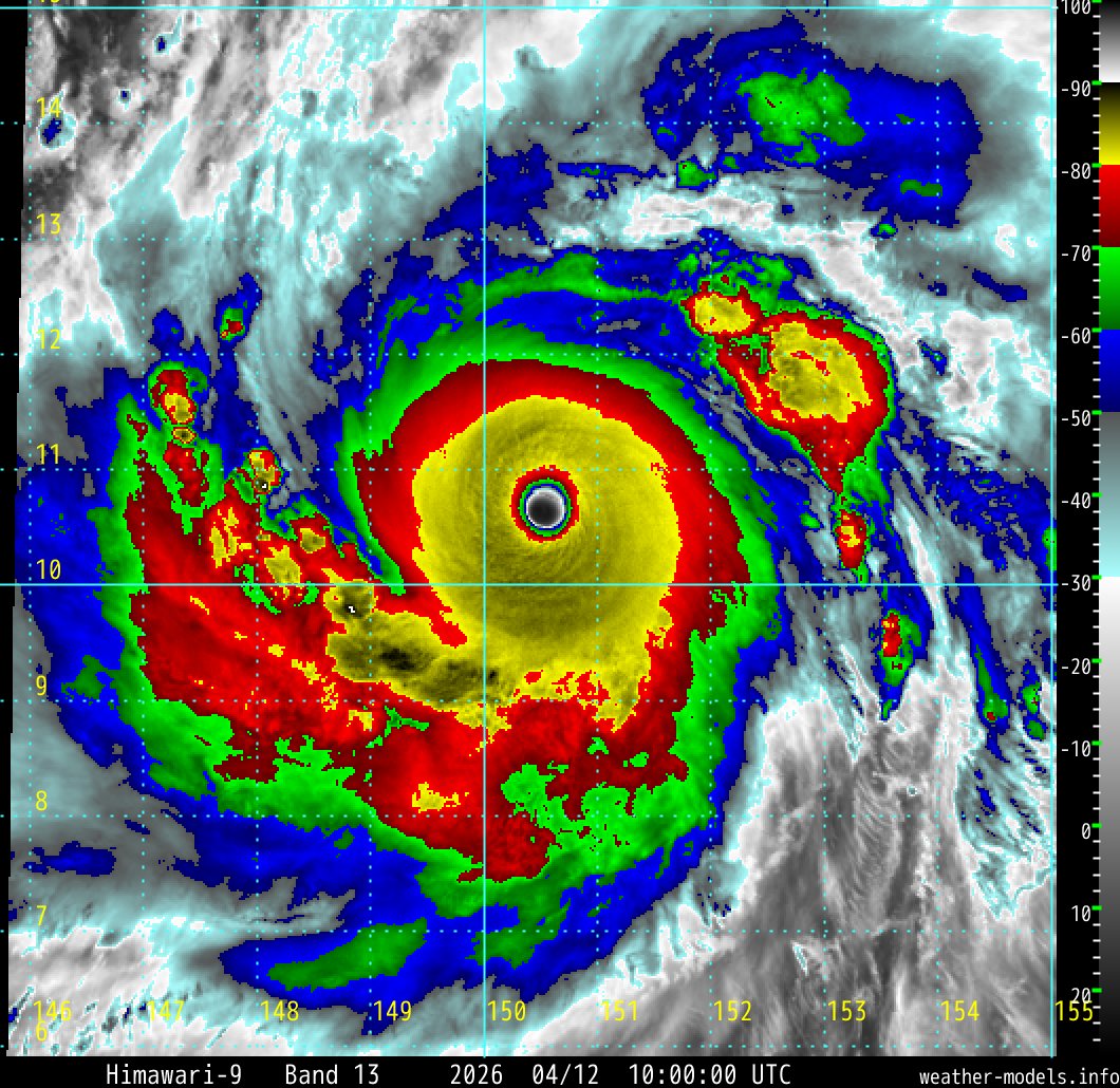
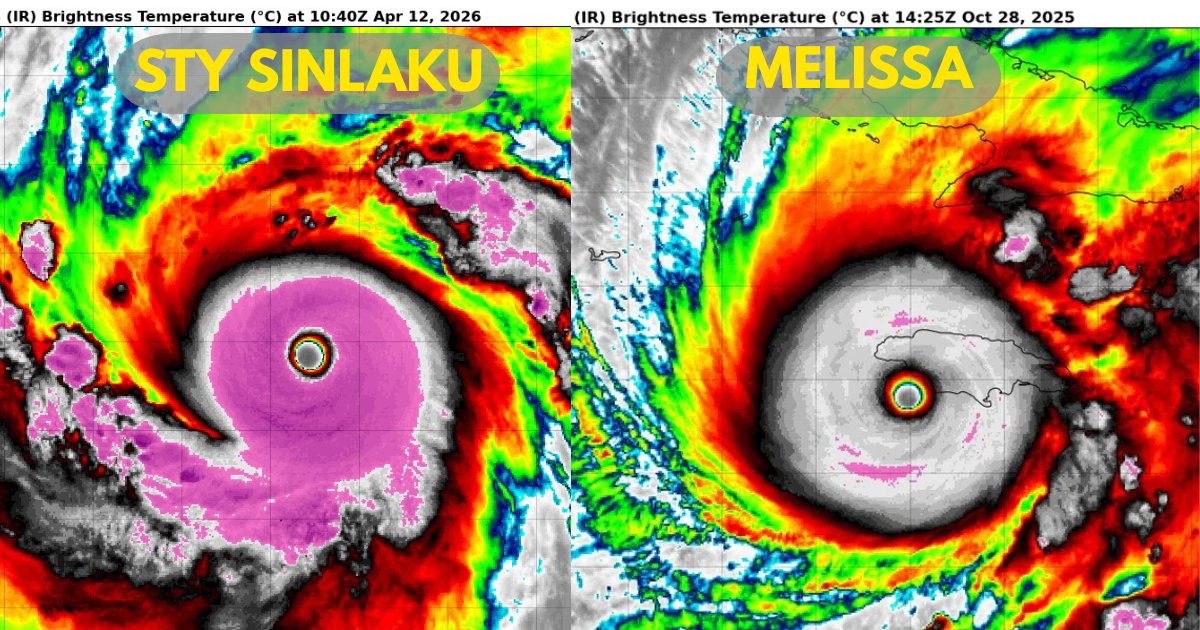
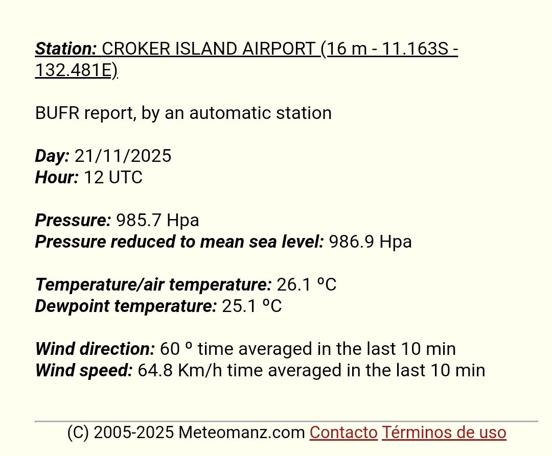
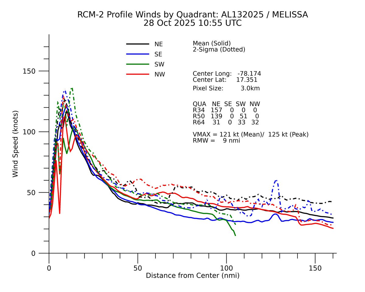
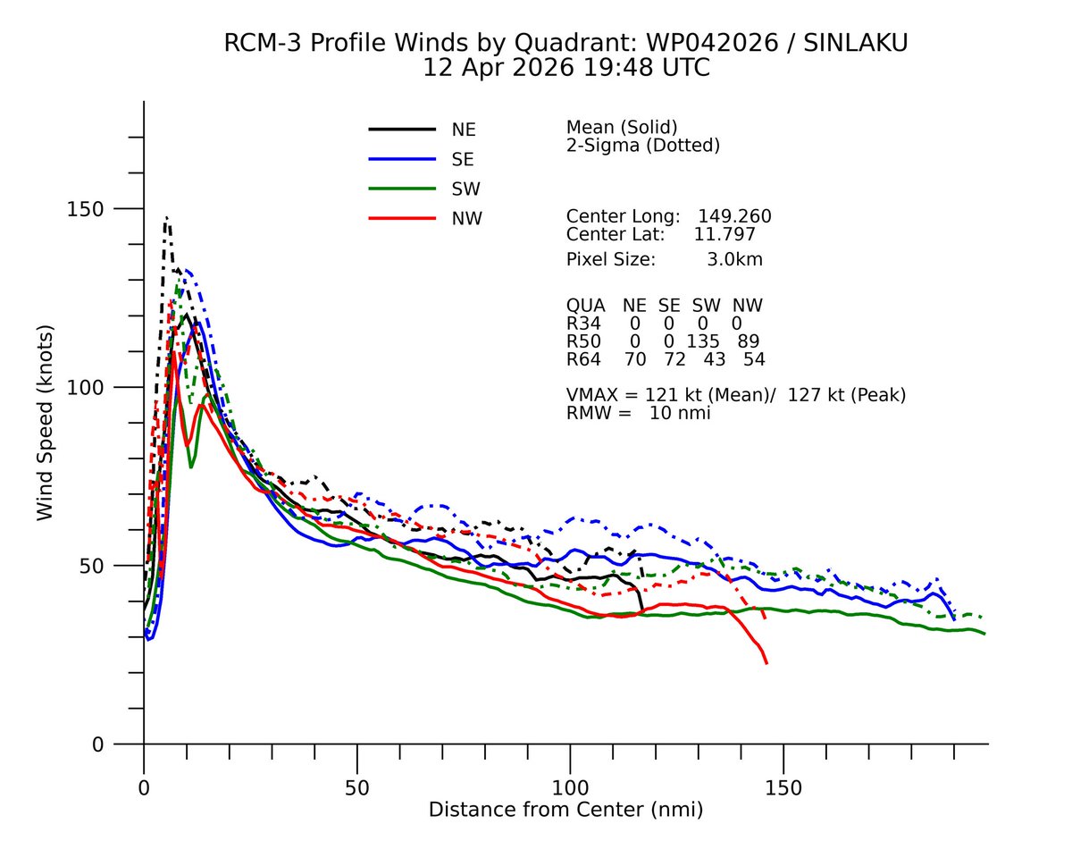


Emmanuel Enriquez
8.5K posts

@WXappraiser
Weather Appraiser!!! Thunder Fan No Itinerary Impulse traveller


The JTWC did override the 18z intensity estimate for Super Typhoon SINLAKU, upgrading it to 160 kt (185 mph) with a minimum central pressure of 890 mb. This makes Sinlaku the strongest super typhoon by wind speed since Bolaven 2023 (165 kt/190 mph), and the first to reach sub-900 mb since Bolaven as well.


The brand new EURO Seasonal Model calls for a Super El Niño to develop this Summer. This upcoming El Niño event is likely to rival 1982, 1997, and 2015 — and has the potential to be the strongest in recorded history. This is a huge deal because El Nino events are typically associated with below-average Hurricane Seasons Atlantic Basin. This is reflected with a -AMO SSTA configuration with the warmest water focused in the subtropical Atlantic, with below-average precipitation anomalies across the tropics. This signals to me El Niño related subsidence & wind shear wreaking havoc in the Atlantic, leading to the quietest season since at least 2015. #tropicaluodate 🌀


After striking Babuyan Island, the eye of STY #Ragasa (#NandoPH) is now passing over Calayan Island. The weather station (★ WMO 98133) on the south side of the island stopped transmitting obs after 21Z, unfortunately, so we'll have to wait for PAGASA to release the data.

