Lexie Horvath

780 posts

Lexie Horvath banner
Lexie Horvath

Lexie Horvath

@WXwithLex

Meteorologist at @live5news in Charleston, SC Virginia Tech alum | ATL

Charleston, SC Katılım Temmuz 2022
885 Takip Edilen2.1K Takipçiler
Lexie Horvath
Lexie Horvath@WXwithLex·
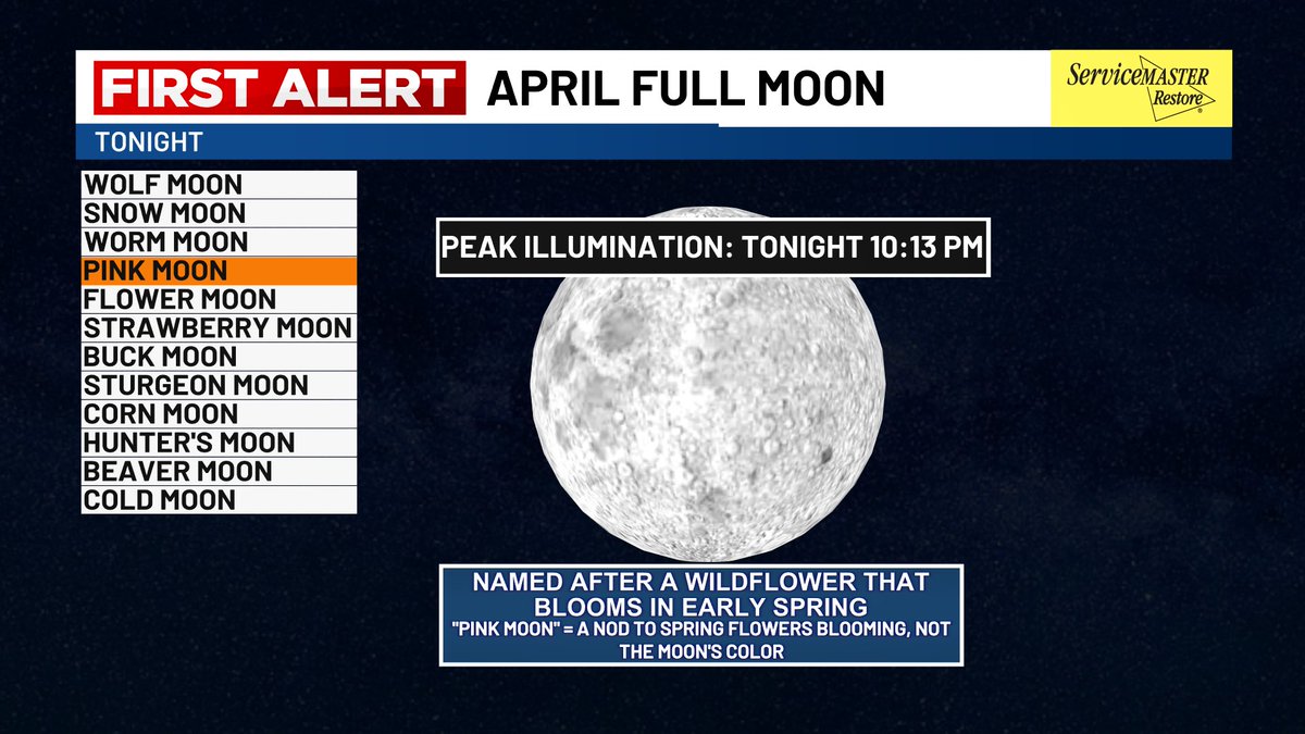
FULL MOON TONIGHT 🌕 | As Artemis II lifts off, we’ll also have a full moon shining Wednesday night. Some clouds in Charleston could get in the way, but it’s still worth a look—eyes to the sky tonight!
Lexie Horvath tweet media
English
0
1
6
230
Lexie Horvath
Lexie Horvath@WXwithLex·
SOUTH CAROLINA | We’re DROPPING more than 20° from Friday to Saturday! Plenty of sunshine but much cooler outside 😎
Lexie Horvath tweet media
English
0
1
3
211
Lexie Horvath
Lexie Horvath@WXwithLex·
SOUTH CAROLINA - A brief cool down is on the way for Tuesday! After several 80 degree days….it’s time to trade in the flip flops for a hoodie (but not for too long 😉)
Lexie Horvath tweet media
English
0
0
3
96
Lexie Horvath
Lexie Horvath@WXwithLex·
WHEW! 😅 Record High Tied Today 🏆 88° at Charleston International Airport - Previous Record was set back in 2011! #charleston #chswx
Lexie Horvath tweet media
English
0
2
13
717
Lexie Horvath
Lexie Horvath@WXwithLex·
GRAB THE SUNSCREEN….Temperatures are HEATING UP for our first weekend of Spring!
Lexie Horvath tweet media
English
0
2
5
115
Lexie Horvath
Lexie Horvath@WXwithLex·
BREEZY SUNDAY in Charleston! Wind gusts strengthen through the day and could exceed 35mph for some areas by the afternoon. Hold on to your hats!!
Lexie Horvath tweet media
English
0
0
4
215
Lexie Horvath
Lexie Horvath@WXwithLex·
Scattered showers and thunderstorms remain possible Saturday afternoon and evening, as a strong cold front moves into the area. A Marginal Risk is currently in place for most of the area. The main threats are heavy downpours, scattered thunderstorms and some gusty winds.
Lexie Horvath tweet mediaLexie Horvath tweet media
English
0
0
7
212
Lexie Horvath
Lexie Horvath@WXwithLex·
SUNDAY (2/15) RADAR 5PM - Some MUCH NEEDED rain has arrived! Scattered showers and a few heavy downpours are likely through the evening. Don’t be surprised if you hear a few rumbles of thunder. Totals expected to reach 0.5” - 0.75” for most of us. #charlestonsc
English
0
0
6
404
Lexie Horvath
Lexie Horvath@WXwithLex·
SUNDAY SHOWERS (2/15) - We start off mostly cloudy Sunday morning with showers and breezy conditions moving in by the afternoon. A few thunderstorms are possible late afternoon and early evening with wind gusts up to 30mph. #Charlestonsc
Lexie Horvath tweet media
English
1
0
4
344
Lexie Horvath
Lexie Horvath@WXwithLex·
ROCKET LAUNCH FRIDAY MORNING! 🚀 Crew-12 is set for liftoff at 5:15 AM from Cape Canaveral, Florida, heading to the International Space Station. Viewers along the East Coast may catch the spacecraft overhead shortly after launch!
Lexie Horvath tweet media
English
0
0
4
213
Lexie Horvath
Lexie Horvath@WXwithLex·
CHARLESTON EARTHQUAKE! Did you feel it? A 3.2 Magnitude Earthquake occurred at 10:37 PM Saturday night expanding 6.2 miles.
Lexie Horvath tweet media
English
0
1
4
382
Lexie Horvath
Lexie Horvath@WXwithLex·
GOOD NEWS! We have officially PASSED the half-way point of Winter. Only 43 days until the First Day of Spring….🌸🌺
Lexie Horvath tweet media
English
1
1
3
155
Lexie Horvath
Lexie Horvath@WXwithLex·
🥶RECORD-BREAKING START TO FEBRUARY🏆 Charleston International Airport dropped to 20° this morning, setting a new record low! This shatters the previous record of 21° set back in 1977…..AND this marks our coldest start to February EVER recorded, dating back to 1937. #chswx
Lexie Horvath tweet media
English
0
0
4
201
Lexie Horvath
Lexie Horvath@WXwithLex·
Almost 3 inches of snow in Moncks Corner, SC! 📸: Trixie Sheheane
Lexie Horvath tweet media
English
0
0
3
165
Lexie Horvath
Lexie Horvath@WXwithLex·
It might not have been a lot….but Miranda Fisher clearly made it work! ⛄️ WHO WANTS TO BUILD A SNOWMAN? 📍Ladson, SC
Lexie Horvath tweet media
English
0
0
6
195
Lexie Horvath
Lexie Horvath@WXwithLex·
READY OR NOT…..Here it comes! 🥶 ARCTIC AIR is surging down south setting the stage for bitterly cold temperatures & wind chills Monday night and into Tuesday. Extreme cold alerts are already in place across much of the US! Bundle up - we’ve got a COLD start to the day.
Lexie Horvath tweet media
English
0
0
4
228
Lexie Horvath
Lexie Horvath@WXwithLex·
SUNDAY (1/25) INCOMING SHOWERS & THUNDERSTORMS - Heavy rainfall, strong wind gusts and a few thunderstorms are possible across the region Sunday evening. Temps will climb quickly Sunday as a warm front pushes in, melting any light morning ice accumulation by midday.
Lexie Horvath tweet mediaLexie Horvath tweet media
English
0
0
4
622
Lexie Horvath
Lexie Horvath@WXwithLex·
A WINTER WEATHER ADVISORY has been issued until 1 PM on Sunday for Berkeley, Colleton and Dorchester counties. Inland areas could see some sleet or freezing rain starting Saturday afternoon/evening through Sunday morning. Closer to the coast, just rain at this time.
Lexie Horvath tweet media
English
0
0
2
174
Lexie Horvath
Lexie Horvath@WXwithLex·
GRAB THE COATS!!! Get ready for a COLD start to the week - Monday morning we drop to the upper 20s and low 30s! We remain cool through the afternoon with highs in the low 50s and sunny skies. Tuesday and Wednesday we’re back to near 60° and sunny! Then……our next cold front.
Lexie Horvath tweet media
English
0
0
3
168