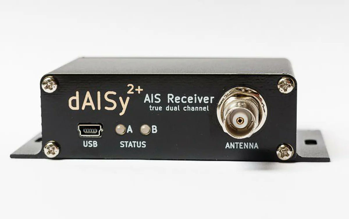
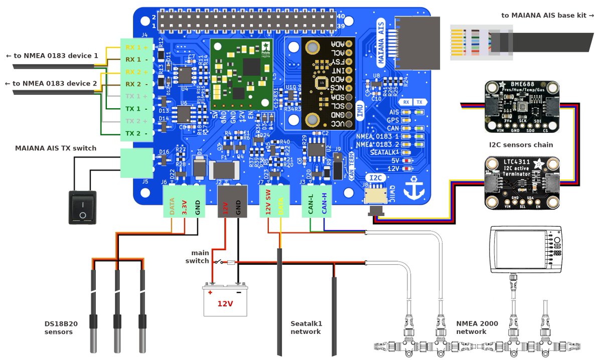
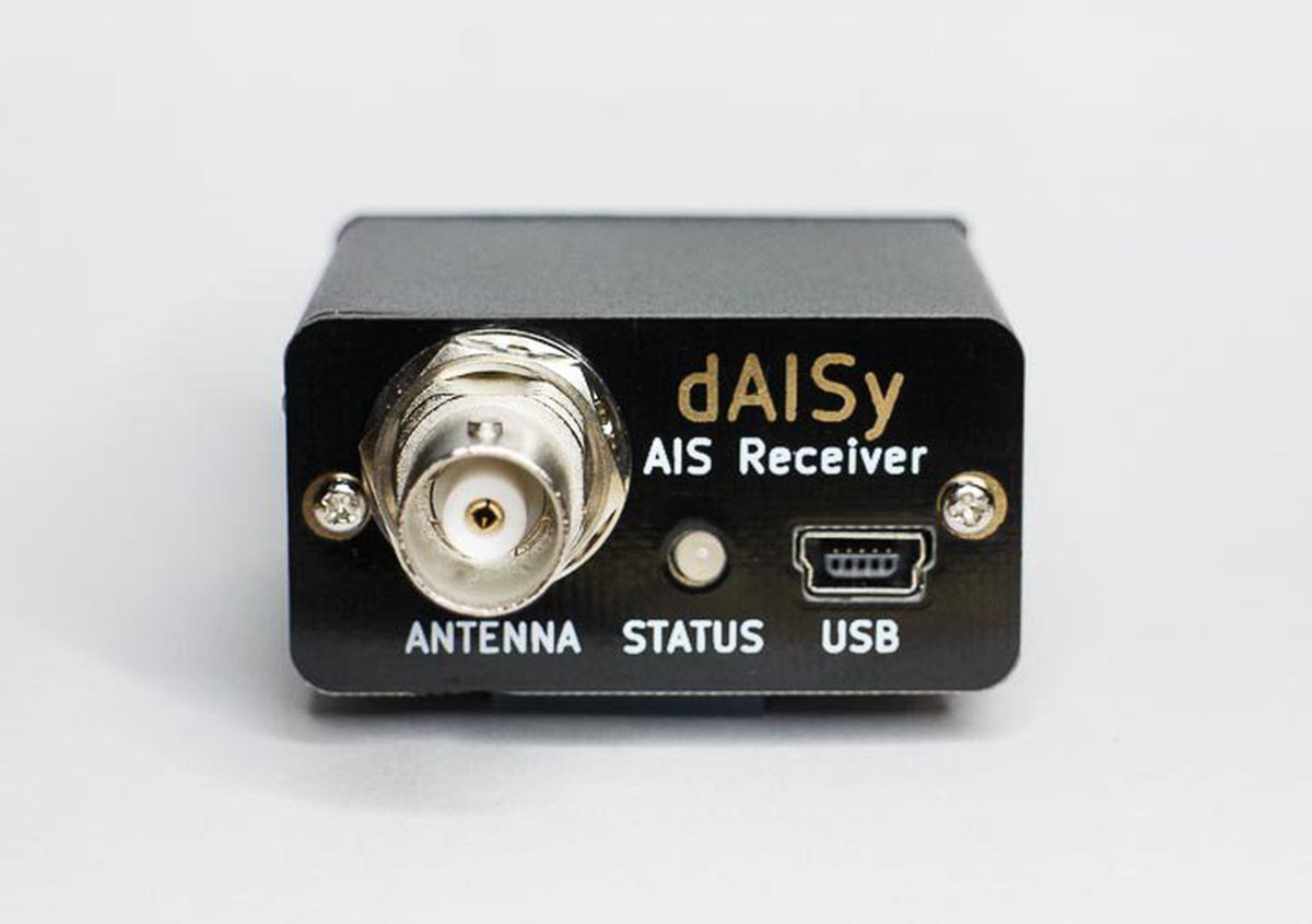
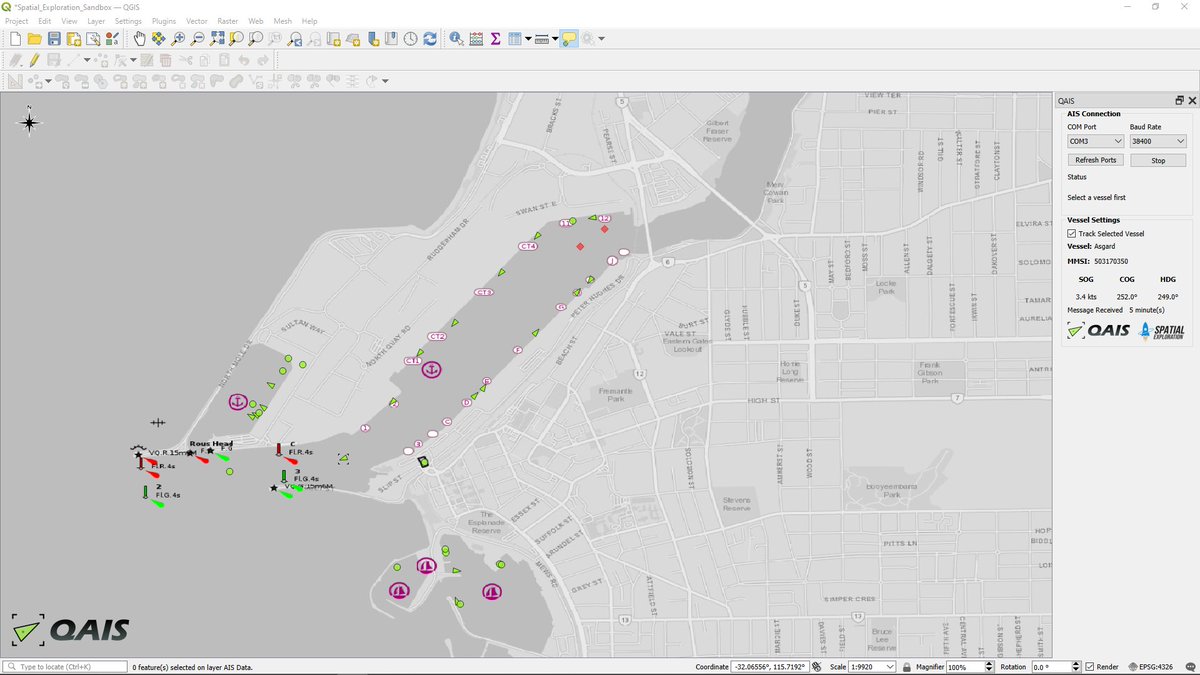
QAIS is a new plugin that adds live vessel data (e.g. from a dAISy AIS Receiver) to QGIS, an open source project for spatial visualization. Something for you GIS nerds 🤓
spatial-exploration.com/QAIS.html
English
Wegmatt
498 posts
@WegmattLLC
Creator of the dAISy AIS Receiver.