FLYGHT7
165 posts

FLYGHT7
@_FLYGHT7
FLYGHT7 creates tracks that aircraft & pilot can follow to have a safe & efficient flight. We provide: PANS-OPS, PBN, Aeronautical Charting & Training
Katılım Temmuz 2020
65 Takip Edilen58 Takipçiler
Our first-ever Basic Aeronautical Charting Course graduates are certified!
🎉 Ready for next-level skills? Join the 1st trimester 2026 course, fill the contact form on flyght7.com


English
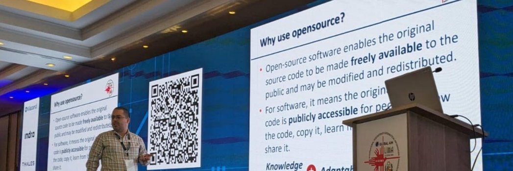
9-min video on our QGIS qOLS plugin for Annex 14 OLS. GitHub link + alpha release inside. Used at FLYGHT7 to boost accuracy & speed. youtube.com/watch?v=7kEnKf…
YouTube
English

FLYGHT7 retweetledi

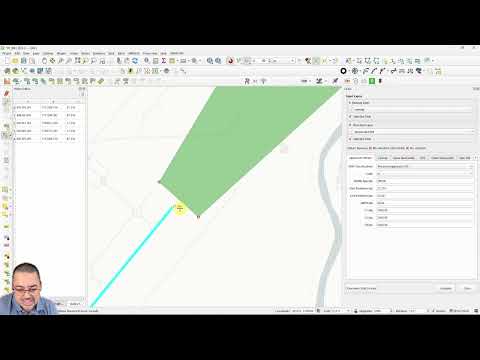
Waiting for the @_FLYGHT7 plugin to be approved, exciting times. Currently it only draws the area, and the analysis part is pending but this is a step in the right direction.
#qgis #python #buildinpublic #opensource #annex4 #aeronauticalcharting #icao #tofpa
English
FLYGHT7 retweetledi
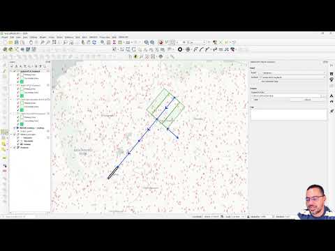
🚀 Here we go @_FLYGHT7 plugin update: now builds RNP APCH (LNAV) straights—Initial, Intermediate, Final. Turns? Planned.
Not full COTS (yet), but 🔥 for training, indie consultants & regulators.
🎥 youtu.be/x_vd37CqiNU
#pansops #qgis #buildinpublic #Crowdfunding
YouTube
English
FLYGHT7 retweetledi
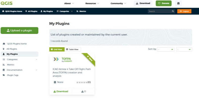
Open-source QGIS plugin for Aviation – TakeOff Flight Path Area (TOFPA) updates! Docs & GitHub coming soon.
Free tools and no license hassle when you get training from @_FLYGHT7
youtube.com/watch?v=ZOKfVB…
#qgis #opensource #aviation

YouTube
English


A few weeks ago we did an Aeronautical Studies and Safety Assessment (ASSA) course at our facility in Tegucigalpa, Honduras.
We had two colleagues join us live and a third one via Zoom so it was a blended course!
#aeronauticalstudy #safetyassessment


English

FLYGHT7 retweetledi

@icao Council adopts new aviation Standards and Recommended Practices (SARPs) for remotely piloted aircraft systems, these will enhance safety and accelerate the transformation of the global air navigation system, including the integration of RPAS. hubs.la/Q02s410-0
English
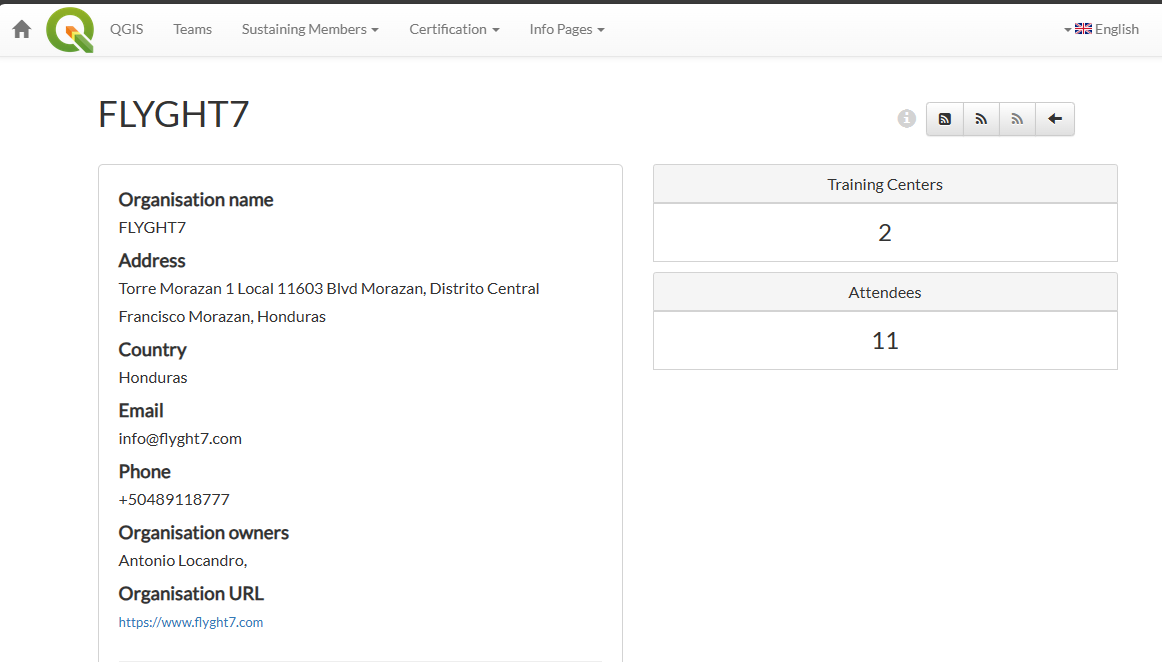
FLYGHT7, currently the only QGIS-approved aviation training provider, has certified 11 professionals since Nov 2023. Discover how QGIS enhances aeronautical workflows at flyght7.com 🛩️✨ #aviation #GIS #certification #FLYGHT7
English
FLYGHT7 retweetledi
I really want to implement a workflow manager / business rules engine so that I can map tasks either manual/automatic but everything I have seen is for software development or arcgis workflow manager
English
FLYGHT7 retweetledi
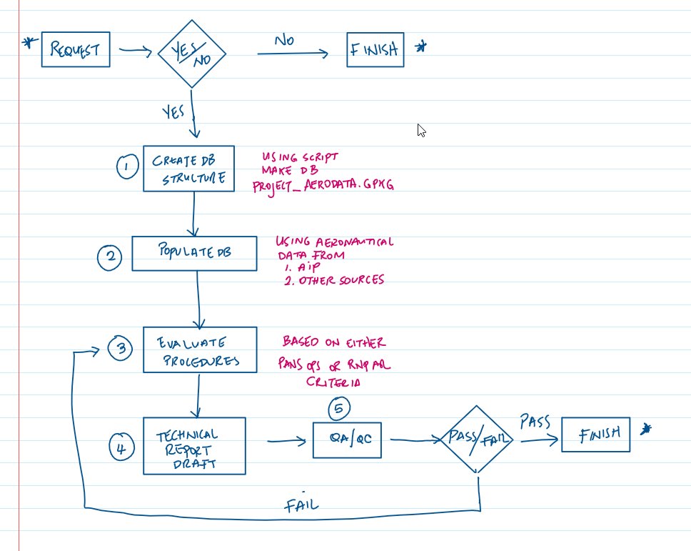
Quick example of what I'm talking about, each numbered step would probably have internal steps to review also or separate procedures with some rules for acceptance
English