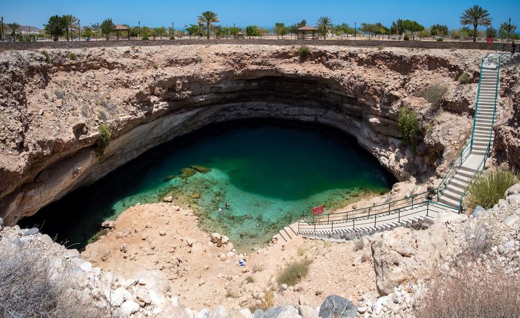
@GEO101SUNY This sinkhole filled with water has now become an attraction in the country of Oman! The sinkhole has filled up with. water overtime. treehugger.com/amazing-sinkho…
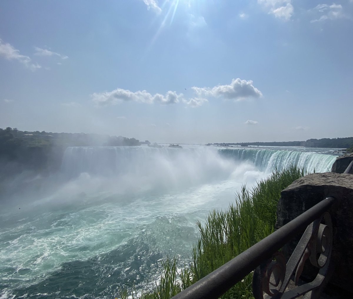
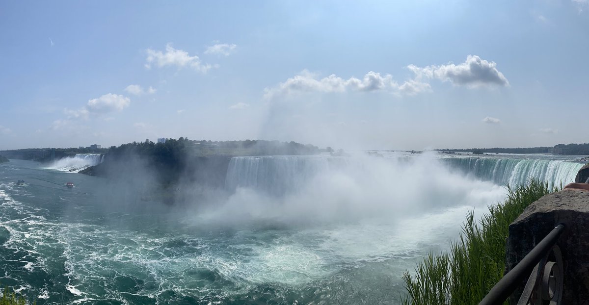
@GEO101SUNY A great example a fluvial landscape is Niagara Falls! The Niagra river has produced a steep gorge marked by the waterfalls. These images are actually my own, taken August 3 of this year.
@GEO101SUNY this image shows the Taal Volcano! This is a composite caldera located in the Philippines. It was formed between the convergent boundary of the Eurasian and Philippine plates. jamescarveronline.com/hiking-taal-vo…
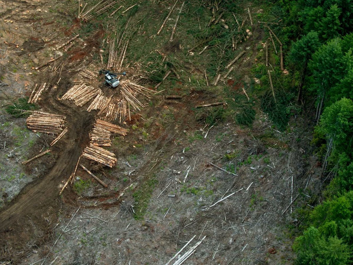
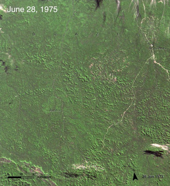
@GEO101SUNY This image shows severe deforestation done by humans to use the logs as materials for other things. This is happening all over and leaves the soil unprotected which in turn results in major soil loss. This soil was once protected by the trees. on.nrdc.org/45FxoRp
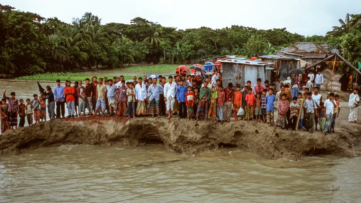
@GEO101SUNY This photo shows villagers in Bangladesh after suffering a flood as a result of rising sea levels. The rise was directly correlated to climate change. Although taken nearly 20 years ago in 2005, these people are still suffering to new erosion. cnn.com/2023/03/29/wor…
@GEO101SUNY This short youtube video showcases the polar climate, E on the Koppen Classification System. The video tells a few facts about the climate such as it’s cool summers and very cold winters as well as shows images from this climate. youtu.be/eCr56YnG8Q8?si…
@GEO101SUNY This YouTube video shows the flooding right in Middletown caused by the extreme precipitation of Hurricane Irene. I thought this video was perfect as it shows that extreme precipitation like this can effect even our specific area greatly. bit.ly/46aMtvh
@GEO101SUNY I found a list of the most catastrophic monsoons. While this is deeply saddening for those who experienced it, I thought it was interesting as it allowed me to get a true glimpse at the damage that these monsoons can truly cause. grunge.com/1241261/worst-…
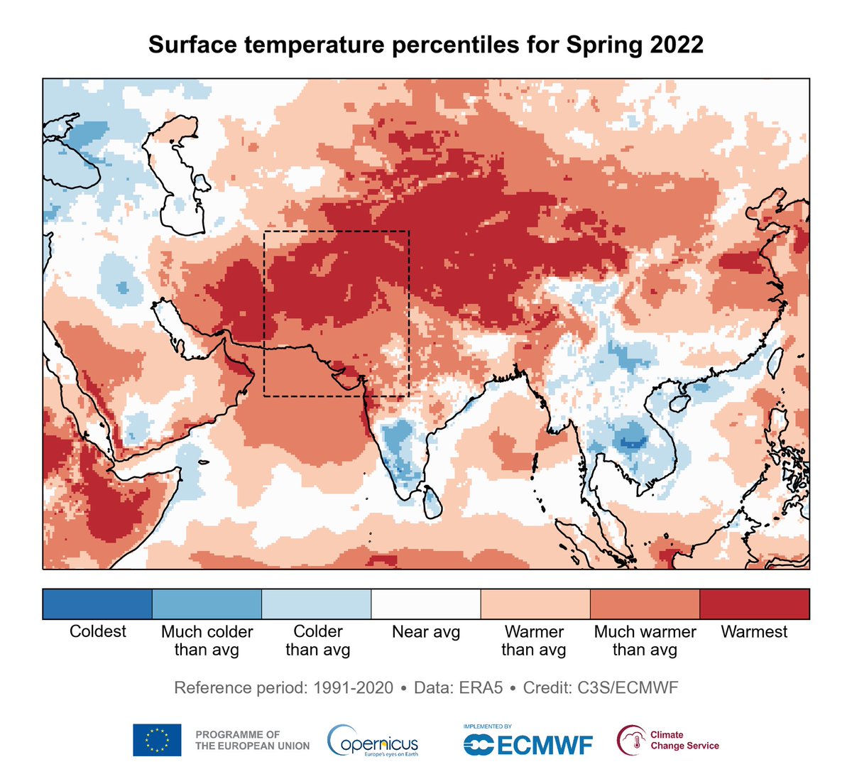
@GEO101SUNY this map shows the surface temperatures during a heatwave in Europe in spring 2022 as compared to data from 1991-2020 with many places reaching record-breaking high temperatures climate.copernicus.eu/heatwaves-grip…
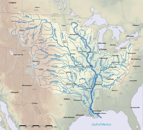
@GEO101SUNY This map shows all the rivers that flow into the Mississippi River. I found this to be quite interesting I did not realize how many rivers there were connecting to the Mississippi! en.m.wikipedia.org/wiki/Mississip…