
Candice King
19.1K posts

Candice King
@CandiceKing
Chief Meteorologist for @mystateline, 3x Emmy nominated, wife and mom, raised on a dairy farm. What more could you ask for! Contact: [email protected]
Rockford, IL Katılım Mart 2010
489 Takip Edilen4K Takipçiler

FREEZE WARNINGS go into effect for northern Illinois late Sunday night. Temperatures are expected to fall into the upper 20s under mainly clear skies. @MyStateline

English
Candice King retweetledi
Our survey crew has confirmed three tornadoes in Winnebago County during the afternoon and evening of 4/17/2026:
- Pecatonica EF-U
- Harrison EF-1
- Roscoe EF-1
We will have additional information on the peak wind speeds, path lengths, and path widths soon.
English
Candice King retweetledi


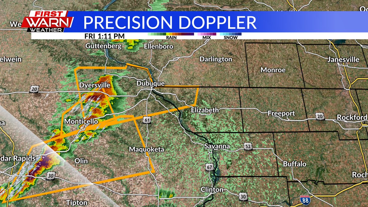
NEW TORNADO WARNING FOR NORTHWEST JO DAVIESS COUNTY until 3pm. The storm was located about 10 miles southwest of Galena, moving east at 30 mph. If you're in the path of the storm you need to seek shelter immediately. Golf ball sized hail will also be possible. @MyStateline

English
4/17/26 - 1:10PM Severe thunderstorm warning for northwestern Jo Daviess County until 2:15pm. The storm is moving northeast at 50 mph and capable of ping pong ball sized hail and 60 mph wind gusts. @MyStateline
English
A Tornado Watch has been issued for all of S. WI and most of N. IL until 8pm.
NWS Chicago@NWSChicago
A tornado watch has been issued for parts of Illinois, Iowa, Minnesota, Missouri and Wisconsin until 8 PM CDT
English
Severe storms likely again Friday afternoon and evening. Keeping an eye on the 2pm-5pm for isolated storms, with more widespread thunderstorms after 5pm/6pm. @MyStateline


English
Patchy fog will continue to move inland from the east (from Lake Michigan) Thursday evening, nearing I-39 overnight. Looks for areas of dense fog Friday morning, especially east of I-39. You can see visibility beginning to lower to the east. @MyStateline

English
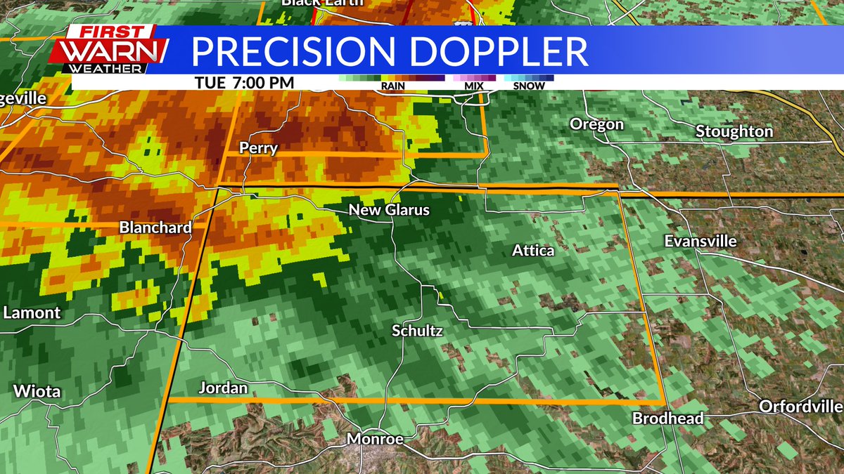
Thunderstorms continue to move across southern Wisconsin and north-central IL late Tuesday evening, but the severe threat has decreased significantly. Biggest threats from these storms will frequent lightning and heavy downpours. @MyStateline

English
Severe Thunderstorm Warning for DeKalb County until 10pm with the storm over Genoa, moving east at 60 mph. 70 mph wind gusts will be possible. @MyStateline

English
7PM (4/14/26): SEVERE THUNDERSTORM WARNING FOR GREEN COUNTY in southern Wisconsin until 7:45pm. This storm is moving east at 40 mph and capable of producing 60 mph wind gusts and quarter sized hail. @MyStateline
English
6:35pm Update (4/14/26): Keeping a very close eye on the storms over northeast Iowa that currently have the tornado warnings with them. These are moving to the east around 40 mph and will continue to have a tornado threat across northwest Illinois. @MyStateline

English
(4/14/26) TORNADO WATCH issued for all of northern Illinois and southern Wisconsin until 10pm Tuesday. @MyStateline

English
1:30am Update: Severe Thunderstorm Warning expired for Rock County, issued for southern Walworth County until 2:15am. @MyStateline
English
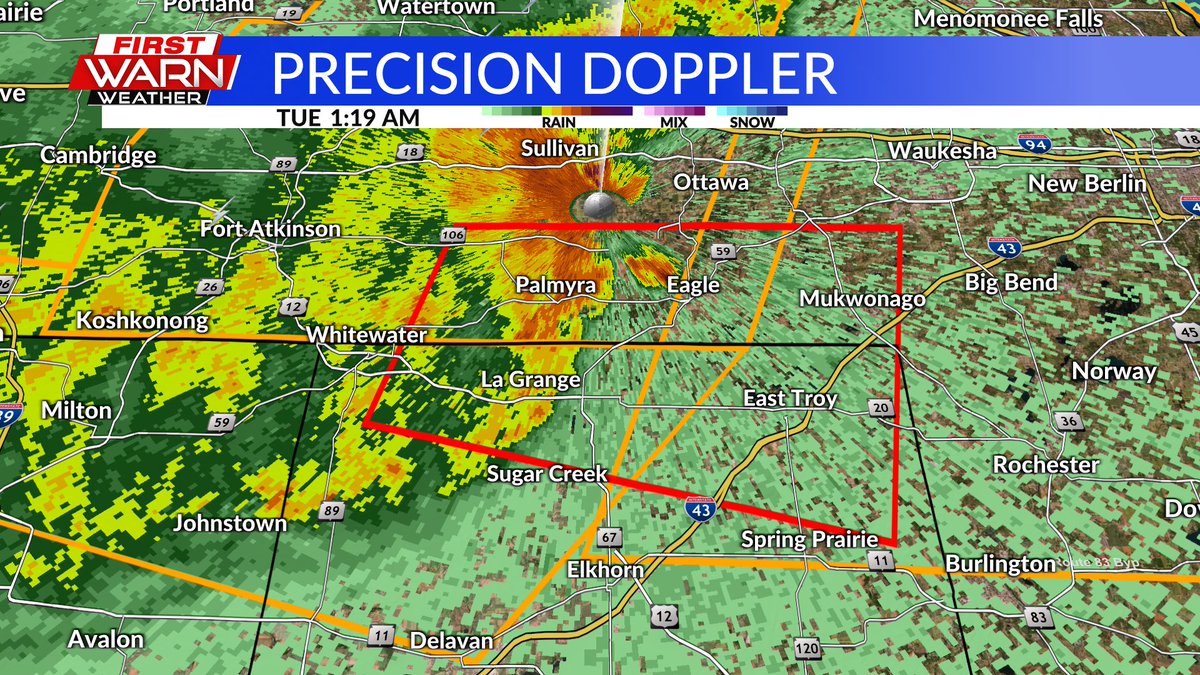
(4/14/26) 1:19am: TORNADO WARNING for northern Walworth County until 1:45am. A severe storm near Whitewater is capable of producing a tornado and is currently moving east at 45 mph. If you're in the path of the storm seek shelter immediately. @MyStateline
English
1:02am 4/14/26: Severe Thunderstorm Warning for northern Rock and northwest Walworth counties in S. WI until 1:30am. Storms could be capable of producing 60 mph wind gusts and penny size hail. @MyStateline

English
(4/13/26) 11:43pm Update: Keeping an eye on the storms to the northwest as severe thunderstorm warnings have been issued for parts of southwest Wisconsin. Main threats right now is for 60 mph wind gusts. Storms are currently moving east at 40 mph. @MyStateline

English
(4/13/26) 9:50PM: NEW Severe Thunderstorm Watch now for S. WI until 4am. Watching the line of storms to the north, moving towards S. WI around 12am/1am. @MyStateline
English
Keeping an eye on the storms to our north and northwest tonight. Severe threat returns for late Tuesday afternoon. @MyStateline
English