DAV
1.5K posts


The American model -- which for past two days was showing BIG snow potential in DC -- has backed down a bit. Unsurprising. We're finalizing our latest forecast. Out before noon. Hang tight.
English
Read our detailed updates, see radar and more here: washingtonpost.com/weather/2026/0…
English
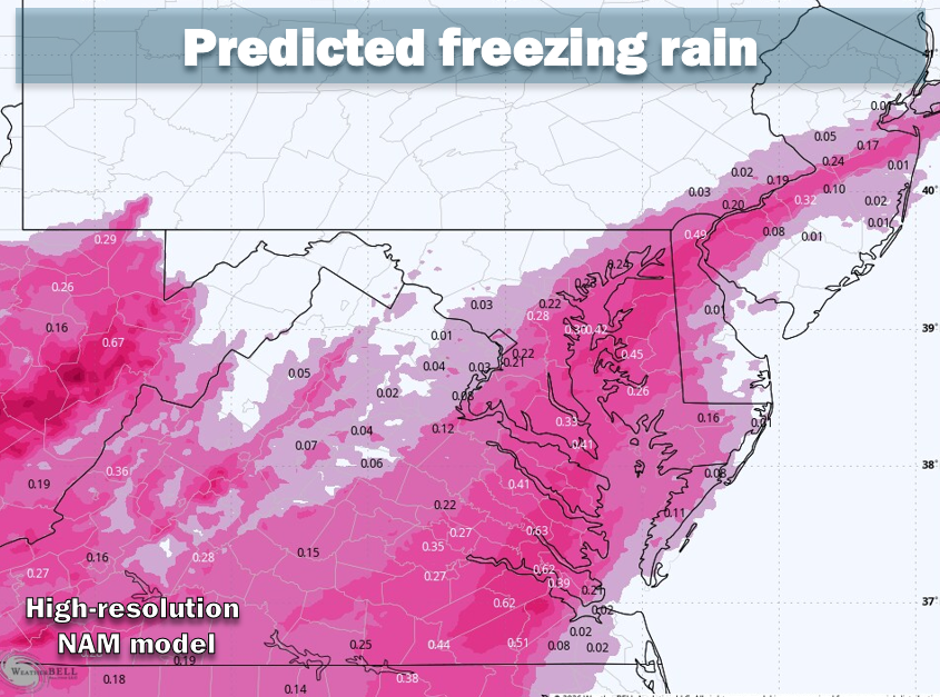
* Steady sleet accumulating throughout the area; freezing rain risk later (1023a) *
As sleet continues and turns the earlier snow into a denser conglomeration, we’re receiving questions about the freezing rain potential and timing.
Most model simulations keep precipitation as sleet through this afternoon. The exception is toward Southern Maryland, where sleet could turn to freezing rain by early to mid-afternoon. Freezing rain will probably creep northwestward toward the I-95 corridor and the Beltway area between 4 and 7 p.m.
If the freezing rain arrives in the early part of that window, it could leave produce a problematic glaze on top of the snow and sleet, increasing the risk of some power outages even in the Beltway area. But if it holds off until closer to 7 p.m, it will only last a few hours before the storm subsides, reducing the power outage risk.
Regardless of what happens inside the Beltway, our far east and southeast suburbs near the bay and Southern Maryland have a much higher chance of problematic freezing rain accumulation and should be prepared for the possiblity of outages.
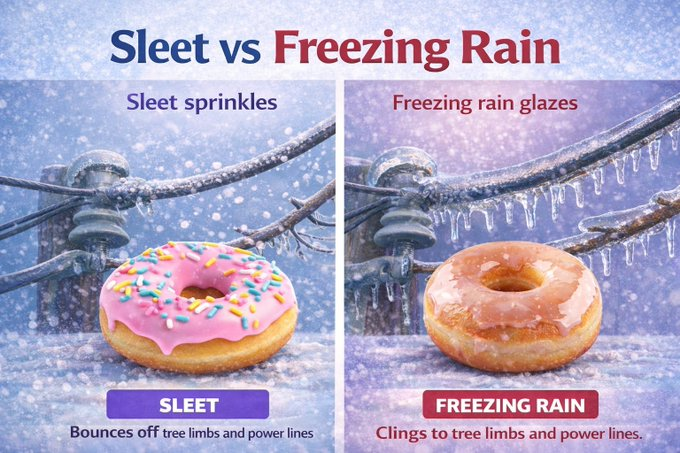
Remember the difference between sleet and freezing rain. See graphic.
English

Gonna try and screen detox today and maybe tomorrow, in the mood for some good poli sci readings. Drop suggestions below
English

It’s called the “downward dog”, but this and missionary
preye🤎@tessysmitha
Collapsed doggy. I won't explain.
English
English

ANOTHER SUPER SEXY ORGY COMING SOON!! With the amazing @AUBREYKATEXXX @ChloeKreams @ErisJolie @Hattrickz91

English