Sabitlenmiş Tweet
David Amunga ⚡️
6.2K posts

David Amunga ⚡️
@davidamunga_
building necessary software. @screensaverso @calckenya
Nairobi, Kenya Katılım Ağustos 2017
195 Takip Edilen2.6K Takipçiler

@davidamunga_ You inspired me to do a small 2D game 😆 Majembe is fighting goons all over Nairobi akitafta Mbavu Destroyer who kidnapped his girlfriend, Mjaka Fine😄😄 . Final fight scene is the big fight with Mbavu Destroyer.
English
David Amunga ⚡️ retweetledi

GeoLibre v2.0.0 is here!
GeoLibre is a free and open-source geospatial platform that runs everywhere: as a native desktop app, in the browser, on Android, and embedded right inside Jupyter notebooks. It brings modern web mapping, cloud-native data formats, and a full processing toolbox together in one place, all built on MapLibre and deck.gl with no proprietary lock-in.
Our first major release adds a true 3D globe, takes mapping beyond Earth to Mars and the Moon, lets styles round-trip with QGIS, and turns loaded vector layers into editable, save-back-to-source data.
What's new in v2.0.0
- Planetary mapping: explore Mars, the Moon, and other bodies with the OpenPlanetaryMap basemaps, a per-project ellipsoid, and a planet switcher right in the Layers panel.
- CesiumJS 3D globe: switch any map pane to a photorealistic 3D globe that stays camera-synced with your 2D maps and mirrors the layer stack.
- True 3D data: render vector layers with Z coordinates, load TIN/MultiPatch 3D shapefiles, and display KML/KMZ Collada (.dae) 3D models.
- Symbology interchange: import and export vector styling as OGC SLD, QGIS QML, and Mapbox GL style JSON, so styles round-trip between GeoLibre, QGIS, and the Mapbox/MapLibre ecosystem.
- Editable source layers: edit vector layers and write the changes back to their source, including GeoPackage and GeoJSON files and PostGIS database tables.
- Weather and sky: a new Weather menu with live cloud and precipitation radar overlays (RainViewer), plus a Google Earth-style sun position simulation for realistic lighting.
- Terrain and lighting: double-click the terrain control to set vertical exaggeration, and view any scene in true 3D relief.
- Smarter data import: bring in CSV without coordinates as an attribute table, split GPX track points and route points into separate layers, and load macOS-zipped and projected-CRS shapefiles.
- Raster in the browser: build normalized-difference indices for any HTTP COG and extract COG/WMS/XYZ bounding-box subsets client-side.
- Field Calculator upgrades: compute geometry length and area directly on your features.
- Attribute table: multi-select rows with Ctrl and Shift, plus faster navigation.
- Google Earth-style extras: "View in Google Maps / Google Earth" actions, camera-reset keyboard shortcuts, and a UTM easting/northing grid mode for the Gridlines overlay.
- New plugins: a Mapillary coverage and street-level image viewer, a Historical Imagery panel, and an Elevation Profile tool.
- Fully localized: all 13 language catalogs are complete, so the entire UI is translatable.
Try it out
- Launch GeoLibre Web: web.geolibre.app
- GitHub: github.com/opengeos/GeoLi…
- Documentation: geolibre.app
- Release notes: github.com/opengeos/GeoLi…
#GIS #GeospatialData #OpenSource #RemoteSensing #DataVisualization #MapLibre #GeoLibre
English

@StanleyMasinde_ Huruma at some point had a section called "Pilot" haha
English

never ceases to amaze me that I can run apps here directly from Android Studio😅

David Amunga ⚡️@davidamunga_
android/firestick tv is interesting , i wonder if i can sideload apps here
English

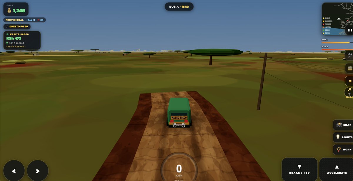
✨ NEW in rodi.ke 🚚🇰🇪
- Passenger dropoff along destination
- Mediocre conductor/pedestrian/traffic npcs
- Better mobile responsiveness
- Improved map view
oh , and type "turbo" for a secret temporary cheatcode 😎
English

@KuyaMukoya This is so cool 😁 ship it once you're done !😅
English

🇺🇬🇰🇪🚚 👉 rodi.ke
added a "small" footprint of Uganda for folks to enjoy driving this weekend
also , i might need another domain name 🫠
English

Yeah i did a sim for this (random drive but with a densely packed low poly game world ) but the perf was so bad on mobile/ , so i worked with an empty map that i can spatially generate the game world with correct coords , roads etc.
hitting some annoying lag the more i add stuff into the game on mobile , but working on making it better every couple of releases i do
Nairobi, Kenya 🇰🇪 English

I've always loved roadtrips....
David Amunga ⚡️@davidamunga_
the game world ends here..... but what if....
English

@dj_skold I can think about this , could you describe more on this 🤔
English

@davidamunga_ Next must be ability to switch betwren direction buttons to steering wheel
English

@_8ongo Thanks for the good recommend ! Will check it out
Nairobi, Kenya 🇰🇪 English