Geospatial Insurance Consortium (GIC)

598 posts

Geospatial Insurance Consortium (GIC) banner
Geospatial Insurance Consortium (GIC)

Geospatial Insurance Consortium (GIC)

@gic_org

High-resolution aerial imagery and geospatial data for insurance & emergency disaster response. The GIC is an at-cost, member-driven initiative of the NICB.

Katılım Eylül 2017
486 Takip Edilen533 Takipçiler
Geospatial Insurance Consortium (GIC)
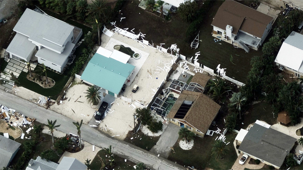
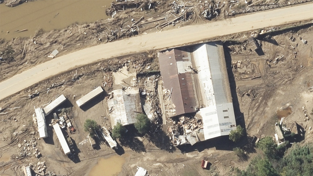
California Fires: Damage Assessments Ready Color-coded damage footprints and property damage assessments are now available for our first collections of the Palisades Fire and Eaton Fire zones. hubs.la/Q0328cmY0
Geospatial Insurance Consortium (GIC) tweet media
English
0
4
6
1.8K
Geospatial Insurance Consortium (GIC)
Earlier today, we’ve published high-resolution imagery from the Palisades Fire and Eaton Fire, including oblique, ortho, and multispectral views of damaged properties and neighborhoods. 📷 View sample imagery at hubs.la/Q03280sX0
English
0
1
6
355
Geospatial Insurance Consortium (GIC)
Gray Sky Update: Wildfire Imagery Response Efforts in California 🔥 With reduced winds and smoke on Friday, our flight crew successfully collected high-res aerial imagery of the Palisades Fire and Eaton Fire. Imagery is in processing now. More at: hubs.la/Q0326ZTP0
English
0
0
0
408
Geospatial Insurance Consortium (GIC)
Missed dropping by and chatting with our team yesterday at #ITCVegas? Today's your last chance! Find us in Booth 3050 and come get all your questions answered about our #aerialimagery, #AI property analytics, coverage in 40+ coverage, including urban and rural areas in the U.S.
Geospatial Insurance Consortium (GIC) tweet media
English
0
0
1
54
Geospatial Insurance Consortium (GIC)
This video shows before-and-after multispectral imagery of the Park Fire in California, where healthy vegetation appears red and burned areas appear gray-black. Notice the stark fireline where properties were successfully protected. More at: hubs.la/Q02KP-3b0
English
0
0
1
109