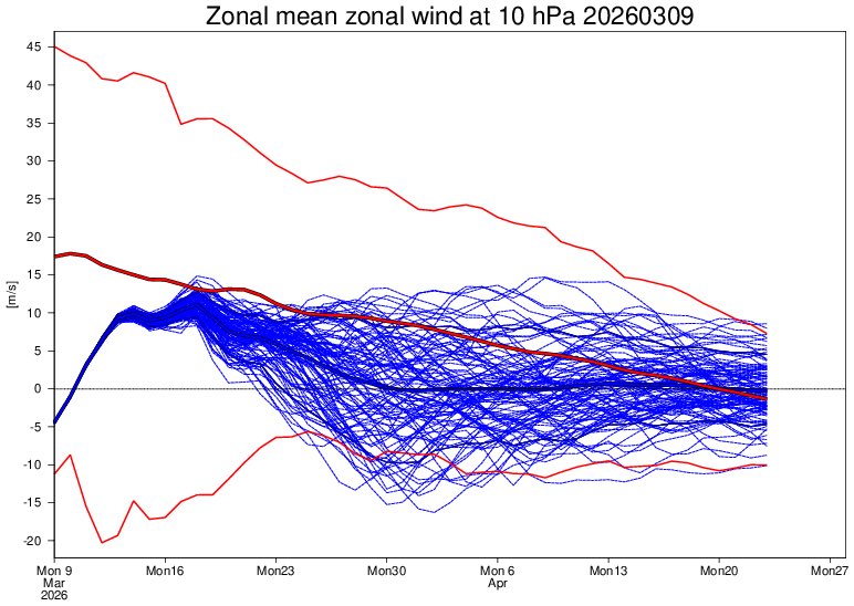
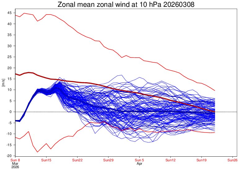
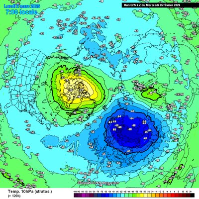
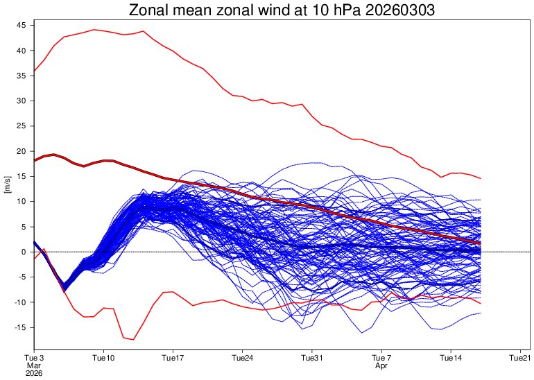
Sabitlenmiş Tweet
weathergod25
1.4K posts

weathergod25
@jnc20001
I love meteorology and doing weather and extreme weather and cold weather prospects and anything to do with weather
Macclesfield, England Katılım Ocak 2024
176 Takip Edilen183 Takipçiler

@Official_WXUK @NorthBankVoice1 Shut ur face u have no right to say anything
English

@NorthBankVoice1 If you're gonna use AI/chatGPT, at least change it a little so it isn't so obvious man
English

00z Update. 🌍📊
This is not something you really want to be seeing for mid-March. Unfortunately, the latest ECMWF 00z run continues to show a rather disappointing outlook. Temperatures are trending below average, and there is a fairly strong signal for this within the ECMWF ensembles as well. ❄️
The cooler theme that begins around mid-March looks set to persist for quite some time. There is currently no clear sign of any sustained warm spell developing in the foreseeable future. High pressure remains displaced well to the southwest, while troughing dominates across northern and western Europe. 🌬️
This setup keeps the UK in a cooler north-westerly to northerly influenced pattern, which is far from ideal if you’re hoping for a proper taste of spring warmth. 🌥️
Overall, the message from the models right now is fairly consistent: temperatures likely remaining below the seasonal norm, with any milder interludes looking brief at best. So if you’re looking for something warm and spring-like on the horizon, the current guidance unfortunately doesn’t offer much encouragement. 🌡️


English

@jnc20001 @SurreyPalmsWX It had one heat spike at the very start. July 2015 was a cool month overall driven by a westerly flow off the North Atlantic cold blob.
English

It does appear that having neutral ENSO in spring, which then transitions into El Niño by early summer, has wrecked a number of UK summers.
1951, 1965, 1968, 1972, 1982, 1991, 2002 (to an extent 2015 & 2023) were all poor UK summers - cool, wet, cloudy etc with minimal heat. ☠️
Dylan Federico@DylanFedericoWX
The brand new EURO Seasonal Model calls for a very strong El Niño to develop this Summer. This is a HUGE deal because El Nino events are typically associated with below-average tropical activity in the Atlantic Basin. This is reflected with a -AMO SSTA configuration with the warmest water focused in the subtropical Atlantic, along with anomalously high surface pressures, and below-average precipitation anomalies. This is the most hostile look I’ve seen leading up to an Atlantic hurricane season since 2015. #TropicalUpdate #flwx 🌀
English
weathergod25 retweetledi


