kadoch

661 posts

kadoch banner
kadoch

kadoch

@kadoch

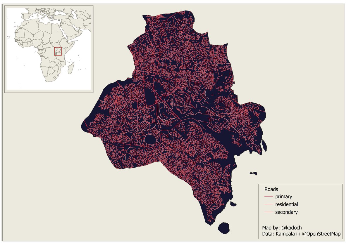
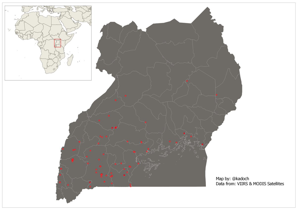
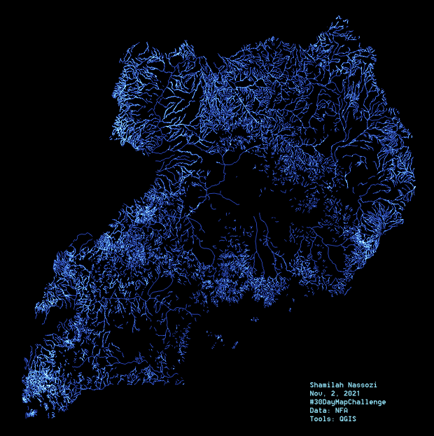
Ugandan. Creating & Using (open) geography data and technology to understand our planet better.

Afrika Katılım Eylül 2009
213 Takip Edilen300 Takipçiler
Janice Kyakundwa, PhD
Janice Kyakundwa, PhD@kyakundwa·
Uganda's minister of Science & Technology @DrMusenero talking about their satellite PearlAfricaSat-1 aka "a big box with wings which captures the sunlight.." 😑🤨🤔 Good lord almighty!!!
English
26
21
86
0
RiobaIan
RiobaIan@rioba_riri·
@kadoch @Shel_Kariuki I believe you would find R libraries more powerful in that. R has these libraries you can look into: sf, raster, spData, tmap, together with some dplyr and tidyverse it will get the job done.
English
2
0
1
0
Carlos Hernandez
Carlos Hernandez@carlitos_m_h·
@kadoch I don't know any libraries for this purpose but the "Transfer learning models" are used for that, also you can use others datasources like WISE or SoilGrids
Manhattan, KS 🇺🇸 English
1
0
0
0
kadoch
kadoch@kadoch·
We appreciate the fact that the training data across these geographies may not be homogeneous, so we're keeping that in mind. We're thinking along the lines of a mapping library in R or Python. Let us know if there's a hack for this.
English
1
0
0
0
kadoch
kadoch@kadoch·
For context, we have a typical machine learning workflow with training data from one country and we'd like to map that data or the features in that data to any other location in the world.
English
1
0
0
0
kadoch
kadoch@kadoch·
Nice thread 🔥 Fascinated by "Changes on our planet" and to that effect, currently working with an amazing team to explore long-term changes on earth with a focus on Land. Work with Open and reproducible workflows for most of my(our) work.
Steven Ramage@Steven_Ramage

To followers: I work with earth scientists, geospatial practitioners, policy developers & decision makers to address environmental & societal challenges we face today & tomorrow. What do you do? Please share so we can all learn from each other and work together. Pls RT.

English
0
0
0
0
Shel 🇰🇪 🇮🇪
Shel 🇰🇪 🇮🇪@Shel_Kariuki·
Today being my birthday, I want to appreciate everyone who responded in any way to this tweet. After several conversations and one amazing interview, I finally bagged a contract with them this month, and I get to use #rstats all day every day...perfect christmas/birthday gift 💃
Shel 🇰🇪 🇮🇪@Shel_Kariuki

The data analytics team @WorldBank uses @rstudio connect. Someone tell them that I am good in using #rstats for data analytics and would love to work for/with them...😭😭🙏

English
59
32
429
0
kadoch
kadoch@kadoch·
Day 1 - Points of the #30daymapchallenge 🔥 🔥 🔥 Live fires detected in the East African nation of Uganda over the last six months. Anyone know why the Western part of Uganda seems to be burning more compared to the rest of the country? Cattle feed 'biz' perhaps? #gischat
kadoch tweet media
English
1
2
4
0
kadoch
kadoch@kadoch·
#rstats #rspatial #shiny peeps, A friend would like to put an R model into production. Goal: dashboard, with maps/graphs/stats and an API. Work with time series satellite images & other spatial data. If you think you can help, please DM me. cc @Shel_Kariuki
English
0
4
5
0
kadoch retweetledi
SotM Africa 2025
SotM Africa 2025@sotmafrica·
Stephen Mather talking about Point Cloud in your pocket: Scaling Open Source Photogrammetry #sotmafrica Day2
SotM Africa 2025 tweet mediaSotM Africa 2025 tweet media
English
0
4
5
0
kadoch retweetledi
SotM Africa 2025
SotM Africa 2025@sotmafrica·
Wow! We're happy to see so many mappers at the first State of the Map Africa! #sotmafrica
SotM Africa 2025 tweet media
English
5
100
165
0